All Activity
- Past hour
-
GWDLT

-
Still incredibly cloudy in Frederick. Oh well, now I feel nudged to do more work.
-
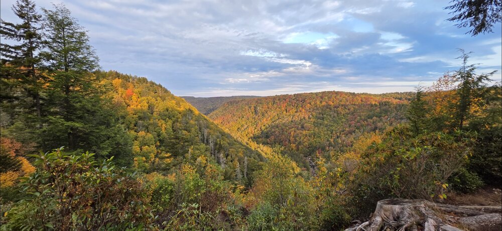
Surprisingly, Blackwater / Davis was near peak color this weekend. Picked a great time to go out.
-
Unlike Erin, it looks like the lead wave could get west enough where even if there’s a trough around there could be a land threat. Steering pattern still looks a bit weird though.
-

September 2025 OBS-Discussion centered NYC subforum
LibertyBell replied to wdrag's topic in New York City Metro
Less than Central Park? or about the same, Ed? -

September 2025 OBS-Discussion centered NYC subforum
NorthShoreWx replied to wdrag's topic in New York City Metro
JFK reported 10" -
I want a storm that’s extra tropical but identifies as a tropical storm
-
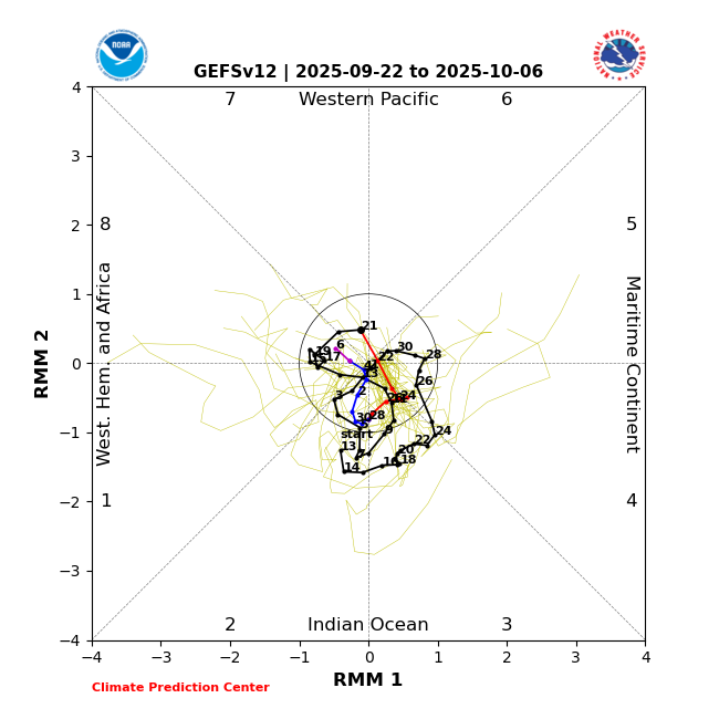
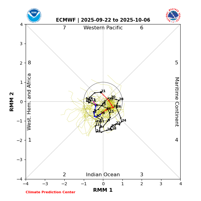
The unusual clockwise dominated MJO rotation that started Sept 1st is continuing and progged to keep going through at least Oct 6th per the images below. So, it went from phase 5 (inside) on 8/31 back to ph 2 9/2-8. It temporarily went forward to ph 3 for 3 days but then backtracked across 2 then 1 and then 8. It’s forecasted to continue backtracking through 7, 6, 5, 4, 3, 2, 1, and 8. I just looked at MJO diagrams for the 2nd half of each year back to 1975 and couldn’t find anything comparable:
-
September 2025 OBS-Discussion centered NYC subforum
LibertyBell replied to wdrag's topic in New York City Metro
PD1 was pretty big, there must have been more snowfall than ISP at JFK and some of the other south shore locations. -
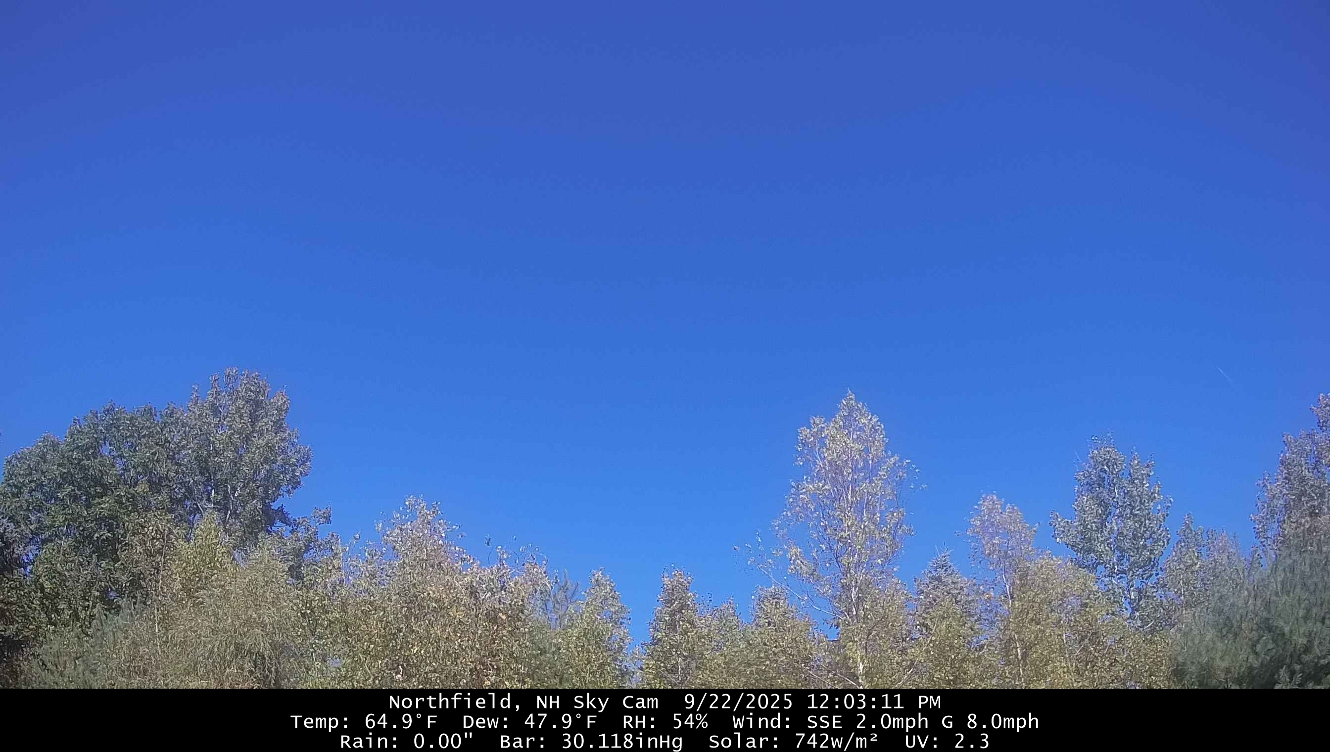
Forecast called for sunny skies today but it’s nothing but clouds here. What the hell?
-
Yeah, given how utterly boring the weather has been here in Southern New England, even a tropical storm becoming extratropical over us would be a treat.
-
September 2025 OBS-Discussion centered NYC subforum
NorthShoreWx replied to wdrag's topic in New York City Metro
I said "snow depth" That mystery hasn't changed. FWIW those daily snowfall totals from ISP in 1979 look reasonable. Here is Syosset comparison for the same period: Syosset ISP 1979 F E B F E B Day 6 0.0 0.0 7 6.3 6.5 8 T 0.3 9 0.0 0.0 10 0.0 0.0 11 0.0 0.0 12 1.5 0.9 13 T T 14 0.0 0.0 15 1.0 T 16 0.2 0.2 17 0.0 0.0 18 0.0 0.0 19 10.1 8.8 -
The unusual westward MJO propagation continues
-
September 2025 OBS-Discussion centered NYC subforum
LibertyBell replied to wdrag's topic in New York City Metro
we really do not need or want this much flooding rain, 1-2 inches of rain like before is just fine and not days and days of depressing cloudiness either. -
September 2025 OBS-Discussion centered NYC subforum
LibertyBell replied to wdrag's topic in New York City Metro
I see 2017-2018 is on that list too that was one of our greatest bookend winters. -
September 2025 OBS-Discussion centered NYC subforum
LibertyBell replied to wdrag's topic in New York City Metro
Islip had some weird snowfall reporting back then, thankfully their snowfall reporting was good for February 1978 (unlike JFK). -
I'm intrigued as well. Certainly something to watch, but like you said, all speculation at this point until we get something to really develop. Lots of factors shall influence that these next few days. I just hope nobody is really expecting a cat 3 here I mean extratropical, subtropical, etc. storms can certainly still be noteworthy so don't want to take away from that aspect.
-
September 2025 OBS-Discussion centered NYC subforum
NorthShoreWx replied to wdrag's topic in New York City Metro
48.7° low this morning. -
September 2025 OBS-Discussion centered NYC subforum
LibertyBell replied to wdrag's topic in New York City Metro
I remember this happening during an SWFE back in February 2008 and it was a big surprise 6-8 inches of snow -- the changeover happened after the heaviest snow moved away and ended as drizzle. Everything had to be timed just right, the heavy snow came in like a wall at around 2-3 am and it snowed heavily into the morning and ended around 9 am as drizzle. It came in so quickly that it just didn't have a chance to changeover during the meat of the storm. -
I’m modestly intrigued. I said in my forecast that if there were an EC threat this year it’d be a shorter fuse wave that develops in the western Atlantic. That lead wave fits the bill. But it’s all just speculation at this point.
-
Btw…happy 22nd day of fall!
-

September 2025 OBS-Discussion centered NYC subforum
Sundog replied to wdrag's topic in New York City Metro
I'll tell you what the "fake cold" is good for though, cooling surfaces down so that when it starts to snow it sticks better. Many times the city will get snow, but we are sitting in the upper 30s waiting for precip to drag our temps down to freezing. Meanwhile several hours earlier some locations were radiating and cooled into the 20s while skies were still clear. That allowed for surfaces to cool down nicely so that even if temps did jump back to the mid 30s when clouds moved in, surfaces are not cooling down from being in the 40s because of solar insolation from earlier in the day, they are warming up from being in the 20s. It makes a nice difference in terms of stickage. -
87/81. Yesterday featured very intense rainfall and loud thunder in the early-mid afternoon hours, then after sunset, great lightning show. Today looks to repeat that here in S FL. A vacation marked by extreme humidity and heat indexes over 100. typically lasts from mid-late may thru early october, such is life in the only tropical rainforest climate zone in the mainland USA.
-
Do not have a great feeling about the ravens game tonight
-
Mabel or Mildred would be brutal oh, there's a Karen this year. That would be a doozy