All Activity
- Past hour
-
Wtf is this crap going to be at the beaches
-
Showers here
-
especially with yet another round of rain...
-
Not seeing 100s at all
-
Nailed it!

-
Plateau Rosa?
-
just finds a way to rain on the weekends-what a bust!
-
GFS is near 100 for BOS on Sunday while the Euro is U60s.
-
Euro is a cool mess here late Thu into Sun.
-
Not surprising to see a MCS ahead of the heat dome. Could help ramp up the dews heading into Mon-Tues so higher heat indices. But yes today's high temp potential will probably get capped at least
-
You might need a hoodie...maybe a ski mask?
-

2025 Atlantic Hurricane Season
BarryStantonGBP replied to BarryStantonGBP's topic in Tropical Headquarters
ZCZC MIATWOAT ALL TTAA00 KNHC DDHHMM Tropical Weather Outlook NWS National Hurricane Center Miami FL 800 AM EDT Sun Jun 22 2025 For the North Atlantic...Caribbean Sea and the Gulf of America: 1. Central Subtropical Atlantic: A trough of low pressure located about 500 miles east-southeast of Bermuda is producing disorganized showers and thunderstorms. Some slow development of this system is possible during the next couple of days before it moves into a region of strong upper-level winds. This system is expected to move northeastward over the central Atlantic during the next few days. * Formation chance through 48 hours...low...10 percent. * Formation chance through 7 days...low...10 percent. Forecaster Cangialosi -
The only good news is that it will dampen the high temperature potential today a bit. But I think Tuesday is still on track to be one of our warmest days of the 2020s. Even models that show the convection are still in the 102° to 105° range Tuesday.
-
lol what? Near and below normal? Nothing shows that and the month is AN
-
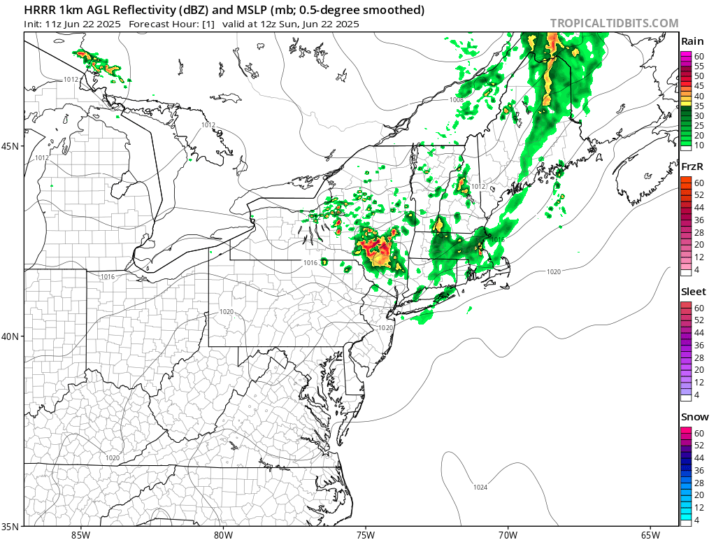
The 6z NAM and RGEM are literally 300 miles off with the rain. 6z!
-
Driving to Ft Devens for a lacrosse tournament. Place is an oven . .
-
The higher resolution models dropped the ball too. Just a poor job all around.
-
NYC isn’t getting squat.
-
I mean, the one hour hrrr was off by at least a hundred miles. Thats batshit.
-
Global models are not designed to track MCS systems. Maybe if they get closer to convection allowing resolutions. So this is par for the course.
-
Before this starts, on the Global side, the ICON is the coolest and shuts the big heat down earliest, while the Euro is still insisting on topping 100. GFS in the middle with upper 90s but pushes any relief well down the line. The mesos have a similar spread, with the NAM Nest on the low side with mid-90s and the Canadians into the 100s. HRRR has upper 90s to near 100 Monday.
-
Man…Why does NYC seem to cash in on this stuff every year? They must get 3x as many storms as the cities to the north do.
-
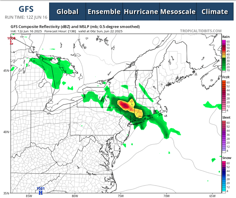
@forkyfork 12z GFS from last Monday had the right idea:
-
I don't know, I'm also not saying that batch will slam NYC, honestly it will probably fizzle out on the way down. But this is definitely not the forecast the models had for Southern New England and NY.
-
Meh on the rain, just enough to muck up outdoor work plans. A couple of very warm days the back to or just below normal