All Activity
- Past hour
-

Mountain West Discussion
mayjawintastawm replied to mayjawintastawm's topic in Central/Western States
2021 was a complete non-winter. Hope this year doesn't replicate that. -

November 2025 general discussions and probable topic derailings ...
alex replied to Typhoon Tip's topic in New England
Bretton Woods opens tomorrow. Can’t wait! -

November 2025 general discussions and probable topic derailings ...
CoastalWx replied to Typhoon Tip's topic in New England
May need to go to bathrooms. It’s a concrete structure. -
Probably threading wind advisory criteria early Saturday for Noon-10PM Sunday, 45-50 MPH gusts. Minor impact except air travel and where a wind blown branch crosses the road. Slot looks BGM-MPO through NYC-LI.
- Yesterday
-
 Can you shelter under bleachers ?
 -
November 2025 general discussions and probable topic derailings ...
CoastalWx replied to Typhoon Tip's topic in New England
Flakes at the soccer field -
November 2025 general discussions and probable topic derailings ...
CoastalWx replied to Typhoon Tip's topic in New England
Slim with the tilted brim? -
72 here today. MLI missed the record by a few degrees with a 73.
-
CFS for December is lit! Advocating above normal precip and below normal temps. That can only mean ONE THING! We torch for the first two days of the month and rain like heck, then flip to cold and dry while the weenies cry.
-

2025-2026 ENSO
40/70 Benchmark replied to 40/70 Benchmark's topic in Weather Forecasting and Discussion
I think it will be better than January. -
February may not be a lost month this winter either.
-
Tomorrow will see highs mainly in the upper 40s to lower 50s. Sunday could turn briefly milder before another cool air mass moves into the region. Some showers are possible on Sunday with the frontal passage, but rainfall totals will generally be under 0.25" in most parts of the region. Temperatures will again top out mainly in the middle and upper 40s through the middle of next week. Meanwhile, today will be Central Park's 1,385th consecutive day without daily snowfall of 4" or more. The record of 1,394 days was set during February 22, 1929 through December 16, 1932. That stretch ended with 6.7" daily snowfall on December 17, 1932. The ENSO Region 1+2 anomaly was -0.2°C and the Region 3.4 anomaly was -0.7°C for the week centered around November 5. For the past six weeks, the ENSO Region 1+2 anomaly has averaged -0.07°C and the ENSO Region 3.4 anomaly has averaged -0.55°C. La Niña conditions will likely continue through at least mid-winter. The SOI was +5.21 today. The preliminary Arctic Oscillation (AO) was -1.534 today. Based on sensitivity analysis applied to the latest guidance, there is an implied 62% probability that New York City will have a cooler than normal November (1991-2020 normal). November will likely finish with a mean temperature near 47.2° (0.8° below normal). Supplemental Information: The projected mean would be 0.5° below the 1981-2010 normal monthly value.
-
You thought he was me and I was him.
-
 37.4 with light flakes Sent from my SM-S166V using Tapatalk
 -
-
Why?
-
Give us this: snow all along Appalachia: https://www.raymondcmartinjr.com/weather/2010/05-Dec-09.html
-
Yeah, it's been a historically warm/dry stretch here. DEN has seen a grand total of .14" since 9/29, with nothing so far this month. On track to rival 2021, which holds the record with just .11" in Oct/Nov. Not quite as warm as 2021, but still ridiculous with six 70+ November days now. Just a complete lack of troughing in the region this fall. -ENSO falls tend to be warm and dry, but 2021 and this year are extreme examples.
-
A December 5th snowfall would be great...
-
Grit is famous for building in a 5 to 7 days delay on any pattern change. This is a wise choice.
-
@Scraff made it a point to say that it’s time for another mid-Atlantic meetup. I couldn’t agree more.
-
November 2025 general discussions and probable topic derailings ...
CoastalWx replied to Typhoon Tip's topic in New England
Kevin does have a creepy voice -

November 2025 general discussions and probable topic derailings ...
ineedsnow replied to Typhoon Tip's topic in New England
About as much fun as tracking shriveled peppers -
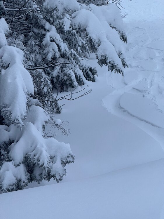
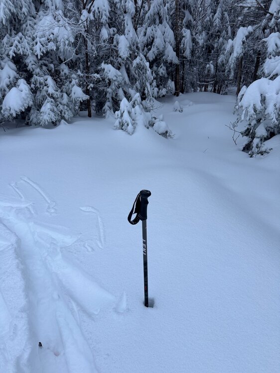
It’s true. This Saturday night event will wreck the surface but it’s going to be minimal melt, if at all, and will only lock the snowpack up tight. Then another 6-10” upslope over two days? The snowpack is bomber. The ol JSpin pole depth check on a 50” ski pole. Couple feet of base on Chin Clip? I’ve seen this trail open on a lot worse coverage ha.
-
I think it sounds like him.


