
All Activity
- Past hour
-
 it hasn't even really started for CT yet.. congrats on 3 plus
 -

Hoisting the Sultan Signal: Heavy Rain Event July 5-7
weatherwiz replied to WxWatcher007's topic in New England
This evolution doesn't scream flood to me outside of any typical spots that flood even when someone leaves their garden hose on too long. I want to see an expansive area of 35-40+ dbz which is almost not moving and with a continuous fetch of moisture and a continued blossoming of the precip shield with intense echoes so the rain shield is essentially stationary.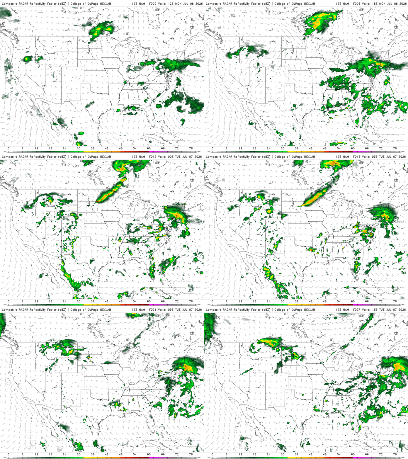
-

2026-2027 Super El Nino
40/70 Benchmark replied to Stormchaserchuck1's topic in Weather Forecasting and Discussion
Yea, one very good month is my thinking...maybe another averageish month if things break right. -
1.45” since July 4. We’ll see if those flooding rains develop later. Radar looks good for another 1/2”
-
-
2026-2027 Super El Nino
40/70 Benchmark replied to Stormchaserchuck1's topic in Weather Forecasting and Discussion
Yea, I am not...at least not at this point in life. My focus is pretty concentrated around SNE snowfall and US cane threats. If the highlight of this winter is severe threats down south, my post count will be considerably lower than usual. -

2026-2027 Super El Nino
LakePaste25 replied to Stormchaserchuck1's topic in Weather Forecasting and Discussion
Just to expand on this, I think 66-70% unfavorable/30-34% favorable is probably the absolute ceiling for this event in terms of best-case scenarios, which equates to 1 good winter month out of the 3. 50/50 or unfavorable 30%, 70% favorable you’re getting into Modoki territory and there’s simply no support for that kind of event. -
did they round up to 32 from like 4
-
 Look at totals so far . 3” will not be the normal in C and N CT
 -
2026-2027 Super El Nino
LakePaste25 replied to Stormchaserchuck1's topic in Weather Forecasting and Discussion
Yup. Avoiding absolutisms (such as “this will be a wall-to-wall shutout, record low snow, etc.”) is key to seasonal forecasting. There will be pacific jet extensions and it will be unfavorable for winter far, far more often than not. Probably as high as 70/30 or 80/20 unfavorable. But there should be some windows of opportunity, even if brief. Of course I am more of a weather weenie than just a snow weenie, so even seeing coastals and severe outbreaks in the South will keep my interest going, plus tracking those brief opportunists to see if a KU event comes to fruition will also be fun. -
Hoisting the Sultan Signal: Heavy Rain Event July 5-7
ineedsnow replied to WxWatcher007's topic in New England
3k looks meh though -
 Looks pretty uniform to me on the radar…been raining nonstop for 12 hrs now, and 3” is looking likely here.
 -

E PA/NJ/DE Summer 2026 Obs/Discussion
BBasile replied to PhiEaglesfan712's topic in Philadelphia Region
About to get dumped on. Can't even really see the storm coming because the cloud base is only 300 feet. Can definitely hear it, though. Picked up 1.01" last night. This might double that. Edit: Rates are 7"+/hr.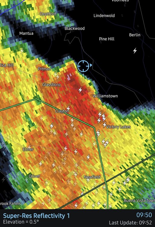
-
Hoisting the Sultan Signal: Heavy Rain Event July 5-7
ineedsnow replied to WxWatcher007's topic in New England
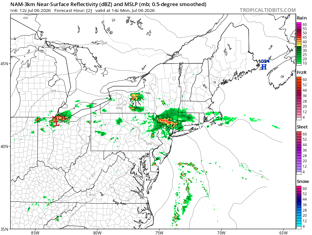
12z NAM going to flood -
Su far it’s gone exactly like I thought with nuisance rains in CT and big totals south and west
-
Hoisting the Sultan Signal: Heavy Rain Event July 5-7
ineedsnow replied to WxWatcher007's topic in New England
you sure about that? 12z NAM coming in -
The blob of heavy slow moving rain over the rockaways and the island beaches have exactly 10 mins to dissipate before the 2 hour NAM blows it. in a shocking turn of events the 1 hr hrrr is better than the nam.
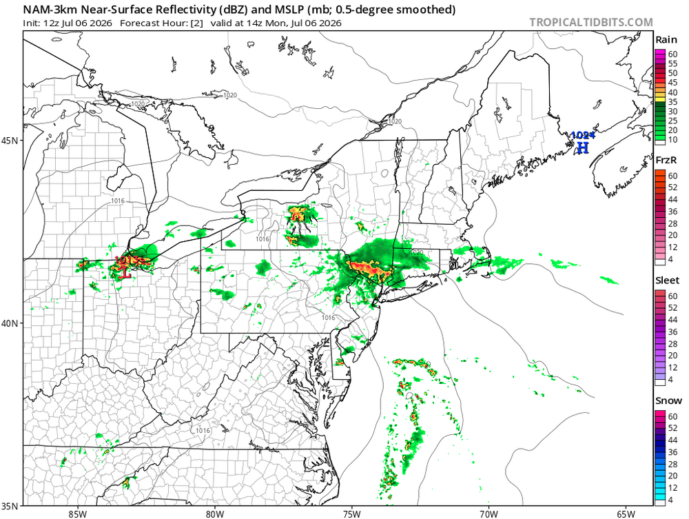
-
Hoisting the Sultan Signal: Heavy Rain Event July 5-7
ineedsnow replied to WxWatcher007's topic in New England
.thumb.png.75ebe54a533387ac33308efb14a82e7c.png)
-
2026-2027 Super El Nino
40/70 Benchmark replied to Stormchaserchuck1's topic in Weather Forecasting and Discussion
What does ENSO state have to do with it? We know guidance has yet to catch up to the intensity of modern ridges because we just witnessed it last winter out west. ENSO state plays a role in dictating where the under-modeled ridging will set up, but it doesn't alter the fact that it is consistently under modeled. The whole "show me update data every season" is a cop out IMHO...the sky is blue, and I don't need data...either look upwards and check Google. -

Hoisting the Sultan Signal: Heavy Rain Event July 5-7
moneypitmike replied to WxWatcher007's topic in New England
pics? -
Should be a busy day today. Already storms developing this morning.
-
Hoisting the Sultan Signal: Heavy Rain Event July 5-7
weatherwiz replied to WxWatcher007's topic in New England
I think its safe to say, that can be tossed and tossed very far -
Yup…CT in the thick of it. Soaking rains. Kev was hedging it stayed south..not happening with this one.
-
2026-2027 Super El Nino
40/70 Benchmark replied to Stormchaserchuck1's topic in Weather Forecasting and Discussion
Yes, this. -
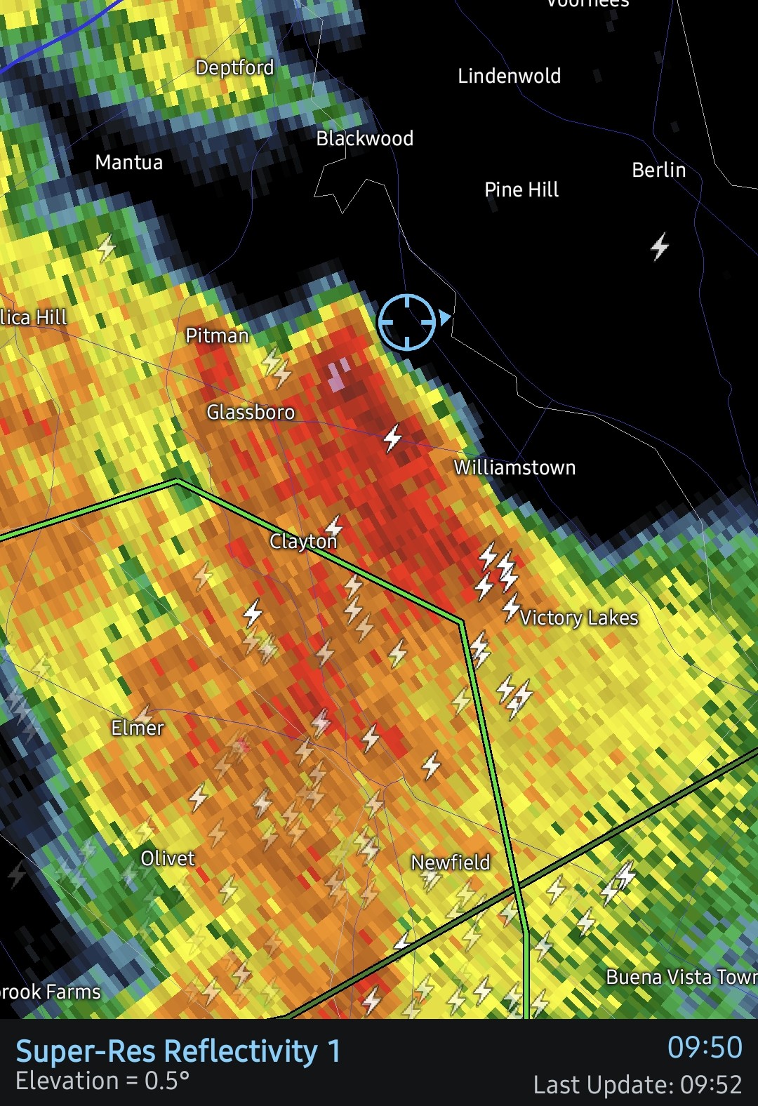
you have a chance of flooding rain very soon - Flood Warning says between 2 - 32 inches -lol FFW from KPHI problem today is these areas of heavy rain just develop very quickly






.png.81ffd7be25504494d5477412c883ce24.png)


