All Activity
- Past hour
-

Strong Nor'Easter/Hybrid Storm Late September 2026
Rjay replied to Rjay's topic in New York City Metro
About an inch of rain. Peak wind gust 55 mph. Costal flooding a little less than expecting. I'm not sold on any stronger winds later but probably another short period of 50ish mph. -

October Comes Early: Late September Multi-Hazard Hybrid Storm
Snowedin replied to WxWatcher007's topic in New England
Easy there brother. We've become used to it from nearly every coastal storm that just happens to graze by us to the one nearly five years ago that brought total destruction to our neighborhood. And we’ve become just as used to our town forgetting our neighborhood even exists on the map. -
 Great discussion from Hammer on this tempest beast https://x.com/ryanhanrahan/status/2103842123522990288?s=46
 -

E PA/NJ/DE Autumn 2026 Obs/Discussion
PhiEaglesfan712 replied to PhiEaglesfan712's topic in Philadelphia Region
I'm surprised they haven't called a ground stop yet at PHL. I know they did so for Sandy. Does anyone remember if there was one for the Blizzard of 1993? -

October Comes Early: Late September Multi-Hazard Hybrid Storm
moneypitmike replied to WxWatcher007's topic in New England
Looks impressive. Feels meh. -

Strong Nor'Easter/Hybrid Storm Late September 2026
Prue11 replied to Rjay's topic in New York City Metro
Winds are strong here but I wouldn’t say it’s anything unusual from a Nor’easter system. The long duration is what’s causing the most damage -
October Comes Early: Late September Multi-Hazard Hybrid Storm
wx_observer replied to WxWatcher007's topic in New England
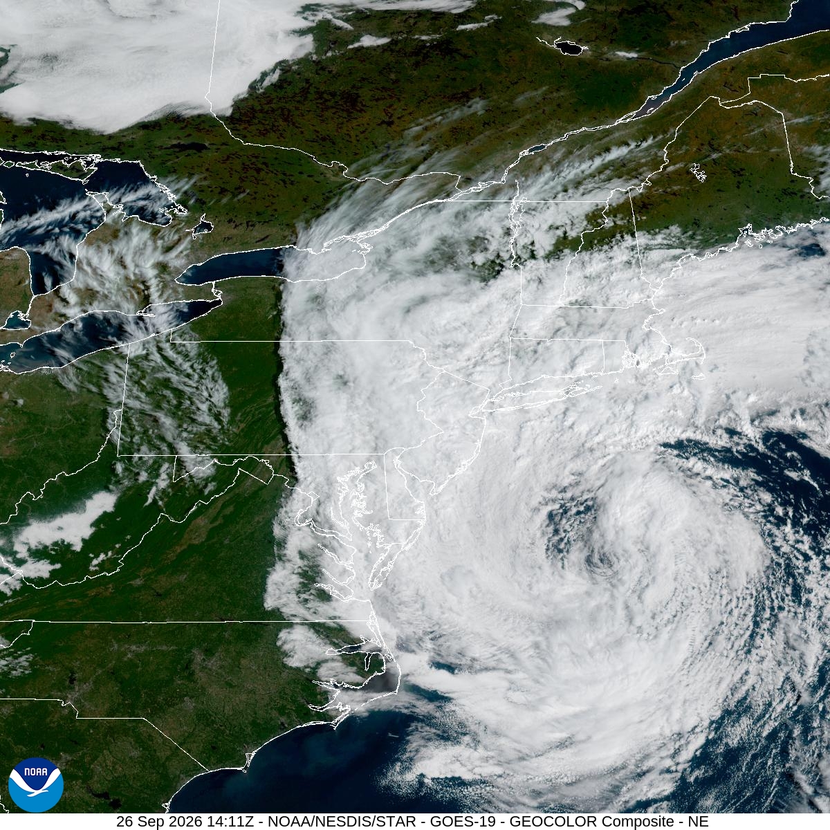
Pretty robust looking storm, despite all the underwhelmed naysayers...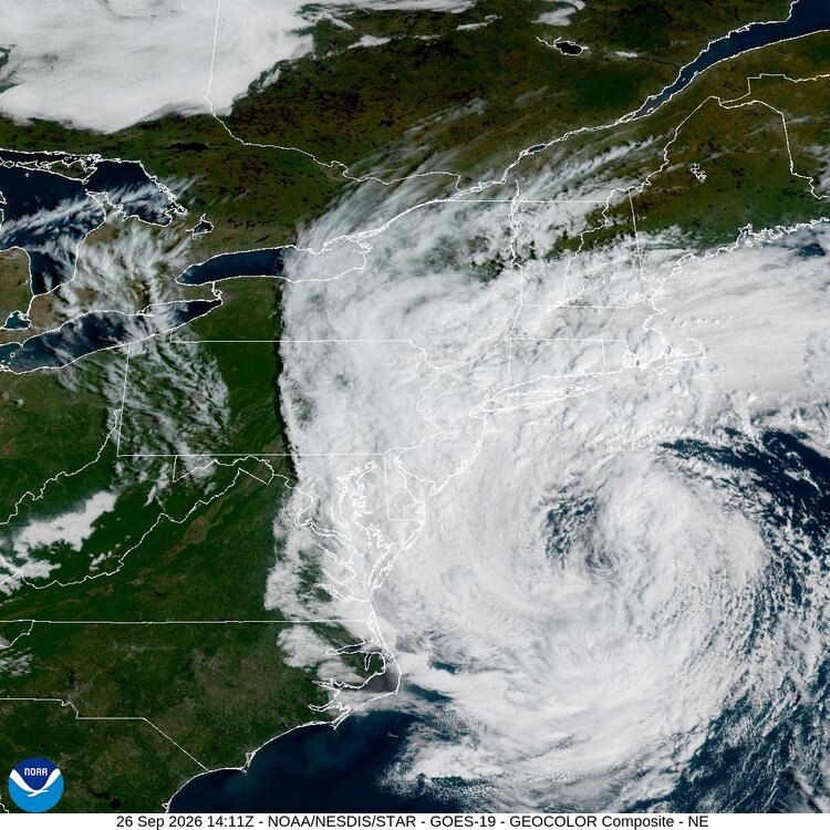
-

October Comes Early: Late September Multi-Hazard Hybrid Storm
CTWeatherFreak replied to WxWatcher007's topic in New England
I know its not tropical, but the clouds appear to be wrapping around what could be termed an 'eye like feature', or so it seems -

E PA/NJ/DE Autumn 2026 Obs/Discussion
BBasile replied to PhiEaglesfan712's topic in Philadelphia Region
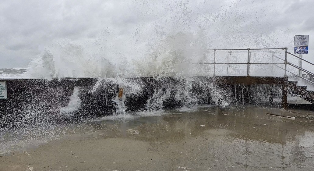
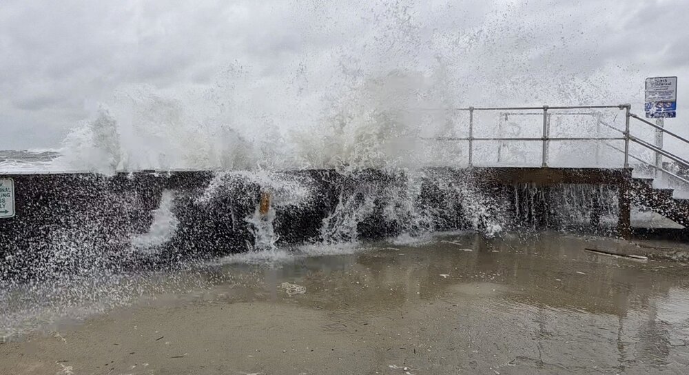
The ocean is angry..thumb.jpg.2e49dbf4edb647a3331cbc8bde2e0718.jpg)
-

October Comes Early: Late September Multi-Hazard Hybrid Storm
WxWatcher007 replied to WxWatcher007's topic in New England
Down to 986mb as of 12z analysis. Looks like it shed the cold front, but still has the warm frontal boundary so obviously not subtropical. -
That 51 at KSAV is the earliest that cold since 1999!
-

Strong Nor'Easter/Hybrid Storm Late September 2026
nycsnow replied to Rjay's topic in New York City Metro
A lot of high res models have strongest winds tonight into 12z ish tomorrow -

Strong Nor'Easter/Hybrid Storm Late September 2026
Intensewind002 replied to Rjay's topic in New York City Metro
Winds peaked here at like 5 am, probably gusting in the low 50s then, now its more like 40-45 range. So far I'd say the wind advisory has sufficed here, doesn't seem like wind is as bad as what you'd see from a higher end event. -
Strong Nor'Easter/Hybrid Storm Late September 2026
Rjay replied to Rjay's topic in New York City Metro
Look again. It's this morning. -

Strong Nor'Easter/Hybrid Storm Late September 2026
Dan76 replied to Rjay's topic in New York City Metro
Tomorrow morning is higher on the charts than today so we'll see -
VT at Boston College at noon could be interesting with rain and winds gusting to 50
-
Septorcher 2026 Discussion - Endless Summer
Damage In Tolland replied to Damage In Tolland's topic in New England
80+ Wednesday/,Thursday -
October Comes Early: Late September Multi-Hazard Hybrid Storm
WxWatcher007 replied to WxWatcher007's topic in New England
Embedded thunderstorms in the current "band" moving through SE CT. Strong winds aloft on radar but nothing particularly impressive yet. -
 A few leaves came by the window. Heading out now to board them up.
 -

Strong Nor'Easter/Hybrid Storm Late September 2026
Snowlover11 replied to Rjay's topic in New York City Metro
Back bays and side streets under water here in AC from what I see from my hotel room. The route i usually leave on is closed/under water. Ocean hasn’t budged much still up on the dunes. Had some strong gusts over night that woke me up im currently on the top floor from my hotel(48th floor). -
October Comes Early: Late September Multi-Hazard Hybrid Storm
WxWatcher007 replied to WxWatcher007's topic in New England
Ray smashing his keyboard and murmuring "this is why I prefer Miller B's"? Suck it up. The pilgrims lived without power. You're part of the softening of society. -
Chilly morning
-
October Comes Early: Late September Multi-Hazard Hybrid Storm
Snowedin replied to WxWatcher007's topic in New England
And there go the lights..right on cue lol -

E PA/NJ/DE Autumn 2026 Obs/Discussion
Kevin Reilly replied to PhiEaglesfan712's topic in Philadelphia Region
Thanks Paul This is a long duration event and the flooding down along coastal sections is going to be quite significant from the back bays especially rolling through the coastal communities. So far here in Media highest wind gust 42 mph and total rain thus far is 0.15" but steady heavier rain is rotating SW down the I-95 corridor so I suspect wind and rain increases over the next hour to two then roll through the rest of the day and evening calming down a bit after midnight tonight. We have a few larger branches, leaves, saw 1 tree down and scattered power outages here around 8 am this morning along Baltimore Pike in Media maybe fixed by now. I have had people asking me if this is January 1-2 feet of snow? I am not sure about that because of the very warm Atlantic and proximity of storm even coming on shore this screams very brief snow to wind swept rain in December to February winter months. Do we know if this is a warm core storm with any tropical characteristics or possibly subtropical? Thanks for your detailed and data rich posts. Kevin Here is 40th and Central in Sea Isle currently significant flooding on gong high tide looks like 2-4 feet of water there in the street. Not sure what it looks like along Landis Avenue in the 50's to 80's streets. -

October Comes Early: Late September Multi-Hazard Hybrid Storm
dendrite replied to WxWatcher007's topic in New England
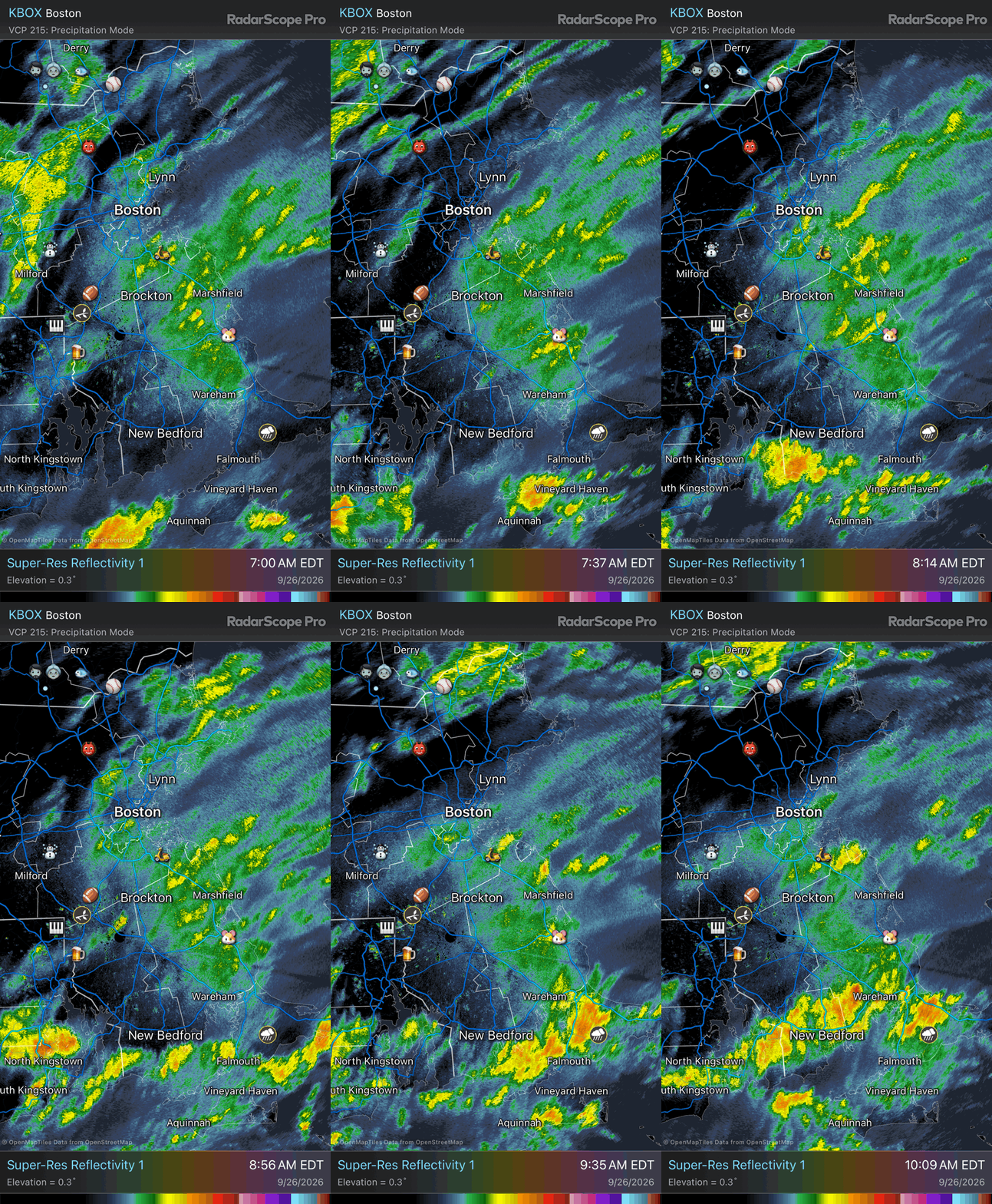
NE MA choking on Scoot’s exhaust all morning. This would’ve been entertaining in winter.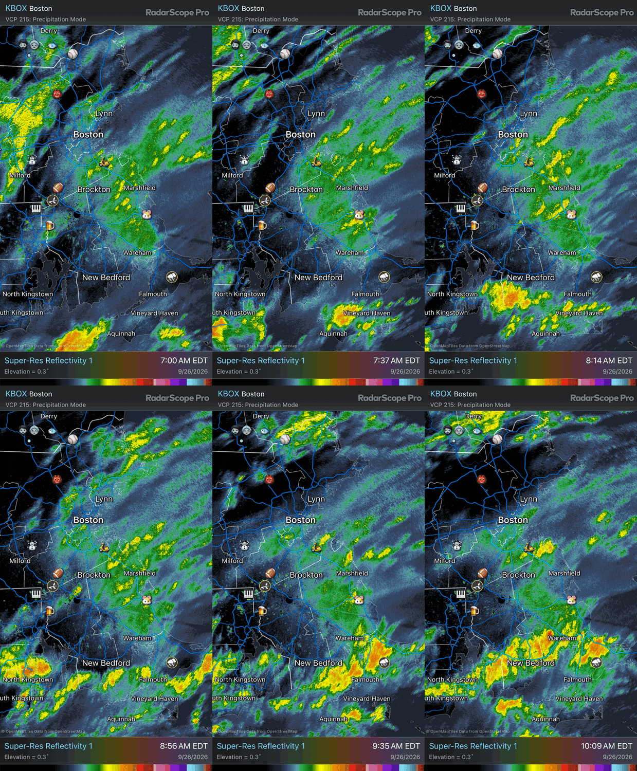

.jpg.038e58d624d12f5d0b583523c8a95f8f.jpg)