All Activity
- Past hour
-
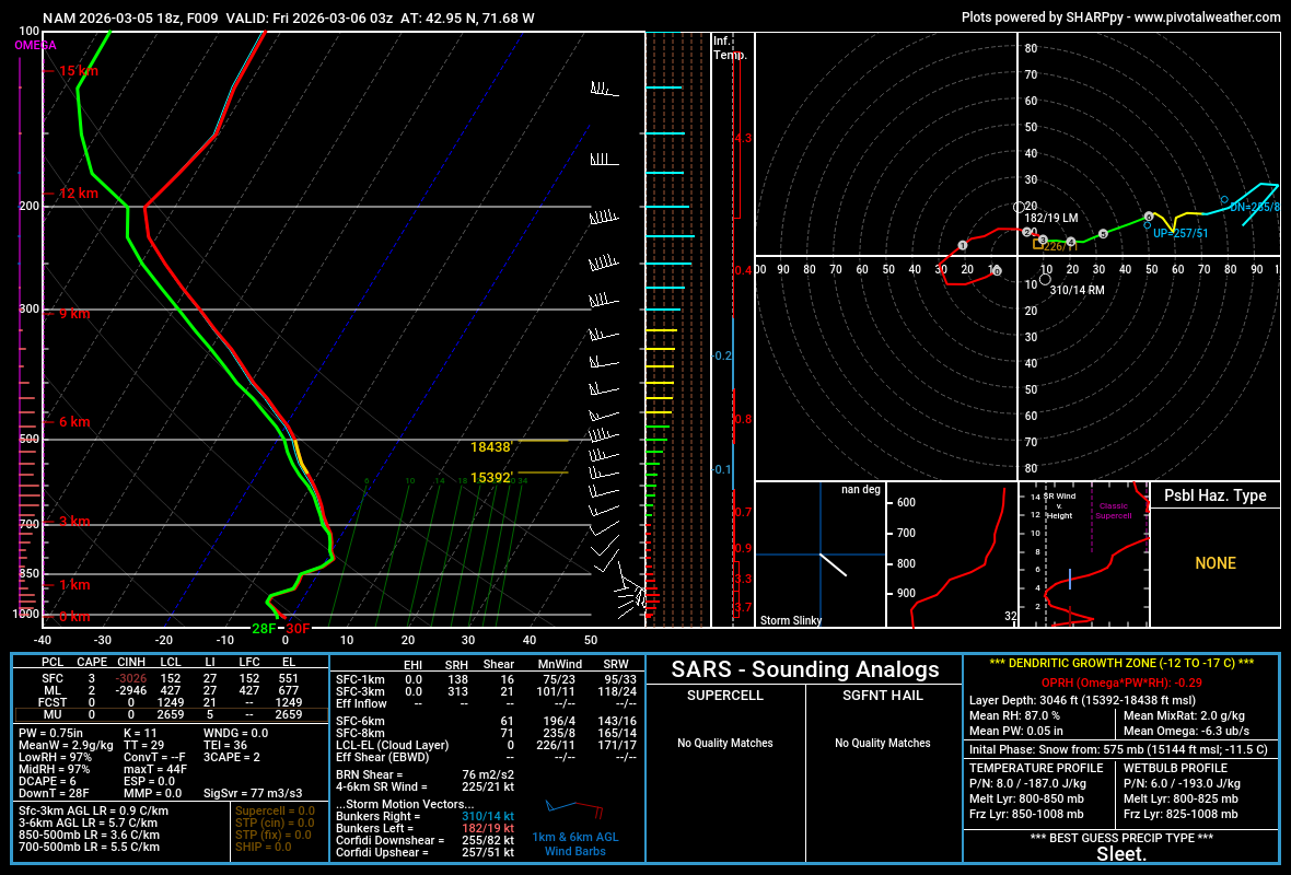
Hour 300, why are we even doing this... but anyway
-
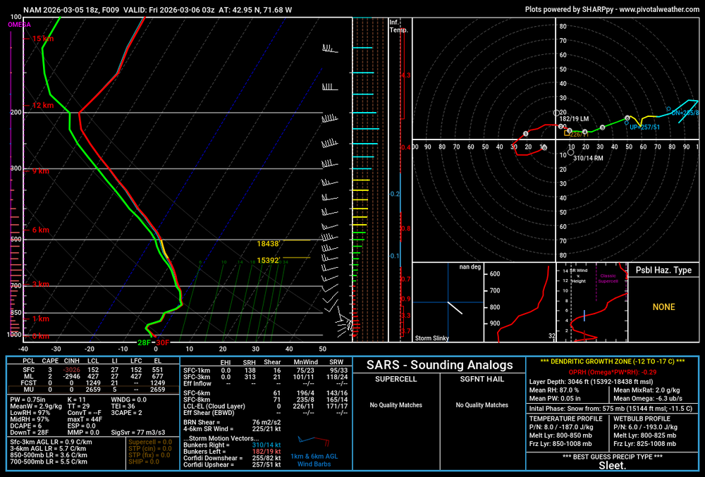
There’s your micro +1C layer. That’s dangerously close to a thump though.
-
I don’t know, but I believe others here can explain it.
-
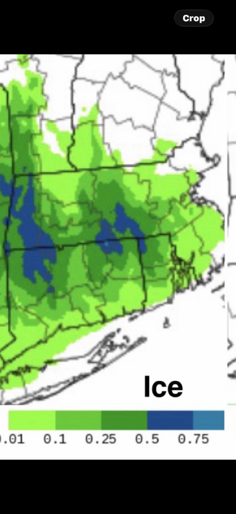
NAM is a scalping to a crusty inch or two here. Meh.
-
It’s usually decent .. but I don’t think so this time
-
Toss that
-
I mean this is either going to break some grids or fail terribly . New HREF
-
Nam is a cancel for most. Probably the right idea.
-
ORH. It’s very noticeable in summer but even in winter . They’re usually lower than everyone else at similar elevations. I’ve brought it up on here before
-
One way to curb fossil fuel burning, make it too expensive?
-
While I am dwelling on the topic, February 2013 comes to mind. There was 27.0" here and 27.8" at ISP. Close enough except that we had accumulated almost 10" here while it was raining at ISP. If we didn't record more snow than ISP in that storm, we never will in a major snowfall. It's not a problem, just differences in the motivation and protocol for snow measurement. Using the Central Park playbook would be a problem.
-
FIT or ORH? Typically ORH is gonna have lower dewpoints because of the elevation difference. But if you’re a rad pit, you may start off the day artificially low because of extra moisture that was lost from the atmosphere when you condensed frost or dew.
-
Christine sucking the life out of the air
-
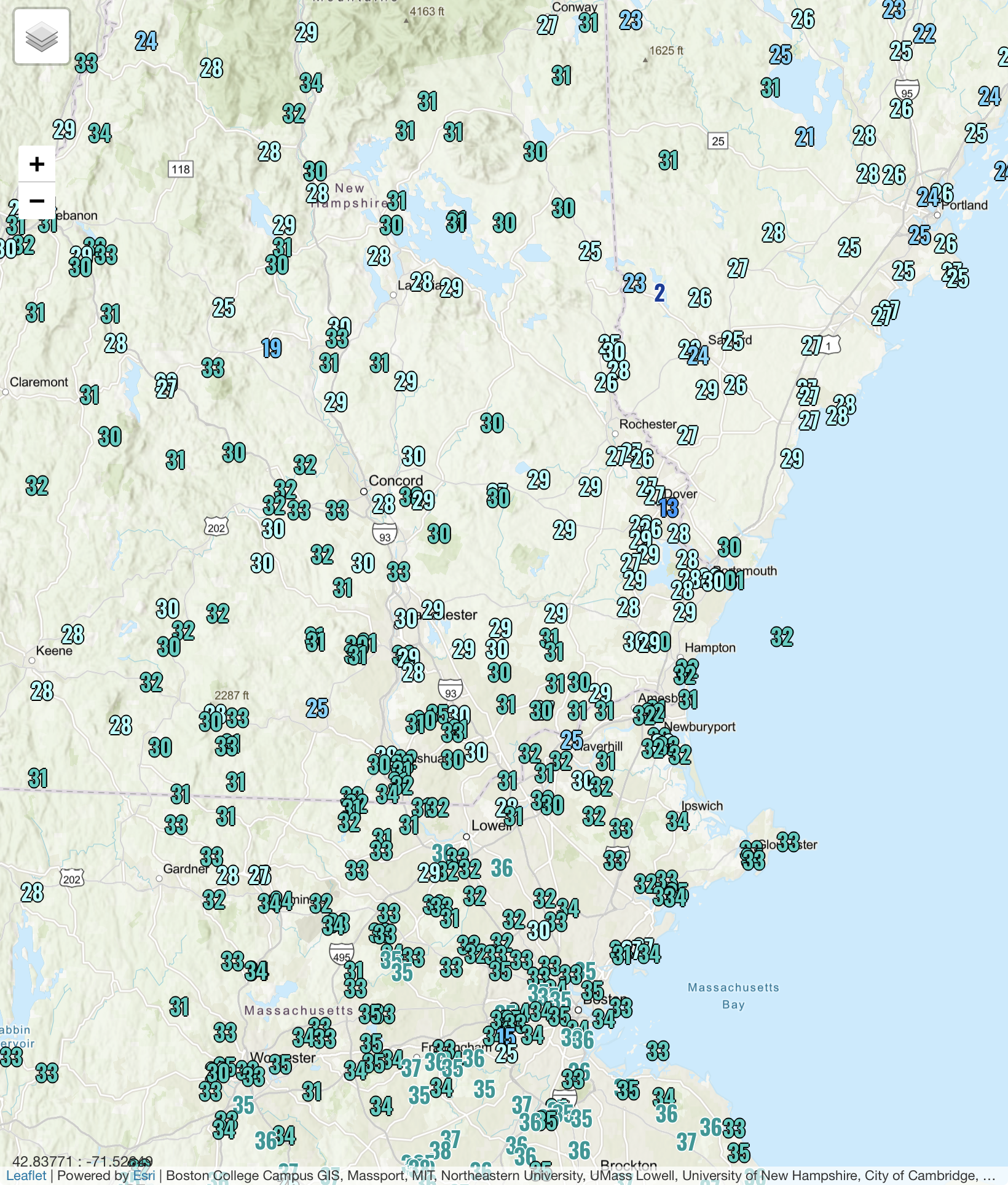
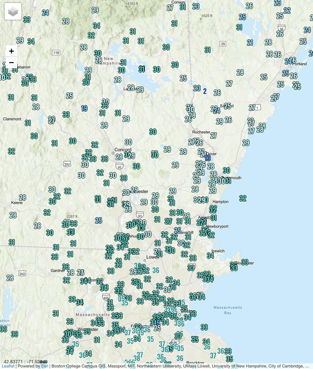
They’re slowly advecting through Rockingham county now.
-
ISP has been holding on to their snow pack better than usual. They are still reporting 5" as of this morning. I have 7", but half of that is the pack thats been on the ground since January. ISP was reporting 0" snow depth prior to the late February blizzard.
-
Their dews are always too low no matter the season . I check it daily. Typically 3-5 lower than all surroundings
-
Down to 35/31. 18z HRRR drops 4" or so here.
-
LOT has 69 in the point for ORD tomorrow, which is only one degree off the record for that date.
-
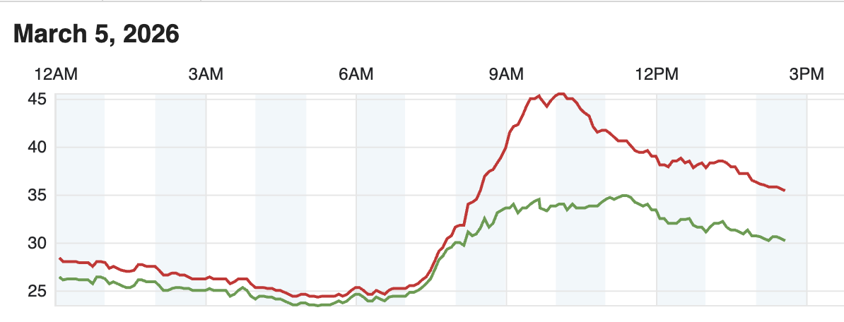
KFIT is prob kind of fake because they radiated so well earlier. ORH has been rotting at 29F dewpoint for hours....briefly spiked to 31F when rain moved in, but fell again when it tapered.
-
Probably less than one not knowing the local history might think. In this latest major snowfall there was an obvious difference in the radar evidence. ISP snowed for many hours while the north shore was dry slotted. In previous major snow storms where there was no such obvious differences in radar presentation, we still fall short of ISP in storm totals (usually significantly so), but the history is that a day or so later, we have equal or greater snow depth.
-
Dews have climbed here in N ORH county. KFIT at 33 now
-
Thanks donald…
-
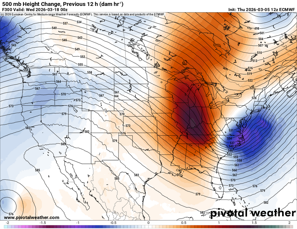
The Euro had the same exact look for this past week at the same time juncture back in Feb and busted horribly (which I called out for its BS). Meanwhile, Chicago will be potentially breaking record highs in the coming days (including tomorrow). Anything hour 240+ is pure fantasy and don't really bother paying any mind to.
-
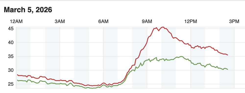
Your area has been warmer than the coast all day. Kind of like April and May
-
The EPS starts warming it back up again by the Equinox (3/20)….