All Activity
- Past hour
-
70 here...
-
We have all winter for temps in the 60s.
-
Today blows
-
If your paving I-93 sure.
-
 Coast is really lucky that Erin is not directly going to hit it.
 -

2025 Atlantic Hurricane Season
Maestrobjwa replied to BarryStantonGBP's topic in Tropical Headquarters
What kind? Banana? -

Hurricane Erin: 130 MPH - 942mb - NW @ 12
NorthHillsWx replied to BarryStantonGBP's topic in Tropical Headquarters
Looks like Erin has made the turn to the north -
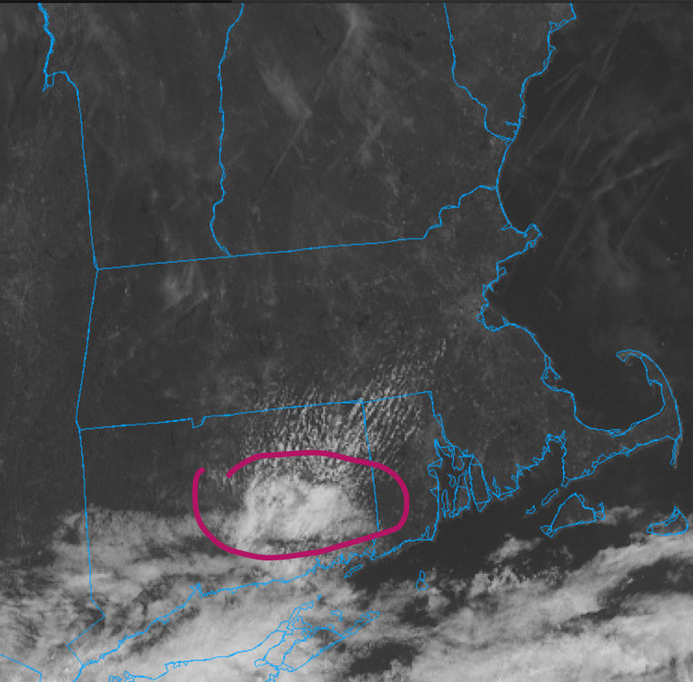
 Possibly all of the wildfire smoke limiting insolation?
 -
 We need this weather to stay, 68 degrees, cool, overcast, no humidity and a nice breeze!
 -
What a refreshing morning
-
 And off Carolina's
 -
Negative. gloom and clouds.
-
Occasional Thoughts on Climate Change
TheClimateChanger replied to donsutherland1's topic in Climate Change
If NCEI comes in at 0.77F above 1991-2020 mean, that would imply an August mean temperature of around 73.82F, or a 3-month summer average of 73.48F, which would tie 2016 & 2018 for 10th hottest on record nationally. A couple BIG caveats - the PRISM numbers are only through 8 PM EDT on Saturday... I suspect the monthly anomaly will be pushing 1F in the coming days. With that said, NCEI usually has LOWER anomalies than PRISM so it might be overstated. They seem to be closer when the heat is centered out west, and there's been a lot of heat in the southwest, so they might come in a little closer. The 10th place years have a pretty large lead over 12th place, so we're almost certainly in the top 12 (i.e., ahead of 2002) even allowing for some offset. Still a couple weeks of data left, so these can move around. It wouldn't take much to get us ahead of 2020 (7th place). Also, NCEI shows a cooler pattern to close out the month - albeit probably pretty close to the 1991-2020 mean, with warmer anomalies in the NW & SE. Prior to 2006, only 1934 & 1936 were hotter for the CONUS (using August's likely mean). -
 Wildfire smoke
 -
Nice to switch off the AC this AM. Low was 59 here. Up to 69 with sun working in from the NE
-

Hurricane Erin: 130 MPH - 942mb - NW @ 12
wthrmn654 replied to BarryStantonGBP's topic in Tropical Headquarters
Hurricane-force winds extend outward up to 80 miles (130 km) from the center and tropical-storm-force winds extend outward up to 230 miles (370 km). -
One of the best days of the entire summer! Ideal for every outdoor activity
-
Hurricane Erin: 130 MPH - 942mb - NW @ 12
wthrmn654 replied to BarryStantonGBP's topic in Tropical Headquarters
Boy what a win for the icon of it's dammed consistency pans out Also the euro AI. Both have been stubbornly consistent. -
67/46 here. It's like heaven.
-
Hurricane Erin: 130 MPH - 942mb - NW @ 12
wthrmn654 replied to BarryStantonGBP's topic in Tropical Headquarters
Af 304 seems to be having some issues with finding a center? 3 passes in a row, 935,938, then 936. -
From the NHC. I wonder if there are more watches up the coast eventually if the nudges west continue. 4. Interests along the Outer Banks of North Carolina and Bermuda should monitor the progress of Erin. Tropical storm conditions and coastal flooding are possible in the North Carolina Outer Banks beginning late Wednesday and a Tropical Storm and Storm Surge Watch may be required later today.
-

Hurricane Erin: 130 MPH - 942mb - NW @ 12
WxWatcher007 replied to BarryStantonGBP's topic in Tropical Headquarters
Also from the NHC 4. Interests along the Outer Banks of North Carolina and Bermuda should monitor the progress of Erin. Tropical storm conditions and coastal flooding are possible in the North Carolina Outer Banks beginning late Wednesday and a Tropical Storm and Storm Surge Watch may be required later today. -
Hurricane Erin: 130 MPH - 942mb - NW @ 12
wthrmn654 replied to BarryStantonGBP's topic in Tropical Headquarters
Based on a number of recent aircraft center fixes, Erin's forward speed has slowed to around 8 or 9 kt. Although there hasn't been much motion this morning, the hurricane has again wobbled to the west-northwest. Nonetheless, the steering pattern and track guidance remains about the same as it has been over the past day. Water vapor imagery shows a trough developing near U.S. mid-Atlantic coastline, and creating a weakness in the western Atlantic subtropical ridge. During the next few days, Erin is expected to turn northward into this weakness, and move between Bermuda and the U.S. east coast in about 72 hours. The official track forecast is very close to the previous NHC prediction and close to the dynamical model consensus. Later in the forecast period, an approaching trough should cause Erin to accelerate northeastward over the northern Atlantic. -
There's all kinds of possibilities re the pattern next week. no one's more likely than the other at this time given what's available via the indexes, as well as poor continuity with the larger synoptic aspects coming from the guidance.
-
Definitely an early fall feel with the temps, low dewpoints, and breeze.


