All Activity
- Past hour
-
Played golf for the second time in my life the other day down in PA. Butter valley golf course. Was with old college friends. Actually did ok. May get a set of used clubs soon.
-
50.2 here.. aahhhhh. Totally fake airmass
-
Even upper 30s on the Cape. Looks like a touch of frost by KTAN.
-
Well that’s it for awhile. Will be 80+ in many areas Tuesday.
-
Down in baldwinville I saw a 33.. I'm sure there's some good frost just down the hill..
-

Occasional Thoughts on Climate Change
donsutherland1 replied to donsutherland1's topic in Climate Change
UHI is effectively addressed in the adjustments. One needs all temperatures to get a good understanding of climate change. https://www.ncei.noaa.gov/pub/data/ushcn/papers/hausfather-etal2013.pdf -
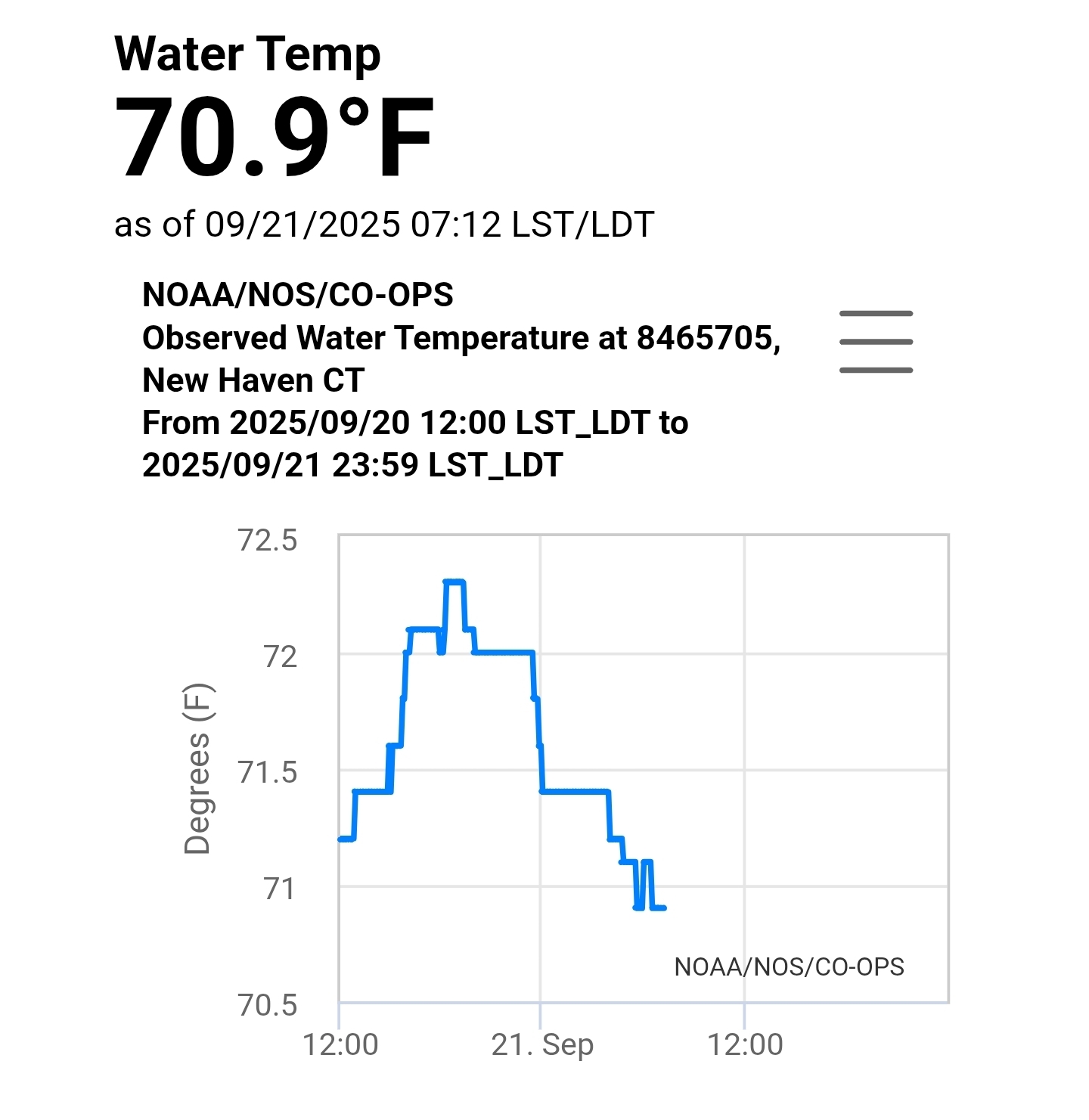
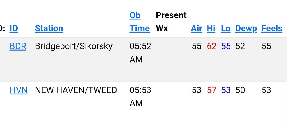
Thanks. Some incredibly warm Long Island sound temps as well for this time of year.

-
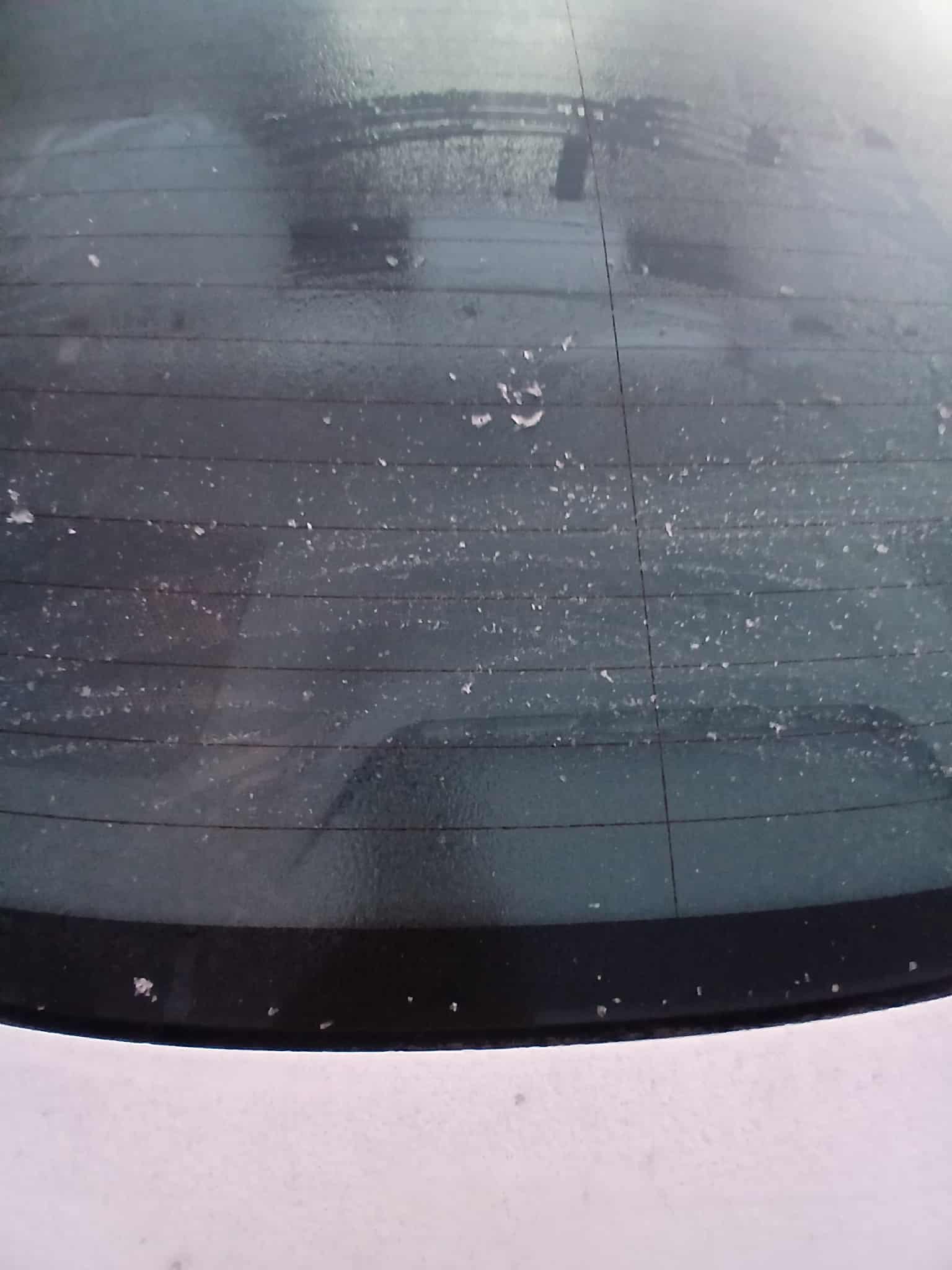
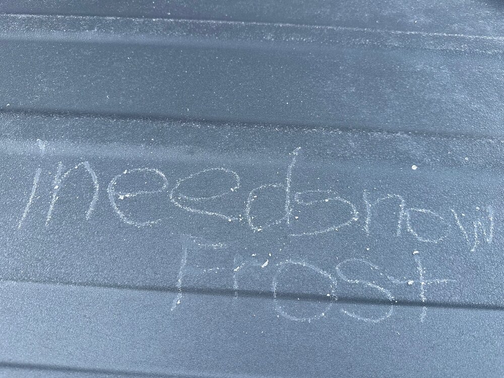
Thats great .. my windows had the slightest bit of frost this morning.. its weird though the top of my car was iced over but the rest was mostly wet.. still manged to get a pic though

-
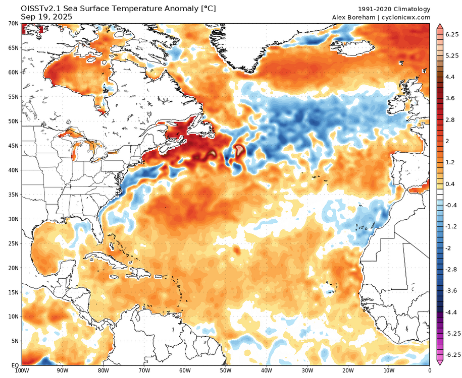
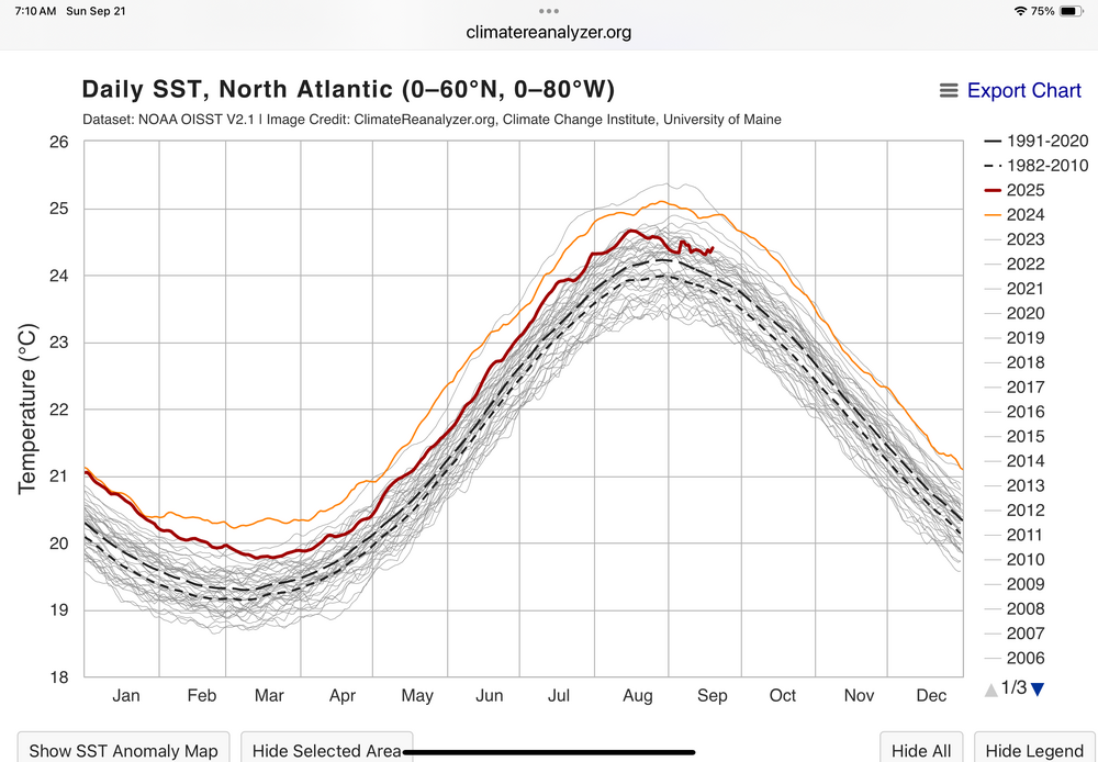
Still looks pretty warm to me since the Atlantic is currently the 5th warmest on record for the date. We also have to remember that this is the warmest 1991-2020 climo. So the actual historical ranking is pretty high. The cold pool west of Ireland is from the locally stronger winds there with the deep low pressure.
-
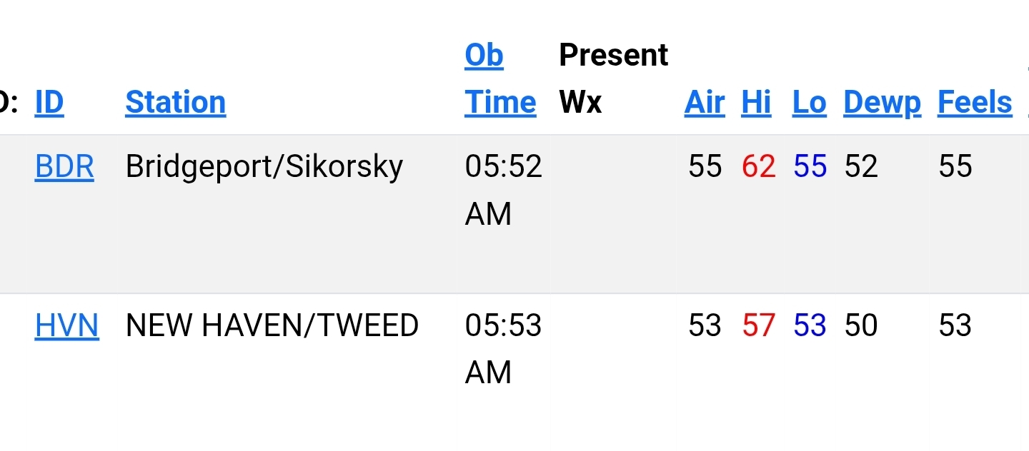
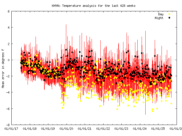
I’ve been watching HVN for a year. More often than not it’s way warmer than stations around it and BDR. They’ll be a day here or there where local nuances might make them close, but as Brian posted above, it seems to run mild. No doubt it’s been warm in the shoreline there.
-
29-30 this morning, less frost than yesterday - not enough moisture.
-
So the data indicates it's off by possibly 2 degrees? Seems to run very close to BDR. There's also like a half dozen or so WU stations near HVN that seem to run pretty close to it.
-
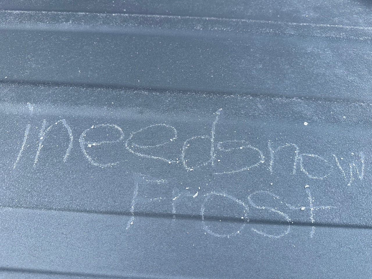
Yep. Trying to tell em.
- Today
-
40F no regerts
-

September 2025 OBS-Discussion centered NYC subforum
bluewave replied to wdrag's topic in New York City Metro
I had 1.78 spread out over 3 days. My wettest single day was only .76. The last 1.02” in a day was way back on May 5th. 3-23-24 was my last 2.92” in one day. This was my 5th driest summer at only 4.99”. It was also my 4th warmest summer here. So all the vegetation and grass was on the brown side. But July 99 back on the South Shore of LI still holds the record for the brownest vegetation that I have seen. Nearly all the lawns and the parkways were completely brown. Time Series Summary for NEW HAVEN TWEED AP, CT - Jun through Aug Click column heading to sort ascending, click again to sort descending. 1 2000 3.02 65 2 1966 4.15 0 3 2022 4.29 0 4 2017 4.76 3 5 2025 4.99 0 6 1957 5.26 0 7 2016 5.28 0 8 1949 5.83 0 9 1965 5.93 0 10 2014 6.23 2 -
We hard frost. Grass is white. 30F.
-
41.5F low. Same as yesterday. Lol a couple of spots in town in the upper 30s (Hubbardston MA)
-
Man, it’s in the 30s all around me. 45.4 here right now.
-
36.1° Had this on top of the car
-
I forget if HVN was on Scoot’s watch list.
-
Well that was awkward down in Calvert yesterday LOL. We visited for a b-day dinner at a restaurant on the bay and I was saying all week "oh yeah we can sit outside - it's gonna be perfect weather." I'm thinking what the heck is this as we drive south thru a heavy shower around Dunkirk, then it proceeds to rain much of the afternoon. That was unexpected!
-
6z GFS closer but meh
-
50.9. May drop a bit
-
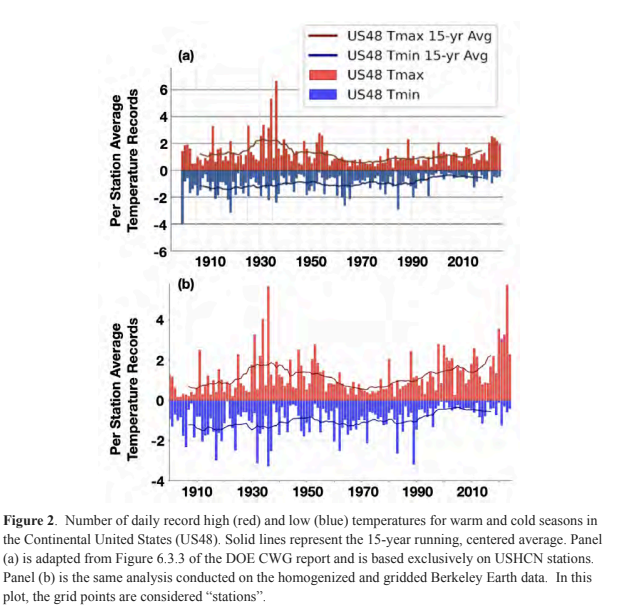
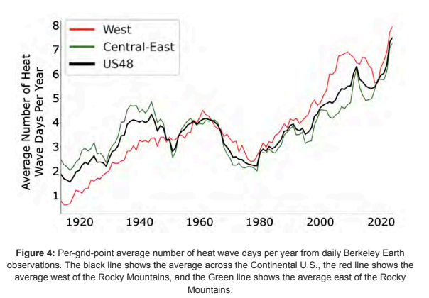
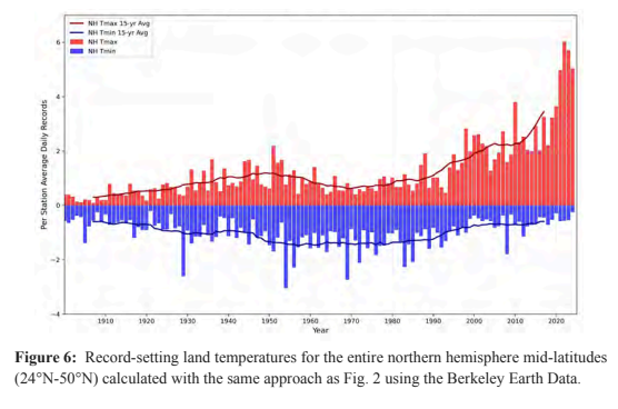
Some charts from the recent climate experts review of the recent DOE CWG report. The first chart shows how misleading taking an average of GHCN stations is because: 1) the stations are not spread uniformly across US and the 2) station network has changed with time both equipment and station locations. The second chart shows that a proper analysis shows heat wave days are increasing in the US and are now well above 1930s levels. The final chart shows that mid-latitude extreme temperatures are increasing much faster outside of the US. https://drive.google.com/file/d/1knIpC4vGrZXDsrF13RC2CujCjhbILgaa/view?usp=sharing
-
36.3° Hopefully that’s it.