All Activity
- Past hour
-
 Getting a downpour now
 -
pouring cold rain and smoked out airmasses, coc
-
Looked like on radar you were getting more.
-

Occasional Thoughts on Climate Change
TheClimateChanger replied to donsutherland1's topic in Climate Change
Speaking of lows: -
Where the hell have you been?
-
it looks like August will average below normal.. its been awhile since we could say that
-
It's too weak.
-
One of the worst summer days in many many years. Congrats Coc ks
-
great week coming up! Detailed Forecast This Afternoon Showers likely. Cloudy, with a high near 62. East wind around 7 mph. Chance of precipitation is 70%. New precipitation amounts between a tenth and quarter of an inch possible. Tonight Showers likely, mainly before 9pm. Patchy fog. Otherwise, cloudy, with a low around 51. East wind 3 to 6 mph. Chance of precipitation is 60%. New precipitation amounts between a quarter and half of an inch possible. Thursday Patchy fog before 9am. Otherwise, partly sunny, with a high near 69. Northeast wind 6 to 10 mph, with gusts as high as 20 mph. Thursday Night Partly cloudy, with a low around 50. Northeast wind around 7 mph. Friday Sunny, with a high near 78. Northeast wind 6 to 10 mph, with gusts as high as 20 mph. Friday Night Mostly clear, with a low around 52. Calm wind. Saturday Sunny, with a high near 81. Calm wind becoming southwest 5 to 7 mph in the morning. Saturday Night Partly cloudy, with a low around 57. South wind around 6 mph. Sunday Partly sunny, with a high near 77. South wind 6 to 10 mph, with gusts as high as 20 mph. Sunday Night Showers likely, mainly after 3am. Mostly cloudy, with a low around 59. South wind 5 to 7 mph. Chance of precipitation is 60%. Monday Showers likely and possibly a thunderstorm. Mostly cloudy, with a high near 76. South wind 5 to 8 mph. Chance of precipitation is 60%. Monday Night A chance of showers and thunderstorms. Mostly cloudy, with a low around 54. Southwest wind around 5 mph becoming calm in the evening. Chance of precipitation is 50%. Tuesday Sunny, with a high near 73. West wind 5 to 10 mph.
-
So is this

-
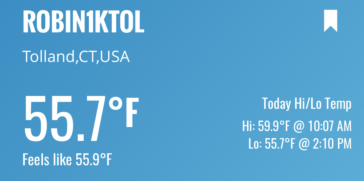
Same. 57.9F high so far.
-
looks like we will stay in the 50s here today
-
 Drizzle/misty all day..Just was able to get one job in
 -
 Steady light rain all day here Currently at .13, will probably nickel and dime our way to a quarter
 -
-
Occasional Thoughts on Climate Change
TheClimateChanger replied to donsutherland1's topic in Climate Change
Excellent post, Tip. The part I emboldened in is an excellent point. One I have made numerous times. When you factor that into the equation, there is NO central US warming hole. It disappears. Current summers FEEL much hotter than summers of the past, including the Dust Bowl, which were the driest (least humid) on record. And while some may say "heat index" is subjective, it's really just a proxy for the wet bulb temperature reading. And that can, in fact, become deadly, even at relatively modest dry bulb temperatures with full (or near full) saturation. Anyways, I often see certain people who deny (some people on here get offended with the term "denier" even though they have used that term profusely in the past, but I digress)... people who deny climate change often say highs are of more value, because lows are more affected by UHI. I would actually argue the exact opposite, and say high temperature readings are more impacted by siting/exposure characteristics and equipment, and low temperatures give us a better look at actual trends. -
The activity in PA seems to be moving this way
-
Low high temp at BDL is 70 from 1922 Current high for the day is 63
-
 Meso models hinted at it yesterday. I-90 special. These very rarely if ever work out IMBY. Somehow they always nudge north and west. I guess 12-15 more hours of mist that gets the total to 0.5”.
 -
CT RI and to about PYM rains. Now that I dropped fert we
-
Occasional Thoughts on Climate Change
TheClimateChanger replied to donsutherland1's topic in Climate Change
That's a stupid graphic measuring surface temperature, not near surface air temperatures. Certainly, being shaded can cool the air temperature as well [not to that extent], but surface air temperatures are supposed to be observed in a location free from shading and obstructions. -

Hurricane Erin: 100 MPH - 954 mb - NNW @ 13
GaWx replied to BarryStantonGBP's topic in Tropical Headquarters
Hurricane Erin Intermediate Advisory Number 37A NWS National Hurricane Center Miami FL AL052025 200 PM EDT Wed Aug 20 2025 SUMMARY OF 200 PM EDT...1800 UTC...INFORMATION ---------------------------------------------- LOCATION...30.6N 73.6W ABOUT 530 MI...855 KM W OF BERMUDA ABOUT 335 MI...540 KM SSE OF CAPE HATTERAS NORTH CAROLINA MAXIMUM SUSTAINED WINDS...110 MPH...175 KM/H PRESENT MOVEMENT...N OR 360 DEGREES AT 13 MPH...20 KM/H MINIMUM CENTRAL PRESSURE...943 MB...27.85 INCHES Some strengthening is expected during the next day or so, and Erin could become a major hurricane again by tonight. Weakening is likely to begin by Friday, but Erin is forecast to remain a hurricane into the weekend. Erin is a large hurricane. Hurricane-force winds extend outward up to 105 miles (165 km) from the center and tropical-storm-force winds extend outward up to 265 miles (425 km). -

Hurricane Erin: 100 MPH - 954 mb - NNW @ 13
NJwx85 replied to BarryStantonGBP's topic in Tropical Headquarters
Thanks -
0.31” so far. Meh


.thumb.png.4150b06c63a21f61052e47a612bf1818.png)