All Activity
- Past hour
-
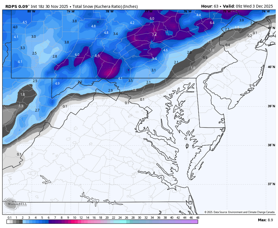
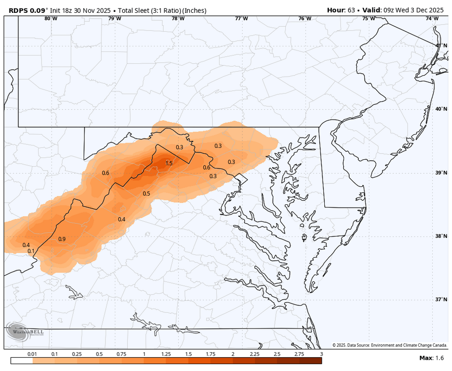
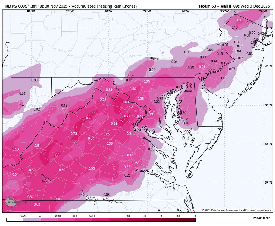
Given the near 0c temps up to 700mb. The guidance on the P-Type is going to be all over the place up until precip time. Things I would focus on now is just amount and timing of saturation. "Wintery Mix" between I-95 and US340/US15 is what I'd go with.
-

First Winter Storm to kickoff 2025-26 Winter season
moneypitmike replied to Baroclinic Zone's topic in New England
Lots of time for this to shift.....don't sweat it yet. You might get more than I. -

First Winter Storm to kickoff 2025-26 Winter season
CoastalWx replied to Baroclinic Zone's topic in New England
Nice try to pull more info out of Me. I think I would be surprised if you were skunked. -
Here's to hoping that lake helps us this time
-

First Winter Storm to kickoff 2025-26 Winter season
Damage In Tolland replied to Baroclinic Zone's topic in New England
So basically there’s a fair chance we see nothing here . This is going end badly -
-

December 2025 Short/Medium Range Forecast Thread
Carvers Gap replied to John1122's topic in Tennessee Valley
I think the MJO is correcting into colder phases with maybe a loop back into 7. The Euro/EPS/EMON has been decent of late in predicting the next plot. I suspect models and ensembles will continue to correct to a colder look. And man, do you all remember ColdRain on the old SE forum. This was his type of day IMBY. RealFeels at 40F w/ light drizzle falling. Scuzzy weather. I like it, but it isn't for everyone. -
First Winter Storm to kickoff 2025-26 Winter season
Johnno replied to Baroclinic Zone's topic in New England
First time in 25 years I have no plowing to do besides my own driveway and shop yard! Can’t wait to throw a log on the fire and watch it snow -

First Winter Storm to kickoff 2025-26 Winter season
CoastalWx replied to Baroclinic Zone's topic in New England
I feel like we beat this to a pulp enough already. You’re definitely close to the line. I’d feel most comfortable right now from about Worcester to say Salem New Hampshire on North and West. Didn’t say that on purpose for Ray, but he may be close to the line too. if the euro is right, maybe shift that south 25 miles or so. -
2025-2026 Fall/Winter Mountain Thread
Buckethead replied to Buckethead's topic in Southeastern States
Down to 34 with fog and drizzle in Wolf. Sent from my SM-S908U using Tapatalk -
This setup reminds me a bit of a hike I went on in the Catoctins last November around this time. Here is a link to the hike I went on which tried to maximize the amount of time I would stay at high elevation while reducing the amount of high elevation road I had to travel up. There's a very long stretch of +1500 feet and you get to start down at 800ft and hike up into it which was awesome. Let me know if you want more details and the link to the hike is here: https://www.alltrails.com/explore/recording/afternoon-hike-at-cat-rock-yellow-trail-to-catoctin-blue-trail-7b13b22?u=i&sh=vrjjqd
-

First Winter Storm to kickoff 2025-26 Winter season
moneypitmike replied to Baroclinic Zone's topic in New England
Have to get through Christmas and New Year's first. -

First Winter Storm to kickoff 2025-26 Winter season
Damage In Tolland replied to Baroclinic Zone's topic in New England
Is MLK coming ? Be honest -

First Winter Storm to kickoff 2025-26 Winter season
ineedsnow replied to Baroclinic Zone's topic in New England
Icon bumped south a bit -

December 2025 regional war/obs/disco thread
Damage In Tolland replied to Torch Tiger's topic in New England
Friday night looks like a 1-3/2-4 type deal -
NAM is still a no go....worrisome because I don't remember getting a storm when it showed nothing.... running 5 degrees warmer at the surface compared to the globals. Upper air temps are also warmer.
-

First Winter Storm to kickoff 2025-26 Winter season
CoastalWx replied to Baroclinic Zone's topic in New England
Yes. The warming from 925-850 there gives them less confidence in CT. -
Get ready for 5th and 6th !
-
Let’s keep it rolling. Why not. Per Lot: EXPECTATIONS ARE THAT TOP-DOWN SATURATION WILL RESULT IN A PERIOD OF LIGHT SNOW SPREADING WEST TO EAST OVER THE ENTIRE AREA, REACHING THE I-39 CORRIDOR BY MID-AFTERNOON AND THE CHICAGO METRO AND NORTHWEST INDIANA BY LATE AFTERNOON. MOST GUIDANCE HAS BEEN CONSISTENT IN GENERATING QPF GENERALLY IN THE 0.15-0.20 INCH RANGE, WITH HIGHER AMOUNTS OF AT LEAST 0.25 INCH IN THE BROADER ENSEMBLE ENVELOPE SOUTH OF I-80. MEANWHILE, A 3KM DEEP DGZ INTERSECTING WITH MOST OF THE MID-LEVEL ASCENT WOULD SUPPORT A HIGHER RATIO SNOWFALL ON THE ORDER OF 15:1 TO EVEN 20:1. PUTTING THIS TOGETHER, A WIDESPREAD FLUFFY SNOW EVENT OF 1-3" NORTH OF I-80 AND 2-4" SOUTH OF I-80 APPEARS LIKELY. HAVE SOME CONCERNS THAT THE 600 HPA F-GEN NOTED ABOVE WILL FOCUS A NARROW (COUNTY-WIDE) WSW TO ENE ORIENTED BAND OF HIGHER QPF AND HIGHER SLR (>20:1) SOUTHEAST OF I-55 IN THE EVENING. IN THIS CASE, IT IS FEASIBLE THAT A NARROW 4-6" BAND OF SNOW WILL BE REALIZED. FINALLY, WHILE NOT EXPECTED (10% CHANCE), SYNOPTIC ENHANCEMENT OF A DEVELOPING MESO-LOW OVER SOUTHERN LAKE MICHIGAN TONIGHT COULD BACK CLOSE TO THE ILLINOIS SHORE AS THE LOW-LEVEL SYNOPTIC FLOW TURNS SSE EARLY MONDAY EVENING. WILL THEREFORE NEED TO MONITOR FOR LOCALLY HIGHER SNOWFALL TOTALS ALONG THE IMMEDIATE SHORE FROM DOWNTOWN CHICAGO TO THE IL/WI LINE.
-
First sub-40 high
-
Just got back to Cary from the (then) sunny coast in the mid-60s. Left in shorts. What a shock coming back to 50 and cold rain.
-

First Winter Storm to kickoff 2025-26 Winter season
moneypitmike replied to Baroclinic Zone's topic in New England
Just realized this map reflects the PWM/BOX/ALY watch areas. -
Given that Greenland Ridge and trough orientation, the 10th to the 11th may be something to watch. Based on EPS.
-
First Winter Storm to kickoff 2025-26 Winter season
Kitz Craver replied to Baroclinic Zone's topic in New England
That map just gave me the bubble gut -

First Winter Storm to kickoff 2025-26 Winter season
moneypitmike replied to Baroclinic Zone's topic in New England
Where you are in Worcester can make a big difference. Airport, e.g., can be way better than the DCU.

