All Activity
- Past hour
-
"wats an eml, is that a bird?"
-
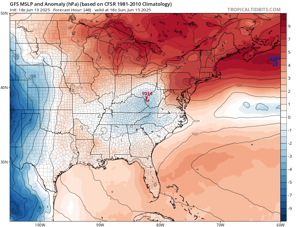
Both Gfs and Euro have periodic EML here starting late next week
-
GFS and 3km NAM have mid 60s. Euro is 70 or so for the region. Pretty impressive wedge as advertised with a flow off the ocean so it could end up on the cool side.

-

E PA/NJ/DE Summer 2025 Obs/Discussion
BBasile replied to Hurricane Agnes's topic in Philadelphia Region
Choked out with smoke right now from the Shamong wildfire. Have ash falling from the sky..thumb.jpg.603c825acdb1d7bb414d67755bd1314a.jpg)
-
Anything EML-driven, rules go out the window. I would say not much to look at for sig severe, tho:/.
-
I haven’t had jack in June until the past 30 minutes. Gotta go to Stephens City for the good stuff.
-
maybe way west NYS VT
-
Tor’s Tiger ?
-
lash Flood Warning DCC001-MDC031-033-VAC013-059-510-610-140400- /O.NEW.KLWX.FF.W.0033.250614T0011Z-250614T0400Z/ /00000.0.ER.000000T0000Z.000000T0000Z.000000T0000Z.OO/ BULLETIN - EAS ACTIVATION REQUESTED Flash Flood Warning National Weather Service Baltimore MD/Washington DC 811 PM EDT Fri Jun 13 2025 The National Weather Service in Sterling Virginia has issued a * Flash Flood Warning for... District of Columbia... Southeastern Montgomery County in central Maryland... Northwestern Prince Georges County in central Maryland... Arlington County in northern Virginia... Northern Fairfax County in northern Virginia... The City of Alexandria in northern Virginia... The City of Falls Church in northern Virginia... * Until midnight EDT tonight. * At 811 PM EDT, Doppler radar indicated thunderstorms producing heavy rain across the warned area. Between 1 and 3 inches of rain have fallen. The expected rainfall rate is 1.5 to 3 inches in 1 hour. Additional rainfall amounts of 1 to 3 inches are possible in the warned area. Flash flooding is ongoing or expected t
-
Thunder in Arlington VA.
-
Maybe we can build an aqueduct from NoVA to central MD to end the drought?
-
Pouring here the last 20 mins. FFW for part of the area till midnight.
-
Flash flood warning up for DC and adjacent FFx and MoCo
-
gonna be a few bangs from that 6/19-20 ...
-
.png.822726269f827f4bf88bf811cd83524d.png)
-
Rain and thunder. Very good.
-
Did you have an electrician wire a line for it?
-
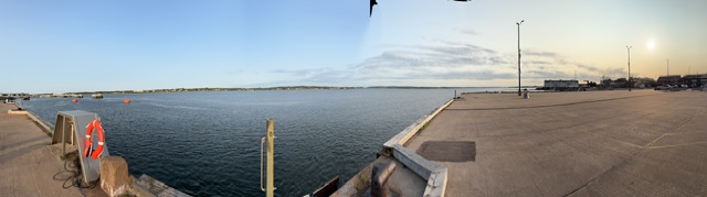
Last evening in PEI. This has been a good trip. I’ve really enjoyed the island and the people.

-
Once a year for me.
- Yesterday
-
Trace. I hate splotchy season
-
-
I know it won't be sig but hope it is. just for taking that chance
-
Franklin farm (south of Reston) got one of the nastiest splits I’ve seen. Storms were to the north and south slowing congealing to be on top of us and then more or less jumped just east into a line.
-

2025-2026 ENSO
PhiEaglesfan712 replied to 40/70 Benchmark's topic in Weather Forecasting and Discussion
Almost reminds me of what happened in summer 2013. Prior to that year, the 3 years before (2010, 2011, and 2012) were very active Atlantic hurricane seasons and hot/dry summers in the East. 2013 was nearly the opposite: A very quiet Atlantic hurricane season and a record wet summer in the East, one that turned cold at the end of July in the Northeast (and was cold throughout the whole summer in the southeast). The difference between last year and this year is the Pacific is active this year, which is why I am more confident in a below average Atlantic hurricane season in 2025. -
HRRR sets up a narrow band right over my golf course tomorrow morning. Can’t make it up.