All Activity
- Past hour
-
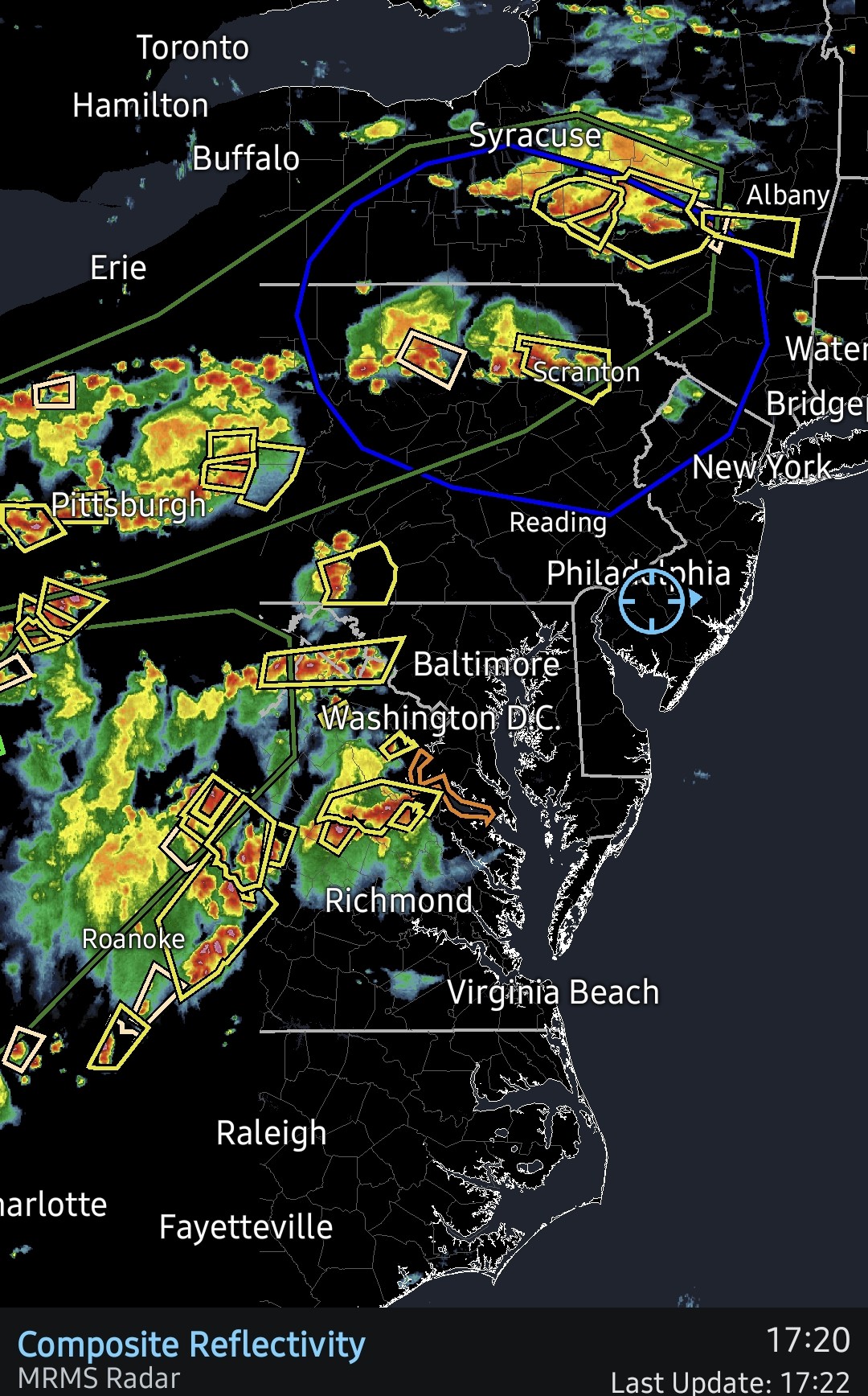
 Nice bow forming . Looks like will go right into POU
 -
Cooling off nicely as the complex shifts north of me. Hoping for some scraps now
-
 COC is 99/74
 -
At least models lost the EC troughing and replaced with WAR. So no real COC weather this month
-

Big Heat (and storms?) Week into July 4th Weekend
Eskimo Joe replied to yoda's topic in Mid Atlantic
BWI, DCA, and IAD all set record highs. IAD fails to get to 100. -
Mid 80s, storms bubbling up all over the region. Happy Independence Day everyone!
-
Im getting all of the theatrics without the rain
-
yeah i just took a look at that cell - good lord. Luckily it's going over an area that is mostly sparsely populated (as long as it stays a good deal west of I-81).
-

Big Heat (and storms?) Week into July 4th Weekend
AnEndlessMaze replied to yoda's topic in Mid Atlantic
Starting to storm here, light rain and thunder. -
Shitty metro area fail? Or will that EZF cluster push north?
-
 Yep. Let’s amp it up and flood.
 -
3 different showers down here 0.05 is all so far.. Good amount of rain down towards Lyndhurst with pretty good amount of limbs and a few smaller trees down..
-
80 dbZ is extremely bad news. Seek shelter IMMEDIATELY!
-

Big Heat (and storms?) Week into July 4th Weekend
SnowtoRain replied to yoda's topic in Mid Atlantic
Current obs from OCMD 86 and one orange crush down. -
75-80 dBZ pixels showing up in Augusta County on Radarscope
-

E PA/NJ/DE Summer 2026 Obs/Discussion
BBasile replied to PhiEaglesfan712's topic in Philadelphia Region
Severe thunderstorm watch engaged!
-
Big Heat (and storms?) Week into July 4th Weekend
Eskimo Joe replied to yoda's topic in Mid Atlantic
Gaithersburg (GAI) hits 101 degrees -
.thumb.gif.f92b16c631a1d15d405ed77b33f0710d.gif) it's all we have. No storms, certainly no severe
it's all we have. No storms, certainly no severe -
Even if Stein holds, hopeful it is a major flooder somewhere because there is nothing else to track
-
You guys are gonna cool down BIG for the Fourth of July festivities lol. Storms inbound, getting more expansive as they approach. Nature's gonnabe putting on her version of fireworks!
-
DCA back to 102/70 with a heat index of 110 - 4th straight day with heat index of 110+.
-
 Models going to be all over.. but someone will flood
 -
Looks pretty nasty down in the SW LWX CWA... lots of purples showing up on radar
-
Let's get after it! 6-12"+!