All Activity
- Past hour
-
 Heat is generally stronger to the north because those places are further away from the moderating effects of the ocean. Manhattan is an island.
 -
I suppose we are due for a colder and snowier stretch, but nothing I have seen or heard seems to argue for their call. On the other hand, I don't see massive torching either.
-
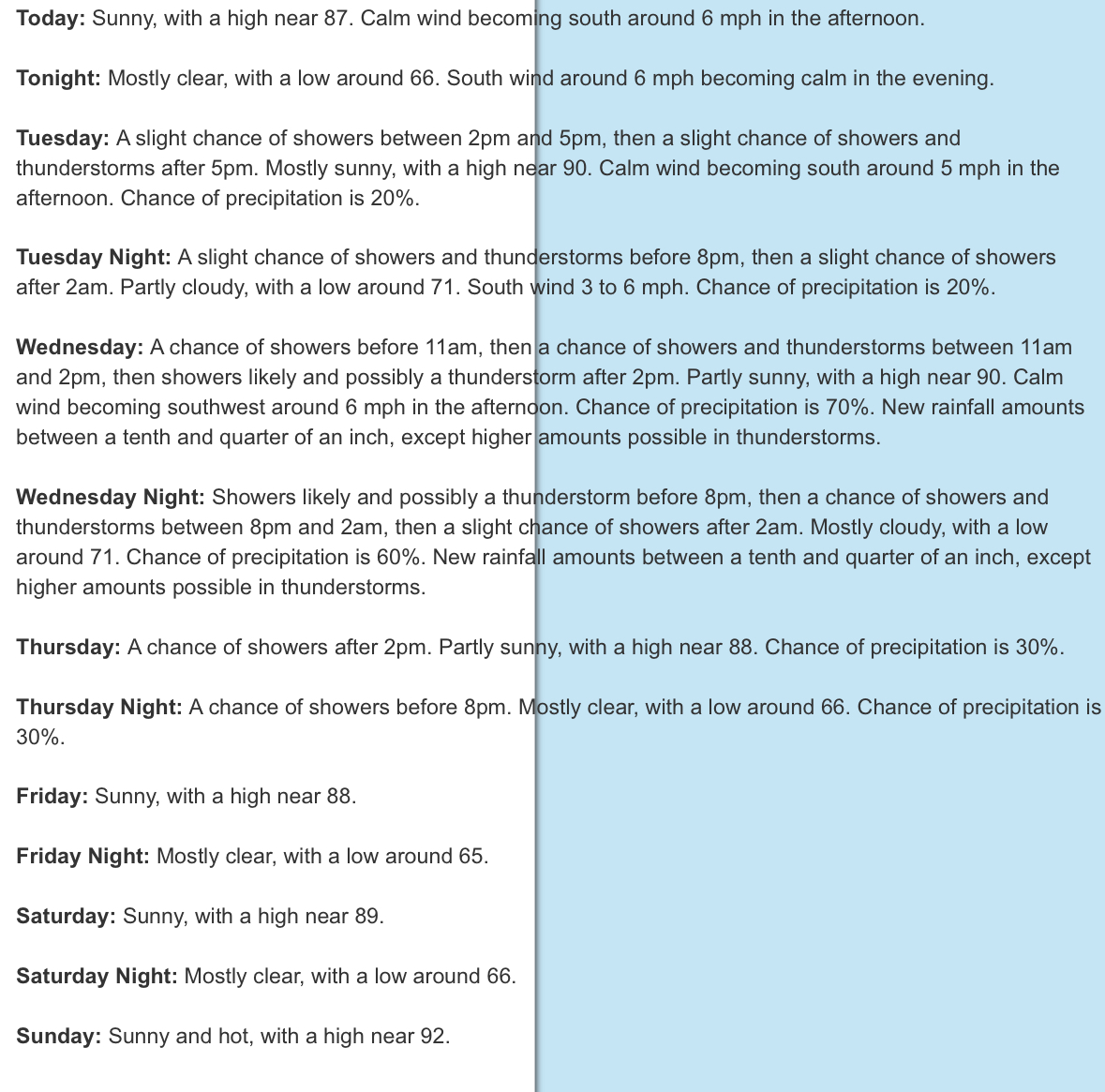
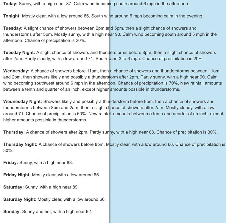
Maybe 100 finally
-
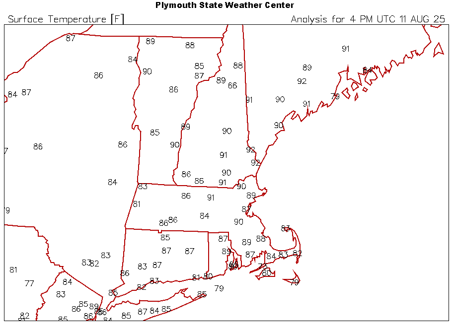
But Newark's temperatures are always 3-5 degrees hotter than the rest of the area.
-
Noon temps for dryslot
-
this all started with ASOS because mets are lazy, we should go back to how it was before things became automated
-
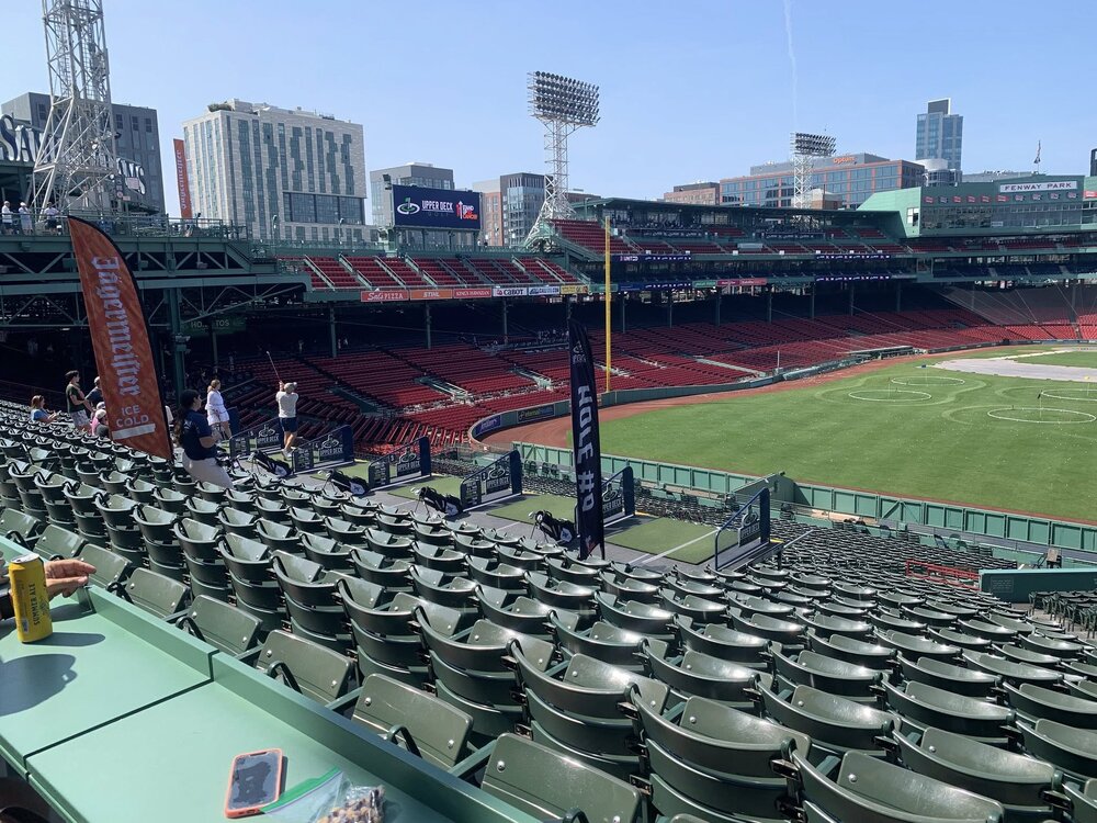
Friend is at Fenway for some golf thing. Must be hot.
-
the history of TC in our area is if they are offshore and recurve, we usually get big heat right after they leave our area
-
Have you looked at the gfs?
-
91/69. Lawn be toast.

-
Agree to disagree. Enjoy your “step down” pattern!
-
Meso models seem to have really struggled this summer.
-
Right...because I haven't seen any long range Euro heat waves posted in here.
-
 Always recording variable
 -
I'm at 1.45 now. Couple more heavy cells in Rutherford heading this way
-
I know who he is. He’s a huge Euro / EPS user. All he basis ideas on, Just tread lightly
-
Heat burn.
-
 nyc's wind obs are also garbage
 -
Sometimes I even surprise myself with the level of genius I occasionally display
-
newark is sited properly and knyc isn't. hope this helps
-
@canderson Your gonna be ok buddy...per NWS 352 FXUS61 KCTP 111109 AFDCTP Area Forecast Discussion National Weather Service State College PA 709 AM EDT Mon Aug 11 2025 .SYNOPSIS... * Early this week will feature a continuation of mainly clear skies with slowly warming daytime and overnight temperatures. * We`ll see and uptick in humidity for the early to midweek period with scattered showers and thunderstorms returning to the region late Tuesday across the west and elsewhere on Wednesday as a weak cold pushes Southeast from the Great Lakes. * A return to dry and warm conditions will comfortably lower humidity for Thursday and Friday.
-
I don't think anyone with a modicum of weather intellect takes it seriously....but by the same token, I'm not sure an endless dose of persistence forecasting is the best avenue, either. Obviously the globe is warming...I get it, but I don't think we are beyond the point of multidecadal oscillations and general variance quite yet.
-
 Ummm, it has been talked about ad nauseam, so lets bring it up again for the millionth time. While we are at it, Newark always seems warm doesn't it? Has that ever been discussed? I never heard this one either over the years. So you are saying that as we warm up a bit, colder departures will be larger with the new norms. That is mind blowing stuff. Any links to papers on it? Fascinating.
 -
This took me by surprise, not gonna lie. I was expecting showery activity but this has been a complete washout. .95” on the day so far, but like you said, plenty more coming.
-
He offers far more data for people to observe whether you like it or not. And much of his is NWS verified. Your and your partner CC (that probably sits in the same chair) are one sided trolls that think its fun to come here and offer agenda driven drivel. This same arguement has been shared with you 100's of times (by myself and others)....yet here we are. Until you and your alternate personality bring objective info to the forum, the reverse trolling will never stop.