All Activity
- Past hour
-
Euro has 2 decent snowstorms but we need stronger
-
What you sayin?
-
Euro has a decent snowstorm before the cold from Hell arrives
-

First Legit Storm Potential of the Season Upon Us
weathafella replied to 40/70 Benchmark's topic in New England
AIs remain steadfast. Let’s see what tomorrow brings. -
If you get really cold early it can make it easier for that to happen. Many trees/plants need to go through a certain amount of hours below a threshold and then they're ready to bloom. In 89-90 there was a crazy amount of blooming in VA/NC/SC in mid to late January because everything reached its hours below in December. In a winter like 15-16 that probably did not happen since you never got cold enough in those areas for them to get required hours on the underside. Up north though it did and stuff bloomed in NYC. Fortunately when the warm spell happens this early the flowers/buds can die and then often get another stretch below threshold to regenerate again in late February or March. If you get heavy blooming in early or mid Feb though and then a killer 3-4 day stretch of 20s/30s the flowers will just die and the tree will leaf out 6-8 weeks later.
-
Well...there's precip..warm and light tho. Oh well. Worst hobby ever
-
Nice slug approaching from our SW at 228...lets see what she does
-

Storm potential January 18th-19th
WeatherGeek2025 replied to WeatherGeek2025's topic in New York City Metro
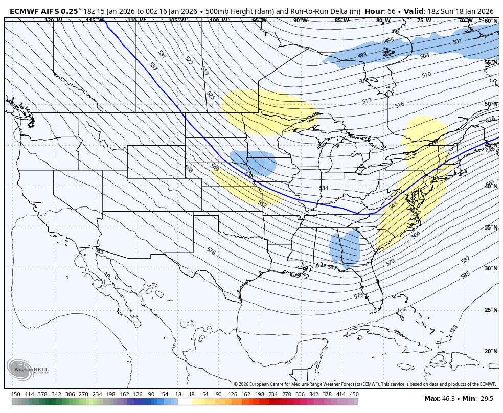
euro has 2-3 inches of snow for saturday for the city and north sunday shows a graze better but still not there. euro will inch west and than make a big move. I don't think the west trend is done on gfs and the other models. The storm will trend stronger and more amped therefore it'll bring more moisture westerly in my opinion! -
Did it just tick a little closer for Sunday? Lol We'll see tomorrow if that was just noise
-

First Legit Storm Potential of the Season Upon Us
wxsniss replied to 40/70 Benchmark's topic in New England
EC a definite improvement though still a graze -
Well, I thought the Euro was doing things at 156...nevermind, just a front it looks like. some light snow tho
-

First Legit Storm Potential of the Season Upon Us
WinterWolf replied to 40/70 Benchmark's topic in New England
If the AI’s win this, that will be a huge win. -
First Legit Storm Potential of the Season Upon Us
weathafella replied to 40/70 Benchmark's topic in New England
AIFS has 0.5 qpf for Boston along the pike to ORH to eastern CT and all of RI -

First Legit Storm Potential of the Season Upon Us
WxWatcher007 replied to 40/70 Benchmark's topic in New England
Still waiting for it on wxmodels -
January 2026 regional war/obs/disco thread
WinterWolf replied to Baroclinic Zone's topic in New England
That would be all time huge Dog….that’s record shattering. -
Must be a systemic change to make them uniform.
-
First Legit Storm Potential of the Season Upon Us
WinterWolf replied to 40/70 Benchmark's topic in New England
How far west did Euro come? -
First Legit Storm Potential of the Season Upon Us
wxsniss replied to 40/70 Benchmark's topic in New England
0z EC AIFS ticked up, warnings to south shore Excellent trends at 0z so far -
January 2026 regional war/obs/disco thread
WxWatcher007 replied to Baroclinic Zone's topic in New England
Big dog cold signal continues -

First Legit Storm Potential of the Season Upon Us
MJO812 replied to 40/70 Benchmark's topic in New England
Looks like the Euro is also correcting west. -
Good morning everyone. I hope you are all doing well. So I have the My Lightning Tracker on my phone and over the past few months when there is nothing in the area for Lightning - my tracker goes off near Hume, VA (mainly to the South and East) / Fauquier County. It happens randomly like today's instance had one strike at 5:52 am and then this evening around 7:47 there were two strikes detected. Does anyone else have this on their phone and seeing the same thing? Obviously the question being - what the hell is it since it is not lightning? Thanks and take care. Ohh yeah... Go Bills!
-
AI euro has 2-4 inches for NYC.
-
Rates (precipitation per hour) are actually modeled to be fairly high. Modeled FGEN is significant across several models. But total precipitation is relatively light due to the short duration. Several models including the GFS deliver over 0.3" liquid over 4-6 hours in or near our region. A few models even have greater than 0.5" liquid nearby. That's a fairly significant QPF signal for short-duration frontogenic banding. The forecast difficulty is that the modeled placement of this banded feature (CT, LHV, CNJ) is highly variable. Forecast temperatures range from the upper 20s to mid 30s across our region with NYC roughly 31F to 35F depending on model during precipitation. Wetbulb temperatures are a little lower and modeled surface temperatures dropping during precipitation. Notably the HRRR is warmest, particularly after precipitation ends Saturday afternoon. NYC will probably record a minimum temperature below 33F on Saturday.
-

First Legit Storm Potential of the Season Upon Us
brooklynwx99 replied to 40/70 Benchmark's topic in New England
AIFS is more amped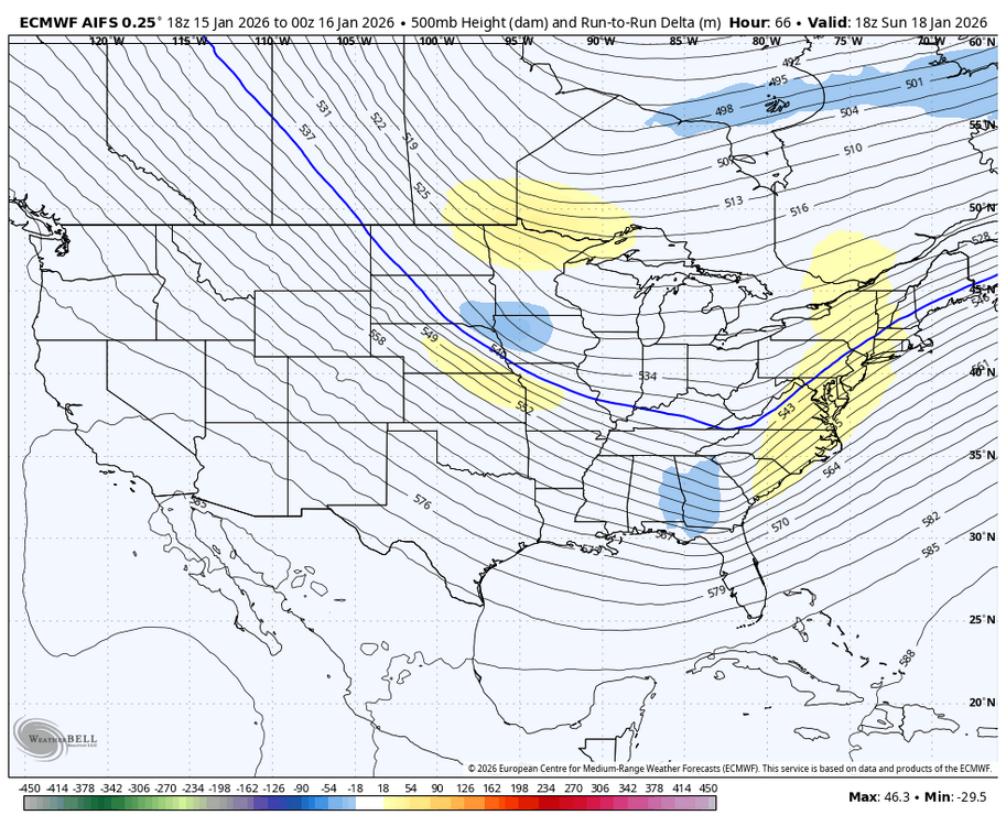
-
I read that 5 days in it has very high grades.