All Activity
- Past hour
-
Another beautiful day for late May! Temps 69/52 for the official Hi/Low for mi casa Currently 61F and dropping slowly. I thoroughly enjoyed driving to work with the windows down this evening. Another nice day in store for tomorrow.
-
I hope so. We are due for a cooler stretch of summer. The things I would do for a 2014 summer redux....
-
Yeah I should’ve clarified… not 1950s New England climo, but like today’s/2000s New England climo. Vegas odds would be on dewy surface moisture levels, not big heat, in the means. Too much crap and moisture in the atmosphere for the big heat numbers but that also means it’s humid with warm nights. Lower diurnal range weather.
-
A few upper 80’s days, retreat back to 70’s then bounce back up again. I feel like there’s not going to be any prolonged high heat or prolonged BN this summer. Just up and down steady as she goes kind of summer with bursts of HHH but nothing remarkable.
-
Stop with that woke nonsense. Do you think the EPA would be doing away with clean air regulations if that was true? Follow your president!
-
As a full region we have definitely gotten more humid over last 10-20 years. Growing up we used to get dry downs that lasted and don’t get those much anymore . It’s especially noticeable at night with warmer mins . BTV is a prime example .
-
That sounds like New England climo summer to be honest.
-
I'll take dews over the heat any day
-
Good call on your installs and Stein by the way.
-
This will be a memorial day weekend to remember weather wise. Great day down on the mall today with some wind chill
-

2025 hurricane season forecast contest -- enter by June 1st
CHSVol replied to Roger Smith's topic in Tropical Headquarters
20/10/4 -
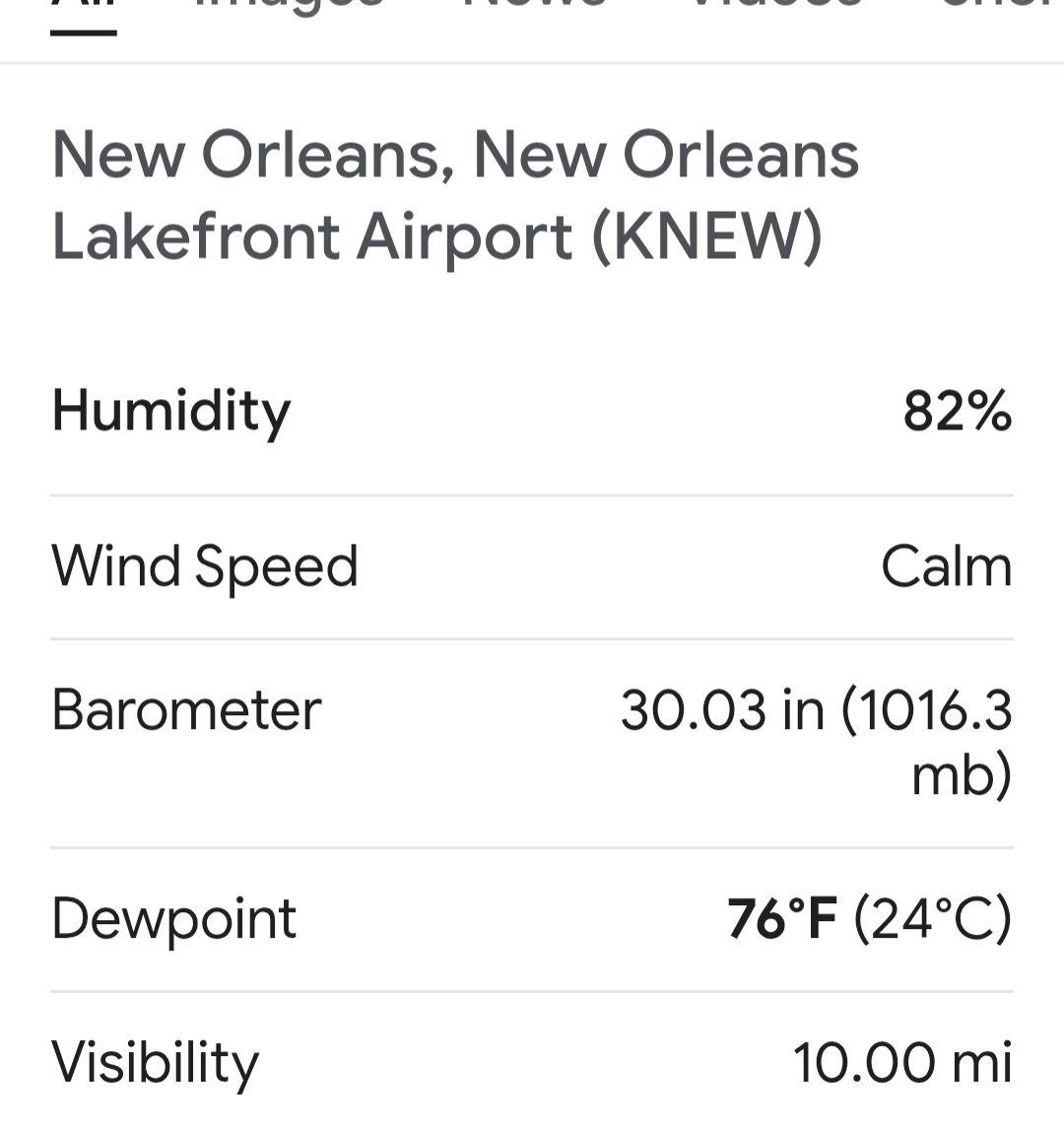
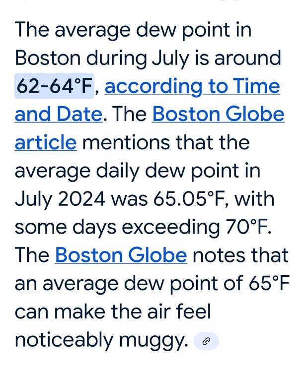
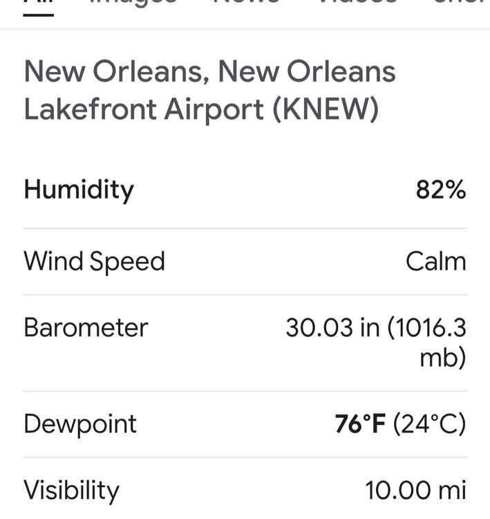
See above. Average dew point last year was 65 in July.
-
We’ve had many summers last 10 years with dews regularly in 70’s. That’s the new climate as we go humid subtropical
-
New England dews are meh. Never bothered me. I spent a summer in New Orleans.
-
Key word "potential." But the numbers I posted showed no warming showing up thru 5/14. Going off those surface maps can be misleading because 1) there are several SSTA product maps out there and they are often different, albeit subtle at times, and who knows exactly which map generates those numbers I posted, and 2) you really can't make an accurate assessment off those maps of subtle changes...iow, eyeballing them doesn't work well most of the time when trying to determine numerical numbers from the CPC.
-

May 17th-20th severe weather discussion
CheeselandSkies replied to Chinook's topic in Central/Western States
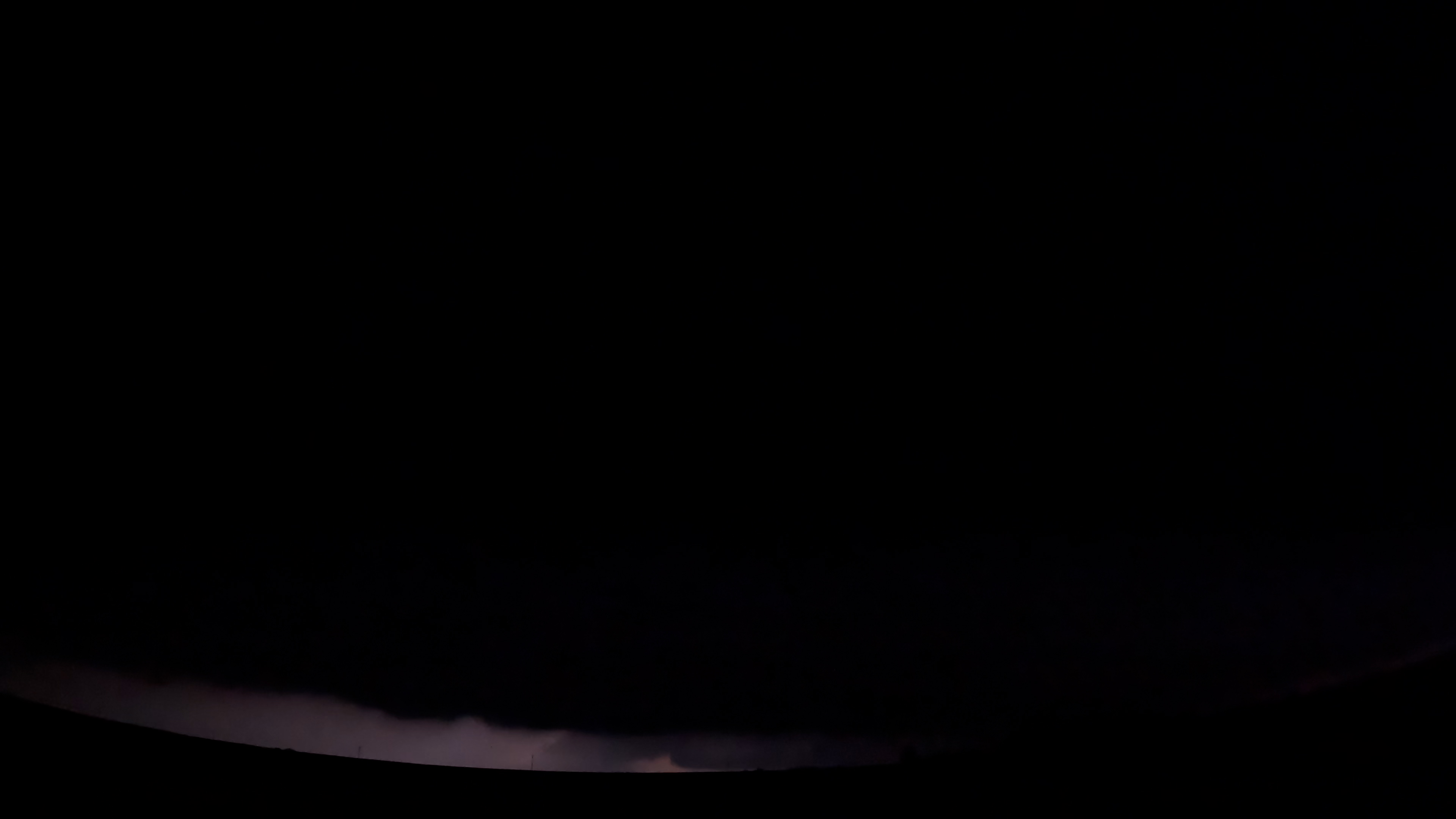
I didn't realize until seeing the DAT that the nocturnal KS beast was actively producing an EF3 while I was on it north of US 54/400 between Cullison and Pratt shortly before 11 PM Sunday. The inflow was howling but the reflectivity signature looked messy from the merger and the velocity, while there was definite rotation, wasn't clear-cut "intense tornado in progress" like it had been back west of Haviland and again from Iuka to Plevna. After I got sick of the pitch black dirt roads (which didn't take very long) and got back on 54/400 eastbound toward Pratt, the lightning didn't illuminate under the base much during the time I was recording. This is the best frame I found that gives some hint as to what was going on, toward the bottom center: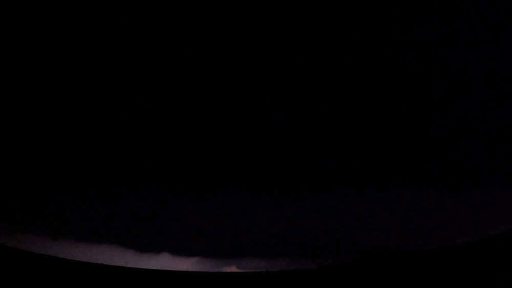
-
This is not scientific, but I’ve had a feeling for awhile that we’re getting a cooler summer. This weekend has been a good sign. Fingers crossed.
- Today
-
Thinking the same..
- Yesterday
-
This is true . So you’ll need to enjoy and root for dews. I think it’s a Dewy summer and not high heat
-
Not a drop of rain at my house today but we ran into a bunch of showers driving all around the area.
-
Beer ?
-
really? noted
-
I don't care if it's hotter than the surface of the Sun as long as the effing rain stops.
-

2025-2026 ENSO
Stormchaserchuck1 replied to 40/70 Benchmark's topic in Weather Forecasting and Discussion
+WPO has been linked to Indian Ocean warming. Indian Ocean SST patterns may be decadal, although the long term trend is generally up. -
Why the two drunks disagreeing?


.thumb.png.4150b06c63a21f61052e47a612bf1818.png)