All Activity
- Past hour
-
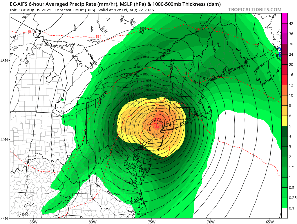
https://x.com/lockingitin/status/1954335676637630589?s=61 300 hr GFS wants to destroy New England
-

2025 Spring/Summer Mountain Thread
Met1985 replied to Maggie Valley Steve's topic in Southeastern States
Just a stellar day today. Had a high of 74 and a current temp of 65 already. Going to be a beautiful night. -
I understand how it would sound that way, lol But I think that's just because of my back and forth between @Chris78 about whether the new owners are responsible for this current mess and I happen to blame Elias much more than them, lol (though their blame meter is gonna go up next year if it doesn't get better). And on this issue I just happen not to care as much if they up now or in two weeks. But trust me...I call it like I see it good or bad.
-
Absolutely.
-
do it!! let's go!!!!!!!! @kdxken every other tree down! take your pick!
-
And it's back...
-
Please please
-
2023 is puzzling given all the energy and excitement around the team that year...was it ticket prices then or something else, I wonder?
-
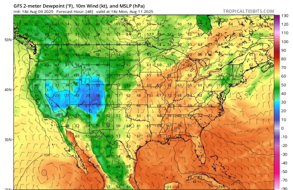
We can mix in dewpoint maps to keep things spicy.
-
 I wouldn't be surprised if we saw a few 90s in September but it would be really hard to do in October, even last October when we didn't get any rainfall at all we didn't see any 90 degree temperatures. Obviously it can happen though, October 2, 2019 it hit 95 here with a heat index of 100.
 -
wild tracks!
-
wow thanks Don, and July is right behind August, which is a little bit of a surprise since July really isn't a month for tropical weather. Maybe these extreme rainfall months are the main reason we don't see very long duration heatwaves and triple digit temperatures as often as we used to.
- Yesterday
-

-
John, N1EGS, headed up to the Foster and Gloucester RI area to look for damage already done. Mike, N1YLQ stated to me that the storm was moving east at 60-70 Knots at this point and that no one could chase to catch up to it. The storm was also dangerous being at night that no chasers were used to 'core punch' the storm, all mobile hams that came on the frequency were used to find damage already done by this very dangerous storm. John found trees down across the Route 100/102 intersection closing the road. With numerous large trees reported down on Route 44 West and also on Route 100 towards Burrillville, RI. Also, along the side of Route 102, there was Golf Ball Sized Hail in Foster RI that accumilated along the side of the road. Quarter Sized Hail was also reported in Burrillville, RI later in the day. Further reports of poles and 4-5" diameter trees down were reported in Smithfield, RI with high tension wires down in Lincoln, RI. Golf Ball Sized Hail was also reported in Smithfield, Cumberland and Lincoln, RI. Route 116 in Smithfield, RI also had 10-12" diameter trees down. In Cumberland, RI, Rick Tellier, SKYWARN Spoter # 00-86, took a picture of several hailstones with a ruler measuring some of the hailstones on a blue mat. Some of the hail stones were near or slightly over 2" in diameter.
-
I've seen dozens of those supercell setups travel over the gulf stream hundreds of miles south off NJ and LI, many many times August/September, but we actually got one over land
-
Also, shows a north Atlantic block that is noteworthy.
-
Once in 10 years
-
True. Everything has to align perfectly for this to verify. I live in RI and Hurricane Bob was the last storm I remember. During Sandy I was living in SC so missed that. Other than an occasional snow storm weather here is pretty mundane .
-
I honestly think he believes it and will stay in low - mid 80’s
-
I am so looking forward to the hourly temp maps over the next few days.
-
Watch it via the vorticity tracker
-
-
I'm really hoping this stays south the next couple of days
-
Well, no I think it’s a fine forecast. NWS is great. Context though matters. Like when SkiMRG would post it wasn’t hot because it only hit 89F at 1,350ft and only 85F at 2kft. I mean I could pull a point forecast from 3,700ft in Stowe and say, hmm not too bad, highs are only in the mid-70s. lol.
-
ERINNNN, 97L BAM BAM BAM 1. Eastern Tropical Atlantic (AL97): A broad area of low pressure, associated with a tropical wave, is producing a large area of disorganized showers and thunderstorms just off the west coast of Africa. Environmental conditions appear conducive for gradual development of this system, and a tropical depression could form by the middle to latter portion of next week while moving west-northwestward at 15 to 20 mph across the eastern and central tropical Atlantic. Locally heavy rainfall is possible Sunday and Monday across portions of the Cabo Verde Islands. * Formation chance through 48 hours...low...10 percent. * Formation chance through 7 days...medium...60 percent.