All Activity
- Past hour
-
What a day
-
Temp at FIT hasn't budged in an hour. 40 F sniffin a bust ?
-
He won’t radiate like BDL
-
oh look! 41 degrees and rain potential!
-
Increased precip in PA also.. hopefully we can increase with 18z and 0z today
-
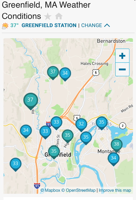
37° here with snow still clinging to the trees.
-
.thumb.png.6df136d0b51017227ac72786b281955b.png)
-
i'm looking at March 13th to March 18th for an overrunning big system that could produce a heavy snowstorm!
-

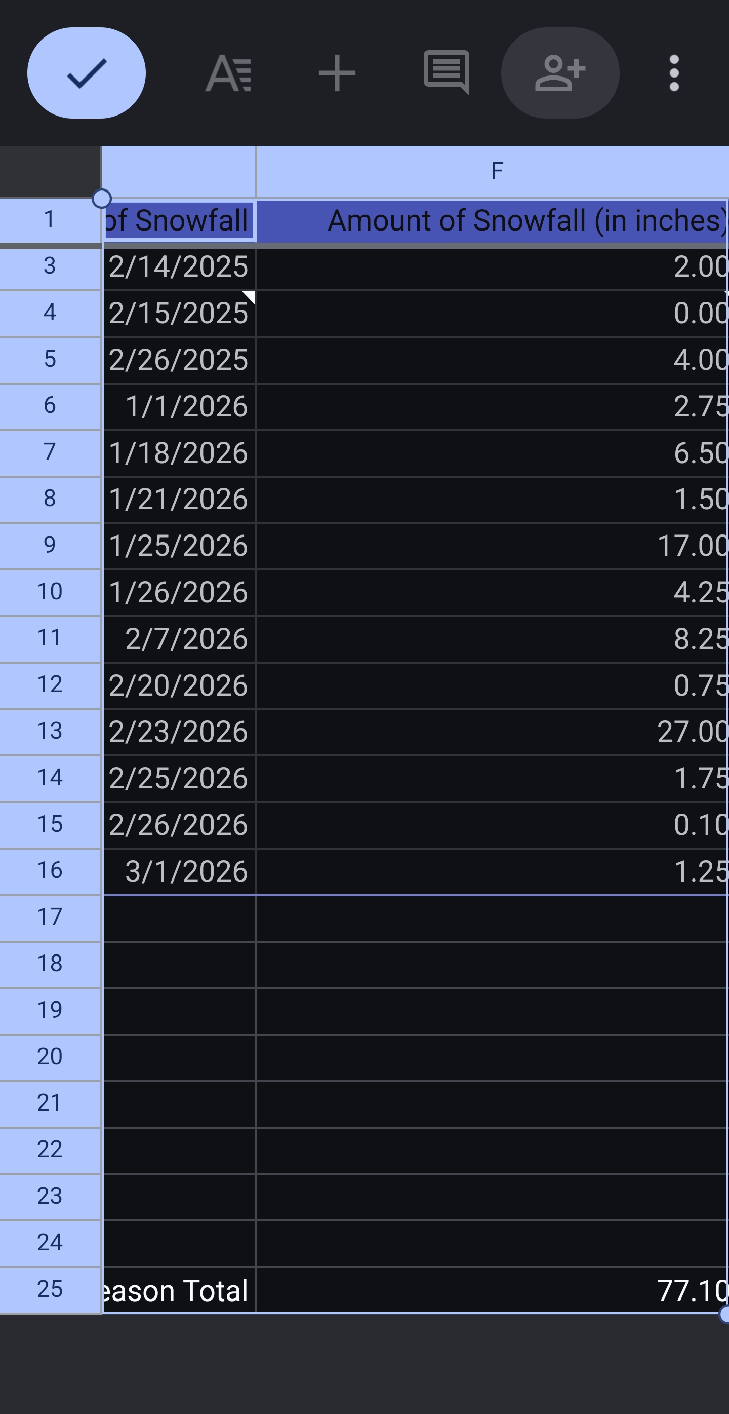
2025-2026 New England Snow Recordkeeping Thread
Ginx snewx replied to bristolri_wx's topic in New England
@The 4 Seasonsmade a math mistake ytd 77.6 with .5 yesterday
-
-
That was HM’s big key years ago when he was still a member of these forums. He harped on the fact that you absolutely need decent west-based -NAO and -AO blocking in mid-late March to get I-95 corridor KU (snowstorm) events….
-
Or trough positioned correctly with a direct tap to cold air (-WPO, -EPO). Not talking KU just accumulating snow.
-
Maybe over a week above freezing there?
-
Will watch this tomorrow

-
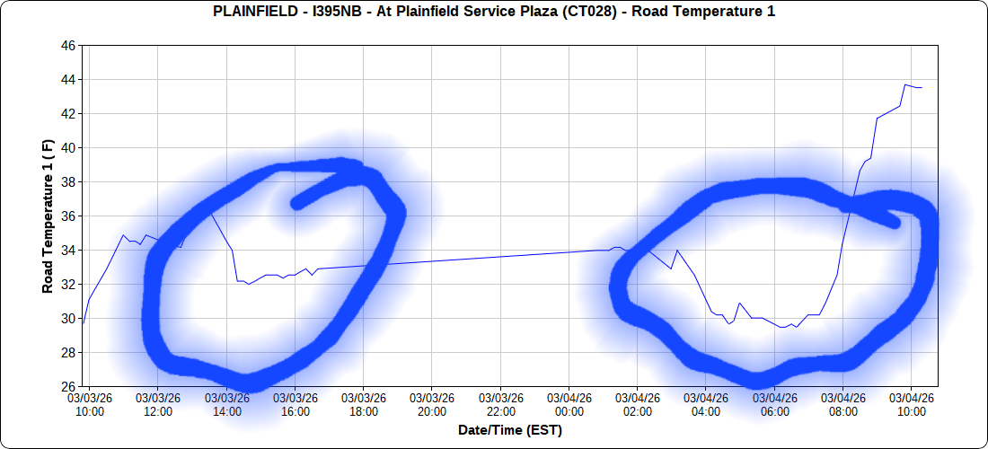
2 major series of accidents on 395 yesterday this morning coincided with road temps

-
I'm not home but sattelite is comical with the clouds trapped in the valley while everyone else is starting to tan the nape.
-
Gfs is definitely interesting into SNH into NE MA
-
Supported
-
Goofus is frigid....basically a warning snow event for BOS after some sleet. Gets ZR into most of CT
-
Congrats Ray on gfs. Even tries to dump near BOS
-
Days and days
-
The NAO/AO will be the key whether we get anything-we almost have to have those in late winter
-
One day of heavy fog is really neat. Whole world looks different. Two days, ok, getting boring. Three or more, let me out.
-
Sell 4 days of 60’s
-
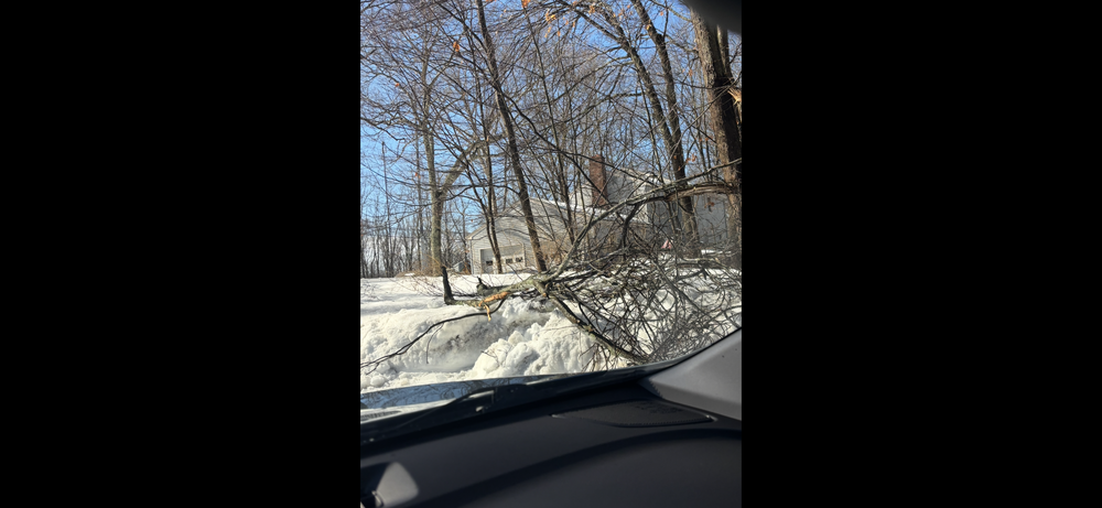
Yeah this won’t be a road issue south of 90. With 40’s today , near 40 tomorrow and near 30 tonight roads won’t be cold . Will be a tree issue and cold surface event. Hopefully more scenes like this in my street this morning .


.thumb.png.4150b06c63a21f61052e47a612bf1818.png)
.png.ee919ac320d154da29d04ce5e2d9e3e8.png)