All Activity
- Past hour
-

December 2025 regional war/obs/disco thread
Kitz Craver replied to Torch Tiger's topic in New England
Bleh, whatever. Cue the cutters of yore -

E PA/NJ/DE Winter 2025-26 Obs/Discussion
Newman replied to LVblizzard's topic in Philadelphia Region
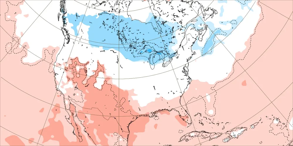
NAM in line with the Euro, obviously more amped because it's the NAM. But cut some of that QPF and it's a general 2-4" along the I-95 corridor. It's a shame this isn't coming 6-12 hours later for the Eagles game -
My 11 year old son who is into engineering and science would probably listen and then start pulling up videos about it on his tablet. My 7 year old daughter would look at me and say "but my unicorn stuffy said it's going to snow" She is clearly the one on her way to a healthier, happier life.
-
Right now, I'd say I'm fairly confident that DCA will get at least 1.1" of snow right now (assuming DCA doesn't do their normal measuring bullshit), making this December the snowiest since 2009!
-

12/14: Sunday funday? Will the south win again?
winter_warlock replied to TSSN+'s topic in Mid Atlantic
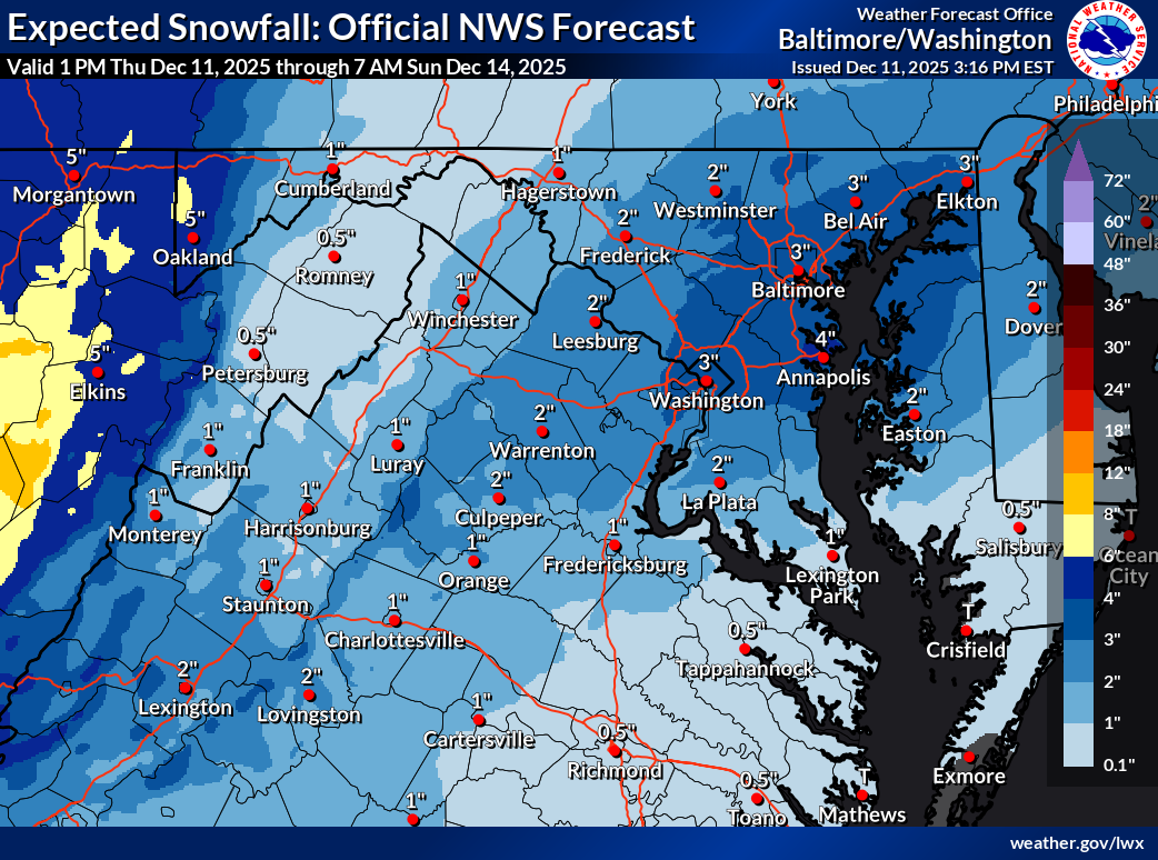
LWX. Upped their amounts a lil..
-
I'll take my 2.5" so that Balt & NW folks get their warning snows.
-

Minor snow possible sunday 12/14/25
WeatherGeek2025 replied to WeatherGeek2025's topic in New York City Metro
i think that's a great call 2-4 inches and you know what if we get that we should be happy with it. especially with what we got in the last 5 years! -

12/14: Sunday funday? Will the south win again?
Scarlet Pimpernel replied to TSSN+'s topic in Mid Atlantic
Let's just not pull an FSU with a wide-right miss! I still remember being there as a grad student for the first "wide right" vs. Miami in 1991 (FSU was ranked #1 and Miami #2 at that time)...ugh!! -
18z NAM
-
I think NG prices move mostly on 2-3 week outlooks, but have no idea past 3 weeks. If the 4th week is going to be cold, and that 4th week rolls forward into week 3, NG prices will jump just the same.
-
Type up a power point presentation about the pdo and sit them down and and explain. Haha
-

Minor snow possible sunday 12/14/25
winterwx21 replied to WeatherGeek2025's topic in New York City Metro
We knew that the 12z NAM was likely overdone. 18z NAM looks fine ... a 2 to 4 inch snowfall is what we're looking for from this type of system. -

Mid to long range discussion- 2025
WinstonSalemArlington replied to wncsnow's topic in Southeastern States
-

December 2025 regional war/obs/disco thread
TauntonBlizzard2013 replied to Torch Tiger's topic in New England
Blah, the ending is where you really notice. Shifted way SE, not even close -
I just want enough for my kids to be able to go sledding or build a snowman. They're starting to ask every day when it's going to snow.
-

12/14: Sunday funday? Will the south win again?
stormtracker replied to TSSN+'s topic in Mid Atlantic
Indeed. Hope it keeps dropping south in line with the GFS/UK/Euro tho just for cushion. IJS -

12/14: Sunday funday? Will the south win again?
Imgoinhungry replied to TSSN+'s topic in Mid Atlantic
Northern maryland’s turn for once!? . -

2025-2026 ENSO
Stormchaserchuck1 replied to 40/70 Benchmark's topic in Weather Forecasting and Discussion
I was going to say - A move from $5.50 to $4.22 in a few days is extreme! It's a good time to assess the situation: What major has happened/changed in this time that could be effecting not only the next few weeks, but the whole Winter? And later in the Winter - as March 2026 has dropped from $4.25 to $3.57? I've seen the models shift warm, which NG changes led by a few days, but I don't have an answer as to the greater picture right now. I know we are going into some more extreme +NAO in the next little bit of time, which effects Europe too. 480sdm low south of Greenland Hrs 120-144. Maybe it's a persistency thought. -
Today’s Euro Weeklies for 12/22-1/18 are even slightly uglier than yesterday’s ugly maps with a strong -PNA bringing warmer than normal for each week’s average for most of the US with the strongest warmth from the lower Midwest through the C/S Plains to the SW US, where it torches for part of the time in late Dec and early Jan. The E US is still clearly warmer than normal but like yesterday no torch dominates there. Hopefully, these maps fail miserably but I hate seeing them. But in case they were to not fail and before y’all jump off of a cliff, there is some good news for the first run with the new week (1/19-25): it transitions toward a -EPO/+PNA/-AO/-NAO. Maybe, this is a sign of better things to come by mid to late Jan? For 1/19-25: N America H5 Global H5: N America 2m temps: ahhhh with much colder than prior maps!
-
December 2025 regional war/obs/disco thread
TauntonBlizzard2013 replied to Torch Tiger's topic in New England
I know people always comment on who posts and what to expect, but the biggest indicators is who isn’t posting. Scooter hasn’t chimed in wt all. Tells you all you need to know about this “threat” -
I’d sign for this so fast.
-
December 2025 regional war/obs/disco thread
TauntonBlizzard2013 replied to Torch Tiger's topic in New England
NAM back to a graze. 2” on the beaches maybe and then a coating up by the pike -

December 2025 Short/Medium Range Forecast Thread
Carvers Gap replied to John1122's topic in Tennessee Valley
The 12z CFSv2 also lends some support to the "jail break" cold pattern potential just after Christmas. -
Minor snow possible sunday 12/14/25
WeatherGeek2025 replied to WeatherGeek2025's topic in New York City Metro
nam doesn't look good -

12/14: Sunday funday? Will the south win again?
Maestrobjwa replied to TSSN+'s topic in Mid Atlantic
Well that would be cathartic! Sounds like we have our goalposts...now we wait, lol