All Activity
- Past hour
-
 canadian pharmacy price checker and certified canadian international pharmacy canadian pharmacy world https://www.google.fi/url?q=https://canpointerx.com certified canadian pharmacyand http://jonnywalker.net/user/icahzouote/ canadian pharmacies shipping to usa [url=https://www.google.ht/url?sa=t&url=https://canpointerx.com]online canadian drugstore[/url] canadian drugstore onlineand [url=https://armandohart.com/user/uosnbqsxfo/?um_action=edit]canada pharmacy world[/url] best online canadian pharmacy
-
From Scott's fav wx movie, CLOUDY WITH A CHANCE OF MEATBALLS!
-
The very worst for @CoastalWx is when it is 39 F and rain all day!
-
when things are going great
-
Yes, I never liked CLR BLO 120. The reason for this is that in the vicinity of airports. clouds above 12,000 ft are irrelevant for take off and landing. ASOS was primarily designed for aviation, so you lost some things when it went from manual obs to ASOS. Like minutes of sunshine (report in the additive data once a day) and of course, snowfall/depth/LEQ on the ground at many first order climate sites. Cloud groups L-M-H (8/xxx) were lost as well. And no distinction between showery and synoptic pcpn anymore. And KEWL remarks like DRFTNG SNW, LTG types, and TORNADO/FUNNEL CLOUD, plus all shorts of unique remarks to describe a wx situation. I made a list back in the late 80s for many of them (I'll post it when I get it from my archives at home). Some I can recall. MOON DMLY VSBL (not something @CoastalWx likes b/c that mean diamond dust at 30,000 ft)! FQT LTG IN CB ACRFT MISHAP (accident at airport) DARK NW SUN DOG WET SNW HLSTO 3 INCH (I always liked that better than the METAR code that would just say "GR 3")! And when LTG was reported, they could actually see it at the airport. Now, many sites report LTG based on CG strikes with a range. LTG DSNT report means 10-30 mi away, but says nothing if anything was seen! TS reported when LTG is within 5 mi, but that does not mean thunder is actually heard at the location. Sure, many times, if a CG is 5 mi away, you will hear thunder, but not always due to atmospheric conditions. And how ASOS can not distinguish HZ from FU and DU . That is significant! An items lost due to METAR code? Svr tstm. If hail 1" or more was falling or a G50 kt or more. The code would be T+ in the SA code. Nothing like that exists for METAR format. Getting back to the CLR BLO 120. That is significant for nowcasting. Even a thin layer of high clouds coming in on a night w/ good rad cooling, that puts the breaks on it from realized its true bottom out potential. And just cloudy days. You can have entire day high OVC at 25k, and the ASOS would never know there were any clouds! Some AWOS now do have ceilometers that go above 12k ft.
-

2026-2027 Record-breaking El Nino
GaWx replied to Stormchaserchuck1's topic in Weather Forecasting and Discussion
Yes, they are by a good margin and that’s important. I’m not disagreeing at all and don’t think anyone is. I’ve pointed out a number of times about 26-7 being the most E based on record. But at the same time, we’re right to also point out that 3.4 is coming in weaker than progged, which is interesting and a fact and makes it even more E based but also means it’s coming in weaker officially. So, in future references to the official strength of the 2026-7 Nino, it appears it will not be as strong in the official table as what the Euro and BoM were predicting. -
 DCA _ NYC _ BOS _ ORD _ ATL _ IAH _ DEN _ PHX _ SEA +1.8 +1.3 +1.6 +2.4 +1.7 +1.3 +2.3 +1.6 +1
-
October Results will be posted here but please post below for November forecasts. As a reminder we will do snowfall forecasts in December if folks are still interested. I will also just make sure people would like to still continue this into the new year. I will create a new thread for the future forecast competition and see if we can keep that pinned up top and use that for potential years to come. Please have forecasts in by 6z November 1st. I won't be around again until November 3rd so results will be delayed.
-

2026-2027 Record-breaking El Nino
OSUmetstud replied to Stormchaserchuck1's topic in Weather Forecasting and Discussion
This is not how the real word works though. The anomalous trades are causing the most east-based event on record. Pointing out that these models just have the peak SST anomalies 10, 20, or 30 degrees east of the Nino 3.4 is relevant and different than the whole event being weaker. -
Yes, it is. Not as torch as it could be though.
-
2026-2027 Record-breaking El Nino
GaWx replied to Stormchaserchuck1's topic in Weather Forecasting and Discussion
Yes and no because the official ENSO strength is determined by Nino 3.4, which is what we’re referring to, rather than other regions. So, in terms of official strength, it technically is coming in weaker than these overshooting models. At the same time, it has become more E based than the models had due to the E regions coming in stronger. - Today
-
This is why the green clean energy inititiave is flawed, as in trying to push everything electric and wind/solar. Where are the decreased costs promised from wind/solar? States like MA claim to be more green energy and yet look what is happening. All the green energy should help keep electric costs down despite higher oil prices, but do you see that happening? We keep being told it will come down, but it doesn't So having other sources available such as NG, coal, diesel, and even all the way back to wood are good to have. Why should the population be constrained to one type energy (electric), which is being pushed by certain powers. Having options allows one to budget better and reduces personal costs. Also, it prevents a single point of failure, like when the power goes out. You still have NG, coal, diesel, and wood as options to help get by. In the end, that's what matters to people. Virtual signaling about "saving the planet" goes out the window when you are struggling to pay bills to heat your home. When push comes to shove to provide the absolute basics for you and your family, this will override anything else. So stock up on wood to alleviate high energy costs!
-
2026-2027 Record-breaking El Nino
OSUmetstud replied to Stormchaserchuck1's topic in Weather Forecasting and Discussion
The overshooting in forecasts is because the SST anomalies are farther east, not because the Nino is weaker. Both BOM and ECMWF SST anomaly forecast has been excellent and if anything undershooting the SSTs in Nino 3. -
That event was cool. Couldn't do it BOS S for the Oct 2011 monster, but a kinda MEH system made for the biggest snowstorm and snowfall in Oct for many locations ern MA and RI. But then @CoastalWx immediately thought of what happened after Oct 2011 for the winter...worst ev-A! So his excitement was quickly quelled!
-
Cue forky
-
Usually, BDFs are not good tstms producers, at least for eastern sections. Once they get to the CT Valley, things do much better.
-
Is this the reason why MOS only reports sky cover forecast <12kft? That's one thing I like about NBM...I believe it accounts for higher clouds and will do much better at the sky cover forecasts. Though I think the NBM can sometimes be a bit too aggressive
-
https://fronteracaredirect.com/# mexico pharmacy ship to us
-

E PA/NJ/DE Autumn 2026 Obs/Discussion
Birds~69 replied to PhiEaglesfan712's topic in Philadelphia Region
Good night to grab a glass of whiskey and stare at the moon... 51F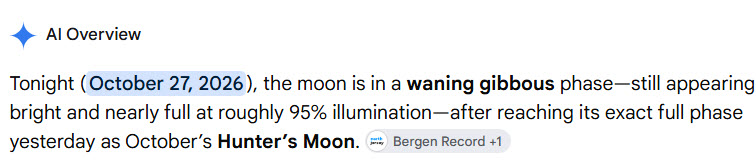
-
My only concern is even if we see it, to get cold enough for snow will be confined to the higher elevations and if the PV gets stronger after, it will make it even more tough to get cold with the super strong niño. Unless this SSW debunks going trends, which i hope it does
-
canadian pharmacy drugs online or best canadian pharmacy canadian pharmacy world http://www.victoirefrance.fr/expire.aspx?Returnurl=https://canpointerx.shop/ best rated canadian pharmacy or https://boyerstore.com/user/rqfumloaqm/?um_action=edit canadian pharmacy legit [url=https://forums.pangolin.com/proxy.php?link=https://canpointerx.shop]canada pharmacy store[/url] canadian pharmacy ratings or [url=https://cyl-sp.com/home.php?mod=space&uid=208829]canadian pharmacies that ship to usa[/url] legit canadian pharmacy
-
Not for people who like nice weather.
-
I have told people that I would expect a wet winter, at minimum, for the region. Snow or no will come down to timing of cold air shots and hopefully some high latitude blocking that can lock in eastern Canadian high pressure. We could easily miss everything and get cold rain, but this season will have one of the better opportunities for precipitation in a long while with the southern jet likely to be very active for months.
-
This would be pretty insane to see occur this early. Wow
-
buying prescription drugs in mexico: FronteraCareDirect - mexico prescription online