All Activity
- Past hour
-

Septorcher 2026 Discussion - Endless Summer
WxWatcher007 replied to Damage In Tolland's topic in New England
It may be a tricky setup but it’s not almost a week away. Follow the ensembles and proceed with caution. -

Septorcher 2026 Discussion - Endless Summer
TauntonBlizzard2013 replied to Damage In Tolland's topic in New England
I definitely wouldn’t be sold on anything meaningful yet. Almost a week away and a tough setup. No different than in winter when people have been tracking a system for 12 days and when it fizzles everyone is surprised -

Septorcher 2026 Discussion - Endless Summer
Damage In Tolland replied to Damage In Tolland's topic in New England
Bend me back like Gumby -

2026-2027 Record-breaking El Nino
40/70 Benchmark replied to Stormchaserchuck1's topic in Weather Forecasting and Discussion
I suspect the PDO will average pretty near neutral this season..we'll see, which could leave us prone to some interludes of cross polar flow, between which we nape. -
.thumb.gif.f92b16c631a1d15d405ed77b33f0710d.gif)
Septorcher 2026 Discussion - Endless Summer
Torch Tiger replied to Damage In Tolland's topic in New England
Yeah, hopefully it misses -

2026-2027 Record-breaking El Nino
Typhoon Tip replied to Stormchaserchuck1's topic in Weather Forecasting and Discussion
Whether this is the case on January 15 ... who knows. But this is an apparent unique - perhaps historically so - state of affairs we are in heading into Autumn. When comparing other warm ENSOs that were anywhere near peers with this one, the PDO was in better agreement. Those being 1982-1983, 1997-1998 and 2015 very warm events. But, +.7 isn't 1.0 The offset .3 isn't exactly a trivial anticorrelation value. 30% of PDO/ENSOs didn't want to cooperate ( according to CDC). The qualitative difference being ... it is easier on intuition to see a weaker warm ENSO being more likely to anticorrelate - break downs in the machinery in weaker gradients..etc. However, very powerful ones would instinctively dominate the hemisphere because tall heat S abuts canonical seasonal lowering hgts N, and that's proficient coupling. That's the '82/'97/'15 events. This ENSO is (presumably) as powerful ( even in a RONI dimming consideration ... it's just too overwhelming? ) yet having this over-arcing -PDO is thus uncharted water ( pun hopefully annoying ... ) It's hard to say how that will impact the circulation 'scaffolding' of the hemisphere, should it persist. This latter bold being a key question. There is a modest pos correlation between the PDO and EPO in November, which strengthens significantly through the winter. This is intriguingly implicating for both warm and cool N/A. In a shortened planetary wave lengths, the -EPO dives the mean height anomaly distribution over the west. This correlates/teleconnects to ridging/+geopotential hgts 80W. But in the winter, when the wave lengths are necessarily long as a physical response to high seasonal velocity foot, the -EPO tends to mean the lower heights progress E fairly quickly. That's the reason -EPOs cause cold snaps. However, the STJ "should be" lurking over TX into the TV and lower MA; so what then should this mean if an ongoing -PDO/-EPO keeps sending in knuckle achers... This sort of 'unicorn' scenario has been discussed among some of us, already. It's not confident enough to predict... for one, we don't know if this -PDO/atmospheric circulation mod over the arc of the N. Pac will continue. You know, that big winter storm - the first of the two - that took place last winter is a reasonable implication/typology. That January one was a broad continental scale overrunning event really.. -
Septorcher 2026 Discussion - Endless Summer
40/70 Benchmark replied to Damage In Tolland's topic in New England
Typical manifestation of CC....it's often not readily apparent and rather insidious. -
 buying prednisone: Axeryl - ordering prednisone
 -

Septorcher 2026 Discussion - Endless Summer
CoastalWx replied to Damage In Tolland's topic in New England
Deep mind has a group of tracks bending west south of the islands too. -
2026-2027 Record-breaking El Nino
40/70 Benchmark replied to Stormchaserchuck1's topic in Weather Forecasting and Discussion
Yea, it's clear something still isn't quite clicking. -
Opinions this weekend 9/25-27: potential evolving hybrid subtropical storm affecting NYC metro-New England. More so EPS, but also a muted agreed signal in the GEFS. Any thoughts? Current guidance is offering a pretty good chance of at least moderate CF, FGEN heavy rain, obviously 45+ wind gusts parts of this region. Or am I counting too much on the guidance as is, and it ends up weaker or further east. We've had spotty modeling of 5-8" rainfall by Sunday night for several days. Glad I'm not seafaring in the NY Biight-Bermuda this coming weekend. Thanks for the check.
-
I ended with 1.50 even
-

2026-2027 Record-breaking El Nino
olafminesaw replied to Stormchaserchuck1's topic in Weather Forecasting and Discussion
What is this the 90s? All out of space on the thread, turn the cassette over to side B? -
2026-2027 Record-breaking El Nino
Typhoon Tip replied to Stormchaserchuck1's topic in Weather Forecasting and Discussion
The ongoing -PDO is statistically quite suggestive of low coupling in a broader NINO relative hemisphere no question. -
BWI's average high on Xmas since 2015 is 52. December has been the month impacted the most by warming. The fact that SST's have warmed impacts the start of winter due to lag in water temps cooling. This has been documented...someone published monthly snowfall changes over the last 50 years and our area was the worst shade for December. January to March has been less impacted. Most of our decrease in snowfall climo has come from losing early in the season. It is what it is.
-
2026-2027 Record-breaking El Nino
40/70 Benchmark replied to Stormchaserchuck1's topic in Weather Forecasting and Discussion
It's a pretty safe assumption that unless otherwise specified, comments in this thread pertain to the N HEM, since that's where we live. If you would like to discuss the S Hem, then the onus in on you to make that known. @SnoSki14originally commented on implications for N HEM winter, which is what prompted my reply. -

2026-2027 Record-breaking El Nino
LakePaste25 replied to Stormchaserchuck1's topic in Weather Forecasting and Discussion
ok, but your original comment that I reacted to implied that it’s only coupled in the tropics, which isn’t true. -
Day 2 of the Great September Deluge and my gage has still not registered a drop.
-
2026-2027 Record-breaking El Nino
40/70 Benchmark replied to Stormchaserchuck1's topic in Weather Forecasting and Discussion
Again...you want to deduce that it will couple in the mad latitudes of the N hem based on what is taking place in the s Hem, fine...different point. I agree with that to a large extent, but that doesn't change what is going on right now. -
2026-2027 Record-breaking El Nino
40/70 Benchmark replied to Stormchaserchuck1's topic in Weather Forecasting and Discussion
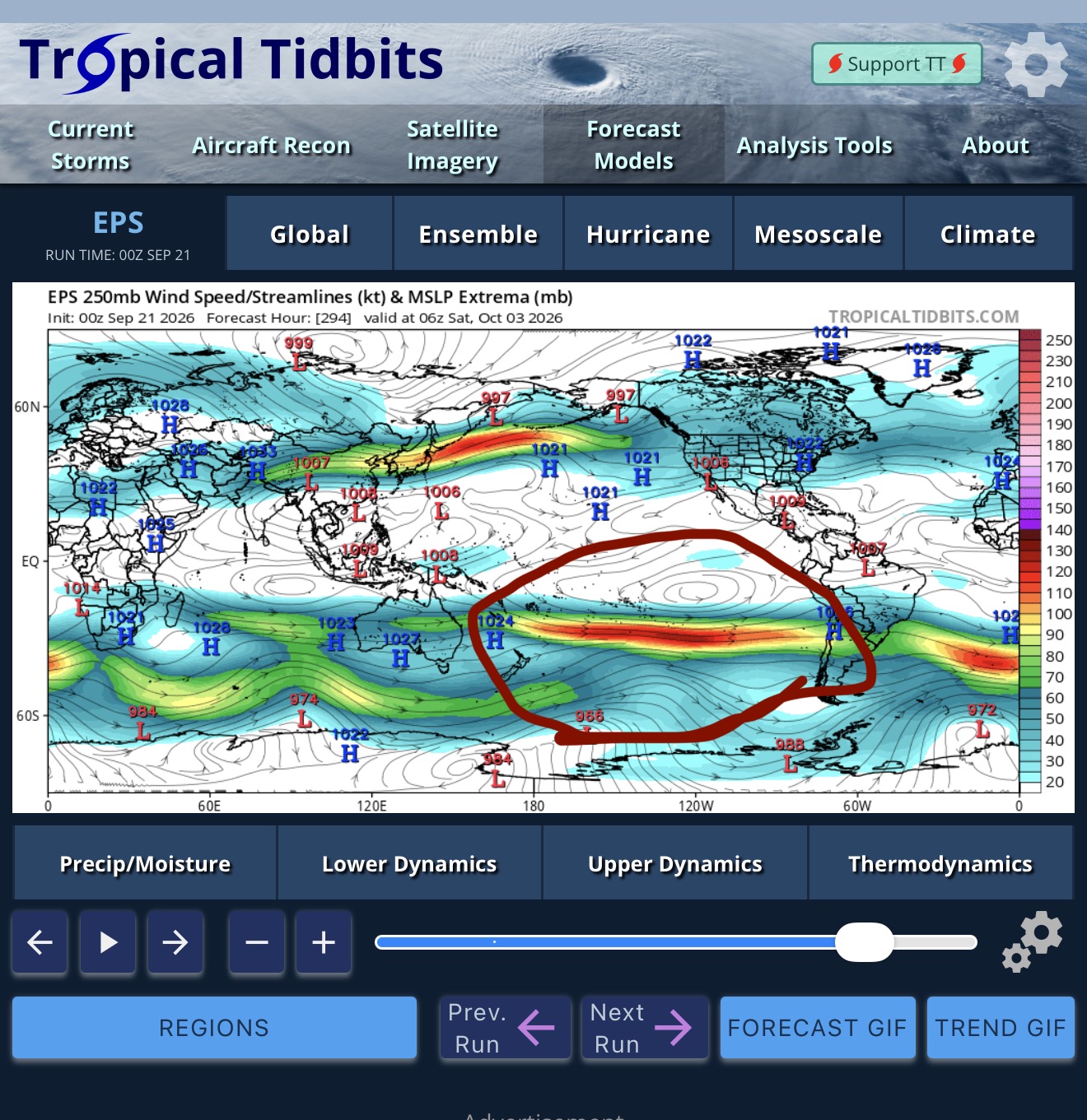
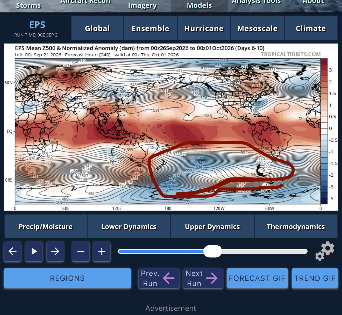
Trying to figure out when that region became the northern Hemisphere.... -
Septorcher 2026 Discussion - Endless Summer
Typhoon Tip replied to Damage In Tolland's topic in New England
heh, as chilly as this seems ... we're actually above normal against climo with the day's lows so far. 68 to 70 is the climo max, BDL-FIT-ASH. Prooobably going to end up below that... we'll see but a sneaky effect here? - Today
-
2026-2027 Record-breaking El Nino
LakePaste25 replied to Stormchaserchuck1's topic in Weather Forecasting and Discussion
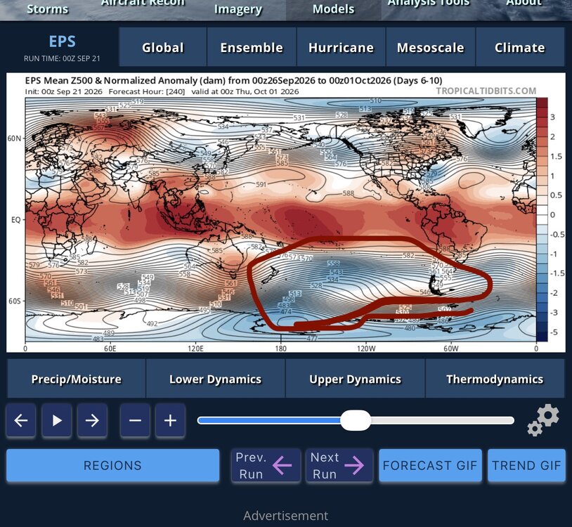
Trying to figure out when this region became the tropics.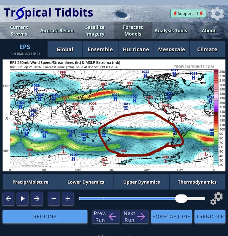
-
2026-2027 Record-breaking El Nino
40/70 Benchmark replied to Stormchaserchuck1's topic in Weather Forecasting and Discussion
May very well get there, but we are talking about NOW...the fact is that El Nino is not very well coupled with the mid latitudes of the N HEM at this time. -
September 21 2005: An unusually intense late season severe weather event affects parts of central Minnesota and west central Wisconsin during the late afternoon and evening hours. Baseball-sized hail, damaging thunderstorm winds, and tornadoes result from several supercell thunderstorms. The most widespread damage occurs across the northern and eastern portions of the Twin Cities. Three tornadoes rake across parts of Anoka and northern Hennepin counties, including an F2, but the tornado damage is overshadowed by the widespread extreme wind damage associated with the rear flank downdraft of the supercell. In addition to the severe weather, many locations received substantial amounts of rain. Many streets and underpasses in the northern Twin Cities metro area were flooded Wednesday night, where radar precipitation estimates were in excess of 3 inches. 1994: 1/2 inch hail in Blue Earth County results in $6 million in crop damages. 1924: Very strong winds occur in Duluth, with a peak gust of 64 mph. For Monday, September 21, 2026 1894 - A heavy chicken house, sixteen by sixteen feet in area, was picked up by a tornado and wedged between two trees. The hens were found the next day sitting on their eggs in the chicken house, with no windows broken, as though nothing had happened. (The Weather Channel) 1924 - A couple of tornadoes, one rated F4 and the other F5, tore paths of devastation through Eau Claire, Clark, and Taylor Counties in Wisconsin. The death toll was 18 and 50 people were injured. 1938 - A great hurricane smashed into Long Island and bisected New England causing a massive forest blowdown and widespread flooding. Winds gusted to 186 mph at Blue Hill MA, and a storm surge of nearly thirty feet caused extensive flooding along the coast of Rhode Island. The hurricane killed 600 persons and caused 500 million dollars damage. The hurricane, which lasted twelve days, destroyed 275 million trees. Hardest hit were Massachusetts, Connecticut, Rhode Island and Long Island NY. The ""Long Island Express"" produced gargantuan waves with its 150 mph winds, waves which smashed against the New England shore with such force that earthquake-recording machines on the Pacific coast clearly showed the shock of each wave. (David Ludlum) (The Weather Channel) 1954 - The temperature at Deeth, NV, soared from a morning low of 12 degrees to a high of 87 degrees, a record daily warm-up for the state. (The Weather Channel) 1987 - Tropical Storm Emily, which formed in the Carribean the previous afternoon, caused considerable damage to the banana industry of Saint Vincent in the Windward Islands. Unseasonably hot weather continued in Florida and the western U.S. Redding CA and Red Bluff CA, with record highs of 108 degrees, tied for honors as the hot spot in the nation. (The National Weather Summary) 1988 - Thunderstorms produced high winds and locally heavy rain in the southwestern U.S. One thunderstorm in west Texas produced wind gusts to 86 mph at Dell City completely destroying an airport hangar. A Cessna 150 aircraft housed within the hangar was flipped over and snapped in two. Thunderstorms produced large hail in east central Utah, while snow blanketed some of the higher elevations of the state. (The National Weather Summary) (Storm Data) 1989 - Hurricane Hugo slammed into the South Carolina coast about 11 PM, making landfall near Sullivans Island. Hurricane Hugo was directly responsible for thirteen deaths, and indirectly responsible for twenty-two others. A total of 420 persons were injured in the hurricane, and damage was estimated at eight billion dollars, including two billion dollars damage to crops. Sustained winds reached 85 mph at Folly Beach SC, with wind gusts as high as 138 mph. Wind gusts reached 98 mph at Charleston, and 109 mph at Shaw AFB. The biggest storm surge occurred in the McClellanville and Bulls Bay area of Charleston County, with a storm surge of 20.2 feet reported at Seewee Bay. Shrimp boats were found one half mile inland at McClellanville. (National Weather Summary) (Storm Data) Observances: 21 Mon World Gratitude Day 21 Mon National Chai Day 21 Mon International Day of Peace 21 Mon World Alzheimer’s Day 21 Mon Escapology Day 21 Mon Mabon 21 Mon Miniature Golf Day 21 Mon National Cat & Dog Gut Health Awareness Day 21 Mon National Garage Condo Day 21 Mon National Opioid Awareness Day 21 Mon National Pecan Cookie Day 21 Mon Telegraph Pole Appreciation Day 21 Mon World Mini Golf Day
-
Capital Weather Gang says otherwise.