All Activity
- Past hour
-

12/14: Sunday funday? Will the south win again?
Stormchaserchuck1 replied to TSSN+'s topic in Mid Atlantic
6" snow depth in southern PA on the 03z RAP Models really moistened up tonight. 4" is looking more possible here, if I had to make a guess I'd say 3-3.5" -
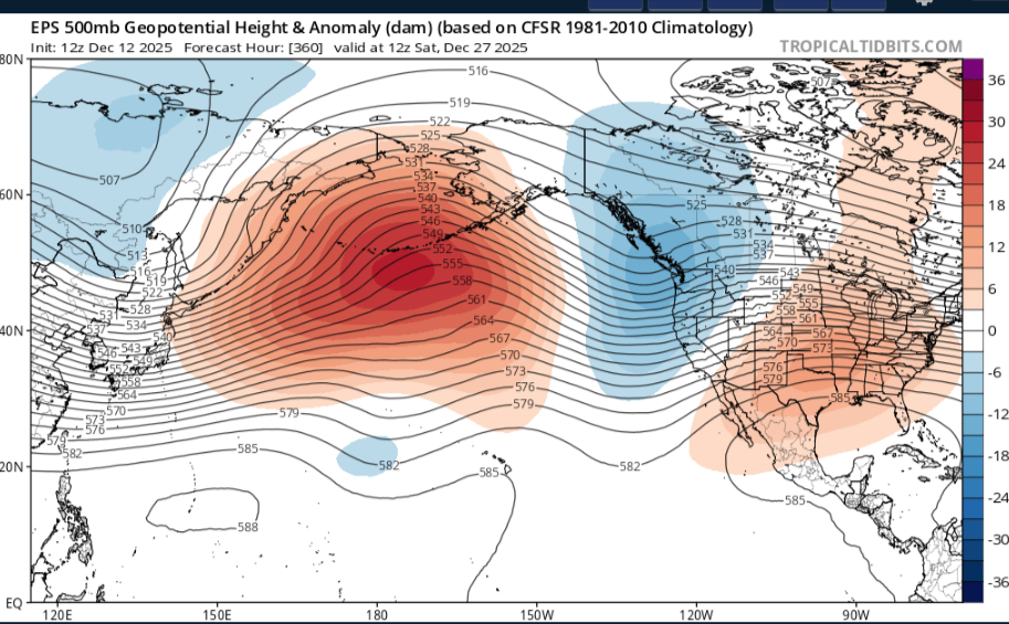
I'll stay here for the time being Dont really see any substantial cool down ,even tho you can see troughs going through East Asia which could cause the pattern to reshuffle more or less but its getting effected by other teleconnections,that Aluetian blocking isn't moving by the EPS OR GEFS, maybe it will change in future runs,but really no signs this is gonna happen anytime soon.We have a better chance of severe upcoming the next couple weeks after this cold snap
-
-

-

December 14th - Snow showers or Plowable snow?
weathafella replied to Sey-Mour Snow's topic in New England
Gfs AI was 2 inches to the pike region. -

Minor snowfall sunday 12/14/25 1-4” possible
SnowGoose69 replied to WeatherGeek2025's topic in New York City Metro
00Z HREF mean is pretty close to the Euro idea...max is in same zone where it seems to want to go like Dover-Monmouth for the highest amounts https://www.spc.noaa.gov/exper/href/?model=href&product=snowfall_024h_mean§or=ne https://www.spc.noaa.gov/exper/href/?model=href&product=snowfall_024h_max§or=ne -
You know it.. Here come the comments Sign here Lock it up Give me that and call it a winter The big ones are sniffed out early. It all is coming.. Until Dr No or the next run. Lol
-

December 14th - Snow showers or Plowable snow?
CoastalWx replied to Sey-Mour Snow's topic in New England
Euro trimmed back too on the runs today. -
Gfs with the Christmas Miracle again. Start a thread!
-

Saturday night/Sunday 12/13-12/14 Jawn
LVblizzard replied to Ralph Wiggum's topic in Philadelphia Region
I went with 2-4” yesterday for our area and I’m making my final call tomorrow morning. I’m pretty sure I’ll be sticking with that. I expect closer to 2” for most of the area but I can’t rule out banding upping totals to 3-4” for some people. -
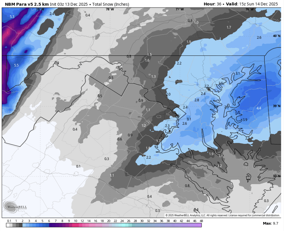
What’s the latest NBM blend looking like @CAPE
-
High res > Ukie for this setup for sure
-
.thumb.png.4150b06c63a21f61052e47a612bf1818.png)
December 14th - Snow showers or Plowable snow?
HIPPYVALLEY replied to Sey-Mour Snow's topic in New England
Snow on beaches is very cool. I just can't chase to Falmouth this weekend. -
Jackpot over my house on that one
-
December 14th - Snow showers or Plowable snow?
HIPPYVALLEY replied to Sey-Mour Snow's topic in New England
This could end up a warning event somewhere between Montauk and Provincetown. -
It sucks with temps IMO. I’d rely on Euro/3k/etc for that at this point.
-
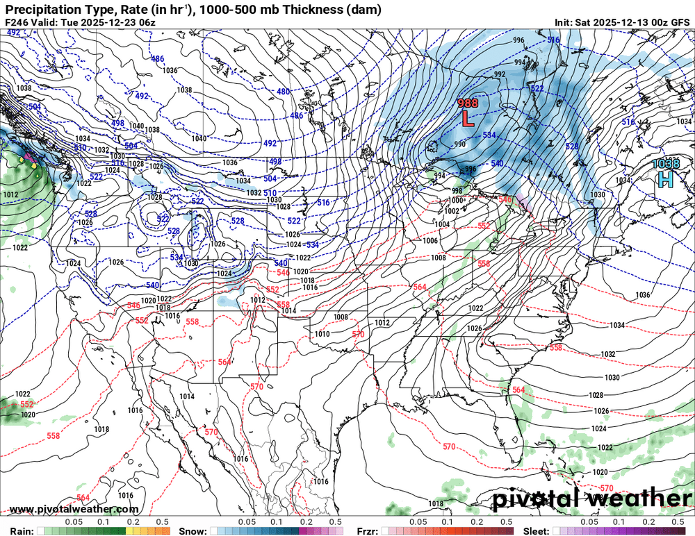
Thar she blows! What a windy looking map.
-

12/14: Sunday funday? Will the south win again?
Maestrobjwa replied to TSSN+'s topic in Mid Atlantic
It seems to be the warmest model overall too. Now we can watch and see if any of the other models get warmer tomorrow, but if not...it could be on it's own. We actually haven't talked much about any potential temp issues... -

12/14: Sunday funday? Will the south win again?
NorthArlington101 replied to TSSN+'s topic in Mid Atlantic
UKIE isn’t exactly awesome at thermals. Given nothing else showing so much precip lost to rain, I’m gonna do a weenie move and toss the snow output and just look at the QPF -
Ukie used to be a better model…it just seems to always be off the last few years. I’d trust the higher resolution models at this point. I do think DC will likely be just under 10:1 ratios.
-

Saturday night/Sunday 12/13-12/14 Jawn
Albedoman replied to Ralph Wiggum's topic in Philadelphia Region
The higher snow ratios maybe achieved north of South Mountain which could lead to a solid 3-5 inch snow event even in the LV if get good digging and upper moisture. South of South Mountain range will be more moisture acceptable so this is a tough call for the LV. The mesos are also having a tough time absorbing the digging aspect of this event -- the GFS was lost-- and the fact there maybe one hell of alot of virga throughout the profile until it collapses. We have a lot of cold dry air to overcome for this event to unfold. This storm event could easily become a debbie downer based on this fact, especially for those north of Philly. -
@mitchnick URGENT - WINTER WEATHER MESSAGE National Weather Service State College PA 1114 PM EST Fri Dec 12 2025 PAZ065-066-131700- /O.EXB.KCTP.WW.Y.0025.251214T0000Z-251214T1800Z/ York-Lancaster- Including the cities of Lancaster and York 1114 PM EST Fri Dec 12 2025 ...WINTER WEATHER ADVISORY IN EFFECT FROM 7 PM SATURDAY TO 1 PM EST SUNDAY... * WHAT...Snow expected. Total snow accumulations between 2 and 3 inches. Locally higher spot amounts are possible. * WHERE...Lancaster and York Counties. * WHEN...From 7 PM Saturday to 1 PM EST Sunday. * IMPACTS...Plan on slippery road conditions. The hazardous conditions could impact the Monday morning commute.
-
Looks good for us though
-
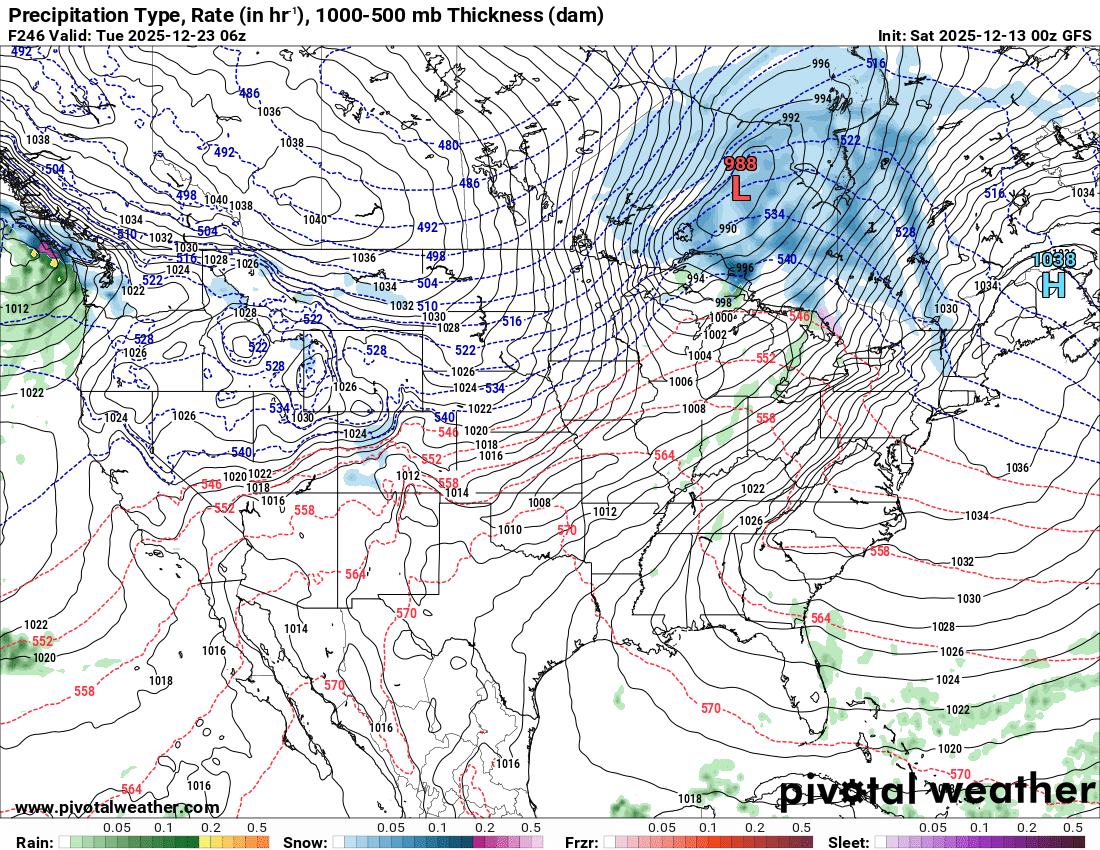
Pivot has some rough graphics man
-
Ukie. Warmth in Metros kill accumulations. Don't like new Pivotal.
.thumb.png.12c2d58f588e85d37941264694f1ab51.png)


.png.acd34a1209bb4bf8998aa27cbad89405.png)