All Activity
- Past hour
-

October Comes Early: Late September Multi-Hazard Hybrid Storm
CT Rain replied to WxWatcher007's topic in New England
You never disappoint! -
 A step or two below 1938
 -
October Comes Early: Late September Multi-Hazard Hybrid Storm
CT Rain replied to WxWatcher007's topic in New England
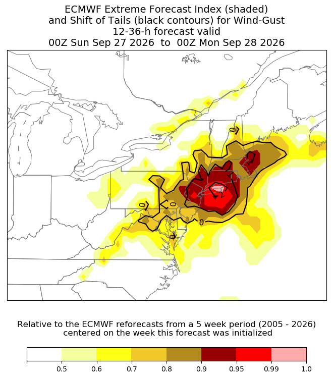
It's pretty cool. Basically how many of the ensemble members are in the 90th percentile of MClimate... and then how far are those beyond the 99th percentile. The shaded area is the confidence in an extreme event and then the black lines are basically how extreme the extreme is. -

October Comes Early: Late September Multi-Hazard Hybrid Storm
WxWatcher007 replied to WxWatcher007's topic in New England
Yeah. Never believed hooking into Cape May. -

Strong Nor'Easter/Hybrid Storm Late September 2026
MANDA replied to Rjay's topic in New York City Metro
Chewed up pretty good! -

Strong Nor'Easter/Hybrid Storm Late September 2026
jm1220 replied to Rjay's topic in New York City Metro
Heavy rains will pivot in and out as the storm meanders around. It’s not like a winter storm where there’s a huge steady overrunning precip shield. Still another 24 hours to go with this. -

Strong Nor'Easter/Hybrid Storm Late September 2026
JonClaw replied to Rjay's topic in New York City Metro
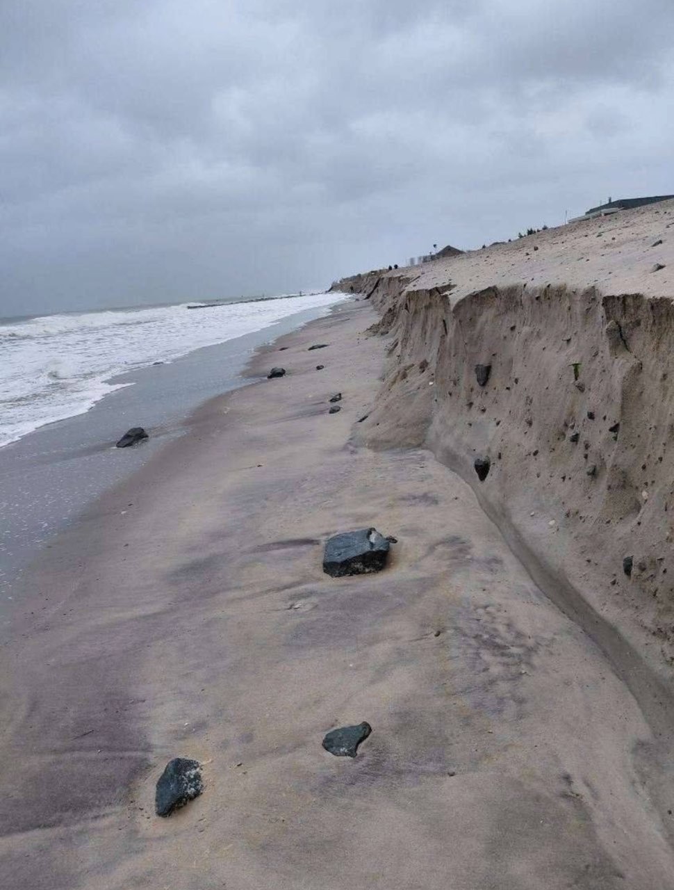
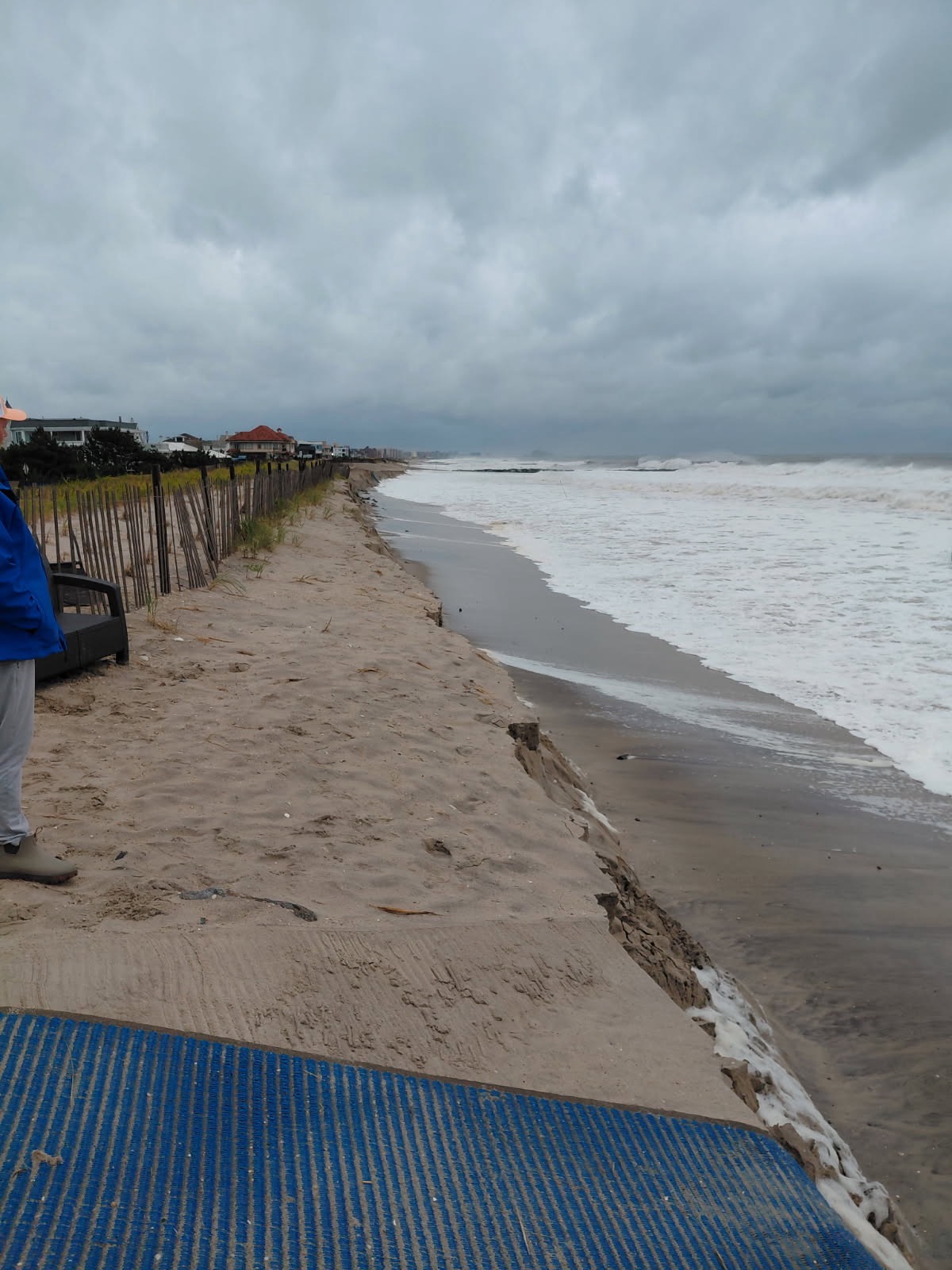
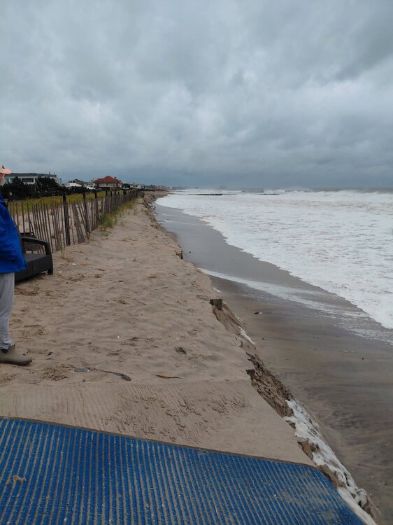
Far Rockaway beach erosion photos submitted to NYCEM a few hours ago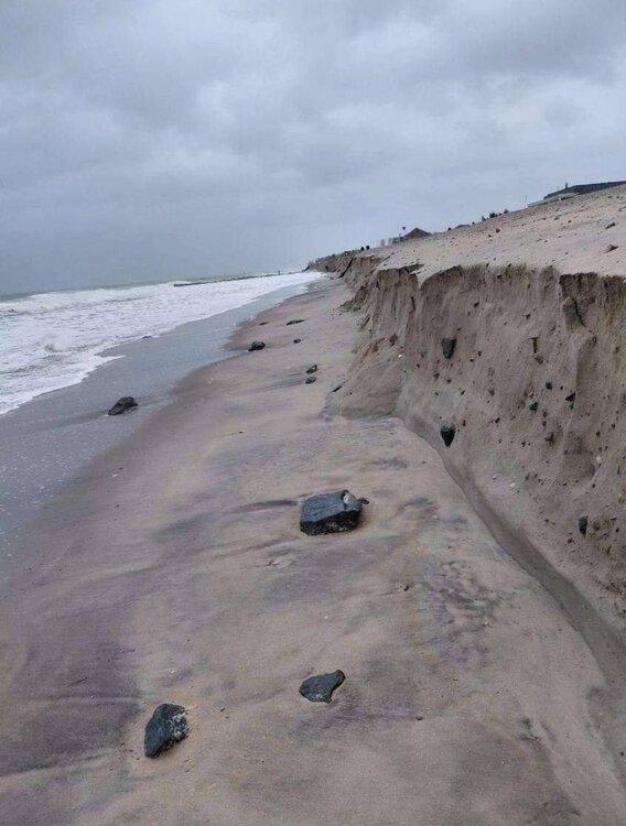
-
Strong Nor'Easter/Hybrid Storm Late September 2026
MANDA replied to Rjay's topic in New York City Metro
Based on latest radar mosaic you can see where best rains are setting up. Best lift / forcing is over southeast New England. As the low starts to bend back west the heavier rains should start to cover L.I. and at least southern CT. Surface low has made it pretty far north. It is already abeam of Atlantic City and still gaining latitude. Have to think this is going to take the center more towards the NY Bight rather than the CNJ coast. If true that would mean the next round of high tides tonight and early tomorrow would be worse on L.I. rather than NJ. Winds are going to pickup overnight area wide through so I'd plan for increasing power outages especially nearer the coast. Heaviest rains going forward look to be from the city eastward and north into southern and southeast New England. https://weather.cod.edu/satrad/?parms=regional-eastcoast-comp_radar-48-0-100-1&checked=map&colorbar=undefined https://www.meteo.psu.edu/ewall/PSUGOES_PA2/loop60v.html -

2026-2027 Record-breaking El Nino
bluewave replied to Stormchaserchuck1's topic in Weather Forecasting and Discussion
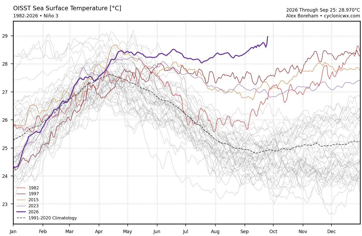
It’s just really wild to see a nearly +29°C warm pool in Nino 3 region this time of year. This is supposed to be the coolest part of the year for that SST region. SSTs this high have only been reached a few times but during the late winter into spring when the annual SSTs peak there.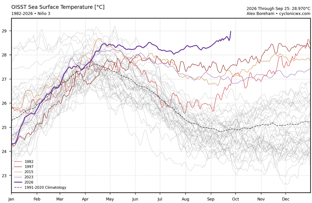
-

Strong Nor'Easter/Hybrid Storm Late September 2026
WxDom replied to Rjay's topic in New York City Metro
Should you come across any storm-related damage, please report it to us! https://www.weather.gov/okx/submitstormreport Downed trees, power lines, etc. Time, location, and what occurred. Stay safe! -

October Comes Early: Late September Multi-Hazard Hybrid Storm
Sey-Mour Snow replied to WxWatcher007's topic in New England
No idea what that actually means but it looks cool . I believe those just mean windy for late September? -
Zay Flowers is questionable
-

October Comes Early: Late September Multi-Hazard Hybrid Storm
Chrisrotary12 replied to WxWatcher007's topic in New England
As expected, absolute yawner here. -
After seeing all the pics of the coastal cities I’m really wishing I had gone to my place on the eastern shore. It’s bay side but north winds would push a lot of water around
-
October Comes Early: Late September Multi-Hazard Hybrid Storm
CT Rain replied to WxWatcher007's topic in New England
-
October Comes Early: Late September Multi-Hazard Hybrid Storm
Sey-Mour Snow replied to WxWatcher007's topic in New England
To be serious though the storm has gone exactly as I expected so far. Great forecast by all besides the usual outlets that hype too much. -
October Comes Early: Late September Multi-Hazard Hybrid Storm
CT Rain replied to WxWatcher007's topic in New England
Yeah in November the trees would barely be swaying. -

Strong Nor'Easter/Hybrid Storm Late September 2026
Brian5671 replied to Rjay's topic in New York City Metro
once the storm makes the left turn that will change. It's filling in here now -

October Comes Early: Late September Multi-Hazard Hybrid Storm
Snowcrazed71 replied to WxWatcher007's topic in New England
From everything that I am hearing about the super El Nino, it's not likely at all that we're going to have a very cold winter. The likelihood is milder than normal, but that doesn't mean we'll just have rain, even if we're a few degrees warmer than the average temps. We can still have big snow storms if everything is timed well. So hard to know. I think that's what keeps. All of us coming back is the unknown and the hope of what we'll see. At least we're heading in the right direction as far as seasons go for all of us snow lovers -
Rough game....
-

Strong Nor'Easter/Hybrid Storm Late September 2026
Rmine1 replied to Rjay's topic in New York City Metro
Beating a dead horse, but it appears that the entire precip field is getting eroded as it approaches w Suffolk. -

October Comes Early: Late September Multi-Hazard Hybrid Storm
Snowedin replied to WxWatcher007's topic in New England
Dumpage right now..it must be a hell of a sight down in places like Brant rock, scituate, revere and the usual spots with waves crashing against the shore. I think we’ll see a few good boulders, maybe even the odd old scooner or two washed up when things begin to settle down late sun! -
October Comes Early: Late September Multi-Hazard Hybrid Storm
WxWatcher007 replied to WxWatcher007's topic in New England
Let’s keep this going through March. With Arctic highs of course. -
October Comes Early: Late September Multi-Hazard Hybrid Storm
WxWatcher007 replied to WxWatcher007's topic in New England
Be careful you may be accused of hyping. Just five decades ago this was just a little rain shower! -

October Comes Early: Late September Multi-Hazard Hybrid Storm
CoastalWx replied to WxWatcher007's topic in New England
Early in the season too. Pretty good storm in late September.