All Activity
- Past hour
-
Temperatures will top out in the lower to perhaps middle 80s in a few warm spots to start the weekend. Clouds will increase on Sunday holding the temperature to the upper 70s or lower 80s. Showers and thundershowers are likely Sunday night into Monday. A few locations could see heavy downpours. Following the frontal passage, Monday through Wednesday should feature temperatures in the lower 80s, along wth partly to mostly sunny skies. The ENSO Region 1+2 anomaly was +4.1°C and the Region 3.4 anomaly was +2.6°C for the week centered around August 6. For the past six weeks, the ENSO Region 1+2 anomaly has averaged +3.72°C and the ENSO Region 3.4 anomaly has averaged +2.15°C. The ongoing strong El Niño, which has reached super El Niño threshold, will continue to strengthen through the summer. The SOI was -22.03 today. The preliminary Arctic Oscillation (AO) was -0.810 today. Based on sensitivity analysis applied to the latest guidance, there is an implied near 56% probability that New York City will have a warmer than normal August (1991-2020 normal). August will likely finish with a mean temperature near 76.5° (0.4° above normal). Supplemental Information: The projected mean would be 1.3° above the 1981-2010 normal monthly value.
-
Just wait until they leave the house to get married.
-
I’m in the middle of tobacco harvest and the drizzle was enough of a concern for “trailers” that were loaded and outside getting wet that we had to bring them all inside and work around them. Rain sucks when you’re doing massive harvest of anything.
-

Augdewst 2026: Summer's Last Stand
jlauderdal replied to Prismshine Productions's topic in New England
Inbound activity -
Charlottesville to north of town just absolutely got socked over - one of the more powerful storms that I've seen in some time even for over here... And not even a sprinkle in my yard again - just saw more water in a hour than my yard has seen in 2 months - simply wild..
-

Augdewst 2026: Summer's Last Stand
Baroclinic Zone replied to Prismshine Productions's topic in New England
Brief shower popped as boundaries collided. Lasted about 5 min but came down in large drops -
Those people living atop Pigeon Hills will be having a banner winter I'm sure. Problem is they don't get great plowing up there, and when they do, there's only a lane and a half cleared. At least, that's been my experience when I've gone up there checking snowfall amounts. But PSU should do equally as well.
-
Ya got me on the time zone in the other thread, but I’m confused on this one.
-
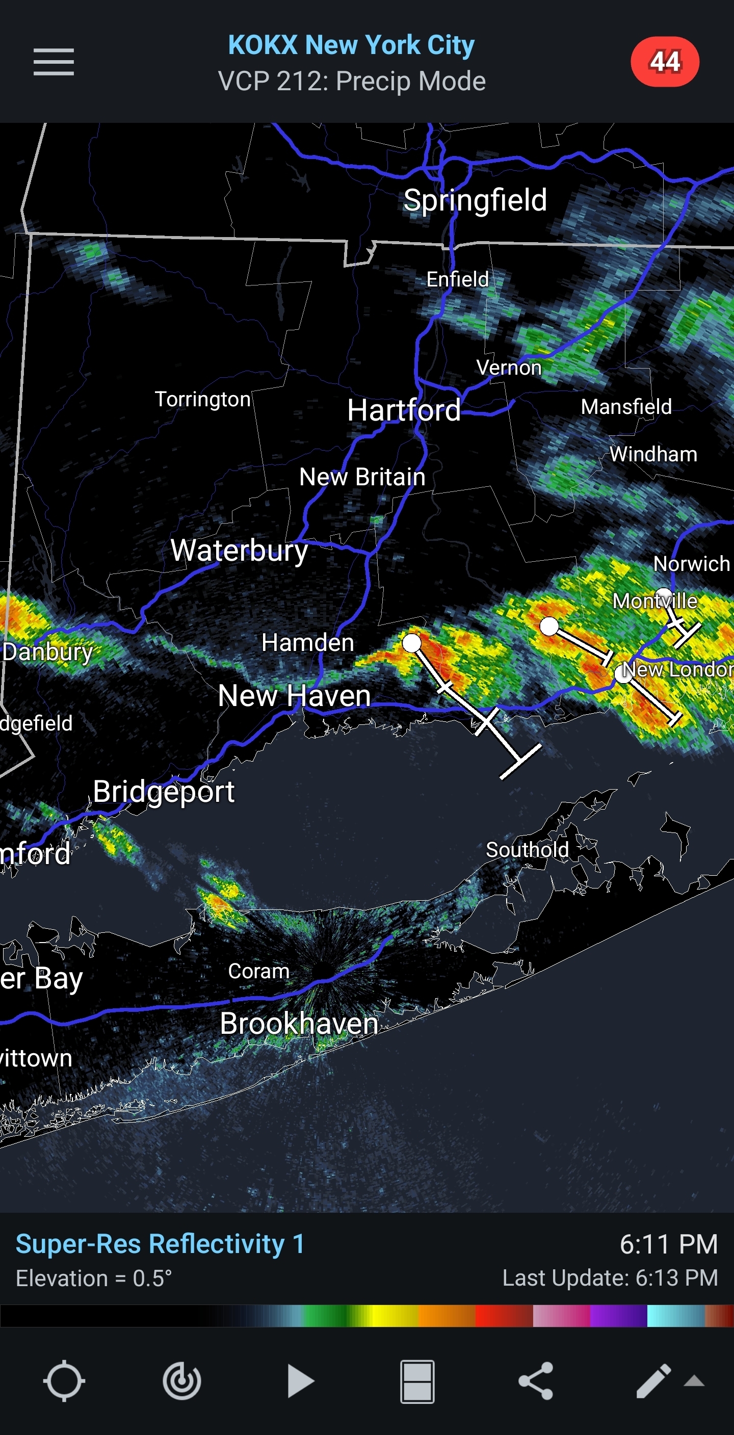
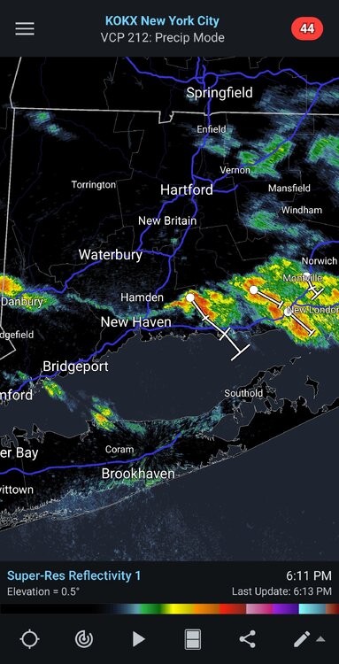
Straight-line Downburst Winds Confirmed in Southern Connecticut. Public Information Statement National Weather Service New York NY 337 PM EDT Fri Aug 14 2026 ... NWS Damage Survey for 08/13/2026 Downburst Wind Event... Straight-line Downburst Confirmed from Milford CT to East Haven Ct Peak Wind (observed and estimated): 85-105 mph. These winds resulted in an approximately 8.5 mile long by up to 1.1 mile wide path of intermittent severe tree and powerlines damage, collateral damage to homes and automobiles, as well as destruction of 2 building structures. https://forecast.weather.gov/product.php?site=NWS&product=PNS&issuedby=OKX
-

Augdewst 2026: Summer's Last Stand
Damage In Tolland replied to Prismshine Productions's topic in New England
Not sure about there but it’s starting to get dry here again . Lawns beginning to show it in sunny spots . 1.87” MTD and most of that was on Aug 3rd . You may have had a storm or downpours that missed here -
Looking forward to missing out on that one!
-

super el nino banter thread
A-L-E-K replied to forkyfork's topic in Weather Forecasting and Discussion
Gonna be lots of weenies on suicide watch after this winter -
Central PA Summer 2026 Discussion/Obs Thread
anotherman replied to Voyager's topic in Upstate New York/Pennsylvania
I wouldn’t say PSU. It was a failure of coaching, specifically the lack of the ability to match his abilities to the scheme. -
 buy viagra here: MenCare - Buy Viagra online cheap
 -
Augdewst 2026: Summer's Last Stand
Damage In Tolland replied to Prismshine Productions's topic in New England
Sunday night/ Monday heavy rains trended south so looks like congrats SW CT and NYC South on anything significant . -
Yeah, edited my post. The world revolves around me and my time frame, at least it does in my head!
-
Been a really special summer here...
-
90/77 split at PHL today.
-
Augdewst 2026: Summer's Last Stand
Damage In Tolland replied to Prismshine Productions's topic in New England
Managed to get missed north , east , and south today . Last chance is that line NW of ALB and see if holds together which doesn’t seem likely -

2026 C and E Pacific tropical activity
WxWatcher007 replied to GaWx's topic in Tropical Headquarters
Six hour time difference. It’s just after noon currently in Hawaii. -
I haven’t gone sub 10” and I’ve had some truly awful winters in a sub-optimal snow spot in SNE. Given the boom/bust cycle we seem to have been in since the 2010s I think a record low is on the table, but probably not that low. As hard as it is to go wire to wire deep winter, I think it’s even harder to go wire to wire zero winter, especially at ORH.
-

Augdewst 2026: Summer's Last Stand
Cyclone-68 replied to Prismshine Productions's topic in New England
It couldn’t possibly be any more “meh” than it’s been around here. Maybe the tropics will provide a temporary diversion -
New? Time says 11am today? edit: 6 hours difference in time zones, my bad!!
-
A thin but Heavy rain shower line training over Port Jefferson.
-

Central PA Summer 2026 Discussion/Obs Thread
Voyager replied to Voyager's topic in Upstate New York/Pennsylvania
My doc started me off on Dilaudid for three days, then backed off to Percocet for I think two weeks, then Tylenol.