All Activity
- Past hour
-

2026-2027 Record-breaking El Nino
GaWx replied to Stormchaserchuck1's topic in Weather Forecasting and Discussion
Thanks for posting about this. After reading your post, I decided it would be worthwhile to check out another forum (with pro-mets): https://forum.arctic-sea-ice.net/index.php I read hundreds of posts in their “The 2026 melting season” thread. The first post I saw mentioning the unusually cold DMI 80+ N temperatures was on 5/25/26 (post #268) on the following page (p. 6) by very experienced pro-met Niall Dollard: https://forum.arctic-sea-ice.net/index.php/topic,4507.250.html Niall said, “I suspect we will see a rapid increase on the DMI N80 graph in the next day or two, as that deep low advects warmth into the general DMI N80 area near the pole. Unusually, the daily mean has been below the 1958-2002 mean for much of the month of May.” ———————— Then go to p. 9 and look at post #474 on 7/16/26 from pro-met Glen Koehler in here: https://forum.arctic-sea-ice.net/index.php/topic,4507.450.html Glen said: “The DMI 80N values are unprecedented. I looked at every annual chart for 1958-2026, and no other year has such a large and prolonged period of below 2C temperature during June and July.” and ”The 2026 DMI 80N chart is so anomalous that it makes me wonder if a sensor or data processing change is affecting the 80N chart in summer 2026. Anoother possibility is that the slushification of the ice near the North pole is creating a different relationship between ice and 2M air temperature.” ———————— Then @TheClimateChanger, who you may recall used to go by “Frivolous” here, posted in #490 (also on p.9) as “Frivolousz21” on 7/18/26 as a reply to Glen: ”It's not from an error. It's just that there has been a relentless PV anomaly and essentially next to no unimpeded solar insolation. It's been pretty crazy. This might end up the best year for ice retention since 2006.” ———————— I went through the rest of the thread and there never was agreement on the cause. So, it remains a mystery there. So, I plan to continue posting these DMI graphs at least until if/when there’s strong agreement in the overall pro-met community with you that 2026 really isn’t as cold relative to past years as the graphs show. —————— Today’s daily update had another sharp cooling (~1C) from yesterday keeping it colder than the blue line’s climo: However, I just looked and the model consensus is showing significant warming of anomalies starting shortly to AN. So, I’m expecting it to go back above the blue line within a few days.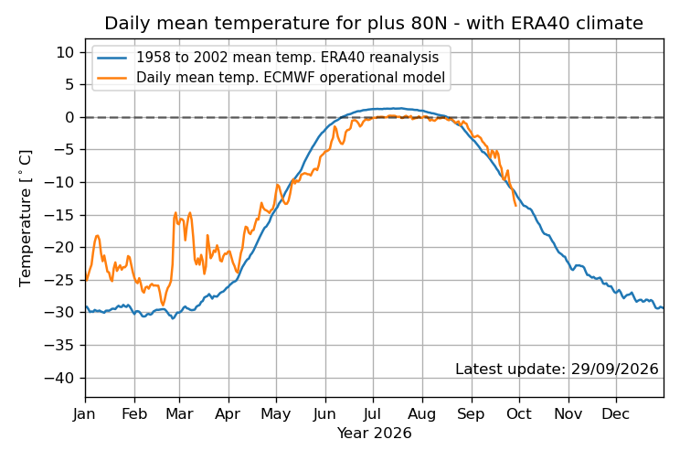
-

Septorcher 2026 Discussion - Endless Summer
powderfreak replied to Damage In Tolland's topic in New England
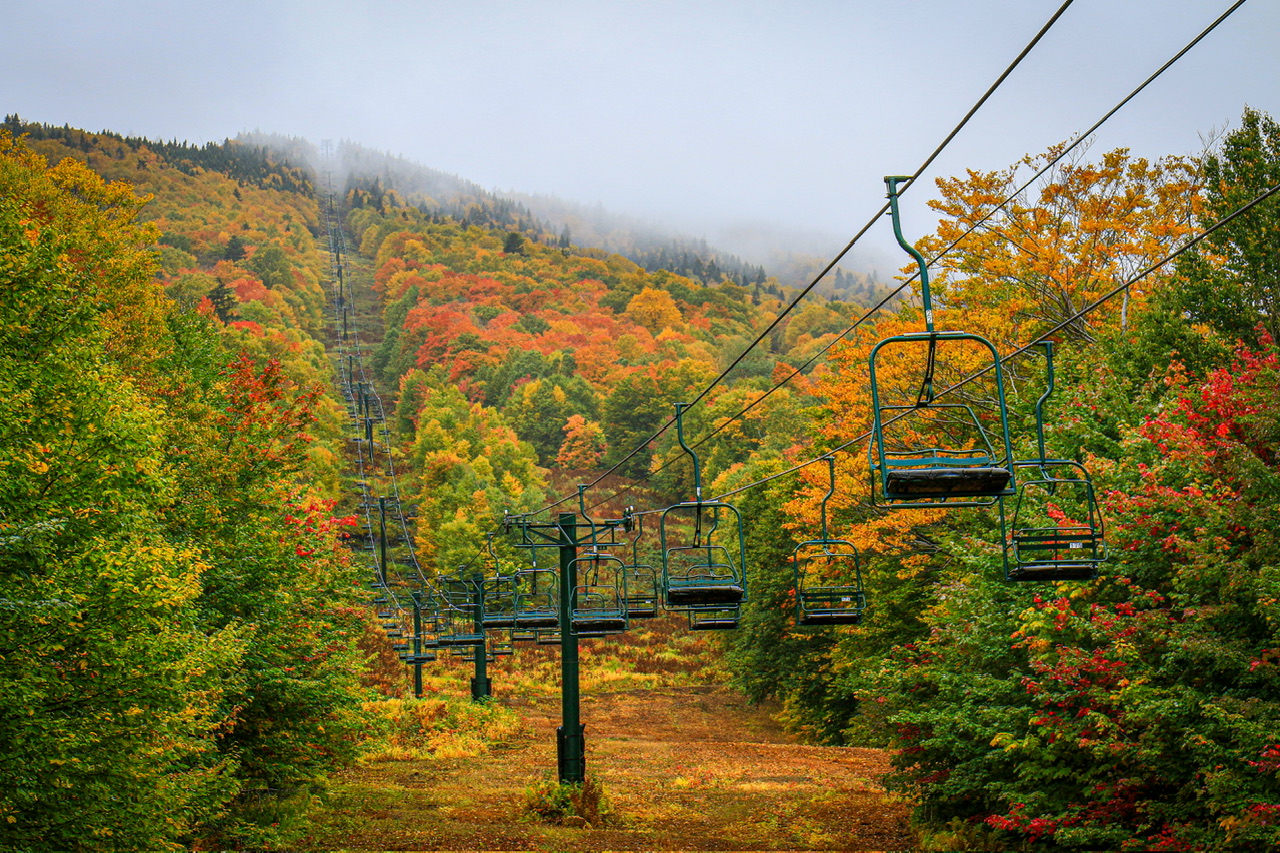
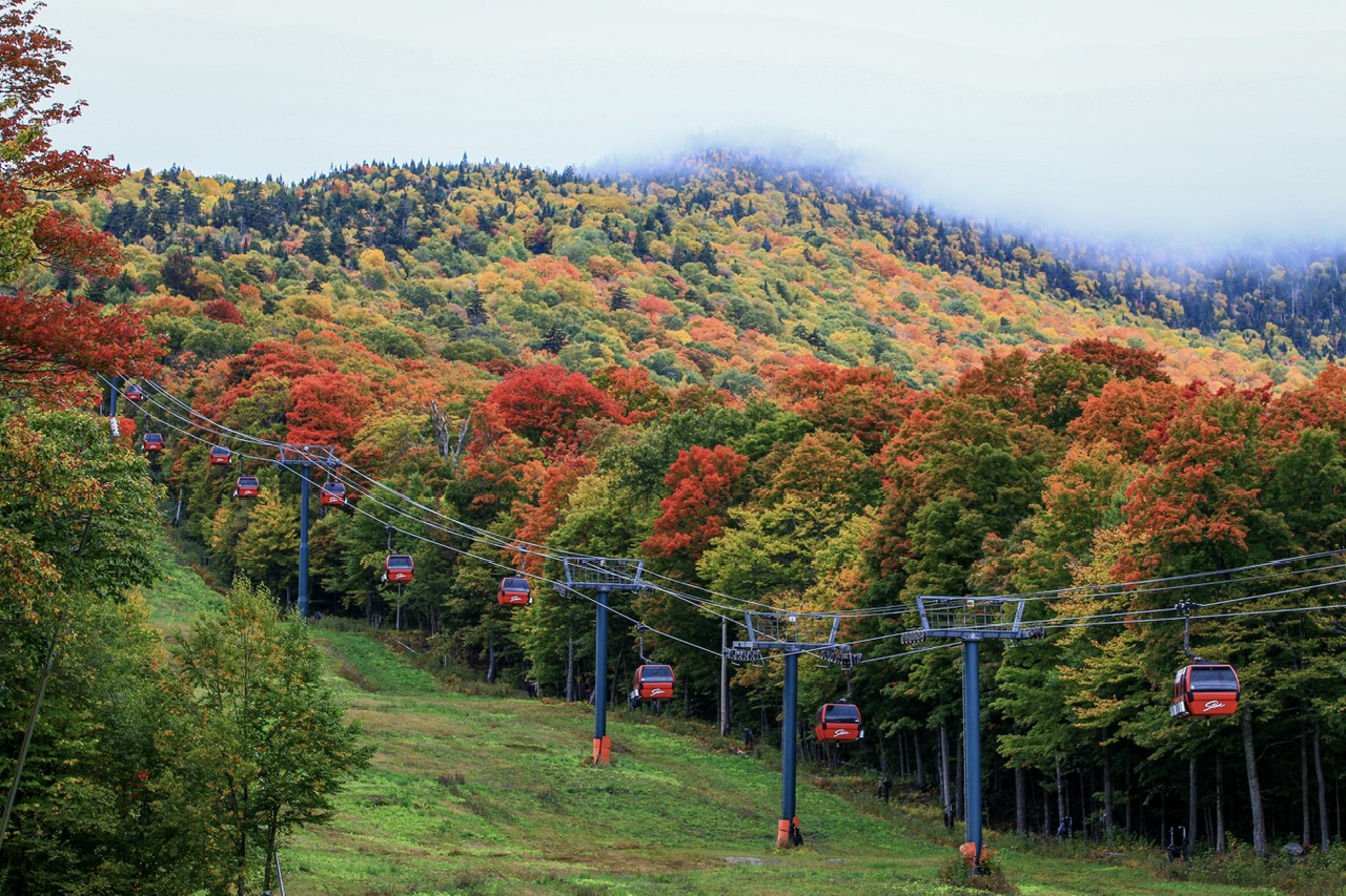
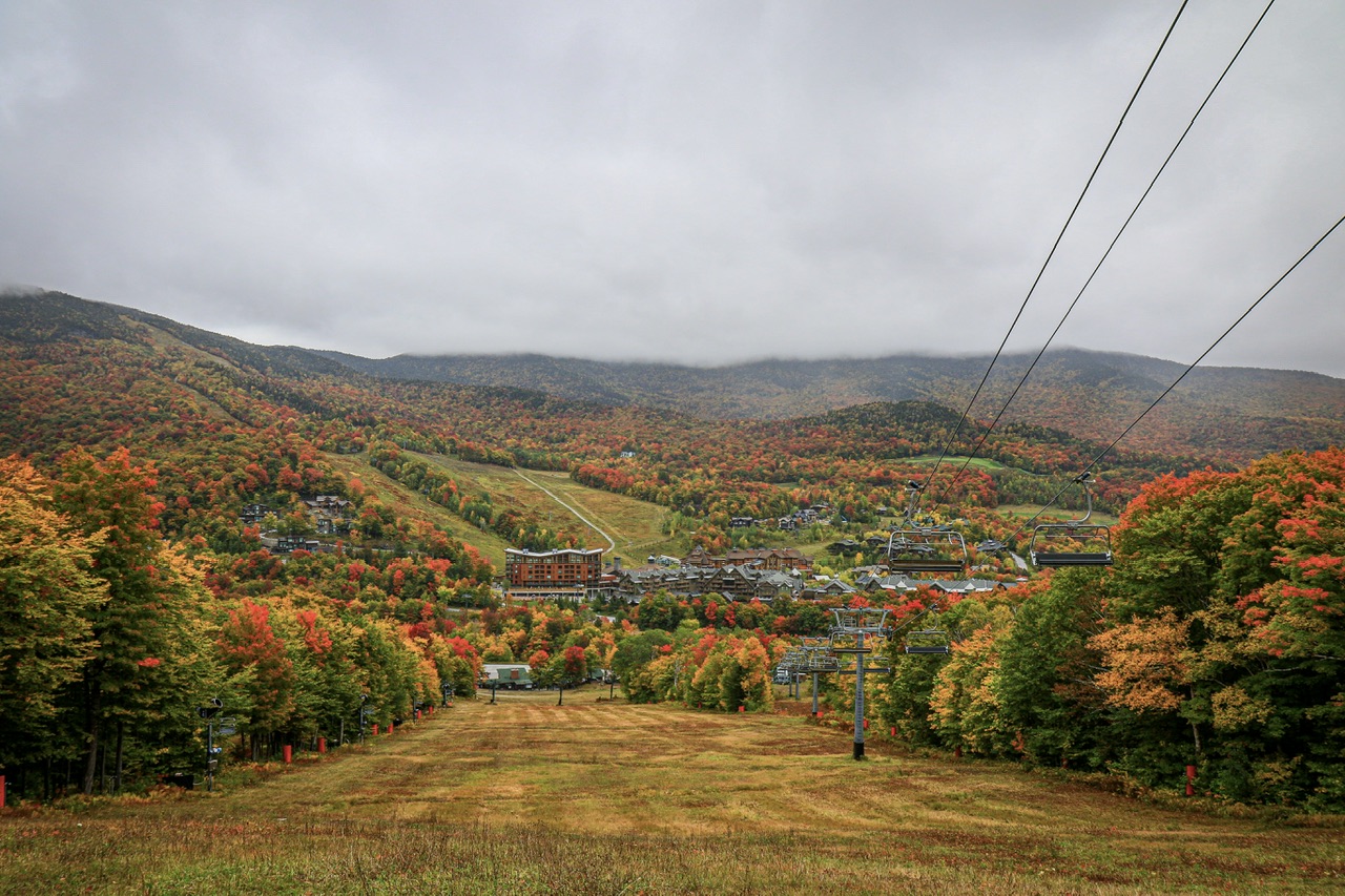
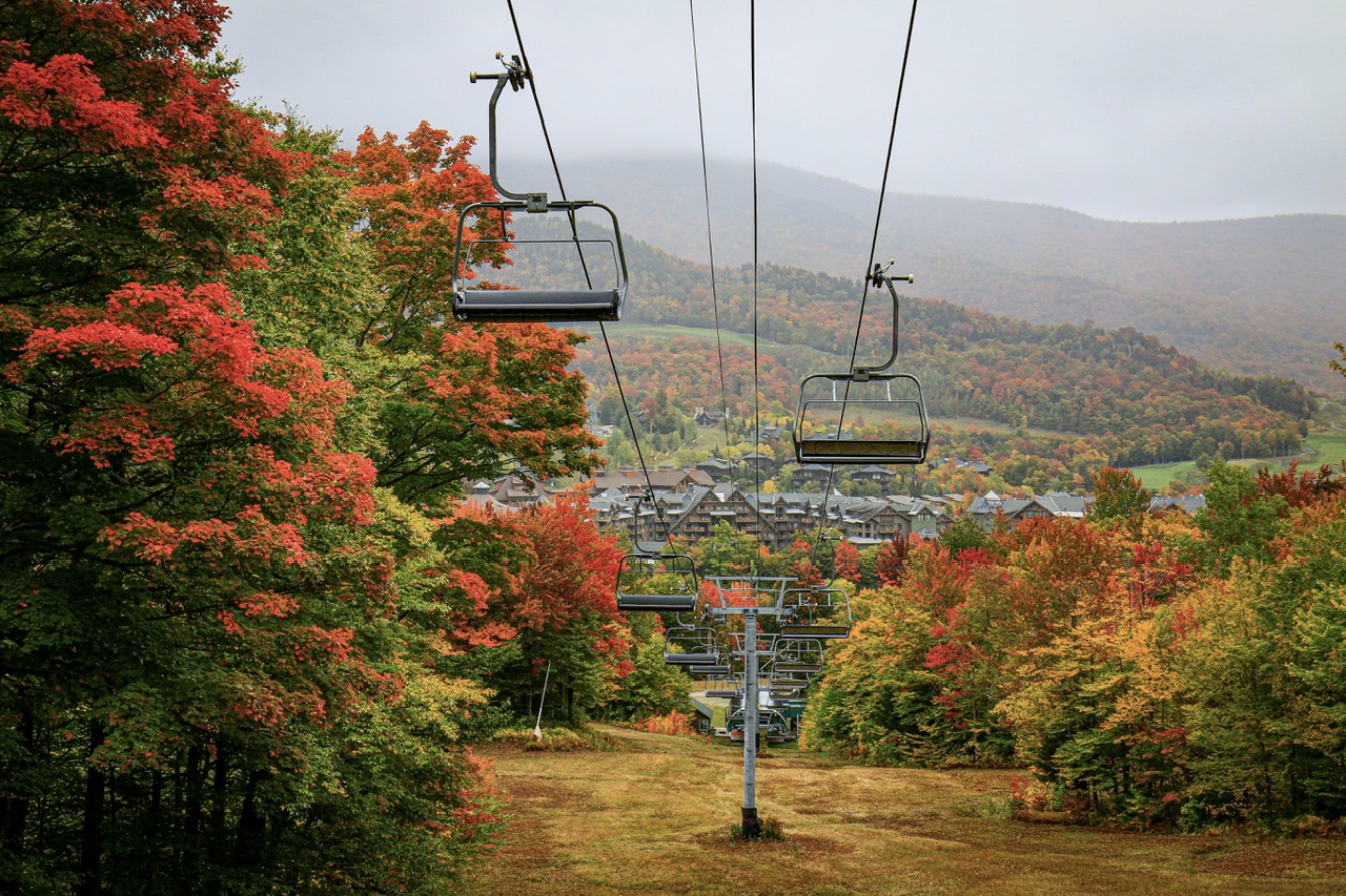
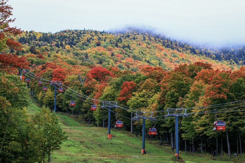
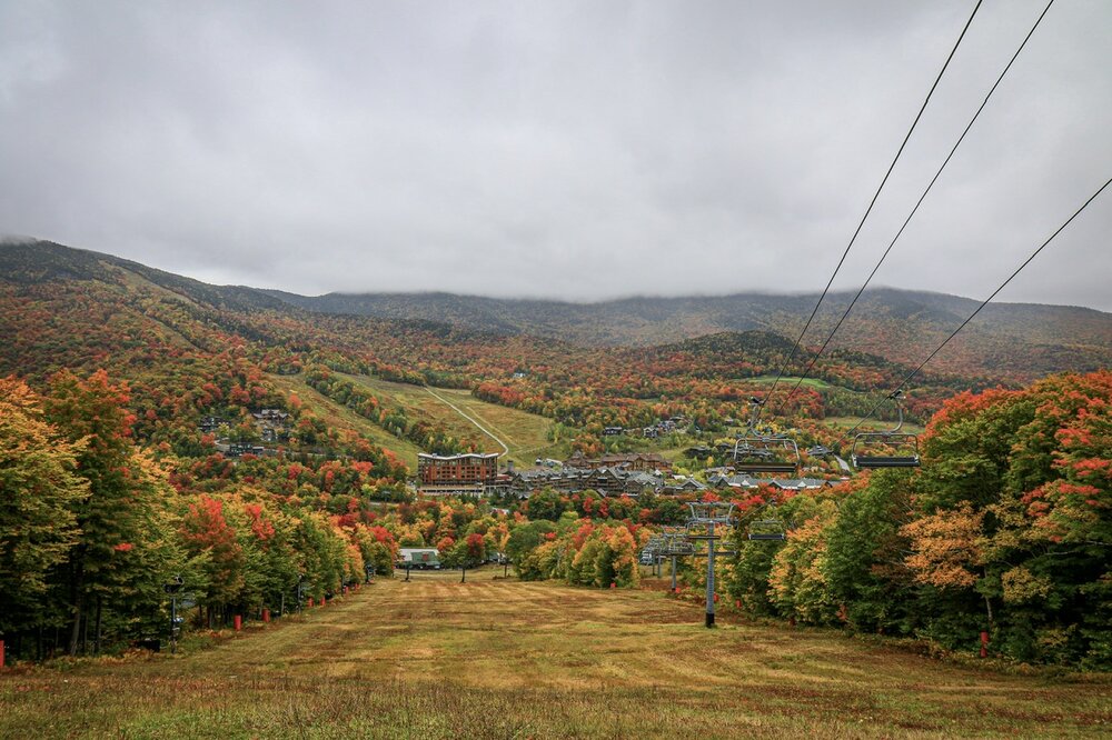
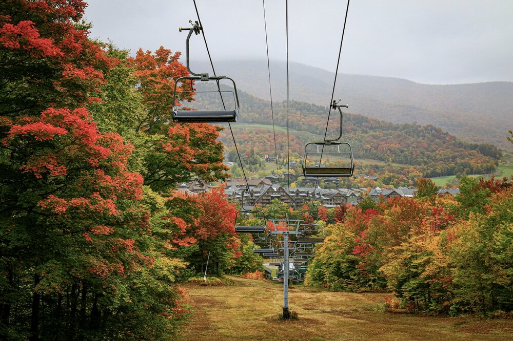
The red and green mix this year is wild. -

October Comes Early: Late September Multi-Hazard Hybrid Storm
DirtySnowDen replied to WxWatcher007's topic in New England
I’ll eat my words. -
there's merely a one letter difference between rainfall and rainfail
-

Septorcher 2026 Discussion - Endless Summer
alex replied to Damage In Tolland's topic in New England
Pictures don’t do it justice, it’s absolutely magnificent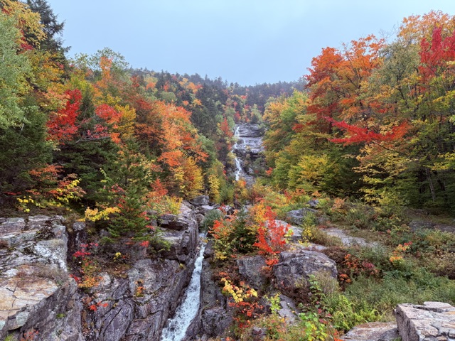
-

October Comes Early: Late September Multi-Hazard Hybrid Storm
vortex95 replied to WxWatcher007's topic in New England
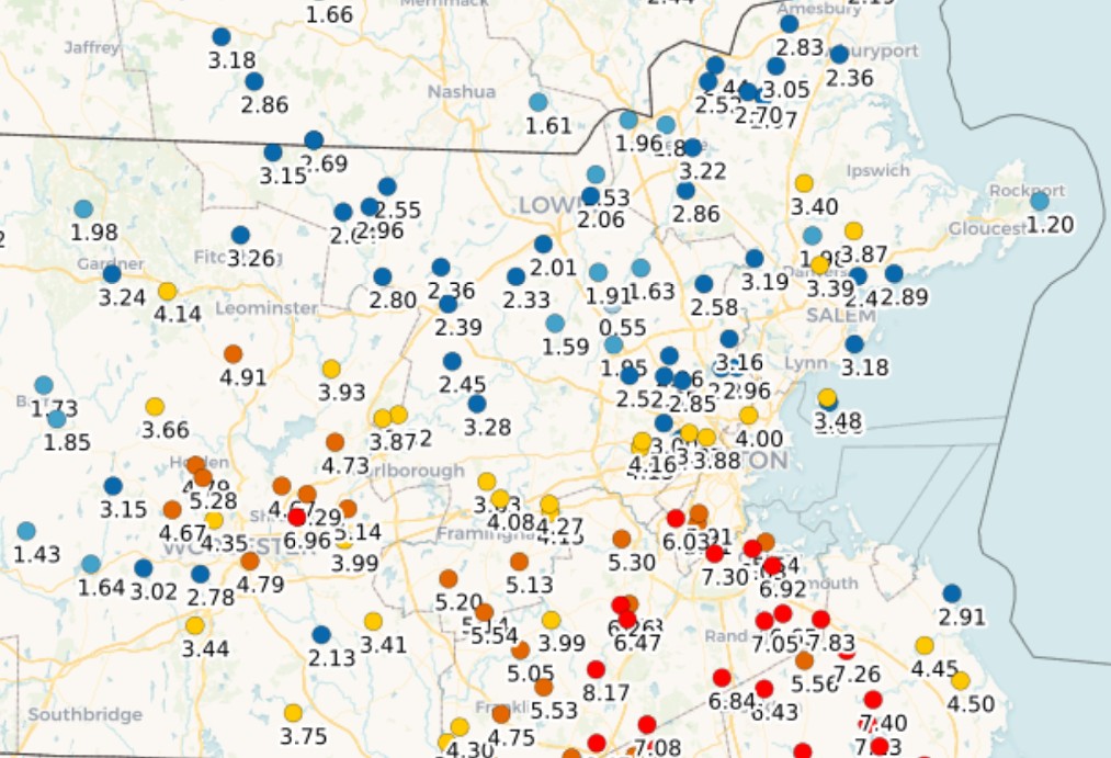
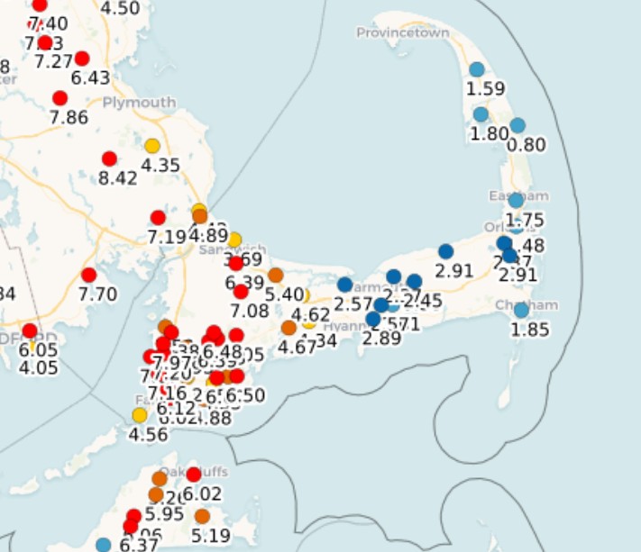
So highest I can find is 8.73" at Blue Hill. Any higher reports that did not make it into the PNS? The pcpn gradients are all over the place. N Shore to S Shore in MA? Ern CC to wrn CC and ORH Co? Seems like frictional convergence played a role as coastal location were low (Rockport 1.20" and Scituate 2.91") and increased not that far inland. Given the entire event was banded pcpn spiraling largely E to W, this makes sense. Imagine the anguish some would be having here from royal screw zones if this was snow and seeing epic amounts not far away. And for once, the max was within 5 mi of Weymouth!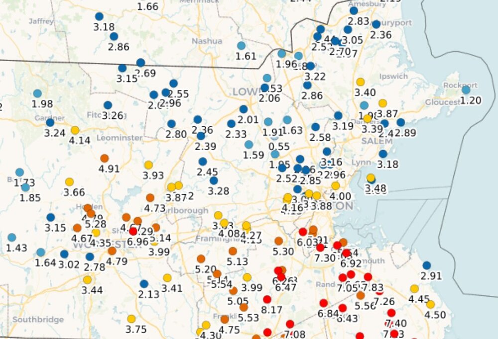
-

Septorcher 2026 Discussion - Endless Summer
kdxken replied to Damage In Tolland's topic in New England
- Today
-
Defintely We have seen 80s in October.
-
 Tadalafil price: TadaStream Rx - buy cialis pill
 -
https://sildendirect.shop/# viagra without prescription
-
blizzards hit Florida
-
October Comes Early: Late September Multi-Hazard Hybrid Storm
vortex95 replied to WxWatcher007's topic in New England
Recall that time, I think in 2018, big rains on Cape Cod, and the dunes were eroded from rainwater flowing into the ocean! You thought that was funny. -
Look upstairs. See my previous post. Not into what model caves to another or whatever, but there is definitely a legit fail mode for our region... Fail if you want rain ofc.
-
Not hating it if we miss the rain this weekend. Maybe selfishly because my yard just had an inch+, but didn't get much over here when places west were getting soaked the previous event. All evens out. I prefer a nice, rainless weekend to enjoy outside stuff- like stacking firewood that's been piled up for a month.
-
October Comes Early: Late September Multi-Hazard Hybrid Storm
vortex95 replied to WxWatcher007's topic in New England
Did not have much "cleaning" of the trees after Gloria in 1985. Bob did some in 1991, but only in RI/sern MA really. The only real big tree cleanings in the 90s and massive power outages was the early Dec 1996 1-2 punch (only time I have seen two discrete strong nor'easter back-to-back in 2 calendar days here!) and then the ice storm in Jan 1998. Then nothing that big until the Dec 2008 ice storm and then we really got some "house cleaning" events since w/ a cluster into the mid 2010s. @CoastalWxcan't stop talking about the GHG tree damage from the Bliz of 13! But a true widespread cleaning is still lacking overall. Need another Gloria or higher for that. Need to tax/pressure the trees inland w/ FQT G60kt and higher for several hours w/ leaves on the trees and an unfrozen ground. @ineedsnow be like "BRING IT ON!" -
What looked like a decent rain a few days ago has withered to almost nothing. Leaves are falling fast.
-
Septorcher 2026 Discussion - Endless Summer
powderfreak replied to Damage In Tolland's topic in New England
My retinas hurt yesterday… the clouds just had the place glowing neon. The reds were hard for the camera to deal with they were so blown out. -
Septorcher 2026 Discussion - Endless Summer
kdxken replied to Damage In Tolland's topic in New England
It's kind of weird I'm beginning to recognize that golf course from the pictures over the years. -
Septorcher 2026 Discussion - Endless Summer
kdxken replied to Damage In Tolland's topic in New England
Gorgeous. Cloudy days are always better. -
Septorcher 2026 Discussion - Endless Summer
kdxken replied to Damage In Tolland's topic in New England
Crickets are liking the weather. -
Septorcher 2026 Discussion - Endless Summer
powderfreak replied to Damage In Tolland's topic in New England
With the real camera yesterday…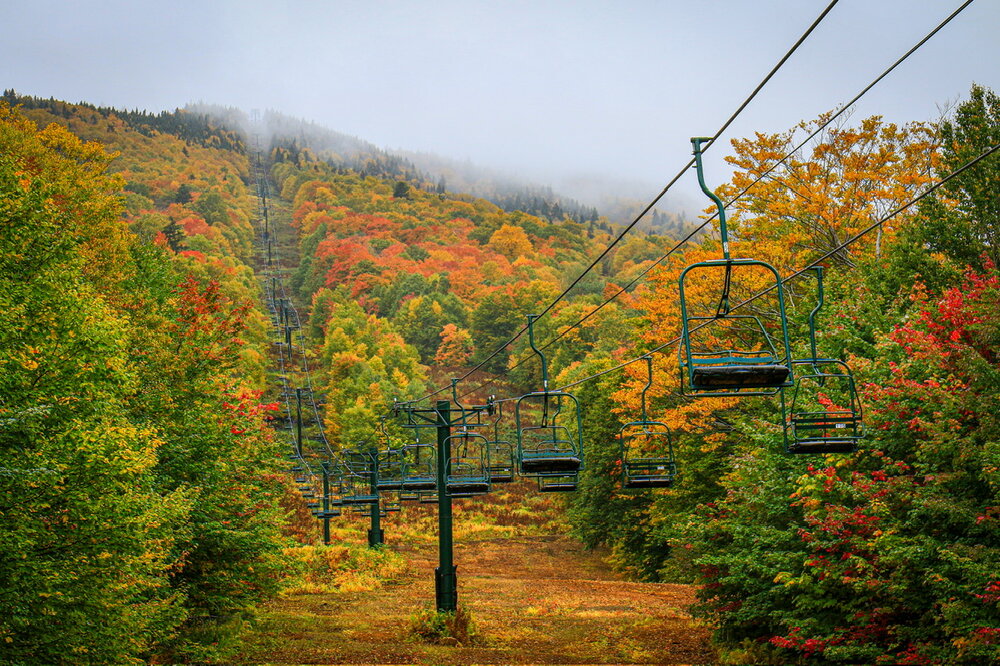
-
-
Yes models have strong westerlies in the npac would encourge evap cooling of the npac
-

Septorcher 2026 Discussion - Endless Summer
dendrite replied to Damage In Tolland's topic in New England
Foliage gone wild -
I'm not sure what you're expecting out of a nino, like bomb cyclones twice a week or something? We just got through with a solid week with multiple inches of precip. It's been crap clouds with occasional drizzle since Saturday at least. We're tracking precip for the upcoming weekend. Our avg precip is like 4" a month, not 14".