All Activity
- Past hour
-
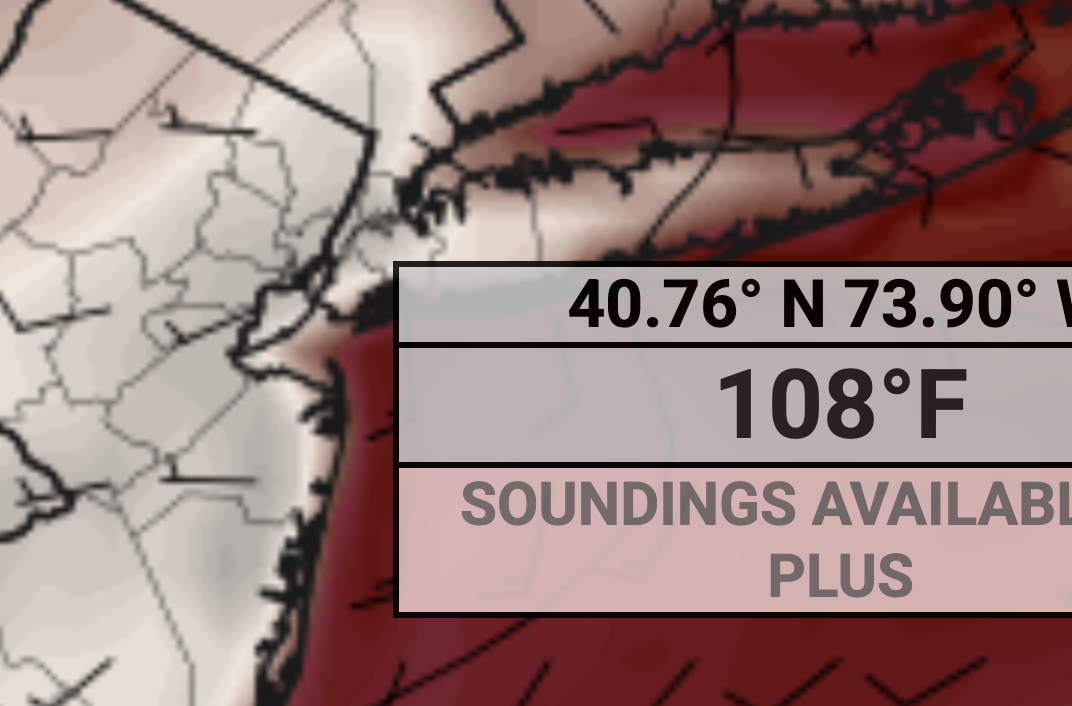
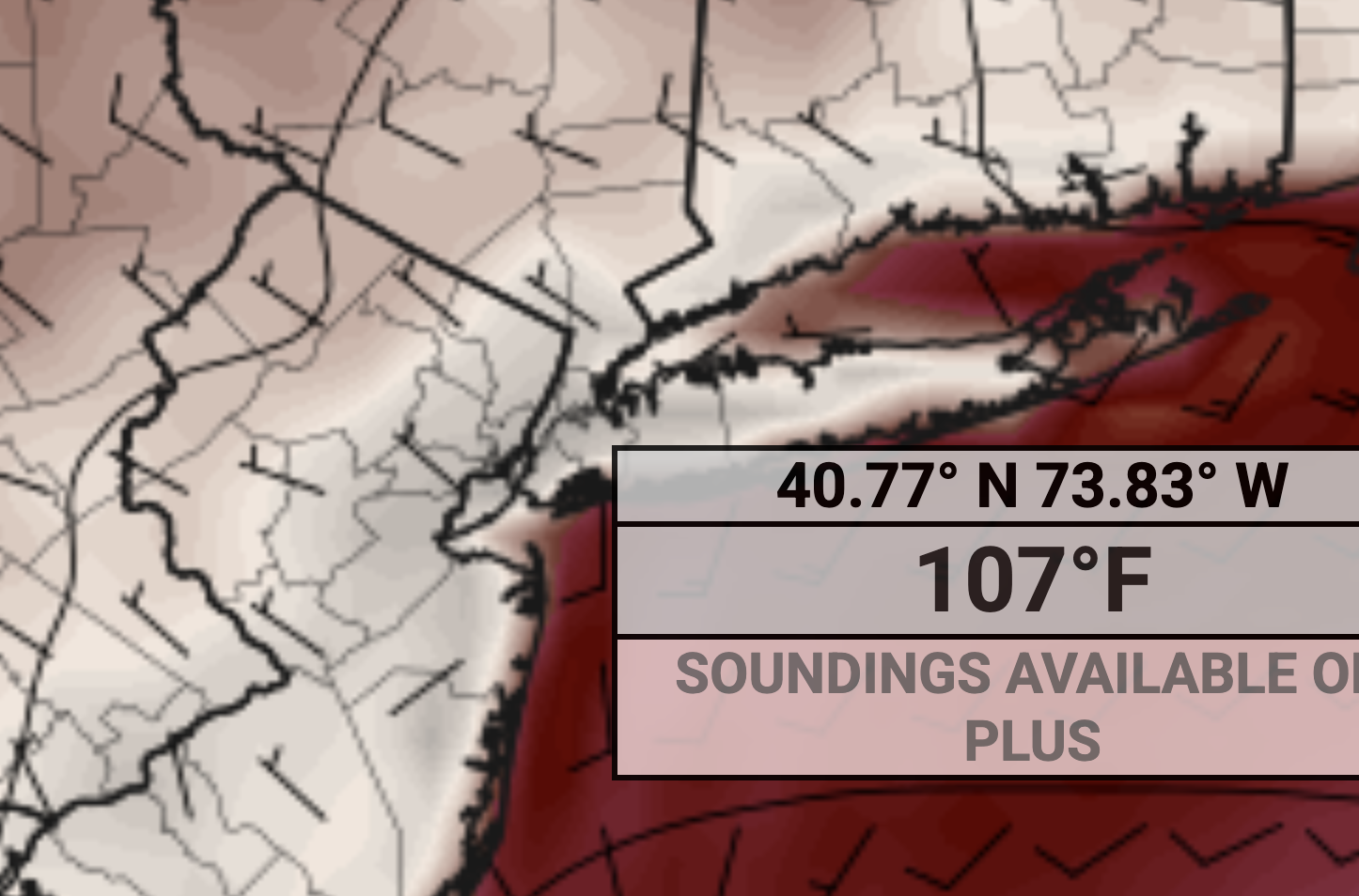
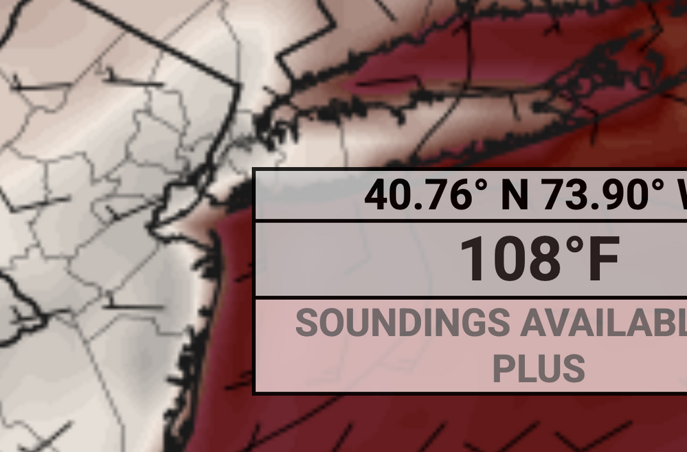
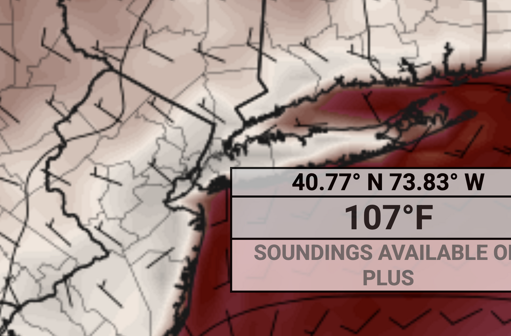
Euro has 107F, 105F, and 108F next tuiesday, Wednesday and Thursday lol. Here is Thursday:
-
Today ended up sun and near 80. Certainly none of the doom and gloom TFlizz was calling for yesterday
-
Pretty nice one out there today.
-
Love me some heat with low humidity. Alas, that probably won’t verify for very long.
-

2025 Short Range Severe Weather Discussion
roardog replied to Chicago Storm's topic in Lakes/Ohio Valley
Without looking back at the specifics from that time I feel like the 12Z euro almost has a July ‘95 look to it. -
More than .5" my friend just outside New Cumberland just told me. I am at nada. If it were snow, I might murder something lol
-
TWICE THE MERCURY!
-
Yep. Pouring in downtown Baltimore too. Hoping this is making its way north of here as well to the drier areas in Balt and Harford counties. Really beneficial after the relative whiff over the last three days.
-
Probably will have fans blowing on it to keep equipment cool lol
-

2025 Short Range Severe Weather Discussion
Stebo replied to Chicago Storm's topic in Lakes/Ohio Valley
I'd have to defer to Ricky on this but every model is suffering from convective feedback, I really don't know how to forecast this one. Verbatim most models are significant but there is a feedback that is amplifying the winds, how much of that is true I don't know. -
We'll see how PSEG and other NJ suppliers hold up after all these data center's that have already been taxing the system.
-
106 in the park, but the park will record 99F
-
Need a whole house generator, I bet CONED will see a ton a voltage issues if the heat is as hot as modelled.
-
What's the hottest temp ever recorded for NYC?
-
MAX temps are probably around 110F because that map is the temperature at 2PM, I have no doubt with that type of flow we would get daytime highs a couple hours later.
-
I have zero confidence the ripoff artists known as CONED can keep the power on with those types of temps
-
These WNW flow heat events are where we really roast and heights are absurdly high. We’ll see if that verifies (107 is likely too high but could definitely be 100+ if we get the downslope WNW flow) or it becomes our more typical southerly flow FL type heat.
-
It's actually a HAIR cooler for next Monday because the wind is more off the water by a tad compared to 0z. But 12z keeps heating up more and more for next Tuesday.
-
Sounds like a real treat with all the excess water evaporation around it will feel like Calcutta
-

2025 Short Range Severe Weather Discussion
A-L-E-K replied to Chicago Storm's topic in Lakes/Ohio Valley
would take the 12z euro -
Euro now has 107 degrees next Tuesday in NYC.
-

E PA/NJ/DE Summer 2025 Obs/Discussion
RedSky replied to Hurricane Agnes's topic in Philadelphia Region
A balmy 62F with dark November like sky and light rain -
Up to about 0.5” of much needed soaking rain.
-
I’d hedge that it’s all overdone a bit…mixing and 850s. Knock a couple C off and expect the dews to overperform as usual. 96-99/70 type stuff.
-
2025 Short Range Severe Weather Discussion
Stebo replied to Chicago Storm's topic in Lakes/Ohio Valley
Saturday has my interest.