Ian Posted December 24, 2010 Share Posted December 24, 2010 Looks like two members jumped west from the previous run, causing the mean to come west a bit as well. yet still largely horrible Link to comment Share on other sites More sharing options...
weatherweather Posted December 24, 2010 Share Posted December 24, 2010 This event resembles 2/89, 3/09 and 1/25/00...overall all 3 systems tracked more north than northeast and needed a major negative tilt at 500 because the ridge was displaced too far east out in the west or was progressing eastward at the time....1/25/00 and 3/09 got it...this one might but I doubt it. The 3/09 event, looking at these maps to me it seems it was the southern s/w that did all the work. Maybe im just readin it wrong. http://www.njfreeways.com/weather/2009/02-Mar-09-500MillibarMaps.html Link to comment Share on other sites More sharing options...
spf Posted December 24, 2010 Share Posted December 24, 2010 This could not have been the case--- the Winter Storm Warning came out before 10 pm. Earlier, at 5 pm, the TV Mets were pretty much unanimous in saying that something was way off with the radar compared to the modeling in South Carolina. The NWS issued the rapid-response WSW at 9:48 pm and the 11 pm newscasts led with that as the top story. Agreed. In DC, as the 6:00 pm news was going off the air, Bob Ryan noted that he was very nervous about the radar moving the storm north rather than northeast. By 10 pm, there was a crawl across the TV screen that DC was now expecting 8-12 inches. Link to comment Share on other sites More sharing options...
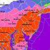
SnowGoose69 Posted December 24, 2010 Share Posted December 24, 2010 http://grib2.com/jma/CONUS_JMA_1000-500_SLPTHKPRP_72HR.gif Link to comment Share on other sites More sharing options...
Bob Chill Posted December 24, 2010 Share Posted December 24, 2010 This could not have been the case--- the Winter Storm Warning came out before 10 pm. Earlier, at 5 pm, the TV Mets were pretty much unanimous in saying that something was way off with the radar compared to the modeling in South Carolina. The NWS issued the rapid-response WSW at 9:48 pm and the 11 pm newscasts led with that as the top story. You're right. 10 years ago and my memory is foggy. I used to get up at 4:30 back then so there is no way I was awake for the late news. It must have been the 6pm forecasts vs the 9-10pm radar I was watching. Regardless, it was one heck of a surprise. Link to comment Share on other sites More sharing options...
PhineasC Posted December 24, 2010 Share Posted December 24, 2010 Where is Ji? The JMA just came way west. Link to comment Share on other sites More sharing options...
weatherweather Posted December 24, 2010 Share Posted December 24, 2010 We got the jma, the trend is ON Link to comment Share on other sites More sharing options...
Edge Weather Posted December 24, 2010 Share Posted December 24, 2010 Well, now every single model has come west quite a bit. http://grib2.com/jma...THKPRP_72HR.gif Link to comment Share on other sites More sharing options...
SnowGoose69 Posted December 24, 2010 Share Posted December 24, 2010 The GFS and JMA would make for alot of angry snowhounds in NYC, LI, and NJ...I'd personally rather have the GEM scenario or a hit...those in between versions would drive me insane. Link to comment Share on other sites More sharing options...
Ian Posted December 24, 2010 Share Posted December 24, 2010 there's a reason ji is just about the only one who cares about the jma Link to comment Share on other sites More sharing options...
SEVAsNOwSTORM Posted December 24, 2010 Share Posted December 24, 2010 Which model has performed the best this season within this time frame? Link to comment Share on other sites More sharing options...
SnowGoose69 Posted December 24, 2010 Share Posted December 24, 2010 Which model has performed the best this season within this time frame? Last event if you ask me it was the NAM....the others all missed E MA with the snows. Link to comment Share on other sites More sharing options...
Clinch Leatherwood Posted December 24, 2010 Share Posted December 24, 2010 As one of the two guys that started that battle royal over the 1/25/00 event this is nothing like it. The NGM was the first to give a hint something was up. It had some pretty prolific VV's offshore at 48h. No other model really offered a hint at that point that the focus had been on the wrong s/w but for about 36-48 hours in the IRC chat Brian and I were banging the drum that the focus was on the wrong system. If all of you remember the progression it went from euphoria to depression. Everyone thought it was all over and had moved on for the most part after the last night where Dave, Brian and I had the scrum. The first hints came from the NGM that the idea of the wrong parcel driving the east coast storm. I don't see this situation as similar in any way. What's lacking in this situation is the epic jet streaks evident and the s/w in the base of the trough...well take a look at the old storm http://www.emc.ncep.noaa.gov/mmb/research/blizz2000/eta500.html It does remind me of another storm that I can never place. Jim Cantore did a storm stories on it, it was a bowling ball that moved across the GOM and was modeled pretty weakly. It blew up coming across the Gulf and had a nasty squall line with it. It was so strong it actually brought with it a storm surge to parts of the Florida coast. OT but anyone remember the date as it does remind me a little of that event. Link to comment Share on other sites More sharing options...
SEVAsNOwSTORM Posted December 24, 2010 Share Posted December 24, 2010 Last event if you ask me it was the NAM....the others all missed E MA with the snows. That could have very well be a coincidence. NAM usually isn't very dependable past 48. Link to comment Share on other sites More sharing options...
SnowGoose69 Posted December 24, 2010 Share Posted December 24, 2010 As one of the two guys that started that battle royal over the 1/25/00 event this is nothing like it. The NGM was the first to give a hint something was up. It had some pretty prolific VV's offshore at 48h. No other model really offered a hint at that point that the focus had been on the wrong s/w but for about 36-48 hours in the IRC chat Brian and I were banging the drum that the focus was on the wrong system. If all of you remember the progression it went from euphoria to depression. Everyone thought it was all over and had moved on for the most part after the last night where Dave, Brian and I had the scrum. The first hints came from the NGM that the idea of the wrong parcel driving the east coast storm. I don't see this situation as similar in any way. What's lacking in this situation is the epic jet streaks evident. It does remind me of another storm that I can never place. Jim Cantore did a storm stories on it, it was a bowling ball that moved across the GOM and was modeled pretty weakly. It blew up coming across the Gulf and had a nasty squall line with it. It was so strong it actually brought with it a storm surge to parts of the Florida coast. OT but anyone remember the date as it does remind me a little of that event. Wow.... Link to comment Share on other sites More sharing options...
TUweathermanDD Posted December 24, 2010 Share Posted December 24, 2010 Wow.... 1993 may just be it. Nah... Link to comment Share on other sites More sharing options...
Ian Posted December 24, 2010 Share Posted December 24, 2010 1993 may just be it. Nah... 1993 was modeled weakly? That's not the story I've heard. Link to comment Share on other sites More sharing options...
Fozz Posted December 24, 2010 Share Posted December 24, 2010 1993 was modeled weakly? That's not the story I've heard. He's kidding. Link to comment Share on other sites More sharing options...
goldstar Posted December 24, 2010 Share Posted December 24, 2010 There is a weather term for the damage caused by that straight line, i read it in my many searches I cant remember either! Link to comment Share on other sites More sharing options...
SnowJoe Posted December 24, 2010 Share Posted December 24, 2010 1993 was modeled weakly? That's not the story I've heard. You should subscribe to the weenie weekly reader.... It's a fascinating read... or so I've heard. Link to comment Share on other sites More sharing options...
NattyBo Posted December 24, 2010 Share Posted December 24, 2010 Per tombo, re: 0z Euro: hr 18 the h5 low opened up over western tex... while 12z the h5 low was closed still. s/w is digging a little better compared to 12z also the hgts on the eeast coast are a little higher hr 24 has a little closed h5 low over central tex..while 12z had a bigger h5 closed low over dallas region...s/w looks alittle more amplified compared to 12z, hgs continue hgr on east coast Link to comment Share on other sites More sharing options...
Midlo Snow Maker Posted December 24, 2010 Share Posted December 24, 2010 0z euro hr.24 closed low SW of 12z heights are buckling up higher in the east, precip is further southwest as well in tx Link to comment Share on other sites More sharing options...
Bob Chill Posted December 24, 2010 Share Posted December 24, 2010 National radar loop is interesting to look at. Sw's in ND and NM are clearly visible. Too bad the timing is going to be off. I'd be happy with a dusting at this point. Just enough snow to keep the holiday season spirit going. Either way, the xmas weather is a heck of a lot better than a foggy/rainy slopfest while watching two feet of week old snow going down the stormdrain. Link to comment Share on other sites More sharing options...
NattyBo Posted December 24, 2010 Share Posted December 24, 2010 Per tombo: hr 30 s/w opened up again over east central tex...12z had h5 closed over east centeral tex...s/w looks slower to compared to 12z northern stream is starting to come down Link to comment Share on other sites More sharing options...
Midlo Snow Maker Posted December 24, 2010 Share Posted December 24, 2010 hr 30 S/W no longer closed a little futher SW heights are higher in the east. N stream diving a little further south as well Link to comment Share on other sites More sharing options...
NattyBo Posted December 24, 2010 Share Posted December 24, 2010 Per tombo: hr 36 s/w is deff slower than 12z...looks a little stronger..northern stream coming down alittle more agressive...continues increase in hgts over east coast. Link to comment Share on other sites More sharing options...
NattyBo Posted December 24, 2010 Share Posted December 24, 2010 Per Tombo: hr 42 h5 still slower..s/w is located just of sw corner of la...while 12z was just east of new orleans... Link to comment Share on other sites More sharing options...
NattyBo Posted December 24, 2010 Share Posted December 24, 2010 Per Tombo: hr 48 s/w over central la...the trof seems not as broad compared to 12z...northern stream still a little more agressive in diving in tham 12z Link to comment Share on other sites More sharing options...
PhineasC Posted December 24, 2010 Share Posted December 24, 2010 Headed towards GFS, possibly better. Link to comment Share on other sites More sharing options...
NattyBo Posted December 24, 2010 Share Posted December 24, 2010 Per Tombo: hr 54 a good bit more amplified...h5 low over ohio..hgts along east coast are bending more towards the coast Link to comment Share on other sites More sharing options...

Recommended Posts
Archived
This topic is now archived and is closed to further replies.