AvantHiatus Posted March 28, 2014 Share Posted March 28, 2014 The data may be real, but what GW people try have us believe is that the sky is falling with the world coming to an end with dead bodies everywhere. These phenomenoms have occured before in history both recorded and likely unrecorded. Nevertheless, the GW people stand to gain a lot of power both politically, and monetarely. Also look at the lifestyles of the GW evangelists and you'll know it's a crock of xxxx. Sent from my VS980 4G I think old school AGW alarmists are a dieing breed of people, ie people who thought Earth could be forced into a Venus-like state through human carbon emissions. There are alot of reasons to combat AGW. The Earth has been warmer in the past but the rate of warming will prevent ecosystems from adapting to the new state change. On the flipside, oil companies and large agra-business have alot to lose by adopting anti-AGW policies. Responding to AGW may bring additional benefits such as a cleaner environment and more accessible energy. The short-term effects are mixed but may pay off in the long-run. I don't support instant mass-shutting down of the economy or power-grid as some have proposed. Link to comment Share on other sites More sharing options...
ORH_wxman Posted March 28, 2014 Share Posted March 28, 2014 The data may be real, but what GW people try have us believe is that the sky is falling with the world coming to an end with dead bodies everywhere. These phenomenoms have occured before in history both recorded and likely unrecorded. Nevertheless, the GW people stand to gain a lot of power both politically, and monetarely. Also look at the lifestyles of the GW evangelists and you'll know it's a crock of xxxx. Sent from my VS980 4G I would reccommend not entertaining conspiracy theories in here...we've had enough outlandish theories getting posted recently in this thread. This should stay focused on 2014 global temps and relevant info as much as possible. Link to comment Share on other sites More sharing options...
The_Global_Warmer Posted March 28, 2014 Share Posted March 28, 2014 Thanks, Obama. Ironically. Obama is actually as pro fossil fuels as any other president. When it comes to energy policy at this point it's all interchangeable down less than 1% of any real world policy effects either way. Link to comment Share on other sites More sharing options...
The_Global_Warmer Posted March 28, 2014 Share Posted March 28, 2014 CPC looks a bit warmer maybe because it's a weekly average rather than one day at a time? I don't know. Or maybe it uses a different baseline. they have corrected twice. However in this case it lines us with the other data source. Link to comment Share on other sites More sharing options...
The_Global_Warmer Posted March 29, 2014 Share Posted March 29, 2014 Here is an animation going back every three days from the DMI SSTA charts. I put this together because it is the only "daily" site I could find. They use 10-11 Satellites now for daily observations. all OBS are only from nighttime scans. The baseline is 1985-2001. Anyways it really shows the major ENSO changes underway. Nino may be upon us before the end of April a least in terms of weekly ONI. Information about the figures The web page shows the sea surface temperature (SST) and anomalies derived from infrared measurements from the polar orbiting satellites. One interpolated field is constructed daily. Only nighttime SST observations are used for the interpolation because these are more representative of the temperature in the upper meters of the water column. One image per day is shown for the last 30 days. The SST anomalies have been calculated with respect to a mean, which has been derived from observations from 1985 to 2001. They are SST climatology monthly values from the Pathfinder project and temporal interpolation is used between the two nearest months to obtain this days SST climatology. For more information on the monthly climatology, see: www.nodc.noaa.gov/sog/pathfinder4km/ Interpolation method Gaps in the observations due to clouds are filled using a 3-dimensional Optimal Interplation technique (see Høyer and She, 2007). The interpolation scheme uses statistics, which are derived locally and provides the "best possible" estimate of the SST observations, assuming steady state statistics. The mean error of the gridded SSTs is about 0.5-0.7oC. Satellite observations The observations of the sea surface temperature are based upon observations from up to 10 different satellites, measuring in Infrared and Microwave wavelengths. The observations are obtained from the Ocean and Sea Ice SAF project (www.osi-saf.org) and from Group on High Resolution Sea Surface Temperature (www.ghrsst.org). The satellites products are listed below: Sensor Satellite Resolution (km) AATSR ENVISAT 1 AVHRR (OSI-SAF) NOAA 2 AVHRR (NAVO LAC) NOAA 1 AVHRR (NAVO GAC) NOAA 4 AVHRR METOP_A 1 Modis Aqua 1 Modis Terra 1 AMSR-E Aqua 25 TMI TRMM 25 SEVIRI MSG 5 GOES 5 Link to comment Share on other sites More sharing options...
The_Global_Warmer Posted March 29, 2014 Share Posted March 29, 2014 This NINO is going to be tremendous. The subsurface warmth is racing across the Pacific Equatorial Basin. I am told Weatherbell spiked back up to .25C+ through 12zMarch28th2014. With the monthlies at .102C+. Given the rapid ENSO warming coupled with the incoming big torch over Australia with winds blowing lightly out of the N/NE from the tropical warmth of Indonesia region, the conus warming up the next few days big time before going up and down towards more normal conditions, and SW then South Central Russia torch over the next week and it just grows. We are already set up for weatherbell to finish with a .67C or so GISS equivalent for March while starting April with a torch. This is with the last three months of ONIs of -0.3, -0.4, and -0.7C. The April giss record is .83C set in 2010 that will probably be out of reach. But May is only .71 set in 2010 and 2012. I think that could be easily crushed. June is .65 set in 2005 if NINO is moderate by then it will probably get crushed. July is .71 set in 2011. Again could be crushed. Global ssta will probably be around .40C+ by then. August is .69 set in 2011. Probably crushed. September .75 set in 2005 and .74 set in 2013. Super Crushed. October .77 set in 2005. Crushed. November .78 set in 2013. Broken or crushed. December .75 set in 2006. Probably broken or crushed. Not predictions obviously just thinking out-loud. Link to comment Share on other sites More sharing options...
Jonger Posted March 29, 2014 Share Posted March 29, 2014 CPC data is fine...we are only analyzing subsurface with it which has an inherent margin of error larger than other variables. You can use the TAO/Triton dataset which I had found to be more reliable in the past two years when CPC was over estimating the OHC. Whether the subsurface pool is +6 or +4 is fairly irrelevant at this point in the game anyway. To put it simply, whatever data in included in pre to post ARGO OHC maps, I don't trust. Abrupt trend changes that took place in 2003 is a big red flag. I don't really care what response I get to this observation either, it's plain to see. Link to comment Share on other sites More sharing options...
skierinvermont Posted March 29, 2014 Share Posted March 29, 2014 To put it simply, whatever data in included in pre to post ARGO OHC maps, I don't trust. Abrupt trend changes that took place in 2003 is a big red flag. I don't really care what response I get to this observation either, it's plain to see. Basically, you are impervious to facts or reason and you like it that way. Link to comment Share on other sites More sharing options...
ORH_wxman Posted March 29, 2014 Share Posted March 29, 2014 I think you might be looking at a shorter timespan. On the 67-present rutgers most of those months are flat or down, except for December which has a clear uptrend. Either way, I think we both agree that this is probably a temporary phenomenon in a warming world even with a 'wavy' jetstream. Either way its pretty irrelevant since albedo change is not a major global forcing in the models despite the fact that we have and will continue to experience major declines in snow and ice during the important summer months for albedo. It's just not significant enough on a global scale. In winter? No, all 3 winter months have a positive trend, even back to 1967. So do Nov and Oct as well...granted, February is barely positive. But zero of those months has a downward trend. Agreed that the albedo of the snow cover is pretty irrelevant on the whole. Link to comment Share on other sites More sharing options...
wolfpackmet Posted March 29, 2014 Share Posted March 29, 2014 00z 3-29-14 CFS update: Back up to +.31 C. Puts March at +.107 C. Link to comment Share on other sites More sharing options...
The_Global_Warmer Posted March 29, 2014 Share Posted March 29, 2014 00z 3-29-14 CFS update: Back up to +.31 C. Puts March at +.107 C. It's gotta be tied to the equatorial Pacific warming in at least a semi substantial way. This was posted in the main ENSO thread. This past week's warming of 0.5 C in 3.4 is the strongest weekly warming since the 0.5 of 5/6/98. The current/recent warmth is nothing is the models are right. They completely consolidate the PV anomaly. This combined with the global ssta moving up around the .30C+ marker will probably cause weather-bell to show .5-.6C+ daily anomalies for a while barring a major cold spell somewhere in the Southern Hemisphere to off-set things. The arctic is so small a cool or even cold arctic compared to normal will pale versus even a slightly to mildly. We can see South/South Central/Central Russia, China, Mongolia, India regions, as well as Western Europe into Scandinavia will see mostly above to well above normal the next 7-10 days. Eventually a large part of Western Canada gets hit hard. While basically all of the cold is locked up around 60N or higher. Link to comment Share on other sites More sharing options...
skierinvermont Posted March 30, 2014 Share Posted March 30, 2014 In winter? No, all 3 winter months have a positive trend, even back to 1967. So do Nov and Oct as well...granted, February is barely positive. But zero of those months has a downward trend. Agreed that the albedo of the snow cover is pretty irrelevant on the whole. I thought Feb might be positive but you are right it is barely negative. I'd still call several of them 'flat' by which I mean no significant trend. Link to comment Share on other sites More sharing options...
LakeEffectKing Posted March 31, 2014 Share Posted March 31, 2014 NCDC Feb is 4th coldest in 2 decades: 2008 2 0.3561 2012 2 0.3811 2001 2 0.4066 2014 2 0.4145 Link to comment Share on other sites More sharing options...
The_Global_Warmer Posted March 31, 2014 Share Posted March 31, 2014 It really shows off the effect mid latitude land regions have on temperatures and how large that effect can become during different times of the year. Link to comment Share on other sites More sharing options...
LakeEffectKing Posted March 31, 2014 Share Posted March 31, 2014 It really shows off the effect mid latitude land regions have on temperatures and how large that effect can become during different times of the year. My statement already takes that into account....ie comparing past Marches. Link to comment Share on other sites More sharing options...
Jonger Posted March 31, 2014 Share Posted March 31, 2014 Very obvious downward trend. Link to comment Share on other sites More sharing options...
The_Global_Warmer Posted March 31, 2014 Share Posted March 31, 2014 Weekly SSTA have risen to .277C+. While ENSO3-4 SSTA have risen to only .315C+. Link to comment Share on other sites More sharing options...
SVT450R Posted March 31, 2014 Share Posted March 31, 2014 Wxbell dailies are at +.27c and march finished at +.118c Link to comment Share on other sites More sharing options...
AvantHiatus Posted March 31, 2014 Share Posted March 31, 2014 Wxbell dailies are at +.27c and march finished at +.118c As of 0z March 31st, will 12z and 18z intervals be incorporated into the monthly departures? Link to comment Share on other sites More sharing options...
SVT450R Posted March 31, 2014 Share Posted March 31, 2014 As of 0z March 31st, will 12z and 18z intervals be incorporated into the monthly departures? You're correct it may change I'll edit it if so. Link to comment Share on other sites More sharing options...
The_Global_Warmer Posted April 2, 2014 Share Posted April 2, 2014 I am told CFS is starting April at .272C+. For reference to last year April on GISS had a .48C+ and March had a .60C+. This March will likely be around .67C+ And this April is going to crush the .48C that came in last year. This is all before a NINO has even started. If we give March a .67C+ and April a .70C+. The yearly average going into May would be .63C versus last year at .56C. So much is gonna ride on what MR. EL NINO does. Link to comment Share on other sites More sharing options...
skierinvermont Posted April 2, 2014 Share Posted April 2, 2014 zucker and I were talking about how the timing is off for shattering annual temperature records unless the Nino is slow to fade. The early start this year means this year will be warm but normally the year following is much warmer. For example, 1997 was actually pretty cool despite the developing Nino. I still think this year will probably break records on most sources. But the big question will be next year. If the Nino lingers into next year, next year could be exceptionally warm. But that is too early to tell at this point. IF we did get a super Nino >2C that has some lifespan to it and doesn't crash into Nina by April 2015, then I could see 2015 finishing at .75 or even close to .8C on GISS for an annual mean. But that is a huge IF at this point and I would give odds of a super Nino at something like 10% at this point. Link to comment Share on other sites More sharing options...
StudentOfClimatology Posted April 2, 2014 Author Share Posted April 2, 2014 zucker and I were talking about how the timing is off for shattering annual temperature records unless the Nino is slow to fade. The early start this year means this year will be warm but normally the year following is much warmer. For example, 1997 was actually pretty cool despite the developing Nino. I still think this year will probably break records on most sources. But the big question will be next year. If the Nino lingers into next year, next year could be exceptionally warm. But that is too early to tell at this point. IF we did get a super Nino >2C that has some lifespan to it and doesn't crash into Nina by April 2015, then I could see 2015 finishing at .75 or even close to .8C on GISS for an annual mean. But that is a huge IF at this point and I would give odds of a super Nino at something like 10% at this point. Do you know why some Niños (1982-83, 2002-03, 2006-07, etc) do not show up as well in the global temperature data, while others (2009-10, 1997-98) feature a clear spike..? I initially thought it might have something to do with the QBO, but the correlation is very weak. Link to comment Share on other sites More sharing options...
skierinvermont Posted April 2, 2014 Share Posted April 2, 2014 Do you know why some Niños (1982-83, 2002-03, 2006-07, etc) do not show up as well in the global temperature data, while others (2009-10, 1997-98) feature a clear spike..? I initially thought it might have something to do with the QBO, but the correlation is very weak. I can explain some but not all of it and I suspect the remaining discrepancy may have nothing to do with ENSO or only indirectly related to ENSO. I think when you properly factor in timing (timing makes a big difference to calendar anomalies since ENSO often fades by the second half of the year) duration and intensity of ENSO events the discrepancy isn't as big as you think. 98 and '10 spiked a lot because the ENSO events were stronger, lasted longer, and lasted later into the following year. ENSO faded early in 2003 and 2007 but lasted mid-way through 1998 and 2010. After using a lagged statistical adjustment (I adjusted Global T by .105C for every 1C of ONI for the month 2 or 3 months previous - can't remember if I lagged 2 or 3 months), I find that 2010 was actually exactly right where one would expect and didn't have an unusually large spike. 1983 should also be thrown out because of the volcano El Chichon that caused global cooling coincident with the El Nino. 1998 was a lot warmer than expected based off my statistical adjustment and 2003 and 2007 were only very slightly cooler than expected. You've got a point with 1998 and a little bit of a point with 2003 and 2007. However, I think some of this can be explained by duration. 97-98 had a much longer duration and my method doesn't fully account for duration. Another good example of duration being important is how warm 1988 was. The big jump was in 1987 but that was actually normal given the intensity of the Nino. What was weird was that 1988 was even warmer despite the La Nina that developed by April of that year. This is clearly due to the very long duration of the El Nino which lasted 2 winters instead of the normal 1. The heat build up lasted into the next La Nina. I believe a method that took into account the duration better than mine does could explain the relative size of the spikes in 1983, 1987, 1988, 1998, 2003, and 2007. The following graph shows my simple lagged statistical ENSO adjustment as the blue line. Spikes up or down in the blue line are where my method has incompletely explained short term variability. You can see such spikes in 1998, 2005, and 1988. I believe a better factoring in of ENSO event duration could partially remove some of these spikes. The second graph removes solar variability statistically as well which helps to make the 5-10 year trends more linear but you still get some annual spikes in years like 88, 98 and 05 (9, 19, and 26 on the graph - forgot to label x-axis). Link to comment Share on other sites More sharing options...
The_Global_Warmer Posted April 2, 2014 Share Posted April 2, 2014 One factor we have to keep in mind now. Is that it's become normal for SON to blow torch regardless of the ENSO state. This year it will certainly be a positive enso state. Even 2010 and 2011 were relatively warm in-spite of La Ninas. We are also going into April with Russian snow cover already in peril. With Mother Russia torching that hard snow cover is going to be wrecked this year. Expect records there at least on the weeklies. Global ssta last week updated to .277C+ with an ENSO neutral. I think we will easily break .50C+ this Summer/Fall on the weeklies. Nothing is ever totally certain. But a run of .70 to .90C+ months the rest of the year on GISS seem like a 60-70% guarantee at this point. Link to comment Share on other sites More sharing options...
The_Global_Warmer Posted April 2, 2014 Share Posted April 2, 2014 Both the EURO and GFS are ruthless on the Temps, sea ice, and snow cover coming up Link to comment Share on other sites More sharing options...
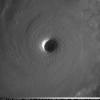
The_Global_Warmer Posted April 2, 2014 Share Posted April 2, 2014 It's arrived. Link to comment Share on other sites More sharing options...
StudentOfClimatology Posted April 3, 2014 Author Share Posted April 3, 2014 Thanks skierinvermont, I really enjoy your posts. Link to comment Share on other sites More sharing options...
ORH_wxman Posted April 3, 2014 Share Posted April 3, 2014 One factor we have to keep in mind now. Is that it's become normal for SON to blow torch regardless of the ENSO state. This year it will certainly be a positive enso state. Even 2010 and 2011 were relatively warm in-spite of La Ninas. We are also going into April with Russian snow cover already in peril. With Mother Russia torching that hard snow cover is going to be wrecked this year. Expect records there at least on the weeklies. Global ssta last week updated to .277C+ with an ENSO neutral. I think we will easily break .50C+ this Summer/Fall on the weeklies. Nothing is ever totally certain. But a run of .70 to .90C+ months the rest of the year on GISS seem like a 60-70% guarantee at this point. I'll easily take your 30-40% odds that it won't be. Link to comment Share on other sites More sharing options...
nflwxman Posted April 3, 2014 Share Posted April 3, 2014 I'll easily take your 30-40% odds that it won't be. I guess it depends what you mean for a string of months between .7-.9 C. Did you mean all the months of the years exclusively, or the average of the next 9 months? Link to comment Share on other sites More sharing options...

Recommended Posts
Archived
This topic is now archived and is closed to further replies.