SouthernNJ Posted September 2, 2012 Share Posted September 2, 2012 A few storms have formed in an area bounded by a Tornado Watch. The storms are being warned, but perhaps are not to the level of being tornadic just yet. This could change soon if things go the way they are expected. Link to comment Share on other sites More sharing options...
SouthernNJ Posted September 2, 2012 Author Share Posted September 2, 2012 Downtown Huntsville under a tornado warning, nothing reported yet from that storm though. Another storm with a SVR has increasing rotation near the Phil Campbell area at this time. Link to comment Share on other sites More sharing options...
jburns Posted September 2, 2012 Share Posted September 2, 2012 NC has gotten active. I am about to get hammered according to radar. Warnings out. Link to comment Share on other sites More sharing options...
SouthernNJ Posted September 2, 2012 Author Share Posted September 2, 2012 Some wind damage was reported in and around Huntsville, but no word of any tornadoes for the time being. The Phil Campbell storm was the best-looking on radar, but has not registered any reports so far. A new rotating storm is entering AL from MS and will pass close to Hamilton and Hackleburg during the next 15 minutes. Link to comment Share on other sites More sharing options...
Dunkman Posted September 2, 2012 Share Posted September 2, 2012 NC has gotten active. I am about to get hammered according to radar. Warnings out. LIne went through my house about 30 minutes ago right as it was being warned. I have to say it looked better on radar than it was in person, at least here. Maybe 30-35mph wind gusts and some lightning. Link to comment Share on other sites More sharing options...
jburns Posted September 3, 2012 Share Posted September 3, 2012 Nice show here. A quick .7 with vivid lightning and dog panicing thunder. Link to comment Share on other sites More sharing options...
andyhb Posted September 3, 2012 Share Posted September 3, 2012 Fairly impressive rotation south of Fulton, MS. Link to comment Share on other sites More sharing options...
Dunkman Posted September 3, 2012 Share Posted September 3, 2012 Storms in NC definitely look more organized. That storm near Graham looks to have some rotation in it now...not saying it will produce anything but something for people to keep an eye on for sure. Link to comment Share on other sites More sharing options...
WilkesboroDude Posted September 3, 2012 Share Posted September 3, 2012 I thought the Orange County, NC storm might go tornado warned. Guess not. They did include this in the warning though... Severe thunderstorms can produce tornadoes with little or no advance warning. Be prepared to move quickly to an interior room of a safe shelter if you hear or see a tornado. Link to comment Share on other sites More sharing options...
Dunkman Posted September 3, 2012 Share Posted September 3, 2012 BULLETIN - EAS ACTIVATION REQUESTED TORNADO WARNING NATIONAL WEATHER SERVICE RALEIGH NC 842 PM EDT SUN SEP 2 2012 THE NATIONAL WEATHER SERVICE IN RALEIGH HAS ISSUED A * TORNADO WARNING FOR... NORTH CENTRAL DURHAM COUNTY IN CENTRAL NORTH CAROLINA NORTHERN ORANGE COUNTY IN CENTRAL NORTH CAROLINA SOUTHERN PERSON COUNTY IN CENTRAL NORTH CAROLINA * UNTIL 915 PM EDT * AT 840 PM EDT...NATIONAL WEATHER SERVICE DOPPLER RADAR INDICATED A TORNADO OVER CARR...OR 7 MILES SOUTH OF PROSPECT HILL...MOVING NORTHEAST AT 35 MPH. DAMAGING STRAIGHT LINE WINDS IN EXCESS OF 58 MPH ARE ALSO LIKELY WITH THIS STORM. * LOCATIONS IMPACTED INCLUDE... SCHLEY... ROUGEMONT... SURL... MORIAH... THIS INCLUDES INTERSTATE 40 BETWEEN EXITS 157 AND 160. Link to comment Share on other sites More sharing options...
WilkesboroDude Posted September 3, 2012 Share Posted September 3, 2012 Well guess they now decide to go tornado warned immediately after I post that. Think they could have given a much better lead time with that, but w/e. Link to comment Share on other sites More sharing options...
SouthernNJ Posted September 3, 2012 Author Share Posted September 3, 2012 Tornado Warning in NC, for the storm everyone suspected..and some damaging winds in a lot of areas by the looks of the radar. Very slow moving line and producing tremendous amounts of cloud-to-ground lightning. Link to comment Share on other sites More sharing options...
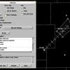
SouthernNJ Posted September 3, 2012 Author Share Posted September 3, 2012 The Mississippi portion of the Memphis CWA still has a couple of spinning storms to deal with, one of which having a nice spiral reflectivity shape to it. Link to comment Share on other sites More sharing options...
WilkesboroDude Posted September 3, 2012 Share Posted September 3, 2012 Well Wilksborodude I guess we're getting pretty good at reading the radar, looks like we spotted it on the same scan the NWS did. I just so happened to be using the NWS Blacksburg radar...wonder if they were looking at it. 1/2 scans after leaving Guilford County it should have been tornado warned. Link to comment Share on other sites More sharing options...
featherwx Posted September 3, 2012 Share Posted September 3, 2012 I'm currently on my porch in Hillsborough. I'll let you guys know what happens, should just be a whole lotta rain. Link to comment Share on other sites More sharing options...
Met1985 Posted September 3, 2012 Share Posted September 3, 2012 Storms blowing up near the TN/NC boarder to. Something to keep an eye on. Looks like tonight is goign to be busy with severe weather. Those storms in MS are looking nasty. Link to comment Share on other sites More sharing options...
NCWX Posted September 3, 2012 Share Posted September 3, 2012 Radar looks good west of us near Durham and those areas.... yet our local news is saying those storms will dry up before reaching 95...... I wonder about that. Link to comment Share on other sites More sharing options...
WNCwx Posted September 3, 2012 Share Posted September 3, 2012 Yes, Met1985, I've been watching the storms, too. It should be interesting. Link to comment Share on other sites More sharing options...
Met1985 Posted September 3, 2012 Share Posted September 3, 2012 Looks like right along the boarder of TN/NC could get hit twice tonight. Once with this first line then with the second line. Seems like those stroms are getting a little more organized. Suprised they have not put out a severe thunderstorm watch yet for WNC. Very thick out there right now. Link to comment Share on other sites More sharing options...
WNCwx Posted September 3, 2012 Share Posted September 3, 2012 Cherokee and Clay Counties already are under a Severe Thunderstorm Watch. GSP typically doesn't warn us in Macon County until storms are a county away from getting here. Link to comment Share on other sites More sharing options...
Met1985 Posted September 3, 2012 Share Posted September 3, 2012 Cherokee and Clay Counties already are under a Severe Thunderstorm Watch. GSP typically doesn't warn us in Macon County until storms are a county away from getting here. Ya true. Seems like these storms are training a little right over the boarder. If they get over the mountains could be some very heavy rain. Link to comment Share on other sites More sharing options...
Met1985 Posted September 3, 2012 Share Posted September 3, 2012 Nice little bow entering SW NC near Murphy. Link to comment Share on other sites More sharing options...
LithiaWx Posted September 3, 2012 Share Posted September 3, 2012 Nice little bow entering SW NC near Murphy. I'm surprised the dynamics are strong enough to keep all of this activity still going. Link to comment Share on other sites More sharing options...
Met1985 Posted September 3, 2012 Share Posted September 3, 2012 I'm surprised the dynamics are strong enough to keep all of this activity still going. Well it is still very muggy out and the current temp is 72 degrees at 11. Strange but seems lik ehow it is going to be the next couple days. Looks like we will be under the gun again tomorrow. Link to comment Share on other sites More sharing options...
Met1985 Posted September 3, 2012 Share Posted September 3, 2012 Looks like Lake Fontana is fixing to get hit pretty hard with this line of storms. Link to comment Share on other sites More sharing options...
WNCwx Posted September 3, 2012 Share Posted September 3, 2012 GSP seems not to be worried about the storms. I think the radar loop looks worse than it is: Here is the latest from the AFD: .NEAR TERM /UNTIL 6 AM MONDAY MORNING/... -- Changed Discussion -- AS OF 1020 PM...SHOWERS LINGER ALONG THE BLUE RIDGE AS CONVECTION MOVES INTO THE MTNS FROM TN. BEST CHC FOR CONVECTION OVERNIGHT REMAINS THE FROM ALONG THE BLUE RIDGE AND WEST...AND HAVE LIKELY POP THERE OVERNIGHT. CANNOT RULE OUT A SHOWER OR STORM ELSEWHERE...BUT SHUD REMAIN ISOLATED THERE. ONLY MINOR ADJUSTMENTS NEEDED FOR LOWS WITH ALL OTHER FIELDS UPDATED FOR CURRENT CONDITIONS. AS OF 755 PM...STRONG LINE OF CONVECTION MOVING EAST OF THE AREA WITH ANOTHER WEAKER LINE MOVING ACROSS THE MTNS AND INTO THE UPPER SAV RIVER VALLEY. THIS LINE WILL MOVE ACROSS THE AREA THIS EVENING BUT DO NOT EXPECT ANY SIGNIFICANT STORMS. ANOTHER LINE OF CONVECTION COULD MOVE INTO THE MTNS OVERNIGHT FROM TN IF IT HOLDS TOGETHER. I'll be finding out in about half an hour or so. Link to comment Share on other sites More sharing options...
Met1985 Posted September 3, 2012 Share Posted September 3, 2012 The line in SW NC seems to be breaking up as it gets more north. Oh well will see some heavy rain at least out of the line. Link to comment Share on other sites More sharing options...
WNCwx Posted September 3, 2012 Share Posted September 3, 2012 As usual, the storms have broken apart just before they arrived. The Nantahala Mountains are effective storm breaker-uppers. Link to comment Share on other sites More sharing options...
Met1985 Posted September 3, 2012 Share Posted September 3, 2012 As usual, the storms have broken apart just before they arrived. The Nantahala Mountains are effective storm breaker-uppers. Yep. Maybe we see something better tomorrow. Link to comment Share on other sites More sharing options...
Met1985 Posted September 3, 2012 Share Posted September 3, 2012 Radar looking active this morning already. I think today could be very interesting. Link to comment Share on other sites More sharing options...

Recommended Posts
Archived
This topic is now archived and is closed to further replies.