ksstormhunter Posted September 3, 2012 Share Posted September 3, 2012 SmartCast Next 24 Hours: Tracking Tuscaloosa, Alabaster, Golden Triangle, Columbus as strongest threat areas through 04/10Z. Tuscaloosa: Tracking Thunderstorm threat from 18Z-10Z, with 18Z-23Z as prime for severe weather Convective Gust potential of 81mph. Tornado Potential around 51% Rain accumulation of up to .8 possible. Hi: 90F Alabaster: Tracking Thunderstorm threat from 18Z-10Z, with 14Z-16Z and 20Z-00Z as prime for severe weather. Convective Gusts of 67mph. Tornado Potential around 62%. Hi:87F Golden Triangle: Thunderstorms through 10Z-10Z, with 10Z-14Z and 22Z-00Z as prime for severe weather. Convective gust of 89mph. Tornado Potentail of 54%. Hi: 88F Columbus: Thunderstorm potential 10Z-10Z, with 10Z-14Z and 22-00Z as prime for severe weather. Convective Gusts of 69mph. Link to comment Share on other sites More sharing options...
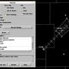
andyhb Posted September 3, 2012 Share Posted September 3, 2012 0-3 km EHI is off the charts in Eastern MS/Western AL in the tornado watch area. Link to comment Share on other sites More sharing options...

Recommended Posts
Archived
This topic is now archived and is closed to further replies.