brooklynwx99
-
Posts
6,218 -
Joined
-
Last visited
Content Type
Profiles
Blogs
Forums
American Weather
Media Demo
Store
Gallery
Everything posted by brooklynwx99
-
i will 100% take this 5-6 days out, let the chips fall where they may

-
lol absolutely not, if the euro was the only model showing a hit without the support from the AIFS it would be tossed in the trash
-
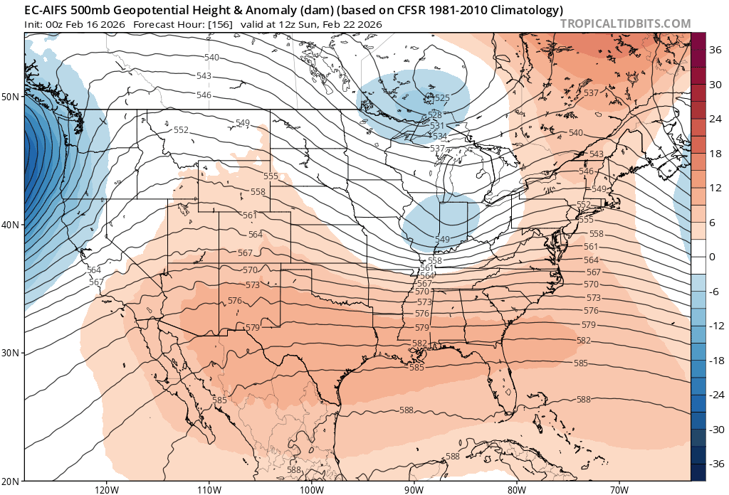
this is looking legit at this range. really impressive synoptic support for a potentially major system... just need to see it hold for a couple more days before we get truly excited
-

“Cory’s in NYC! Let’s HECS!” Feb. 22-24 Disco
brooklynwx99 replied to TheSnowman's topic in New England
pretty impressive model agreement and synoptic support for a potentially major storm at this range -
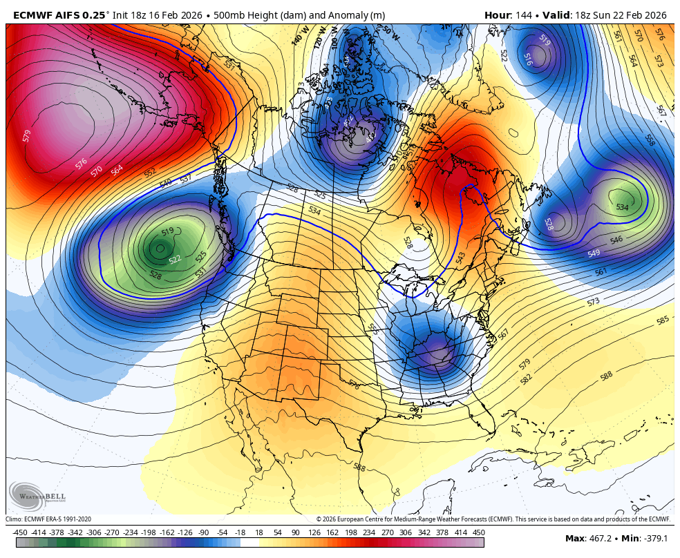
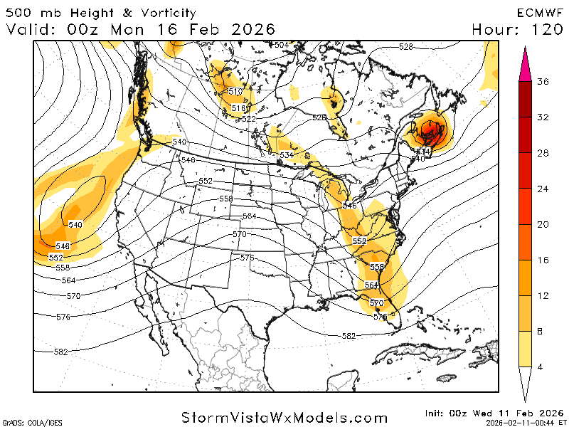
this speaks for itself... AIFS-ENS is very similar to Feb 21. not advertising impacts like that, obviously, but it's becoming clear that this setup holds high end potential. we'll see how things trend in the coming days, but man that is uncanny
-
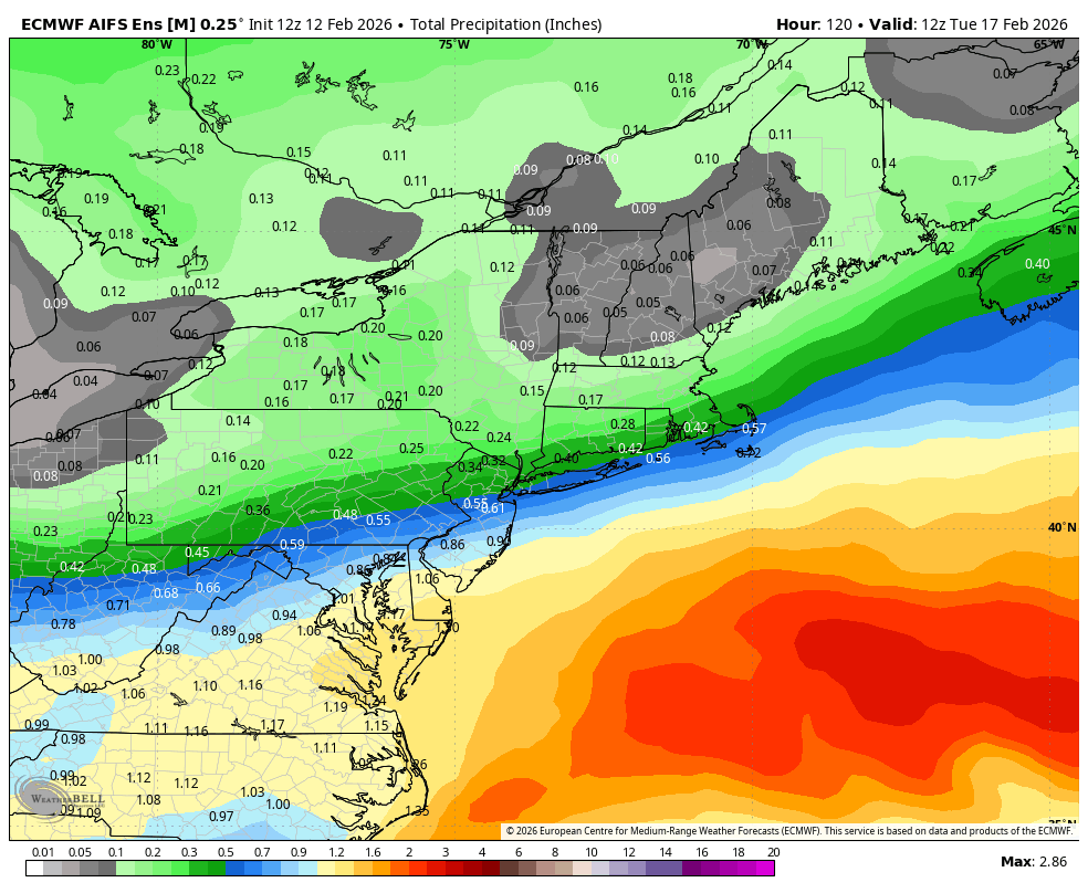
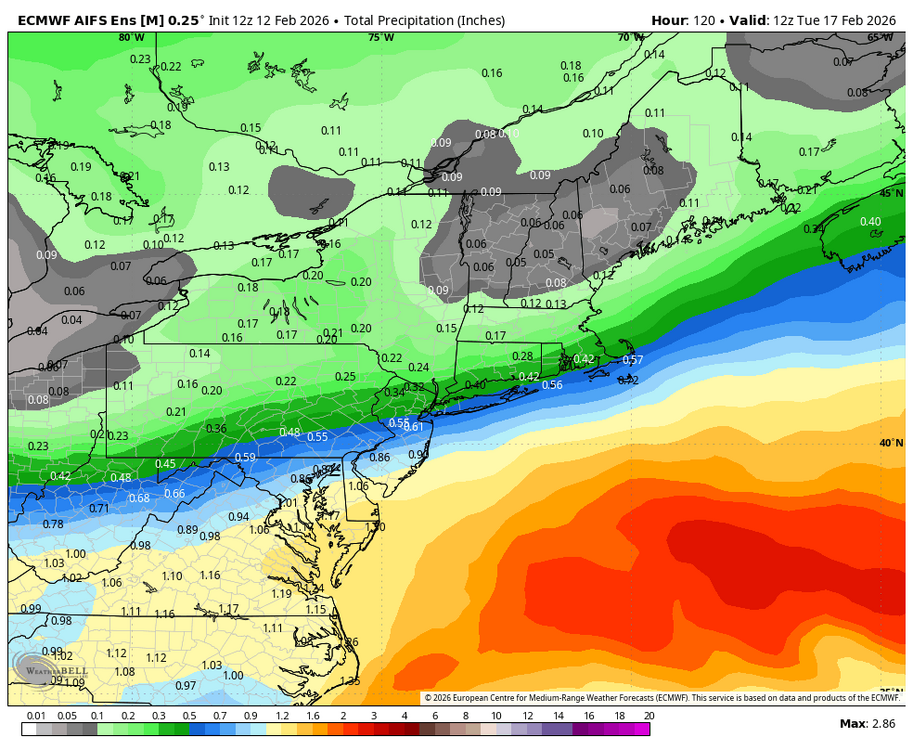
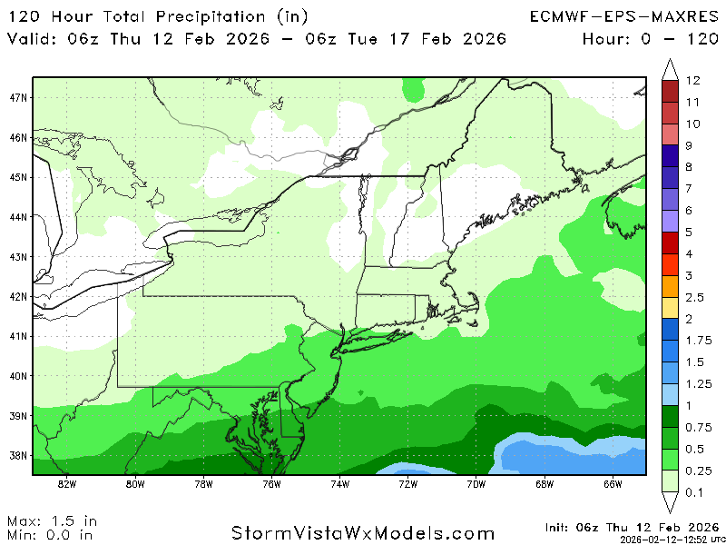
AIFS is a MECS, 12-18 NYC to TAN
-
Late February/Early March 2026 Mid-Long Range
brooklynwx99 replied to WxUSAF's topic in Mid Atlantic
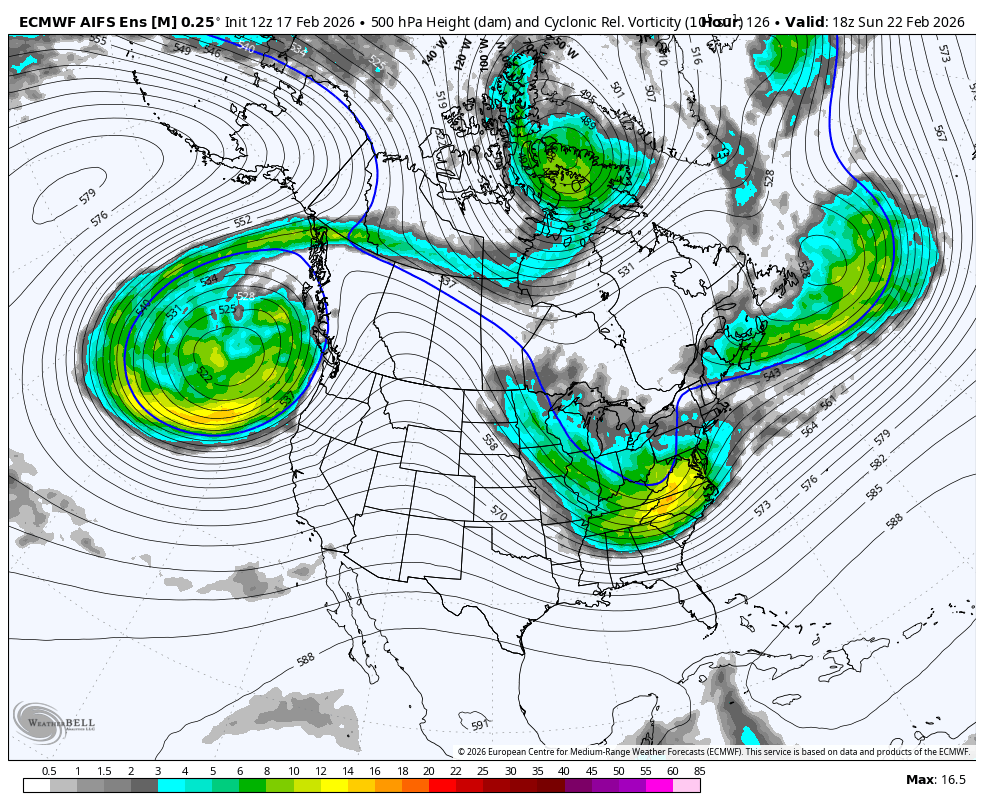
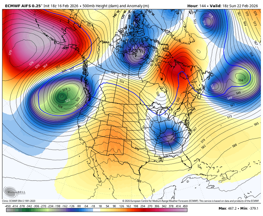
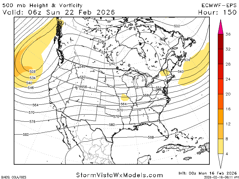
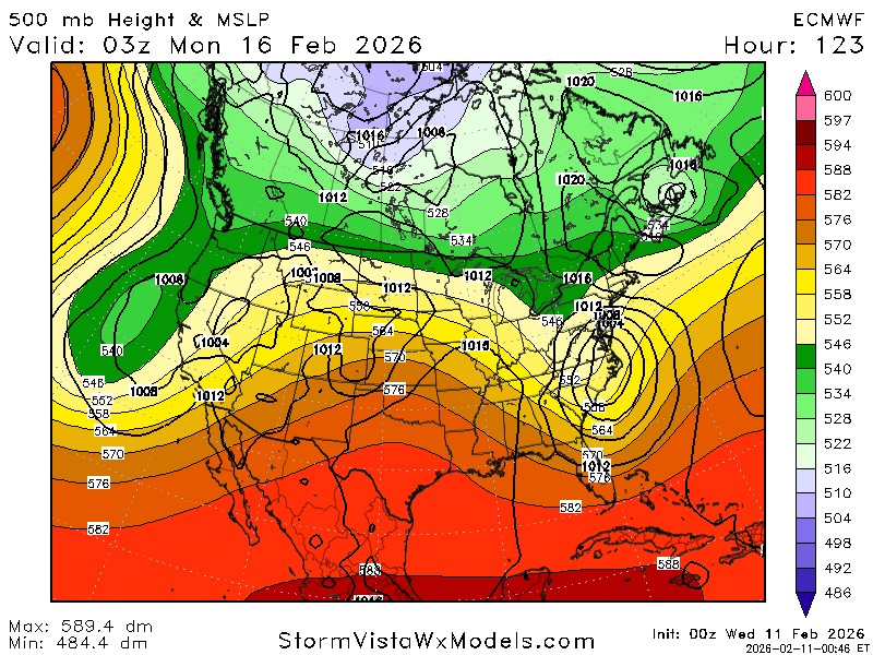
really nice configuration on the AIFS-EPS synoptically... Pacific trough is spiking a ridge over MT, decaying block over SE Canada with confluence, and vort amping underneath the block. one of the better setups we've had recently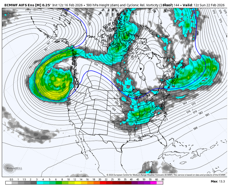
-
really nice configuration on the AIFS-EPS synoptically... Pacific trough is spiking a ridge over MT, decaying block over SE Canada with confluence, and vort amping underneath the block. one of the better setups we've had recently

-
really nice configuration on the AIFS-EPS synoptically... Pacific trough is spiking a ridge over MT, decaying block over SE Canada with confluence, and vort amping underneath the block. one of the better setups we've had recently

-
the ridge spikes right over ID/MT as the trough amps, which is what matters
-
so much more phasing there, great to see
-
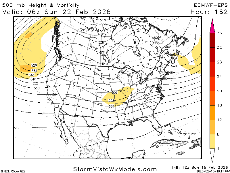
lol what happened to the EPS, man
-
can already tell the euro is going to increase wave spacing early on at 12z. should be better and then you're literally only left with the CMC OP. we shall see but yeah, agreed. the AIFS is deadly with synoptics
-
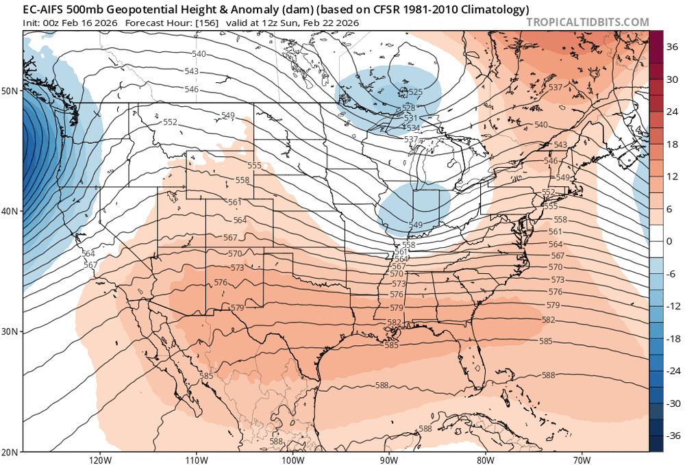
that trend in the ridge out west is encouraging
-
AIFS going for broke too
-
lots to like here IMO
-
lol
-
lol hold that thought
-
me too. just weird seeing the most skilled piece of guidance we have end up that aggressive. something will give by tomorrow
-
this would be quite the flop from the AIFS-ENS
-
spread tightened up
-
if only it wasn't the highest skill model we have at this range
-
why even look at the euro do this shit when you have the AIFS
-
well, euro is a full phaser
-
its ensemble has consistently been farther north FWIW