brooklynwx99
-
Posts
6,215 -
Joined
-
Last visited
Content Type
Profiles
Blogs
Forums
American Weather
Media Demo
Store
Gallery
Everything posted by brooklynwx99
-
 EPS looks good!
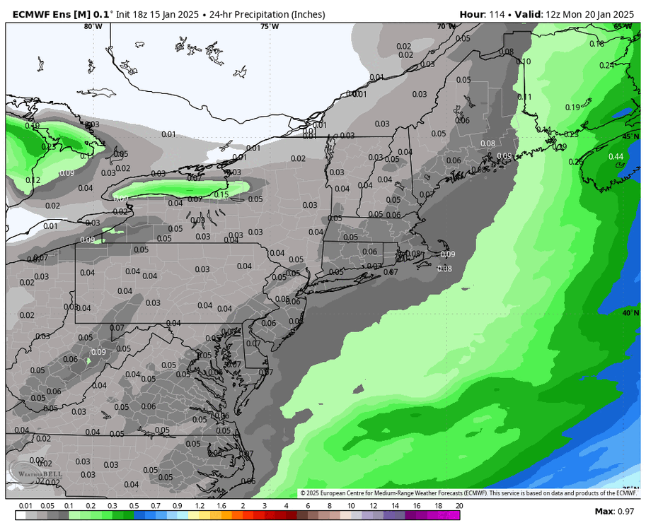
-
January Medium/Long Range: A snowy January ahead?
brooklynwx99 replied to mappy's topic in Mid Atlantic
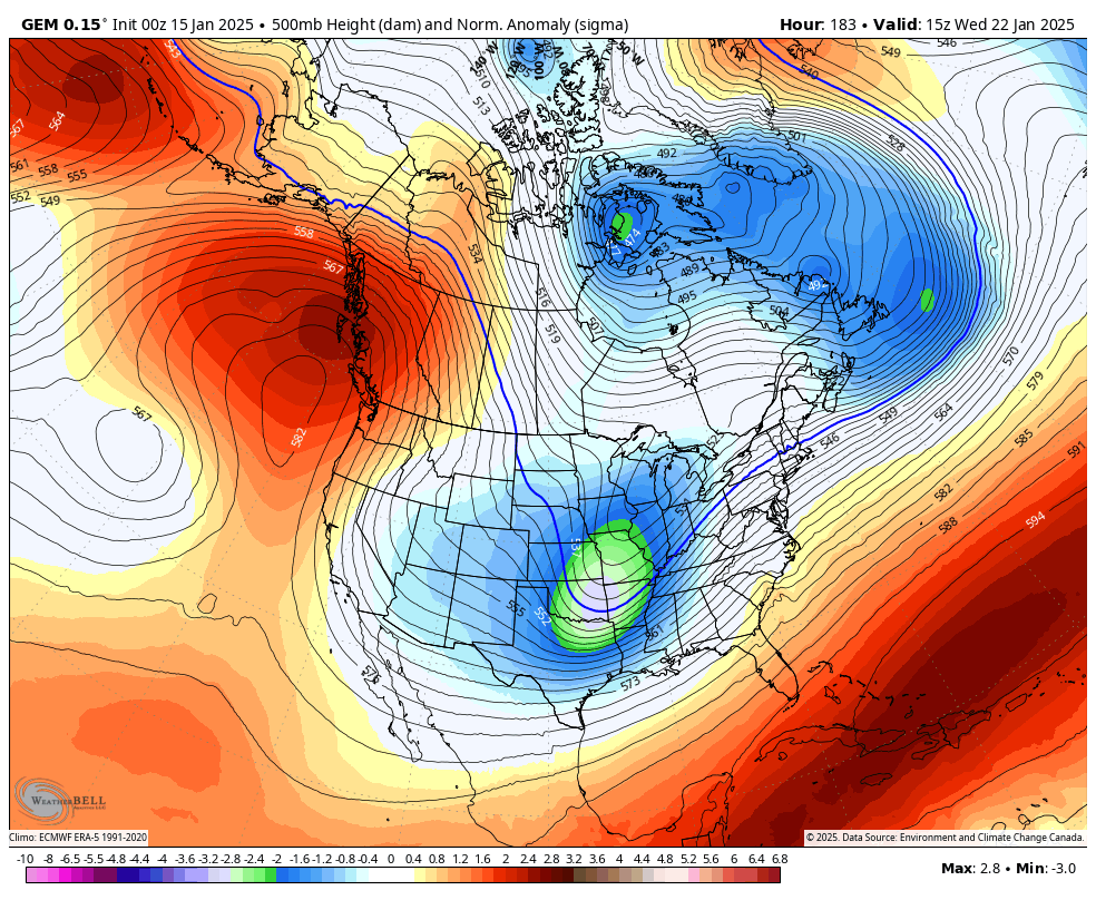
EPS is actually pretty damn solid for the 22nd. lots of hits with the trough swinging a bit more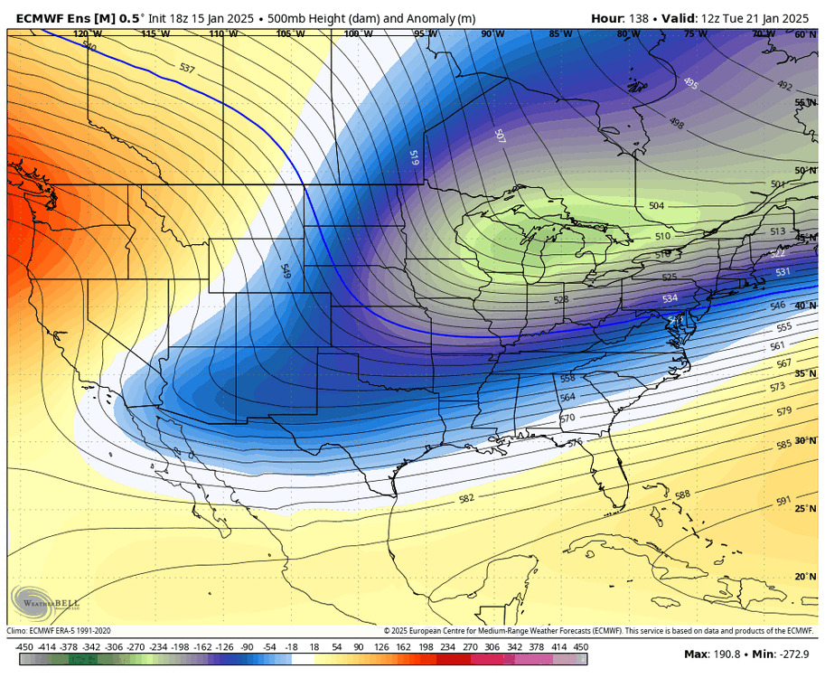
-
January Medium/Long Range: A snowy January ahead?
brooklynwx99 replied to mappy's topic in Mid Atlantic
the difference between the CMC and ECMWF is quite small. really difficult forecast
-
the difference between the CMC and ECMWF is quite small. really difficult forecast
-
this is the difference between next to nothing on the ECMWF and widespread 3-6" on the CMC. good luck figuring that out

-
GFS is notoriously progressive in these setups
-
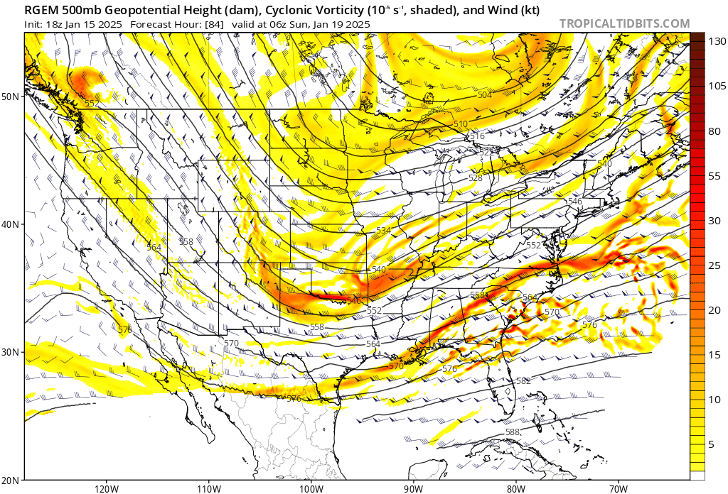
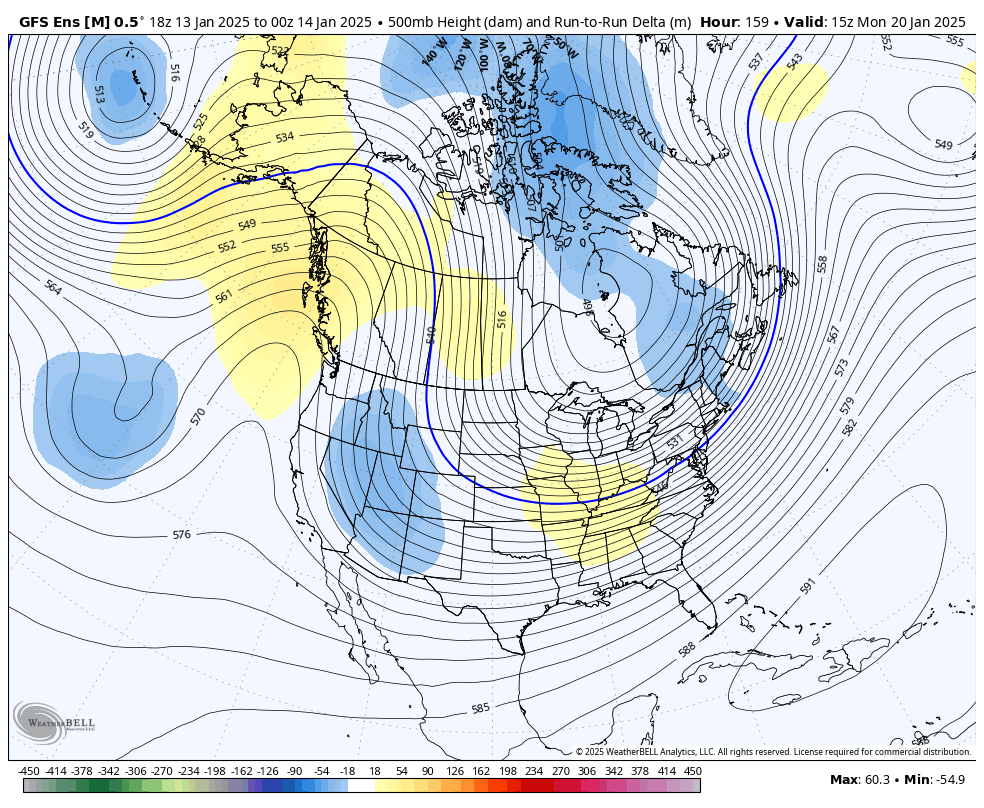
CMC likely moves SE given the RGEM deamplifying from 12z
-
RGEM is a bit less amped than 18z... looking at this, CMC likely ticks south a bit

-
January Medium/Long Range: A snowy January ahead?
brooklynwx99 replied to mappy's topic in Mid Atlantic
lol couldn't have seen this coming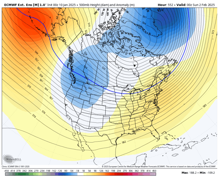
-
how predictable

-
last time I checked, the event hasn't happened yet, so saying one model is correct or incorrect is kinda silly. but that's just me
-
ehh, the setup is touchy and this is 4 days out. these waves generally like to trend NW as we get closer so hopefully we can reel a light to moderate event in
-
January Medium/Long Range: A snowy January ahead?
brooklynwx99 replied to mappy's topic in Mid Atlantic
yeah, this really isn't warm. can see a cutter beating the gradient down for a colder system following up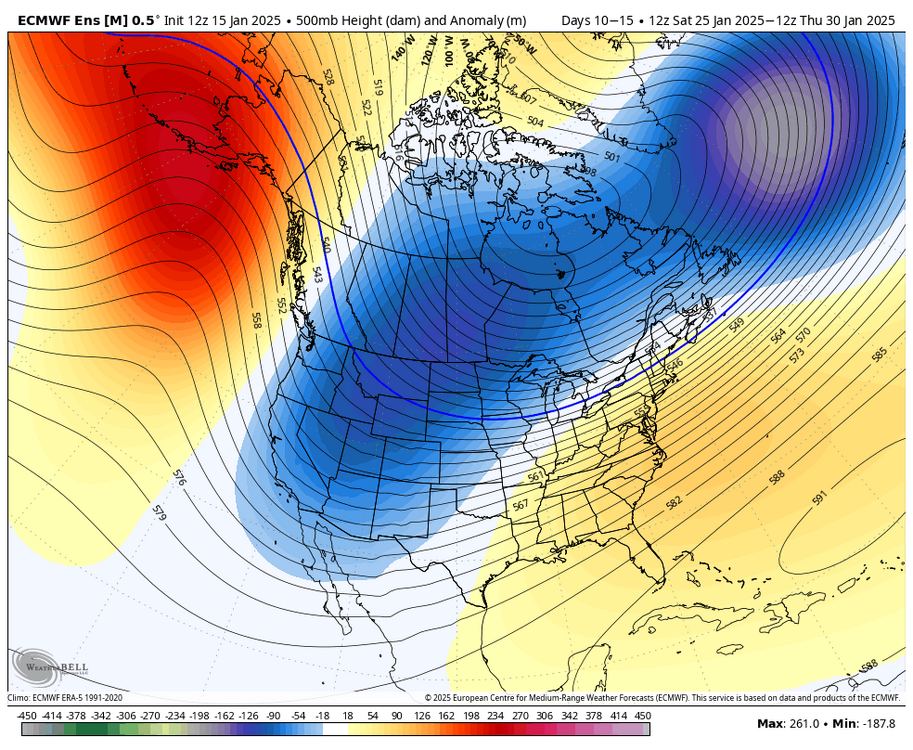
-
January Medium/Long Range: A snowy January ahead?
brooklynwx99 replied to mappy's topic in Mid Atlantic
be still, my beating heart -
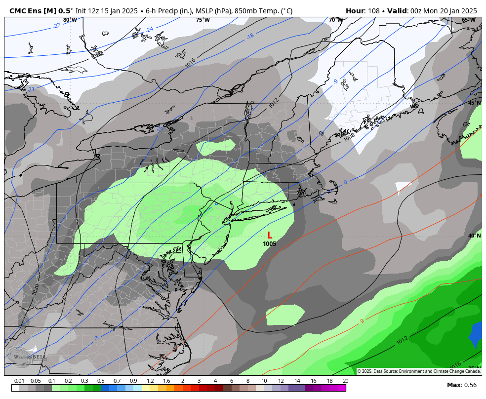
yup, less amped for sure. solid run here

-
GEPS looks good... bit less amped than the OP. i like the CMC as a west bound and the GFS as an east bound for now
-
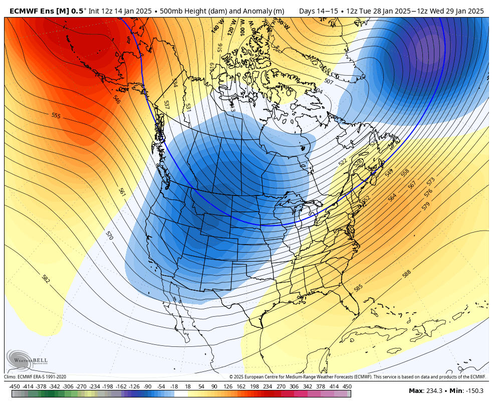
much better phasing signal with the super amplified +PNA
-
January Medium/Long Range: A snowy January ahead?
brooklynwx99 replied to mappy's topic in Mid Atlantic
makes sense to see a solution this amplified with a pattern that looks like this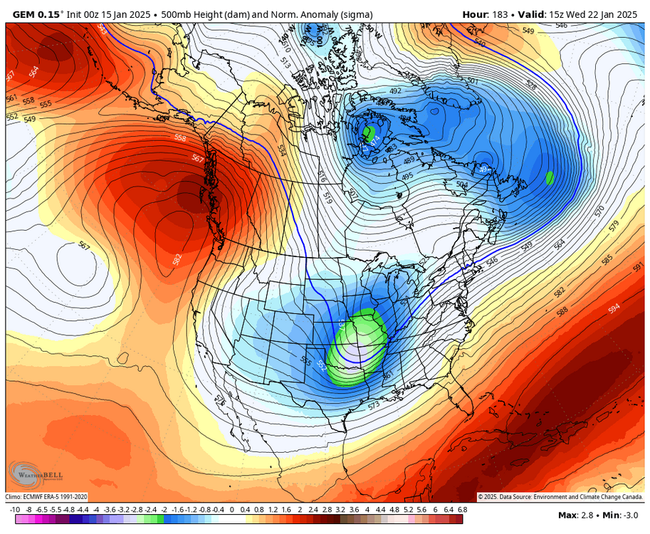
-
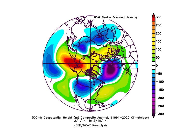
the pattern reminds me of early Feb 2014, if anything
-
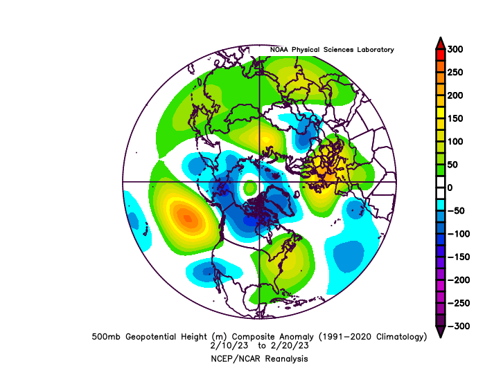
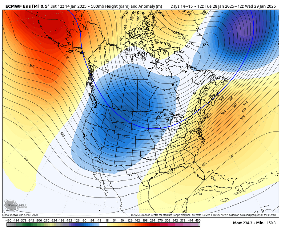
it doesn’t really look all that warm with the -EPO bringing Arctic air into the CONUS, the TPV nearby, and some weak -NAO in there too i wouldn’t even call it a SE ridge. the core of it is over the Caribbean
-
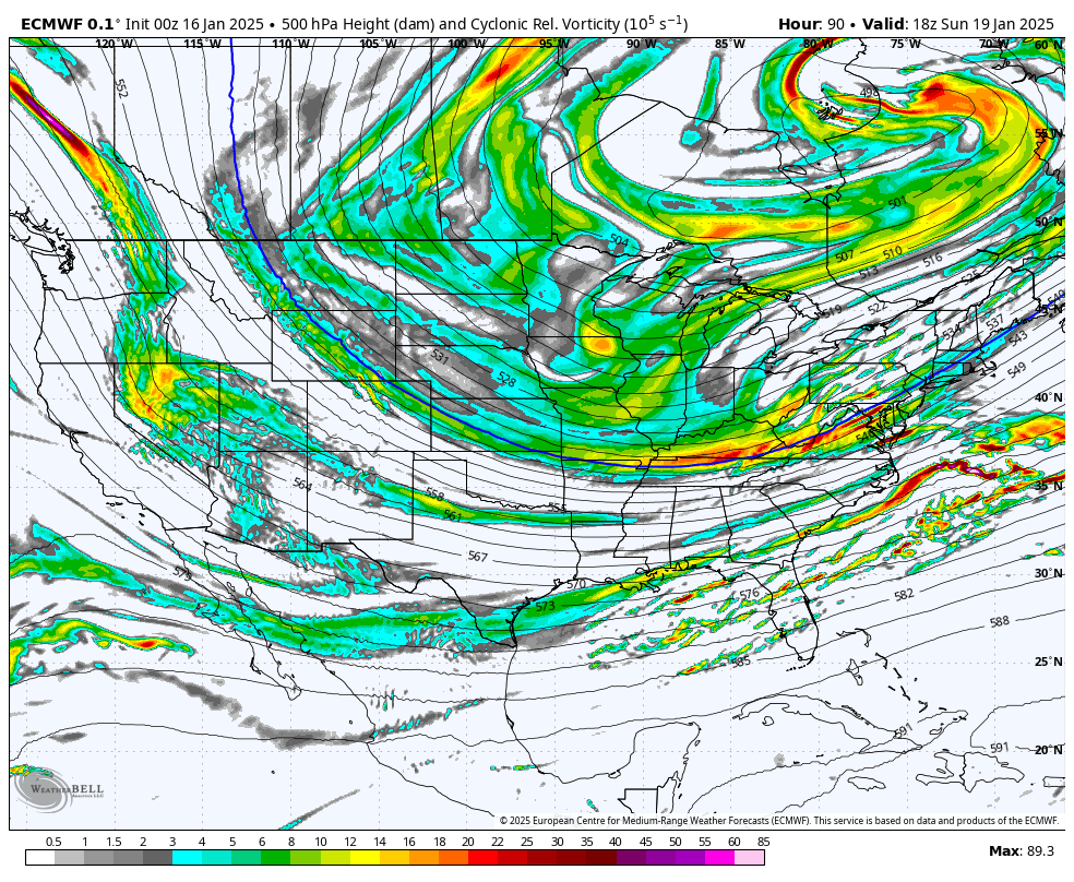
as of right now the 19th looks like a light to potentially moderate event if the vort amps more as it swings around, which is totally possible. looks like greater potential around the 22nd with a phasing kind of look as the TPV eases and PNA ridge remains strong. more of a signal for some southern stream vorticity to get left behind for that timeframe as well

-
January Medium/Long Range: A snowy January ahead?
brooklynwx99 replied to mappy's topic in Mid Atlantic
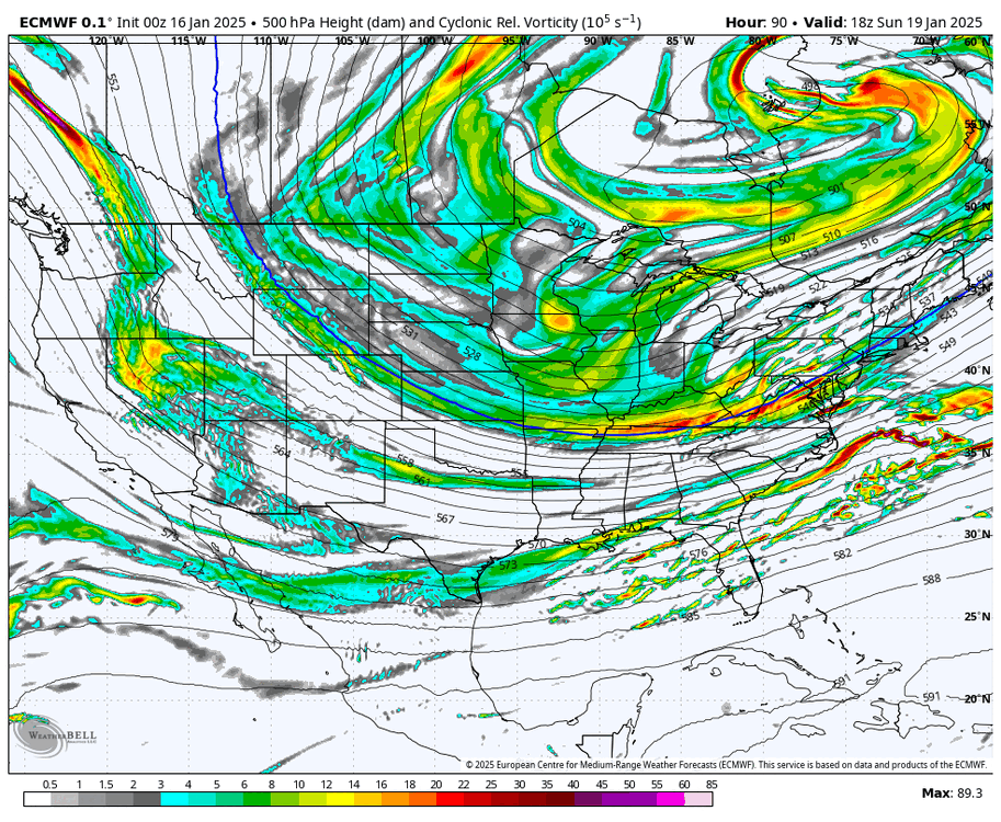
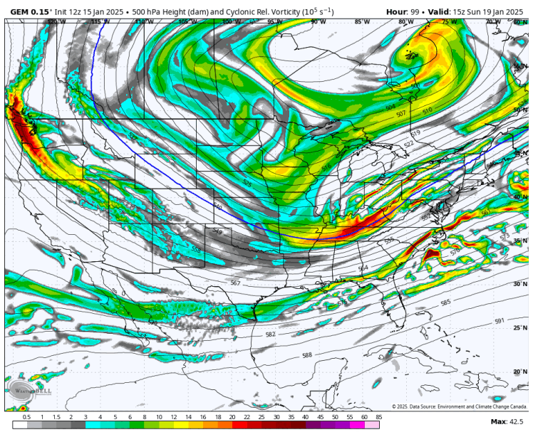
definitely a phase-y kinda look here
-
January Medium/Long Range: A snowy January ahead?
brooklynwx99 replied to mappy's topic in Mid Atlantic
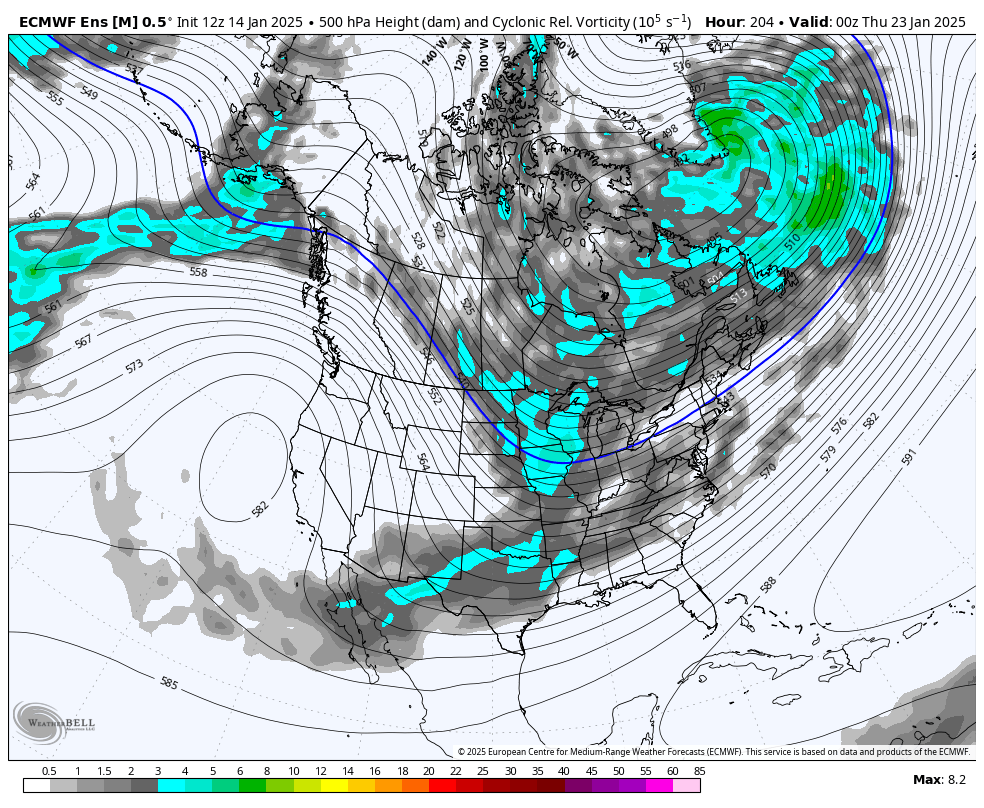
GEFS shifting to hanging more of the vorticity back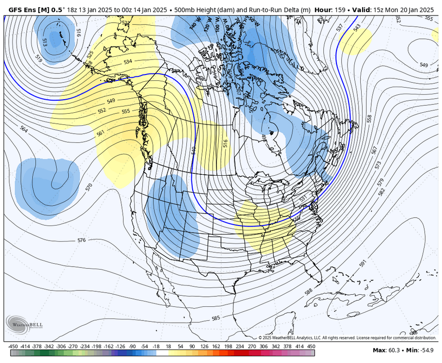
-
January Medium/Long Range: A snowy January ahead?
brooklynwx99 replied to mappy's topic in Mid Atlantic
we've seen the Pacific jet get stronger time and time again as we head into the medium range so the retrogression might just be overdone -
yes they are. a cutter pattern has the mean storm track over the OH Valley with a deep -PNA and strong SE ridge. cold and dry has the mean storm track out in the Atlantic with a deep trough over the East. two completely different things. this is a cutter pattern: also, it doesn't even look dry. precip is about normal and ensembles are still showing a signal for that 18-22nd timeframe. I swear some of you are just making stuff up