brooklynwx99
-
Posts
6,215 -
Joined
-
Last visited
Content Type
Profiles
Blogs
Forums
American Weather
Media Demo
Store
Gallery
Everything posted by brooklynwx99
-
 lemme show you a couple of three solutions
 -
kinda hilarious that this is the difference between the RGEM, ECWMF, and GFS
-
kinda hilarious that this is the difference between the RGEM, ECWMF, and GFS

-
EPS basically held serve. maybe a bit more precip NW
-
conventional wisdom would have you blend, bringing you to an AIFS/GFS type solution, but who knows
-
conventional wisdom would have you blend, bringing you to an AIFS/GFS type solution, but who knows
-
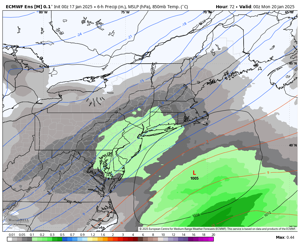
ECMWF is 2-4" for all. not bad whatsoever
-
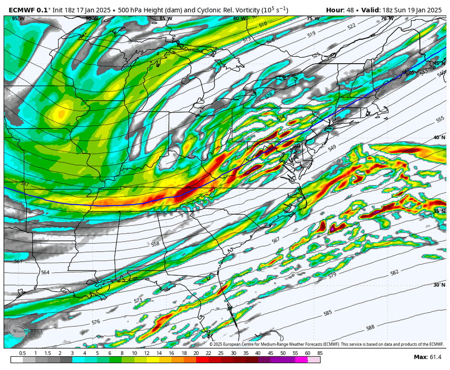
if you look on the OP, you can see the mean trough over the Midwest weaken a bit, which helps to flatten the overall downstream flow a bit. hence the more zonal yet consolidated PVA

-
yup, vort is tightened up even more, but heights aren't much higher downstream. makes everyone happy from PHL to BOS

-
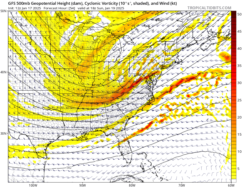
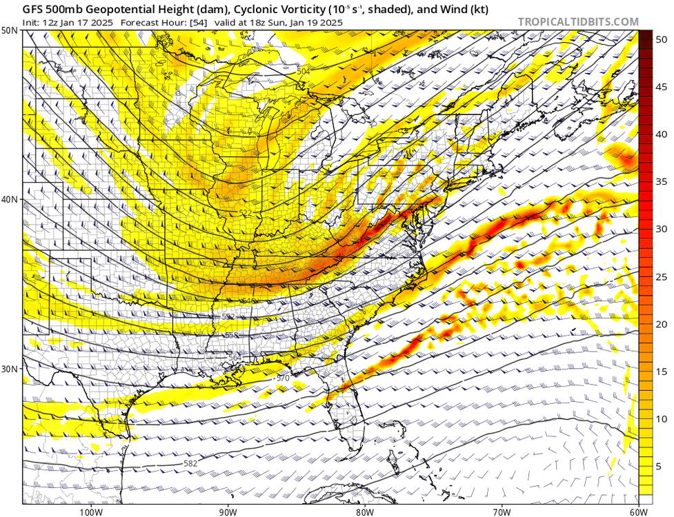
GFS is a smash hit. PVA is oriented a hair more zonally but is also more consolidated. equals a colder and stronger solution
-
GFS is a smash hit. PVA is oriented a hair more zonally but is also more consolidated. equals a colder and stronger solution

-
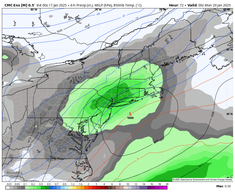
the RGEM spits out 1-1.5" of liquid from SE PA into NH. idk, i don't think the setup calls for that here. seems a bit wonky
-
RGEM also ticked like 25 miles SE which is nice to see
-
EPS looks good. bit wetter than 18z without many CMC-like members
-
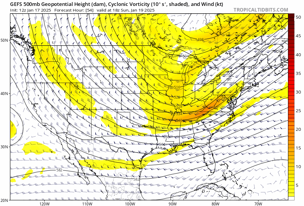
EPS looks good too. sharper vort with more precip. snowiest run yet

-
GEPS looks good. most of its members are SE of the OP

-
GEPS looks nice. the OP is on the NW envelops of the ENS... most members are SE
-
January Medium/Long Range: A snowy January ahead?
brooklynwx99 replied to mappy's topic in Mid Atlantic
I couldn't tell you what the CMC is doing. the beacon of consistency
-
GFS is more consolidated. low end warning event for many
-
RGEM moves W and ICON moves E. what a time to be alive the RGEM does seem like a far W outlier. it's like 25-50 miles W of the farthest W EPS member
-
the RGEM is an outlier for now. i'd leave it at that
-
EPS is maybe a hair drier but largely held serve. a solution like the RGEM is a pretty large west and amped outlier
-
EPS is maybe a hair drier but largely held serve. a solution like the RGEM is a pretty large west and amped outlier
-
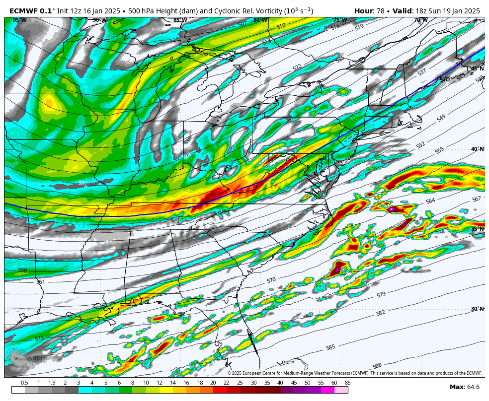
lol the ECMWF isn't east. vort is sharper

-
ECMWF is a bit better... sharper vort with more PVA