

Typhoon Tip
-
Posts
44,477 -
Joined
-
Last visited
Content Type
Profiles
Blogs
Forums
American Weather
Media Demo
Store
Gallery
Everything posted by Typhoon Tip
-
Little bit of tree rustling and WNW breeze here. AWT, less cloud has resulted. Some up over SE NH but that's got a short lease on life I presume. Open sky heating here now. 85/71, up 9 in the last 1.5 hours. We'll see how '10 after 10' works out -
-
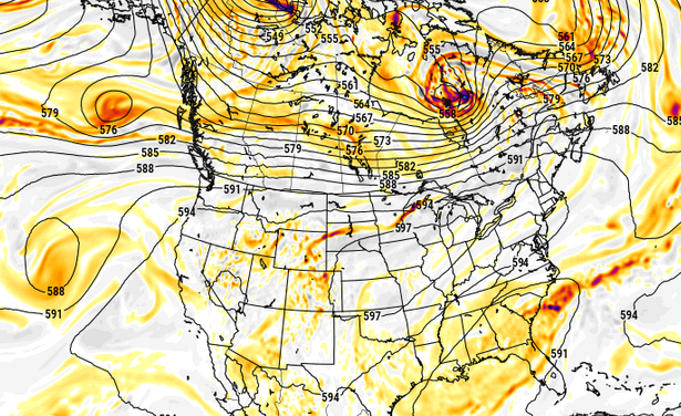
Nasty heat at the end of the Euro run (inferred) ... This was a purely SW lava puke that gets trapped over Chi-town ...with (probably in this kind of structure -) briefer inject through our region. But what's up with the over-zealous polar jet over top in Canada, huh. That's what keeps it brief for us - again ... if this depiction should prevail. which it won't but just sayn
-
op ed: You know ... as impressive as this three, maybe four day heat wave is.. I'm seeing subtleties in the guidance like they are tussling with a fast atmosphere offset. Typically, fast would negatively interfere with establishing resonant feedbacks - 'fast' sends disturbances into the engine that gums up the gears so to speak. In this case, linear forcing appears to be outweighing the non-linear mechanics (addition) to end up with a ridge surplus so some resonance is established. And there is a bit of non-linear neg interference in play ... evidenced not so much in the velocity of the flow, but by the rate of emergence and decay of pattern resonant features - which is a non-linear wave function. Faster life cycle means the pattern identities just can't seem to stay in place. This is something I've noticed frequently over recent decades - the emergence and fade life cycle of patterns occurring faster. I have conjectural ideas that some of the heat of CC is being absorbed and then converted and stored in the non-linear... which is then expressed by the energy required to move larger mass fields more frequently. It takes a lot of energy to change a pattern. A locked pattern is actually lower burden on global budget. But if you have negative EPO modes wildly transitioning to +EPO ... or more so, imagine an index as large as the PNA's domain space...etc, ... it costs to change the geometry of those mass fields. It's probably a good thing this dynamic is available otherwise, Antarctica might be half its size already and NYC's skyline would be a massive mooring harbor
-
It's actually not that convective element up there the NAM's using. It's actually just erupting a smattering of convection over and E of the Tug Hill country of N NYS, from diurnal instability, and then quasi converting the mass of it all into a very steeply arc tan angled right turn. I don't wanna trash the idea of some convective response today, entirely. The NAM used to be the ETA, and when it was the ETA, it was a superior ( lesser known) skilled tool for convective initiation. Basically, it's QPF smatters that we largely think of as noise tended to be eerily on point. I've never look to see if the NAM may have inherited that same trait - might be a testing op. Anyway, the broader synoptic consideration would argue suppression but this isn't absolute, either.
-
I could be wrong about this, but I doubt it means much down here. Perhaps NNE... but even there, the building heights that begin the main surge today, that's a neg interference. We'll see.
-
Yeah..that'll be a fun test tonight and more likely tomorrow night. Do the climo-favored warm nocturnal therm sites hold 80+ ? It seems to me that's a tough one. It happens from time to time, but it seems more usual to end up with a 5 minute, 78.4 or 79.4 blip on an otherwise 80 80 80 ... 80 score card.
-
no ... I think you're gonna find that no amount of distaste for heat, hot patterns, or those that like to rhetorically emphasize the significance of it... will change the reality that these are not very interfering, typical nocturnally enhance cloud types that are in the process ( like normal ...) of melting away with the diurnal processing of the sun - already evidence on high res sat. Heights are rising. That's intrinsically a DVM exertion. This will be a suppressive cloud factor as the day goes forward. Probably there will be mainly sunny conditions from 11 ... 11:30 on if not sooner. Should expect full realization of at least machine numbers. Probably a mean of 94 with outliers higher. Given the thrust of ridge bulging for the next 36 or so hours .. this will neg interfere with MCS mechanisms. I believe that MCS is not as much of a risk going forward until the other side, when we see the evolution of this ridge receding over the weekend. Perhaps Friday night?
-
I know this post is 9 hours old ... and what I'm about to wonder is incredibly tedious but, I always think of BOS as being climate tainted in these west wind dragon tongue patterns. Logan AP, being basically right outside the Boston urban anus, isn't likely to be cooler than BAF. Probably it would be more like OWD... But like ..who cares. right
-
90 was the high 88/66
-
Also, when I said we're...I meant that in deference to CT and points SW... Not sure what's up where I am up here is Massivetwoshits but it looks like the situation is evolving into something else. We have Mass Pike little bombs that just erupted. Even triggering warning, meanwhile that MCS itself appears to be weakening? So this all may change the picture some.
-
well hell if this doesn't confirm what I just said to Wiz DISCUSSION...Volumetric radar data from KTYX indicate a bow echo with a well-defined rear-inflow jet moving southeast at around 50 kt. Extrapolation of current motion takes the bow echo to the vicinity of Watertown, NY, between 1:00-1:30 PM EDT. Visible satellite imagery shows considerable mid/upper-level cloudiness and some elevated convection ahead of the MCS across the Tug Hill region; however, stronger heating is occurring across the Finger Lakes and far western NY with latest objective analysis indicating MLCAPE of 1500-2500 J/kg. Persistent westerly low-level flow will advect that more unstable air mass into the region ahead of the MCS. Thing is, these things tend to expand. I may turn right.. not sure, but I could see an outflow arc evolving with growth along it doing that curl and that would probably end up near ORH later this evening.
-
I think we're getting clocked ... big wind potential mcs
-
Right. altho, that version of the GFS was actually demoted by the following spring I think. I thought that was 2017 tho? meh either way. It seems like there was new GFS version ever 18 months between 2015 and 2022
-
ahh... good snark needs to have some truth to it... Not sure you're on point this time. Ha. Seriously. 100? It's not as common to reach that. Perhaps that's getting easier in recent decades. Granted. Almost has to. But even in these later decades, we're not doing it often enough to justify snark. It's coming though. Much to the chagrin of the assholes that will one day actually be dying from heat while setting confused emojis to anyone that dares talk about it.. that's unavoidable.
-
I your defense... I remember these summers since 2020 as having 101's on the car dash driving around during heat waves. Depended on where one was. It was like that kind of quantum oscillated away from the tarmacs to hide it, heat. hahaha. Anyway, point being ...when your 98 in a lazily flag waving sear, it's sort of like "close enough" ? That sort of puts this thing in coming up a notch because good luck hiding from this. Ineedsnowcocaine'll be all giddy to tell us how his elevated wooded residence is only 94 so I guess it fails, huh - 2021 had a June bizarre kind of DP heat wave. It was 93/81 ... I remember this specifically because both my kitchen refrigerator and my main living area window AC both crapped the bed literally within the same hour at the apex of that motherfucker. It was like the week after the solstice. Holy hell. and of course... because it was afoot, I had to skulk around the country side for hours to find both on emergency. I pulled it off though. Sat in a blast of cold AC air stream by 8 pm that night, and the refrigerator was picked up the following afternoon.
-
It may be that we've been "playing with fire" ( n'yuk n'yuk ) in having missed this kind of multi-day integrated heat type. I mean seriously.
-
well... "heat" is typical in summer - or supposed to be... heh. We've had some summers that were little torpid in that regard - certainly with respect and comparison to CC and the world. I mean it's been warmer than normal? it has.. no question. But we ware lagging ( or been so - ) over the rest of the world for bigger heat event frequency. As others et al have noted and we've discussed, we've accrued much of our CC through nocturnal/low temperatures. Otherwise, as Scott and Brian and I have explained, there's too many ways to discretely interfere with temp rising. Subtle. I mean discrete when using that word, because it is not always very obvious ... We can look identical in the entry to Des Moines IA, yet they're 104 while we're 95...etc.. For that, which is fairly objective ... a result like what this looks like ( currently ) it's capable of achieving, would have to be considered atypically hot. But there's also a couple of facets simultaneously true. Those numbers I described, by scalar AND their implication when combined, are both above normal, but also above "normal heat waves". Any heat wave here is an anomaly... but f we were to say a 90/90/90 three days is 1 standard deviation, this is well above a single Standard Deviation if it goes on that way
-
Thanks Brain yeah... was just analyzing the grid. If this were not the case ^ than something is seriously wrong with the technology heh
-
Idiosyncratic notables about this NAM output continue... 6 consecutive periods of at or > 580 dm thickness. Usually even the hottest synoptics tickle 580 around 21z each afternoon and we settle back 576... But this is hanging around at that ungodly height. Trust me...I've paid close attention to these gridded guidance numbers for long years. Tomorrow's no picnic, either. 31C max at Logan is probably a 35 C walking down Cambridge Ave or out over the parking lots of of Natick. HFD and Lowell are cooking.
-
The 12z NAM grid's fully on board. ..whether this shows up in the machine interpolations or not, notwithstanding... but this is about as hot as I've ever seen these numbers. BOS and LGA Thursday, left to right: 5400051 31 19 -1292 11 25 11 82 34 26 19 5400048 28 12 -3294 142310 82 34 26 20 6000054 39 34 -5891 10 24 16 83 34 27 18 6000047 32 20 -0993 132513 83 35 27 20 Left to right these number illustrate a pure sear scenario. Man and I mean it! 31 and 19% is bone dry sky. Open blue, 100% undiluted solar dump in. So is 39 and 34% at 00z Friday ( bottom row). That's BOS (Logan). Likewise, LGA (Laguardia) is no different. That's the sky coverage... The next digits moving right correspond to wind direction, and speed. 24 and 25 represent 240 and 250 deg, respectively, which average WSW, at 11 to 16 kts LGA, 280 and 320 is WNW, which is idealized actually ...and given to the fact that both locations are identical synoptic constraints, these are also mutable. Call it a west wind at both for now. 0 oceanic influence. The 82 and 83 corresponds to 582 and 583 hydrostatic heights ( referred to as 'thickness'). Anything over 572 is getting into a very warm column distinction. Obviously ... raising this number means integrating more and more water into the column and in order to do that, requires heat. So, clearing 580 is both exceptional rare around our latitude, but also rare for our geological limitations. I'm starting to feel this is our best synergistic heat performance we've seen since the phenom was recently codified. The rest of the numbers, "34 26 19" (BOS, left) is 18z, are deg C. 34 C, left, is at the 980 mb level. Which is very rare, because the actual 2 meter by convention is typically a minimum of 3C above this number in a well mixed adiabatic environment. 4 or even 5 C is not out of the question given to the fact that the total combination of synoptic parametrics are really quite spectacular when taken holistically ( this is part of the synergy consideration). So... in simple terms, a 38 or even 39 C over a the urban sprawl of metro-west of Boston towns is quite doable. Now ... the NAM is the NAM is the NAM... there's that. It also can sometimes go large in heat in the 48+ hour range...then settle back on newer runs. The other 12z guidance is probably rolling out now.
-
87/66 Kind of a threshold combo. Just starting to feel it.
-
Yeah I was just going add .. I bet they're just as abysmal as any along coastal land/sea contention. But that's part of the whole "local gradient" thing. As always ... resolution resolution resolution
-
What goes up … must come down I suppose https://www.instagram.com/reel/DaMVGHzxElA/?igsh=ajBta25tb29sYmtu
-
ICON had it running into Sunday now... 94 to 98
-
I saw that. NBM is heavily used by NWS per AFD omission. Is there a verification page or ?


