

Typhoon Tip
-
Posts
43,447 -
Joined
-
Last visited
Content Type
Profiles
Blogs
Forums
American Weather
Media Demo
Store
Gallery
Everything posted by Typhoon Tip
-
March 9: Little Critter that could part 2.
Typhoon Tip replied to Sey-Mour Snow's topic in New England
4” -
March 2022 Obs/Disc: In Like a Lamb, Out Like a Butterfly
Typhoon Tip replied to 40/70 Benchmark's topic in New England
I like the Euro's plan, personally... Season flips D6 ? I'll take it! Sunday bites balls with 35 mph gusts lingering under deep anomalies at 850 mb... figure mid 20s ( impressive cold for the date). But it's shorter duration. Wind relaxes ... yeah, it stays chilly Monday... but that's it. +15C recovery in 24 hours heading into Tuesday morning, with low ceiling RH values and WSW winds ...talking high 60 under pearl blue sun sear. That's how you masseuse the napes. There is a more seasonal cool shot D7 ... but the ensemble mean from all three, GEF/GEP/EPS ... have warm 850 mb anomalies from D6 into noise on their respective runs. It looks like the deep cold is cut off and relegating back to N Canada. Which isn't to say April won't bust balls ..just that it's a nice look for spring enthusiasts. ( caveat is always BD season ) -
March 9: Little Critter that could part 2.
Typhoon Tip replied to Sey-Mour Snow's topic in New England
Light to moderate burst of snow here in Ayer the last hour. 31 F ...maybe 1/2" so far -
March 2022 Obs/Disc: In Like a Lamb, Out Like a Butterfly
Typhoon Tip replied to 40/70 Benchmark's topic in New England
No longer 'early' march in reality. That distinction ended 2 days ago. Objectively, ... if one were looking at charts on say March 5, for a storm on March 12, that doesn't count as 'early' March either. You'd have to go back to the last week of February to logically invoke climate arguments related to early March. On March 9? anything going forward is definitely more Ides -related. -
March 2022 Obs/Disc: In Like a Lamb, Out Like a Butterfly
Typhoon Tip replied to 40/70 Benchmark's topic in New England
The ensuing sore butt contest will likely take place at some point or the other ... but if it is any consolation, the boat merely sunk at different rates. We up here in interior NE Mass may have been at the bow of the Titanic, ...your region at the stern, but we all went down with this ship. It was not a "good" winter anywhere. Falling short of seasonal snowfall averages, which barring a lucky bowling ball moving forward ... too many are sure to succeed, is < C grade. You have to at least make average to get a C - ... seldom do I engage in the "objective" grading game ( LOL ) but just for shits and giggles... That's sort of the way I view it. Average snow is minimum requirement for average grade. Leave all the passion out of the judging. This year...on the border of D and F ... -
It’s called ‘recreational outrage’
-
March 2022 Obs/Disc: In Like a Lamb, Out Like a Butterfly
Typhoon Tip replied to 40/70 Benchmark's topic in New England
Three flag 500 mb winds moving off the Del Marva with that thing this weekend. That's 160 mph synoptic scale wind max ... The cyclone on that cold front moves from DCA to CAR in < 12 hours ... It's be moving past at 75 to 80 mph. That's pretty amazing -
March 2022 Obs/Disc: In Like a Lamb, Out Like a Butterfly
Typhoon Tip replied to 40/70 Benchmark's topic in New England
Maybe .... This look (blw) is shared in essentials by the GEFs and GEPs for D9 ... It may be wet though. But plenty of time to adjust the boundary draped from DTX to BTV more NW of that axis, in which case we'd dry out and sore. The only difference between this sort of look now compared to a month ago, is solar - add that to it and we start to synergize the warm days One thing I'm noticing as a "hint" in the longer range ( beyond this weekend) is that the whole hemisphere appears to "flash" - it's when the cold suddenly bites less. The hydrostatic thicknessess rise sort of unilaterally all at once, and the colder mass ebbs back into higher latitudes of Canada. This ... that may be how this season really ends it. I've seen this other years, too... it's kind of interesting phenomenon for apparently no one else but me lol. I mean it varies year to year. Anyway, this weekend ordeal seems to coil up the cold around it and spins it away and continent below 55 N behind rapidly warms. -
March 2022 Obs/Disc: In Like a Lamb, Out Like a Butterfly
Typhoon Tip replied to 40/70 Benchmark's topic in New England
Looking closer at the Euro that's likely flashing to heavy snow ORH-Monads ...collapsing E 18 thru 21 z on Saturday early afternoon... It would prooobably be like 1.5 hours of it, then moderate for 3 or 4 shredding out to flurries and also very strong backside wind pulse -
March 2022 Obs/Disc: In Like a Lamb, Out Like a Butterfly
Typhoon Tip replied to 40/70 Benchmark's topic in New England
This has a huge upside up your way... In fact, I'd say that is the case from about CON ...maaaybe MHT NH latitudes on up. That's based on the GEFs ensemble mean and nuances in the operational run. In general: I'd like to point out to folks the 101 rule of continuity: you need it. The 00z Euro looks one way. Then, the 12z looks like a better (for winter enthusiasts). That is reduced continuity. I mean if getting it right is any goal, that's not inherently supporting the Euro. That said, by the time we get to central NE and points N-E, the models are trying to max out dynamics - perhaps unrealistically so at that but cross the bridge. it probably I could see it doing weird things near Fryeburg ME... where there is cat paw rains with giant partially refrozen gulf ball that are quasi hail, with lightning and thunder .. flashes over to S triple + for 2 hours then ending... That's pretty wild stuff... But, seeing these guidance en masse trying to really press this on a more E track - like I was saying to Scott, I wonder if all this is "model flux" en route to more of a whsiky wave on an extreme fropa. If that happens ...this ends up a faux ANA -
March 2022 Obs/Disc: In Like a Lamb, Out Like a Butterfly
Typhoon Tip replied to 40/70 Benchmark's topic in New England
This may be on the verge ( future runs...) of converting into an even more open wave/ intense fropa, and this run catches the eyes mid way ... in other words, the low ends up more middling on a very intense cold front... Some notables that are pushing the climate tin on previous runs. ROA to CAR motion of the cyclone in 10 or 12 hours, while bombing 30 mb. It's a little odd ...impossible? NO. But strange. I tend to be a fan of pathways of lesser resistance and that seems like a difficult logistic achievement there, but we'll see. Also, there is a ceiling event isollabaric wind potential if that happens. Because we don't feel the wind on the front side, where the motion of the cyclone is almost the same speed as the restoring acceleration, but when that house sucker low leaves the region, the full payload comes in the back side from a deep pressure well... you get the drill. -
I get you. I’m just not sure acts of nefarium are proportional - it’s like two different metrics really One is innate douchiness - I think your point is that, to which I agree The other is “ornate” douchiness. LOL and a problem with modernity The arithmetic argues it is worse now in actual “events” of questionable morality, because that’s the logical conclusion when there are more triggers tapping into number one
-
March 2022 Obs/Disc: In Like a Lamb, Out Like a Butterfly
Typhoon Tip replied to 40/70 Benchmark's topic in New England
We just had severe wind criteria here in Ayer. -
Mmm - not sure that makes mathematical sense. Global population is ~ 8X’s more massive than 1800 …. obviously doesn’t take rocket science to see the conjecture there. Incidence of “dim morality” would at minimum have to increase at a paced geometric proportionality. But cultural evolution has taken place at a slower rate to the technological revolutions raw power to influence. Fringe … or conditionally fringed ideologies, are both greater in numbers - because of the above geometry - but also are not held in check by that lagged cultural evolution … instead are being sieged by unfiltered triggers. That adds an exponential value that augments the geometric proportionality. The notion that humans are *unts and will always be … is essentially true, though. But now … in modernity, there are elicit trigger activation means that has to be considered in the ‘always has been’ model. Both conditions are likely true. There are both increased incidences - relative/comparing history - but also fuller disclosure.
-
March 2022 Obs/Disc: In Like a Lamb, Out Like a Butterfly
Typhoon Tip replied to 40/70 Benchmark's topic in New England
um... the previous 4 months of persistent experience ? just a guess - In fact, it's still highly probable, based upon the paranoid persecution complex model (the PPCM), that we'll spend the next day and a half gettin all lubed up and ready to go and then she'll pull up panties and run for the Atlantic door on us -
March 2022 Obs/Disc: In Like a Lamb, Out Like a Butterfly
Typhoon Tip replied to 40/70 Benchmark's topic in New England
Marginal's fine at this time of year. 10 minutes in marginal with fall rates into moderate density will have golf balls side carring cozy rain drops. -
March 2022 Obs/Disc: In Like a Lamb, Out Like a Butterfly
Typhoon Tip replied to 40/70 Benchmark's topic in New England
The way this winter went ? Winter won't die if it means drillin one last tortured blue baller BD ...seemingly on life support just so's it gets to do that. Everywhere SW-W-NW of us, we are surrounded by a rampart of 80F 39 in still air under slate gray skies east of the Berks -
March 2022 Obs/Disc: In Like a Lamb, Out Like a Butterfly
Typhoon Tip replied to 40/70 Benchmark's topic in New England
Way to early for it ... buuut, it does remind me. I'm interested in whether NW NE and Southern Ontario/Quebec host late April thru early June heat waves again. I've noticed that tendency over recent years, to go along with a lot of other subtle/under the radar CC -related likeliness ... strongly suspect to be so. What happens is residual fast flow curls around high pressure nodes in that area, with any SW/W heat expulsion getting caught in side... The Mid Atlantic to coastal New England doesn't fair so "hot" because said curl wraps around and pulls a tongue of cooler 850 mb air from the Maritimes .. all the way down to where it turns NW and comes in on a SSE flow mash up dimmed warming. Like PHL-BOS will be 84/55, but 96/48 at BTV so to speak -
March 2022 Obs/Disc: In Like a Lamb, Out Like a Butterfly
Typhoon Tip replied to 40/70 Benchmark's topic in New England
Not as though to be taken seriously ..per se ( eh hm), but did you see the 00z Euro operational 10 day layout... That's a full on SW heat expulsion/release - or in the minimum, an analog behavior. Centered on the 15th -17th, that's what has become of the original Ides signal from a week ago. LOL ... Pretty much polar opposite. Thing is,... the EPO was supposed to behave differently. It was even modeled to - sort of - do so, enough that it might go ahead and punch up the +PNA ... With erstwhile -EPO having loaded cold over Canada and near-by, boom... right? Wrong That migration in the mass-field hasn't since improved coherency in the models. It has in fact... decayed. Now, the EPO blizzum blazzum retros back to Kamchatka...and the Pac punches through with a zonal flow that's bottling the cold JB or above latitude, and flooding the mid lat continent S pretty much in spring. Even the GFS operational has a couple of huge warm thickness plumes - Unfortunately for the winter-lorn, without that EPO relay into the PNA ... I don't see anything out there that renders us back to a March winter. In fact, the opposite when looking a that standard PNA/AO/NAO metrics. That, plus the last 10 years of proving that we can 80 at this time of year... As an aside, that's gotta be CC related. Sorry... Too often, regardless of any seasonal telecon, air ocean or coupled, that has happened... I have no eye-rollin' inhibition in adding that factor to this too. Euro likely doesn't verify? But I don't say that because of climate, any more. Only by virtue of D 10 uncertainty, alone. The former proves it certainly can and will happen if given the synoptics. -
March 2022 Obs/Disc: In Like a Lamb, Out Like a Butterfly
Typhoon Tip replied to 40/70 Benchmark's topic in New England
Ah let 'em have their solace man. We could very well be writing the mortem pages of this winter's tortured novel, anyway .. Lol. I mean it's snark humor, but it's kinda of true. If what I am seeing overnight is any signal of worth .. that critter may be a last hope to resuscitate this palliative 10 days remaining. You know ...I've come to sense over the years, there really is like a post mortem angst at this time of year in some folk. But, the crucible of time purifies this the engagement, in this particular social media platform, to be a concentration of those heads. It's a real S.A.D. experiment by accident of it's existence. There's a semblance here of "negative S.A.D." ... It's real condition -seriously. It afflicts some 10 to 15% of the background population ... Those of that minority are equally "jilted" by the loss of 'darkness', colder stormier times - essentially the opposite of the majority S.A.D. types that get pissy in the autumn. When I first muse-read of that I was intrigued ... Intrigued because the description was so spot on matching the tamber of posting content. The music that happens around here when either, storms miss, season begins to exhibit migration toward spring, ...or just any warm look overall. But ... this isn't intended to gas-light anyone. I have shared in this in my personal head-space when in my youth - or some variant of it. I did not like thinking or facing the prospect of dwindling snow pack and escaping storm chances, or how the sun became undeniable more illuminating in mid February --> ... It's just that as I've gotten older my wiring has changed on all that. I just have become someone that can change geek gears on a dime, equally dorking out on heat waves( cold waves) respectively... Except Aprils - .. never can for some reason forgive Satan's rectum month -
March 2022 Obs/Disc: In Like a Lamb, Out Like a Butterfly
Typhoon Tip replied to 40/70 Benchmark's topic in New England
reminded me of April '97 at 500 mb -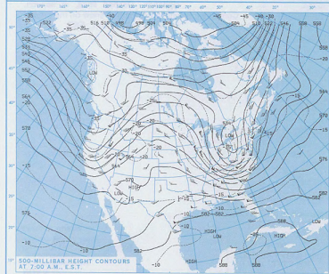
-
March 2022 Obs/Disc: In Like a Lamb, Out Like a Butterfly
Typhoon Tip replied to 40/70 Benchmark's topic in New England
Heh ...this is typical of March's in the last 10 years.. which is probably fair to say it's typical of CC era - much to eye-rollin' chagrin of those that don't exactly deny... but equivalent post pursing their lips and dosing their anuses with Preparation-H whenever they have to face it. We start getting one and done 65ers in a fast flow warm sectors, probably as the new order. Maybe you'll even get 2 or 3 days at a pop... But they go back to pointless cold. Every march since 2012 except maybe 2018 ..? But that year did it February so take your pick. I guess I'm just musing that we should expect these kind of warm bursts this time of year. We've already started getting them going back 3 weeks ago. It's been about ever 5 days. They'll be every 3 days by the 20th... and lasting longer ... until BD season kicks off in April and winter begins... -
March 2022 Obs/Disc: In Like a Lamb, Out Like a Butterfly
Typhoon Tip replied to 40/70 Benchmark's topic in New England
Well... I could pretty much gamble huge sums of money this 18z operation GFS won't verify that way... It's hard to believe a 965 mb low's gonna grind along the White's cordillera, experiencing no resistance along the way, carving out a bombogen hole < 950 mb as it buzz saws the summit off Mt Katahdin like that. That's like ... not going to happen. -
March 2022 Obs/Disc: In Like a Lamb, Out Like a Butterfly
Typhoon Tip replied to 40/70 Benchmark's topic in New England
66 -
March 2022 Obs/Disc: In Like a Lamb, Out Like a Butterfly
Typhoon Tip replied to 40/70 Benchmark's topic in New England
64 ... up 5 last hour. Probably good for another 4 F on top, considering the winds are light WSW under 925 mb T of 14C ...that'd support low 70s in the 2-m actually.


