-
Posts
2,220 -
Joined
-
Last visited
Content Type
Profiles
Blogs
Forums
American Weather
Media Demo
Store
Gallery
Everything posted by frostfern
-
Would be nice to get one solid storm before the warmth is gone.
-
Ready 2 soak.
-
Where are you? I’m seeing massive towering clouds all over the eastern sky. Hard to believe they are actually a long ways away. Its not quite dark enough to see the lightning yet from here.
-
I’m having trouble looking forward to winter. Last year had some huge lake effect storms that made people not in the lake effect zones jealous, but there were also a ton of days with solid clouds and temps in the 30s. The constant darkness and gloom just gets to me after a while. I love snowstorms, but I get really tired of the endless gloomy periods.
-
The high yesterday was 65 at midnight. It stayed between 61 and 64 all day during daylight hours with a thick cloud deck pretty much at ground level, along with drizzle and showers. Rained 0.6”.
-
I was thinking more the period from Aug 25 to Sep 7 in 2018. There were a few tornadoes on Sep 1, but it was mostly a ton of lightning and heavy rain. I don’t know what it takes to get that kind of low-level jet with 70+ dews repeatedly surging up into MI vs stalling near the southern border as is more typical. If there was an easy way to access the data I’d look it up. I suspect something was going on in the Western Pacific, like recurving typhoons, but don’t know. It was atypical as the previous summer was pretty dry from what I recall. In any case, I think I’d much rather go on a spring chase vacation on the plains to witness a tornado.
-
Overall disappointing summer here too. The best storms were April 4-5. There was an ultra-rare baseball sized hail supercell I drive 20 miles south to see that evening, then loud cracking thunder that jolted me awake at 5am the next morning. The two big July I-94 squall lines came through at a bad times where I couldn’t chase. I wasn’t really feeling well enough to drive anyways though. Last year the best show IMBY was Sept 20, so I suppose there is still hope. It was completely non-severe but had amazing lightning nonetheless.
-
Frustrating how the models are more consistent long range than short range. The early ECMWF consistency didn’t really make a lot of sense though. I’d expect that kind of pattern with a developing low to jump around each run. I just hope the season lingers like it did 2018 and 2019. Those years were full of storms, and well north of I-80 warm sectors, right up to and even into October.
-
I noticed the dewpoint up with the lake breeze here yesterday.
-
It trended south.
-
2023 Short/Medium Range Severe Weather Discussion
frostfern replied to Chicago Storm's topic in Lakes/Ohio Valley
GFS still refuses to budge. It doesn’t even show a good closed low until it’s moving away. Really hope the ECMWF doesn’t lose it too. -

2023 Short/Medium Range Severe Weather Discussion
frostfern replied to Chicago Storm's topic in Lakes/Ohio Valley
Thanks to the constant death ridge over the SW parts NA, there’s a subtropical jet that normally isn’t there this time of year. I have seen that jet appear in summer from time to time other years, but never this consistent. Between this and the neverending blocking from May through the first half of June, I don’t know how people can say its normal climatology. These patterns just didn’t used to lock in for such long periods. -

2023 Short/Medium Range Severe Weather Discussion
frostfern replied to Chicago Storm's topic in Lakes/Ohio Valley
Hope a nice solid squall line comes of this. Like halfway between GFS and ECMWF would be nice. It would be nice to know if the pattern that follows will be good too. -
Yea. Individual major events are impossible to predict from teleconnections alone. Especially severe weather events. The El Nino phase does statistically favor Dixie Ally for severe though, and a strong one usually means a mild and dry winter for the upper Midwest. 2015 had GHDII though so its impossible to know for sure. I didn’t even remember that was a Nino winter as I wasn’t living in Michigan that year.
-
I think neutral ENSO is best for most of this sub actually. Strong La Nina is really only good for MSP peeps. These days it means a lot of rainers even into Wisconsin. Some weak El Nino winters have been snowy as well, just back-ended. Strong El Nino is usually bad for everyone but severe lovers in the deep south though.
-
El Nino pretty much guarantees a boring winter though. At least the early half, though who knows these days where tornado outbreaks sometimes happen mid-winter.
-
There’s not much in the way of exciting weather to look forward to until this El Nino finally flips to Nina.
-
Welp. Smoke haze was already visible aloft this morning. At least there wad one day of vibrant blue sky with neither wet aerosol haze nor smoke.
-
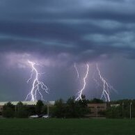
Severe storms are often uncoopertive for lightning photography, during the day at least. There often are a lot of CGs per detection network, but usually not out in front where they can be easily photographed. The best views are usually from the rear as the storm moves away.
-
Yea. Here too. They were like 10 minutes apart, but very loud and deep. Storms lately have all had unusually heavy stratiform rainfall. Its nice to finally see deep blue sky again today. Hope it lasts. I can’t believe how hazy and smokey its been lately.
-

2023 Short/Medium Range Severe Weather Discussion
frostfern replied to Chicago Storm's topic in Lakes/Ohio Valley
You have been putting the tag on every post I make obsessively since May. Nobody else has been doing this. Not every single post, regardless of actual relevence. And you do not single other people out this way. It's obsessive and spiteful you've been doing it for two months now. I really don't give a damn what you think my expectations are. I'm just disappointed after the entire month of May and majority of June being stuck under constant blocking and choking smoke. That wasn't normal "climo" at all. Missing a lot of really good action by very small margins a lot of the time this past month isn't really a "climo" problem either, just bad luck. You have never "explained" anything to me I don't already know. I've lived hear almost 40 years. I became "unhinged" because of other things in my life that have nothing to do with the weather or you. Weather is an escape for me. You being an unholy nuisance just tipped me over the edge. If you actually want to "help" me simply stop talking to me and tagging my posts. I block you and you block me and we're done with it. If you continue to harass me I'll bring it up with moderators and if they have no solution I'm just going to leave. You can then have your delightful power trip of trolling a long time member off the board and jerk yourself off all day. I'm offering an apology to Stebo as he didn't deserve my outburst. We have our differences but we normally get along okay. I'm having a hard time wanting to apologize to you though. Sorry, I just don't like you. I'm going back and cleaning up the old posts I made on 2 hours of sleep if the mods haven't already. -

2023 Short/Medium Range Severe Weather Discussion
frostfern replied to Chicago Storm's topic in Lakes/Ohio Valley
Derp. Didn’t happen. 80 dews broke the cap and cut off the supply way south of the dynamics. -
Weak.
-

2023 Short/Medium Range Severe Weather Discussion
frostfern replied to Chicago Storm's topic in Lakes/Ohio Valley
I'd gladly take this "junkvection" as it's full of lighting. Sucks to always be so close but miss out. -

2023 Short/Medium Range Severe Weather Discussion
frostfern replied to Chicago Storm's topic in Lakes/Ohio Valley
You can easily recover from junkvection overhead at 6:00am. Non-overturned airmass advects in from the SW by evening. Being downstream of junkvection is worse.


