frostfern
-
Posts
2,267 -
Joined
-
Last visited
Content Type
Profiles
Blogs
Forums
American Weather
Media Demo
Store
Gallery
Everything posted by frostfern
-

2023 Short/Medium Range Severe Weather Discussion
frostfern replied to Chicago Storm's topic in Lakes/Ohio Valley
Something trying to form. No warning yet though.
-
2023 Short/Medium Range Severe Weather Discussion
frostfern replied to Chicago Storm's topic in Lakes/Ohio Valley
Looking ominous.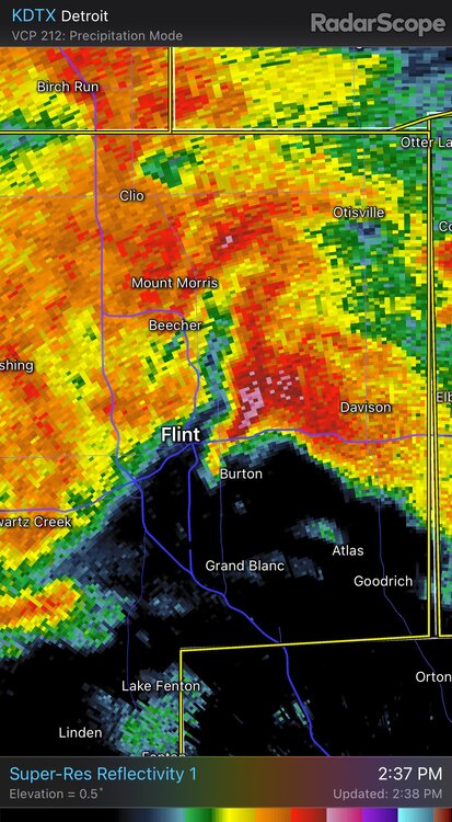
-
2023 Short/Medium Range Severe Weather Discussion
frostfern replied to Chicago Storm's topic in Lakes/Ohio Valley
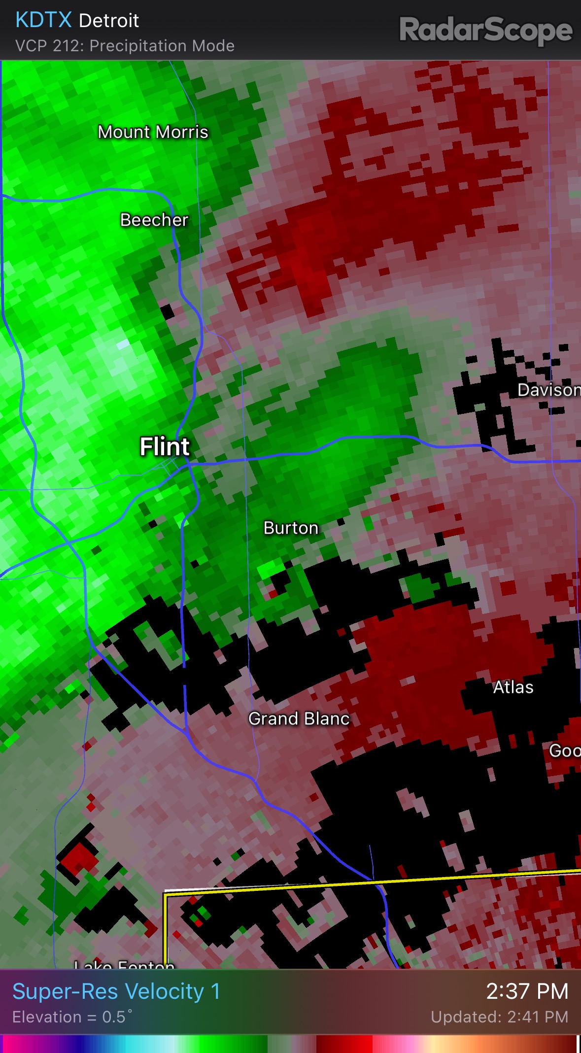
Flint area going to get crushed with straight line winds and supercell mergers. -
2023 Short/Medium Range Severe Weather Discussion
frostfern replied to Chicago Storm's topic in Lakes/Ohio Valley
Getting that supercell look.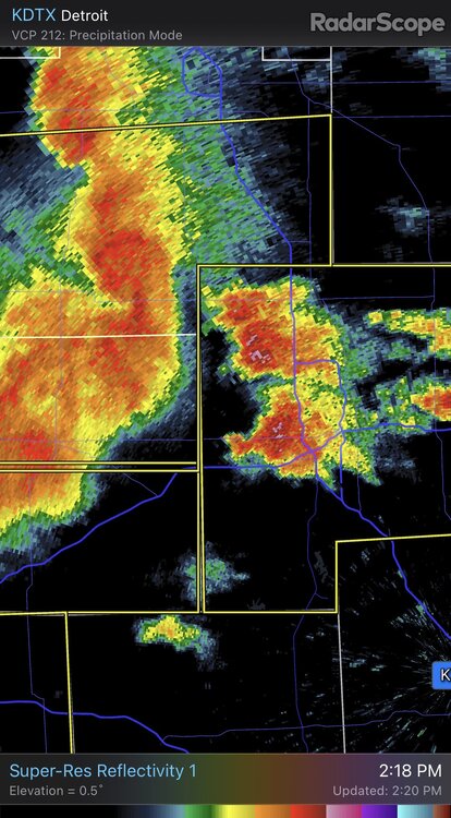
-
2023 Short/Medium Range Severe Weather Discussion
frostfern replied to Chicago Storm's topic in Lakes/Ohio Valley

-
2023 Short/Medium Range Severe Weather Discussion
frostfern replied to Chicago Storm's topic in Lakes/Ohio Valley
That notch looks interesting.
-
2023 Short/Medium Range Severe Weather Discussion
frostfern replied to Chicago Storm's topic in Lakes/Ohio Valley
I think the best chance of rotation is when the line interacts with any lake breezes later in the afternoon. Problem is the the low level wind is strong so it would probably be over the water. Otherwise the 0-3 km is kinda unidirectional. Thats the only problem though. CAPE and overall shear are impressive. -
Summer 2023 Medium/Long Range Discussion
frostfern replied to Chicago Storm's topic in Lakes/Ohio Valley
Getting the old skip over again. -
There was a 5 minute torrential downpour with a few pea-sized pingers mixed in around 2am last night. Not much in the way of CG lightning though. Just a few flashes and soft rumbles.
-
How about we lock you outside with no access to AC or heating for a few days and see which is more survivable. I'll pick 40 every single time if it's not wet. Wetness complicates the situation slightly as choosing between hypothermia and dehydration / heat stroke is a tough one, but you can at least dress for cold and wet. My honest criteria is more complicated. The worst is really anything between 32 and 50. If it were up to me I'd skip the months with average temperatures in that range. I'll maybe appreciate a sunny day in the upper 40s in late February or early March if the snow is all melted anyways.
-
It's baaaaaack.
-
I miss heat and storms with good lightning. Its lush again, but still an uninteresting summer up here and the long range is disappointing again.
-
2023 Short/Medium Range Severe Weather Discussion
frostfern replied to Chicago Storm's topic in Lakes/Ohio Valley
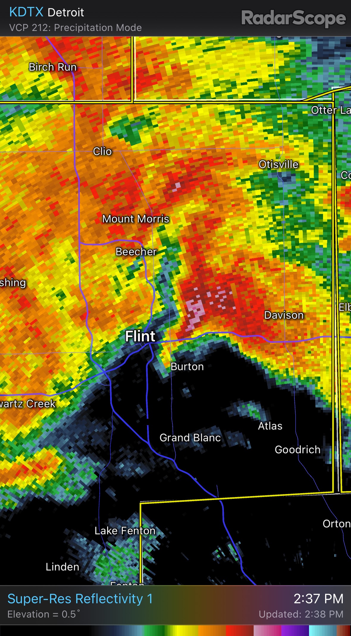
Its gone for now, but could cycle back. Watching that southern one too.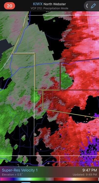
-
2023 Short/Medium Range Severe Weather Discussion
frostfern replied to Chicago Storm's topic in Lakes/Ohio Valley
That northern couplet is real. Small rain-wrapped tornado.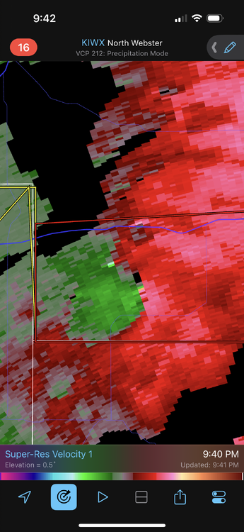
-
I really think it will hold together or even build more south. It’s only 9:30 PM. These things typically die off in the early morning hours, and it will teach you before then.
-
I no longer have the energy to chase at night after dark. If I had someone else cover some of the driving it might be doable. Just too exhaused these days. I really just want a nice big loud cracking and thumping storm IMBY, not wind and tornadoes. There’s an occasional flash and rumble, but nothing frequent. Same as previous July storms IMBY this year. Mostly just heavy rainers.
-
There’s no way that line is going to miss you and it will have lightning. I would chase if it wasn’t so late. Drought is past over up here but really no light show at all. Just plain hard rain.
-
2023 Short/Medium Range Severe Weather Discussion
frostfern replied to Chicago Storm's topic in Lakes/Ohio Valley
Surface based instability isn’t as important as 0-1km shear for IMO. As long as SBCAPE isn’t zero, slightly elevated instability just north of a weak boundary is enough. Lots of sun and deep mixing directly overhead creates more CAPE, but it makes the 0-1 km shear more unidirectional too. -
Another stratiform snooze fest with next to no lightning.
-
2023 Short/Medium Range Severe Weather Discussion
frostfern replied to Chicago Storm's topic in Lakes/Ohio Valley
That story never changes. -
2023 Short/Medium Range Severe Weather Discussion
frostfern replied to Chicago Storm's topic in Lakes/Ohio Valley
Completely skipped over this side. Hope to finally get a good nocturnal light show at some point when the front comes back north. This summer has not been cooperative. -
Next 10 days looks wet now, possibly really wet if the next cutoff stalls in the right place, but no heat or high CAPE IMBY for a long time. Still boring for summer, but better than drought and smoke.
-
Summer 2023 Medium/Long Range Discussion
frostfern replied to Chicago Storm's topic in Lakes/Ohio Valley
We got smoke season instead this year. -
I remember living in Seattle where the pattern is extremely bimodal in early summer. In June you get a lot of cloudy days where it barely gets above 60, then you get some offshore flow to burn off the stratus and you have a stretch of 80s. The average high is dead smack in the middle, but "average" days aren't the norm at all.
-
Summer 2023 Medium/Long Range Discussion
frostfern replied to Chicago Storm's topic in Lakes/Ohio Valley
Still feels like miss south will be the rule for me with the frontal zone refusing to push north of I-80. High latitude Greenland block is good for shear/baroclinicity this time of year, but the constantly bad MJO / ENSO phase combo keeps the SE ridge from ever really flexing.