luckyweather
-
Posts
617 -
Joined
-
Last visited
Content Type
Profiles
Blogs
Forums
American Weather
Media Demo
Store
Gallery
Everything posted by luckyweather
-

Winter 2023-24 Longrange Discussion
luckyweather replied to michsnowfreak's topic in Lakes/Ohio Valley
Shitposting from just about any other poster. But you lob a 3 letter forecast and it verifies. If we pay $99 per month can we get the sauce behind your forecasts? -
Been missing your longer range thoughts recently. Come back to us.
-
This is like mostly a swag but I’m kind of prepared for a low snow winter, probably a few soul crushing (for a winter lover) cool / cold rainers, and the chance of a handful of heavy wet marginal thermals thundersnow featuring big dogs with a scary close rain/snow line when we tap some probably fleeting cold. At my and your latitude any sustained snow cover probably not gonna happen as we’ll probably see a ridiculous warmup or three or four / bike riding weather. Probably a bone dry 30-45 day stretch from Christmas to mid Feb. I’ve set my expectations, anything worse than that though and I’ll probably need to find a therapist. edit: also a better pattern will show up around 3/20 and it’ll stay cool til May 15. You’ll highlight all the misery all winter and troll the hell out of me and then I’ll get some penance as I watch you squirm when winter shows up in spring.
-
Looking like we could see a dip or two of lows in the 30s the holiday weekend but also looks like maybe just for 3-5 days and then back to average/above average. Way longer term I was kind of getting worried the climate train wreck would manifest in Siberia torching or something this fall. Not the greatest start but the Siberian snowpack did start building about two weeks ago so a total train wreck northern hemisphere year without a winter disaster scenario looks to be off the table.
-
how do you mute somebody on here
-
little throwback to when Chicago was near the equator
-
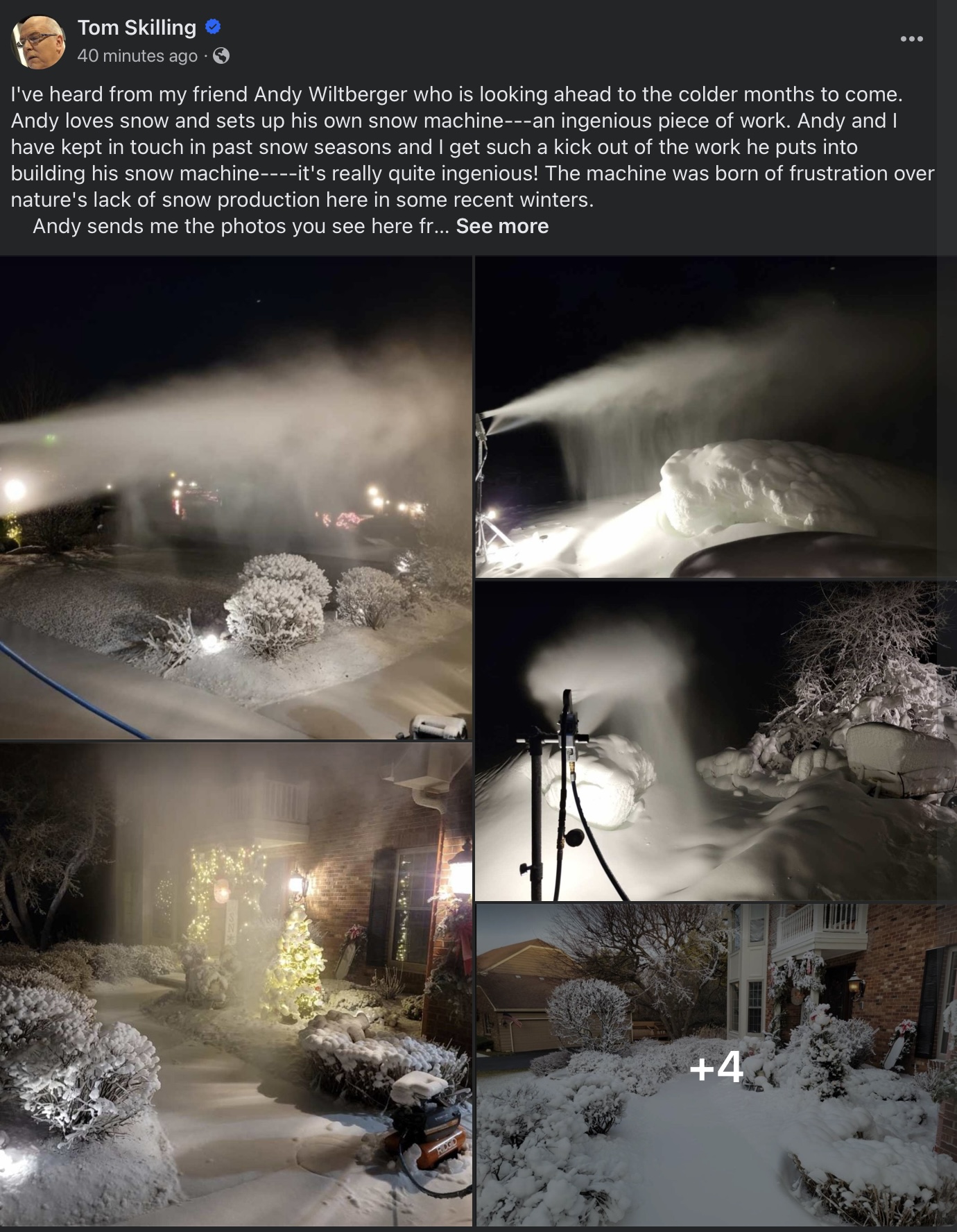
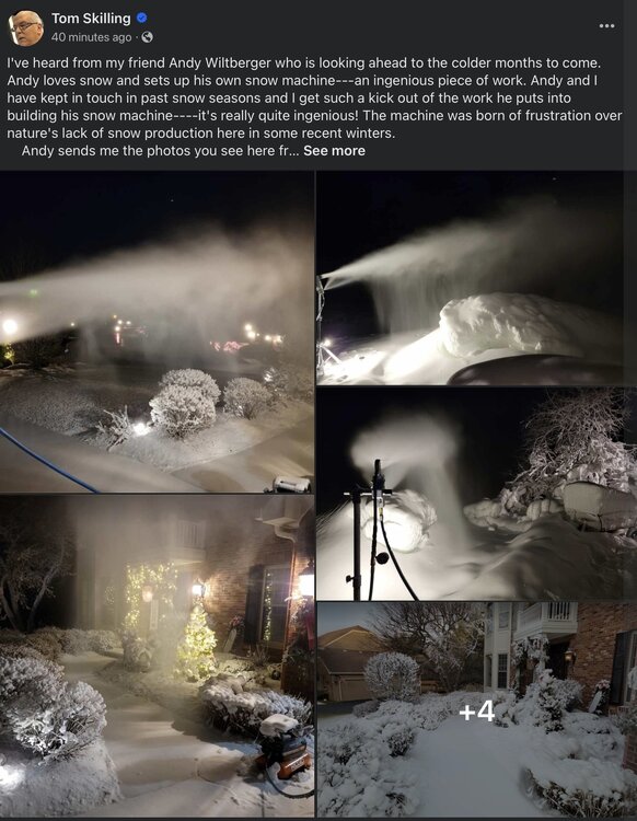
Skilling showing some love to the cold & snow lovers. I'm not Andy (my snowmaking rig is better). Won't be long.
-
Quick getaway for some MTB in Park City UT on Labor Day weekend, drove up to Big Cottonwood Canyon on Sunday night as a big storm was moving in. Was all rain while I was there but woke up the next morning to see they got their first measurable snow later that night. Flew home to find nothing but 70s and even a 60 in the point looking ahead. Life is good.
-
Ridge looking beastly. Seeming like this could end up being the headline heat event of the summer. Gonna scorch solid from Sunday to Thursday.
-
a tale of two mondays. got RFD at 61 on one and 105 the next.
-
Oshkosh WI
-
on cue starting to light up in the watch box in NC Iowa.
-
Got a little over an inch from late morning through early evening from the “pulsey splatty” (LOT AFD’s words, not mine) mini train that brought 5 distinct cells with heavy downpours NE of Rockford on the WI border.
-
a year ago for compare and contrast fun:
-
Anecdotally it does semi track with reality though. I’ve thought to myself a few times not too far north of RFD when Cyclone has posted a 90+, “hmm what a difference a hundred miles makes”.
-
2023 Short/Medium Range Severe Weather Discussion
luckyweather replied to Chicago Storm's topic in Lakes/Ohio Valley
Tornado warned cell about to cross the IL/WI state line into Mchenry County. My wife was driving to an event in Lake Geneva and heard the warning on old fashioned FM radio. -
Same. Non measurable sprinkles northeast of Rockford over the past 3 days.
-
Passed through IL-94 a few hours ago from Dallas City, IL to Carthage, IL, 20 miles of apocalyptic destruction. Most trees were down, all homes had roof damage, many imploded grain bins, some grain bins crumpled in random fields and pushed off the road by equipment to re-open travel. Most electric poles laid down or split in half. Most corn pushed down flat. I’m not talking about a mile stretch, the entire 20 mile route was total destruction. Seems pretty certain extremely strong winds were present at the surface as the derecho pushed through that area.
-
N. IL truly has been a rainless paradise. I haven't been watching the temp grids too much but between your reports and Cyclone's reports west of me, I can deduce we've also been in a pretty sweet spot in the gradient here in N. Central IL. The most pleasant spring in my lifetime. Farmers likely not seeing the beauty in it. This is the slowest start to corn here I've ever seen. Most years the old "knee high by the 4th of July" has been more like "knee high by the 4th of June". Nothing knee high here yet, some late planted fields have barely emerged.
-
Summer 2023 Medium/Long Range Discussion
luckyweather replied to Chicago Storm's topic in Lakes/Ohio Valley
LOT: Confidence continues to rise in a much-needed pattern change Sunday onward as zonal to northwesterly flow becomes established aloft and opens the door for numerous upper-level shortwaves to propagate into the Great Lakes. The net result will be a return of regular chances for showers and thunderstorms (e.g. every few days), rising humidity levels, and moderating temperatures. It`s still a hair too early to talk specifics about timing, intensity, and coverage of showers and storms next week, though at least parts of the area appear in line to receive much needed rainfall from Sunday onward. -
Spring 2023 Medium/Long Range Discussion
luckyweather replied to Chicago Storm's topic in Lakes/Ohio Valley
I have a feeling we'll have to pay in arrears for this. 105 degree days in October on tap. -
Northern IL crop situation about to transition from annoying but periodic drought to a more severe, generational type situation if we don’t get rain in the next 10-14 days or so.
-
I joined the board because of the OG Morch. You were a prolific poster back then under another name. I thought you were a trip but not in a bad way. As a cold lover you get on my nerves when you start jonesing for spring but seeing this I get it man. Never change.
-
gonna head up to Madison to Tyrol’s June Jam tomorrow. Pic from last year, they said they have significantly more snow this year. At least an acre of coverage. I’m not sure how they keep it at Tyrol but usually hay and/or sawdust will do the trick. A-Basin in Colorado closing this weekend, but it was snowing there today. Still got about 11 minutes of day length to pick up, but it’s almost over. Less than 19 days til they start getting shorter.
-
“Not to hijack your thread” Proceeds to make 5 successive replies on Toledo’s average mean temp in a historical drought thread. [emoji848][emoji848][emoji848] I remember as a kid in the 80s seeing several segments on the local St Louis area news about various shipwrecks being exposed as the Mississippi and Missouri rivers all but dried up.