luckyweather
-
Posts
637 -
Joined
-
Last visited
Content Type
Profiles
Blogs
Forums
American Weather
Media Demo
Store
Gallery
Everything posted by luckyweather
-
.46" rain imby in the early morning today. First measurable precip since .27" on 9/13. July's 8" and August's 4" are distant memories. I have two spring fed creeks nearby, they have slowed some but not much over this dry stretch, so the water table & aquifer is still doing okay.
-
89.1 at mdw last hour. so close.
-
Right at 1/2" here mtd, 0.0 for the past 10 days. heard thunder on and off all weekend it seemed like but your screw zone has engulfed me finally. 1-3" weekend totals all around me.
-
Closing in on a month of dry here, only 1/10" since 8/18. Everything started getting crunchy this week. Hail Mary conditional chance for a little training overnight/tomorrow morning, but if that doesn't manifest gonna get into the yellow on the drought map. Last several GFS runs showing a low breaking the ridge down next weekend but then has it coming back after, Euro isn't biting, ridge in place to the end. That early taste of fall might be all she wrote until October.
-
Nice. Was there also, only regret was not sitting up high, assuming you didn’t either we both missed seeing the last fireworks of the summer as he was wrapping up the show. Bears owner be damned Soldier Field is having a hell of a weekend. Prez be damned the city is having a hell of a weekend also, felt like the center of the universe with everything going on.
-
Saw turnpike troubadors at the salt shed last night. The weather made a really good show truly great.
-
Coming up on the 35th anniversary here in less than two weeks. 60mph gust from the outflow of a cell that clipped to the north, rainless, then picked up a quick 8/10” as it filled in. Second cell incoming now, also pretty gusty.
-
1.07” imby ne of RFD for the weekend, all yesterday. Been a lush summer here, no stretches of crunchy grass or dust yet this warm season. The corn out this way looks as good as you’ll ever see it.
-
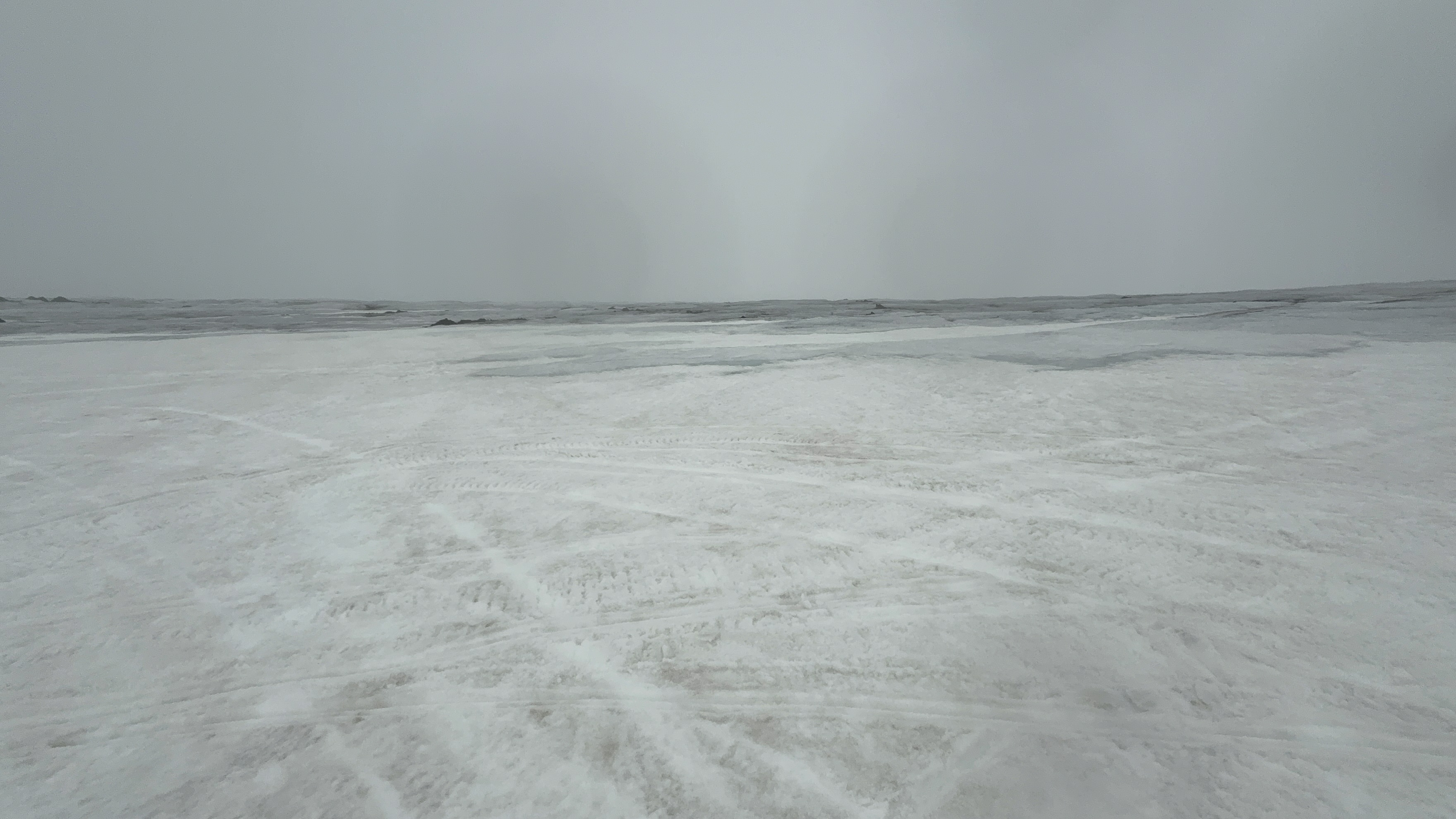
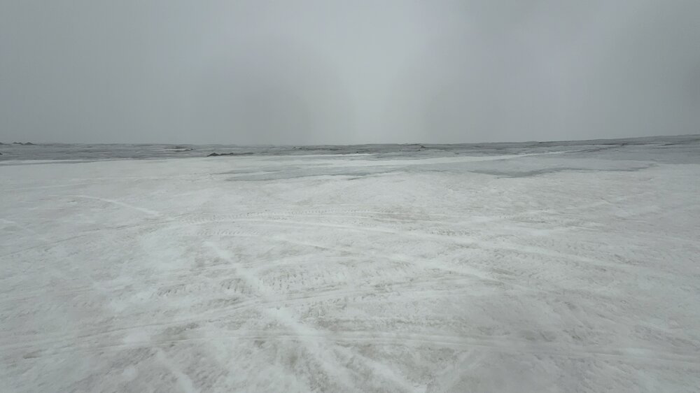
just came off the Geitlandsjökull glacier in Iceland about an hour ago. Not quite as photogenic as banff but helped with the snow withdrawals
- 104 replies
-
- 10
-

-

-
A couple of the recent LOT AFDs were issued by ILX including the current one. I haven't noticed that before, hope all is well at our local wfo.
-
was in Lake Geneva today, sky is milky white with the wildfire smoke, hints of burning plastic outside. bleh
-
Got about 1.5" in an hour west of Harvard. Still backbuilding to the west, might end up with around 2". Some of the gusts just now flattened some of the surrounding corn to the degree there's definitely going to be some yield issues.
-
Rockford Ironman tomorrow is going to be brutal.
-
That blessed stretch where Oak St beach might as well be Waikiki.
-

Spring 2025 Medium/Long Range Discussion
luckyweather replied to Chicago Storm's topic in Lakes/Ohio Valley
mjo moving phases and ssw incoming. potentially more active, cold, and stormier around here (chicago) later into March. (am a weather dummy also, hopefully the professor is proud but prepared for my lashes) -
Fall/Winter '24 Banter and Complaints Go Here
luckyweather replied to IWXwx's topic in Lakes/Ohio Valley
I go to DC annually to visit privately with most of the IL congresspeople, I’ll be in DC in two weeks and am going to hammer them on NOAA/NWS. Like him or hate him Rep Bill Foster has built his brand on being the pro science voice of Congress, going to be particularly interested to hear his take. -
unlikely wx related if the wing is missing. passenger probably bumped the wings fall off toggle switch.

-
^^^ a rare sight x2, the stateline chair spinning at Wilmot for the first time in a few years, and fresh goods coming down for the lift ride
-
- 711 replies
-
- 11
-
-
Fall/Winter '24 Banter and Complaints Go Here
luckyweather replied to IWXwx's topic in Lakes/Ohio Valley
Got some snow laid down with a few hours of wet bulb temps of 20 or so, although the wind made it pretty inefficient. All the N. IL and So WI ski areas have been blowing for the past few days. Alpine Valley and Tyrol Basin in WI open tomorrow as well as Sundown in Iowa. Chestnut in IL looks to open next weekend along with Cascade, Devils Head, Granite Peak, and Wilmot in WI. -
Fall/Winter '24 Banter and Complaints Go Here
luckyweather replied to IWXwx's topic in Lakes/Ohio Valley
maybe we get to do a jebwalk? -
Seven tenths today northeast of Rockford
-
Spring/Summer '24 Banter and Complaint Thread
luckyweather replied to IWXwx's topic in Lakes/Ohio Valley
Really sorry to see this and sending warmth to you Stebo and your family, donated, hope it helps. I imagine you’ve got this covered but just in case not, would retain a lawyer who specializes in bike law, there are several in Michigan. All too often I see the perps of cyclist hit and runs somehow get off with no or little punishment. It’s like somehow what otherwise would be straight up murder is okay because it was car vs bike. The specialty bike lawyers are prepared for that and know how to fight for accountability while obviously trying to recoup their fees and ensure the family is able to recover costs and some form of settlement. I got dinged on a Divvy in the south loop on Labor Day weekend by some clown, I wasn’t hurt and was able to keep riding but the guy just threw up his arms at me and sped off. Sorry bro, I was riding on the marked green bike lane and you decided to come out of a blind alley at 30mph, I was definitely the asshole. -
Spring/Summer '24 Banter and Complaint Thread
luckyweather replied to IWXwx's topic in Lakes/Ohio Valley
Looks like common hop. Common hop is a vine that’s native here in N. IL. -
2024 Short/Medium Range Severe Weather Discussion
luckyweather replied to Chicago Storm's topic in Lakes/Ohio Valley
https://x.com/PettusWX/status/1804681264936415268 Janesville tornado on traffic cam