wawarriors4
-
Posts
1,284 -
Joined
-
Last visited
Content Type
Profiles
Blogs
Forums
American Weather
Media Demo
Store
Gallery
Everything posted by wawarriors4
-
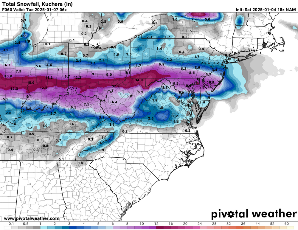
It is a good run for EZF. The Nam for EZF with its hole was comical. I really do like the 5-8”+ with some ice on top as a forecast around FXBG from NWS LWX.
-
It’s just so comical……
-
Wow, what a hole! Around Fredericksburg, this is my favorite map ever……

-
I wish, but a Monday night in Atlanta would be tough with other commitments and future time off from work.
-
Me too, should be a great game.
-
So true. The sleet always finds its way to FXBG.
-
Haha, fair enough. Though more focused still on college football and the Orange Bowl Thursday night. Go Nittany Lions!! My wife and her family are big DC sports fans, so I’m pretty used to the ribbing I get!
-
As locked in as I’ve seen it in a while. Still feel there’s some mix that makes it to mby. 6” (maybe 8”) plus seems pretty plausible.
-
Whew, that is noice ❄️
-

Richmond Metro/Hampton Roads Area Discussion
wawarriors4 replied to RIC Airport's topic in Mid Atlantic
0z Euro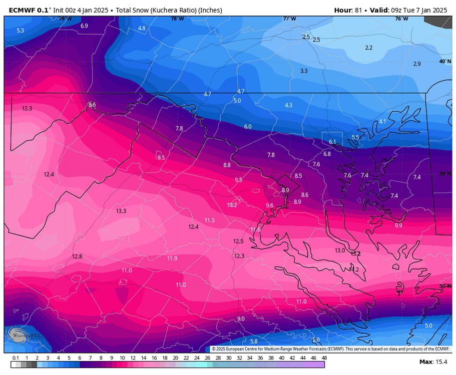
-
I’ve definitely had to put a few on the ignore list, it gets unreadable. Maps get posted and discussed when stuff is Norther, but radio silence if it’s otherwise….
-
Richmond Metro/Hampton Roads Area Discussion
wawarriors4 replied to RIC Airport's topic in Mid Atlantic
18z Euro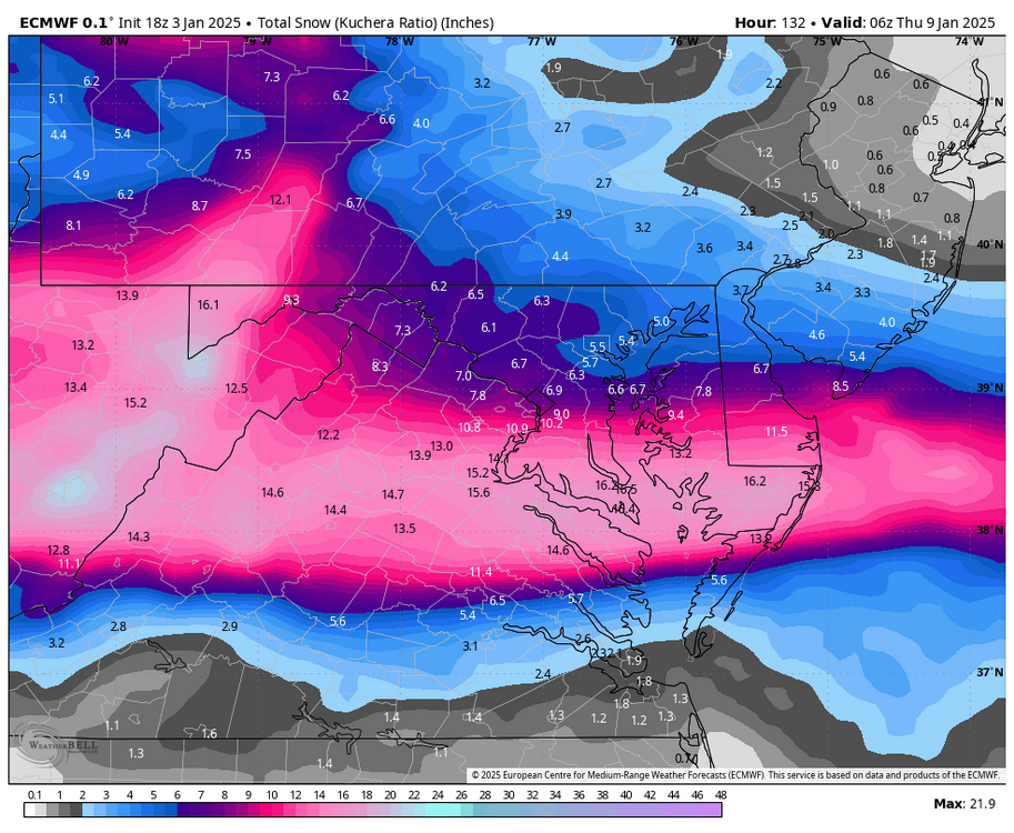
-
https://x.com/jon180018/status/1875287231688274008?s=46&t=GcJrdtSs3JJfCsUHkcq4ow
-
Hmm, based on the history of my area, that's congrats I-66, but I'm happy to wrong.
-
Richmond Metro/Hampton Roads Area Discussion
wawarriors4 replied to RIC Airport's topic in Mid Atlantic
12z Euro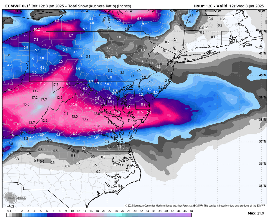
-
Richmond Metro/Hampton Roads Area Discussion
wawarriors4 replied to RIC Airport's topic in Mid Atlantic
6z Euro Souther again…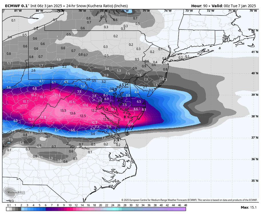
-
From your keyboard to the weather gods ears!
-
I’ve put a few people on ignore for this very reason. Gets unreadable.
-
January: Medium/ Long Range: May the Force be with Us....
wawarriors4 replied to Weather Will's topic in Mid Atlantic
Very acceptable, but I live in Stafford. This has a between EZF and DCA bullseye feel to it, but I’m prepared to be screwed in some way like usual. -
Got 0.04" of rain in Spotsy this morning. Wild to see rain drops again.....
-
Just picked up a solid 0.81” in about 45 minutes here in Stafford.
-
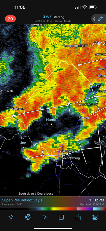
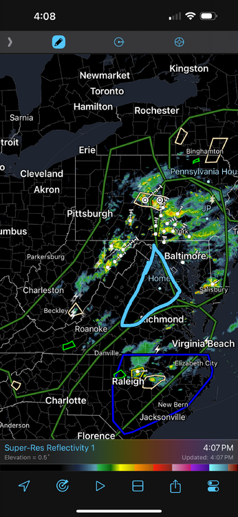
Truly comical how the rain broke up on approach to the FXBG area. Grande total of 0.02” very crispy in the yard less than 4.00” of rain since June 1.
-
Managing to get whiffed by all the activity firing up around Fredericksburg. Places less than 3 miles North, East, and South getting good rain….. 0.06” here ETA…. Comical
-
This is comical. Heavy precip discussion in all directions…..
-
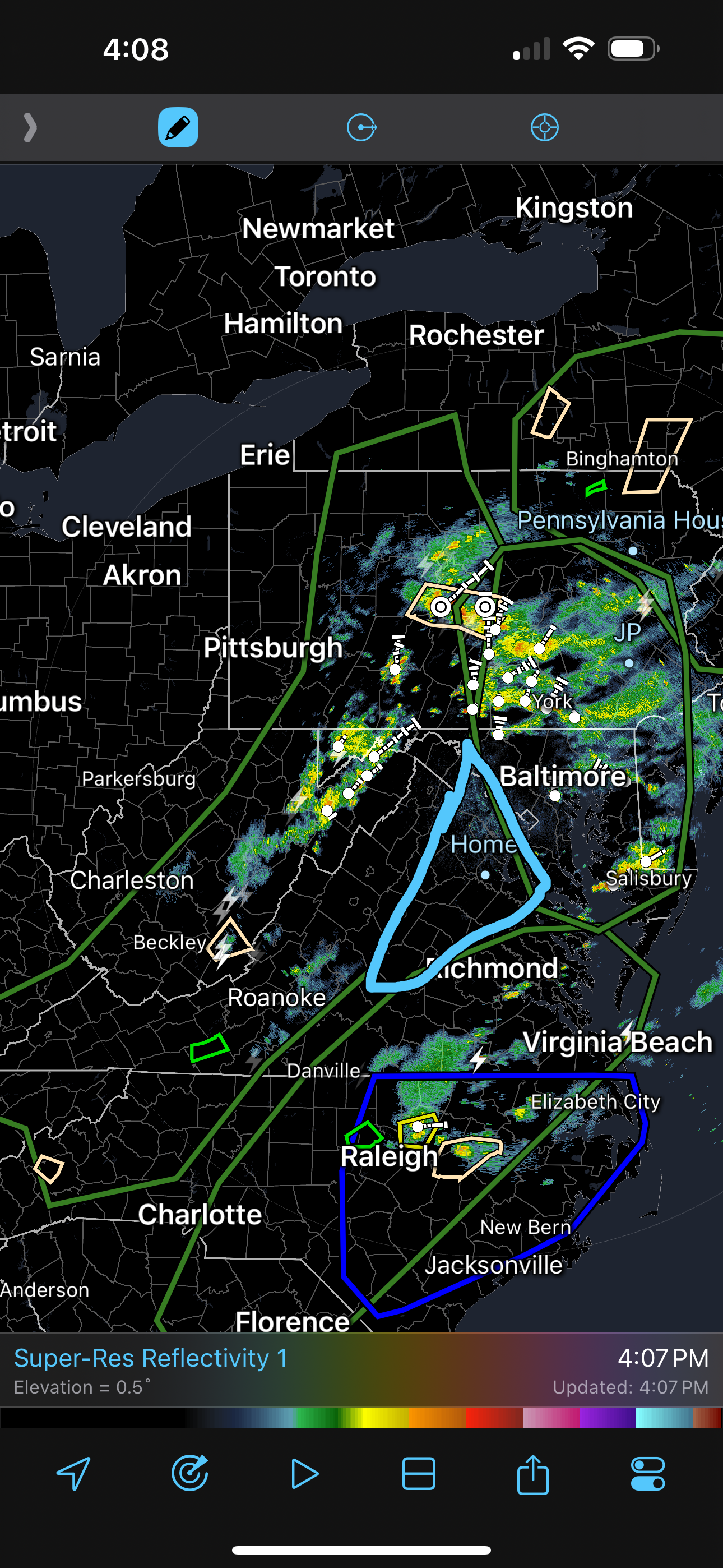
I hear you. Just looked at the radar for last few hours. It’s like there is a wall south of Fredericksburg, the rain shield hit it and just dissipated. It stinks……