

jm1220
-
Posts
26,172 -
Joined
-
Last visited
Content Type
Profiles
Blogs
Forums
American Weather
Media Demo
Store
Gallery
Everything posted by jm1220
-
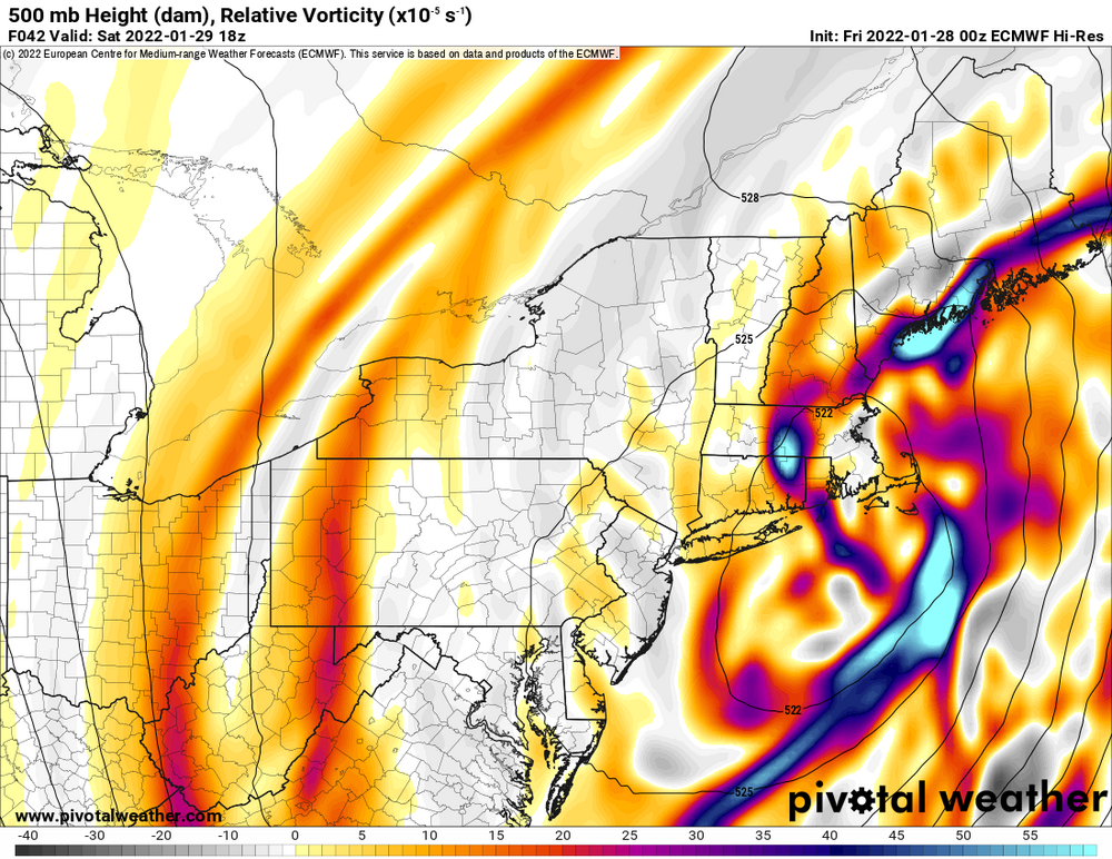
I don't have access to 18z free maps but comparing to 12z the Euro definitely looked a little better. Nice more compact closed low that we could still use closing off a couple hours earlier but two closed contours E of Montauk. 700mb also looks better to me, less sloppy.
.thumb.png.ac8e6a8c6d57335b81a64dbcbf8270e9.png)
-
Yeah, seeing posts saying it ticked west. Keep that coming por favor. I don't have access to free maps, hopefully the upper air looks better too.
-
Who knows what'll happen. I'm sure there will be some kind of surprise with this. Often the west edge of the heavy QPF has a heavy deformation band. If I get 12-15" I'll be beyond happy.
-
I would be too if I was you (I'm looking forward to it also but my odds are still a little less than yours IMO). You have a really good chance at seeing 20".
-
I'd be pretty stunned if there aren't 20"+ amounts out there. Prime area is probably Rt 112 to near Riverhead.
-
GFS also should have shown considerably more than it did given how it has 2 closed 500mb low contours SE of Long Island. I think that would be a foot easy from NYC east. I think the whole Island should be good for 12+. NYC is on the bubble, I'd say 8-12" there-8" Bronx 12" Rockaway. Still need another west push.
-
A bit?
-
Way out of its range but entertaining at least.
-
Or over Sayreville, NJ like for Boxing Day 2010 lol. I'd still say the best chance for it is central/eastern Suffolk County but there'll be plenty of heavy snow west of it.
-
Looks good, similar to what it seemed to have at 18z. 1" liquid starting around NYC maybe, no huge death band shown though unlike the NAM/Euro it seems. Similar to RGEM which shows a larger 12" or so area rather than the death band 30" stuff.
-
Wasn't the Lindsey Storm 1969 a big Nassau County Miller B storm? 2/8/13 would have been substantially better had 1/3 or more of the storm not been wasted with rain/sleet in Long Beach. I can't get on board with crazy 20+ amounts yet for us but I'm becoming more confident we'll get past 12". GFS should have been better with that upper air chart. There's really only upside when you see two closed 500mb contours just SE of you. Rolling the dice here but I may be coming to Long Beach for this one. For all out blizzard conditions it would be a great place to hang out even if snow totals are a little less.
-
This won't go hugely further west, we're probably near the limit or within 30-40 miles but to me it's just the maps catching up to the potential that's been here all along finally.
-
There won't be any problems with the dry slot or mix for us. MAYBE for out by Montauk if the west trend really does continue. Our issue would be subsidence zones between bands which can't be forecast now. I can definitely understand Forky beginning to get excited. Boxing Day 2010 was supposed to be a LI focused storm too and it buried E NJ. I don't see how this has to stop going west here.
-
Yeah if that happens we won't have to worry at all from the city on east about picking up totals over and possibly well over a foot. That's a thing of beauty.
-
Metsfan's right. Miller A's (which this storm is more of than miller B ) aren't the GFS strong suit. It seems to do better with storms dominated by the northern stream which the Euro can struggle with. And GFS was very close to being considerably better. It had the stupid double low which stole a little and dragged the storm east.
-
Jeez is anyone shocked? What a shame that after this big upgrade it still sucks royally on pinning down these coastal storms more than 48hrs out.
-
That's fine, I'm not concerned about it. When has it not caught up at the very end with these? As long as it's moving in the right direction it's fine by me.
-
Lots of us were saying what could happen with a slightly earlier closing off of the low. This could and probably will make shifts but there's nothing to really stop it from coming west at least another 30-40 miles. And it's not a given that it'll trend back east at the last minute. 1/4/18 came west until the very end, I think 12/19/09 trended NW until the end, so did Boxing Day 2010. Sure some do tick back east but it's not a rule.
-
I lost my dad just over 2 years ago when I was 33 and I still think about him every day and probably will for the rest of my life. He wasn't too much into my weather hobby; my mom was always a little annoyed at it-"why do you care so much about snow?". But he would at least have conversations with me about things like this.
-
With this storm and the dynamics/moisture at play, QPF probably isn't overdone. But again the Kuchera maps especially in the worst of it with blizzard conditions aren't happening. I could see maybe 12-1 ratios there. Winds will break the flakes apart and hurt ratios. The best ratios will be inland where winds will be reduced and there can be more piling up (but there will be less QPF).
-
I’ll believe something like that when I see it but that Nam run would be how it happens.
-
I’m so sorry for your loss. Hopefully this upcoming storm can be something of a consolation for you. Here’s to your dad!!
-
O Lord above, only one thing I pray unto you this night. THAT THE NAM FINALLY GOT A CLUE!!!
-
Wow. Essentially draw a line south from Nantucket. Each of the solutions west of there when nearest us would probably be big for the city on east. Huge chunk of members there.
-
That was a very encouraging run even back into NYC. I wouldn't go crazy over the precip output although it still shows a borderline MECS in the city verbatim. And yes it can still keep ticking west if the upper low closes off a few hours sooner as others pointed out. Trend is undeniable for the Euro since 6z to bring the heavy snow west. Interested to see the EPS and how many monsters it has that can bring crippling amounts into the city. Those are a possibility. Not high possibility but can't be ignored. But wow, central and eastern Suffolk are quite possibly in for an all out blizzard on Saturday. 2 foot amounts will be common there if the banding sets up like the Euro showed here. Could be 2/8/13-like where that happens, Euro showed roughly along Rt 112 over to the William Floyd for the death band. Latest NAM was a little east of there. And NW of NYC should be encouraged too at the heavier amounts inching west. Could probably be a warning event on this run out to western NJ, and there ratios will help. Again I wouldn't go higher than 12 or 13:1 ratios near the coast because of the strong winds. But the 1.2" liquid it shows on the Nassau/Suffolk border would still be 14-15". Can't really talk all out blizzard for near NYC yet but trust me it isn't too far away from that with some minor added improvement.

.png.35c561daa63935b1a917df78edb26cc7.png)


