

Met1985
-
Posts
16,911 -
Joined
-
Last visited
Content Type
Profiles
Blogs
Forums
American Weather
Media Demo
Store
Gallery
Everything posted by Met1985
-

2022-2023 Fall/Winter Mountains Thread
Met1985 replied to BlueRidgeFolklore's topic in Southeastern States
12z euro Sent from my SM-G998U using Tapatalk
-
2022-2023 Fall/Winter Mountains Thread
Met1985 replied to BlueRidgeFolklore's topic in Southeastern States
12z nam backs way off. Sent from my SM-G998U using Tapatalk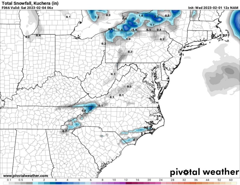
-
2022-2023 Fall/Winter Mountains Thread
Met1985 replied to BlueRidgeFolklore's topic in Southeastern States
06z gfs is pathetic lol. Sent from my SM-G998U using Tapatalk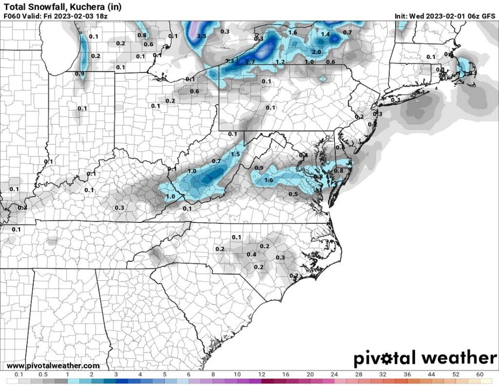
-
2022-2023 Fall/Winter Mountains Thread
Met1985 replied to BlueRidgeFolklore's topic in Southeastern States
3k NAM at 06z. A little better but that model has been way off this season... Sent from my SM-G998U using Tapatalk.thumb.jpg.89e67f74fa13c62f0312ba5d7b1df786.jpg)
-
2022-2023 Fall/Winter Mountains Thread
Met1985 replied to BlueRidgeFolklore's topic in Southeastern States
06z nam. It's not backing down that's for sure. Sent from my SM-G998U using Tapatalk
-
2022-2023 Fall/Winter Mountains Thread
Met1985 replied to BlueRidgeFolklore's topic in Southeastern States
00z nam. Pretty aggressive. Sent from my SM-G998U using Tapatalk.thumb.jpg.dc454194ef211809e3f803d16bd24580.jpg)
-
2022-2023 Fall/Winter Mountains Thread
Met1985 replied to BlueRidgeFolklore's topic in Southeastern States
Just saw where this January was the 6th warmest in record in Asheville... -
2022-2023 Fall/Winter Mountains Thread
Met1985 replied to BlueRidgeFolklore's topic in Southeastern States
The Canadian Sent from my SM-G998U using Tapatalk.thumb.jpg.a99ac3776e988df69a48c7a3d18551d8.jpg)
-
2022-2023 Fall/Winter Mountains Thread
Met1985 replied to BlueRidgeFolklore's topic in Southeastern States
The NAM Sent from my SM-G998U using Tapatalk
-
2022-2023 Fall/Winter Mountains Thread
Met1985 replied to BlueRidgeFolklore's topic in Southeastern States
The gfs Sent from my SM-G998U using Tapatalk.thumb.jpg.cdcba6455252e8cacfd73eaa0336ff87.jpg)
-
2022-2023 Fall/Winter Mountains Thread
Met1985 replied to BlueRidgeFolklore's topic in Southeastern States
Was just looking at this very thing. Looks promising at a very close range. -
2022-2023 Fall/Winter Mountains Thread
Met1985 replied to BlueRidgeFolklore's topic in Southeastern States
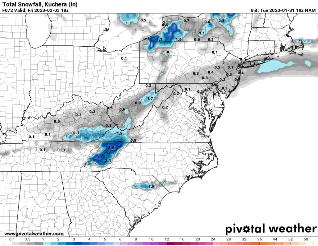
While west and middle Tennessee get a winter event our outlook is possible flooding with so much rain coming in. I have zero faith in any winter weather the first week of February at this point. -
2022-2023 Fall/Winter Mountains Thread
Met1985 replied to BlueRidgeFolklore's topic in Southeastern States
At the current state we are looking at a ton of rainfall and not a snowstorm or any winter weather storm. We will see a glancing blow of cold air and that's it. The ensembles look meh and the operational models don't give any hope. -
Yeah I think you are right. I think it is definitely contributing to the volatility of the models. I mean I can't remember when we had such swings on all the models from run to run.
-
You know I've been thinking us pretty much switching the enso state is causing the models to really go crazy. The signal is complex and off because of that. I think we are going to have a damn cold spring because if it also.
-
2022-2023 Fall/Winter Mountains Thread
Met1985 replied to BlueRidgeFolklore's topic in Southeastern States
Temp down to 24 already. Going to be mighty cold tonight. Also the gefs looks good from the 2nd on. Seems like we aren't punting this little chance for some winter weather currently... Am I optimistic? No. Am I pessimistic? No. I'm watching and waiting... -
2022-2023 Fall/Winter Mountains Thread
Met1985 replied to BlueRidgeFolklore's topic in Southeastern States
Had a skiff of snow this morning with temps in the 30s all day. The forcing with this was never really there. Will be waiting for more rain this Sunday. -
January/February Mid/Long Range Disco IV: A New Hope
Met1985 replied to stormtracker's topic in Mid Atlantic
What's the link for this please -
2022-2023 Fall/Winter Mountains Thread
Met1985 replied to BlueRidgeFolklore's topic in Southeastern States
Great news! I bet that was freaking scary as crap. Thank gosh for bathtubs. -
Good thing it's Ensembles disagree with the operational.
-
The gfs Ensembles don't agree with the operation at all. I completely understand the frustration but the Ensembles really haven't changed that much the past several runs. Cold works in her around the 2nd through the 9th but things may teter back and fourth a bit. Take a deep breath and enjoy life.
-
2022-2023 Fall/Winter Mountains Thread
Met1985 replied to BlueRidgeFolklore's topic in Southeastern States
I will gladly punt the rest of this winter if I don't have to see this piece of junk pattern again for another decade. Yeah same here. -
2022-2023 Fall/Winter Mountains Thread
Met1985 replied to BlueRidgeFolklore's topic in Southeastern States
The 18z gfs operation doesn't look good either. Doesn't really make a great push of cold air in here at all. The negative epo just dumps west and the SER flexes and the trough cuts north of us. -
2022-2023 Fall/Winter Mountains Thread
Met1985 replied to BlueRidgeFolklore's topic in Southeastern States
Not sure if it's a blip because of the supercomputer outage on the euro but wow is it ugly after this next storm and the ensembles kind of agree. The cold air is pushed back to the 4th on the 12z eps now. Again maybe a blip but this is why I have little to no faith currently in us seeking a change anytime soon that is really meaningful. -
2022-2023 Fall/Winter Mountains Thread
Met1985 replied to BlueRidgeFolklore's topic in Southeastern States
Yeah probably so. It's calm here in my bowl.
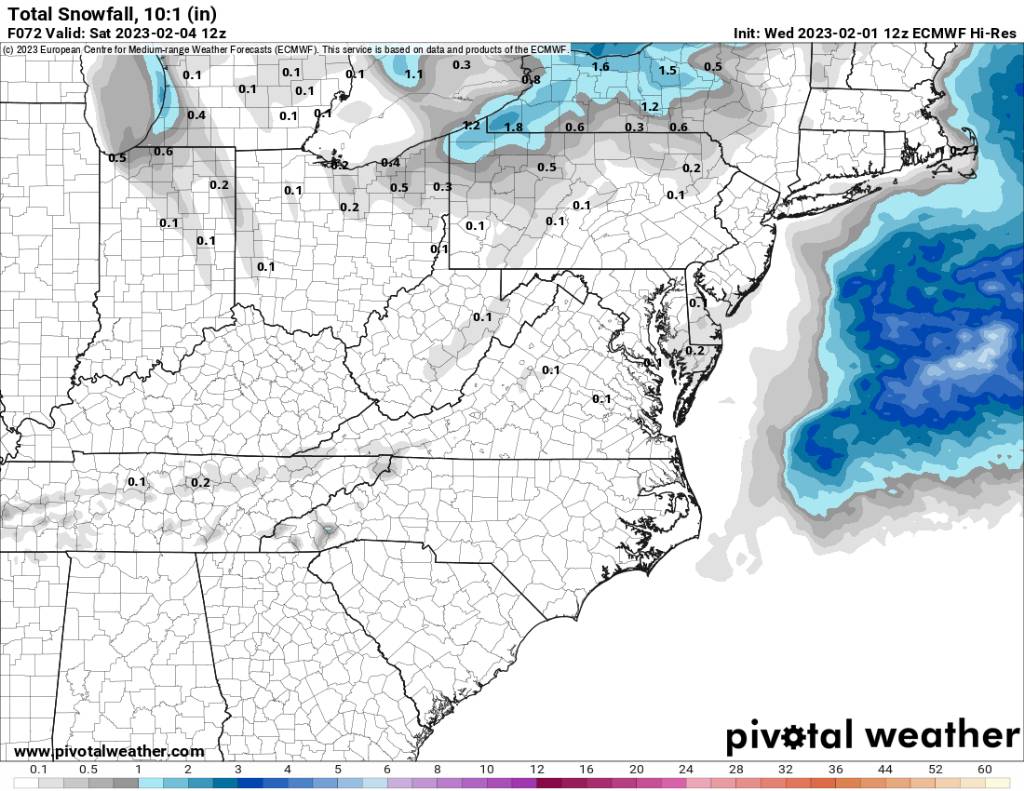


.jpg.e10dba5473c78d43352a6ada48494f51.jpg)
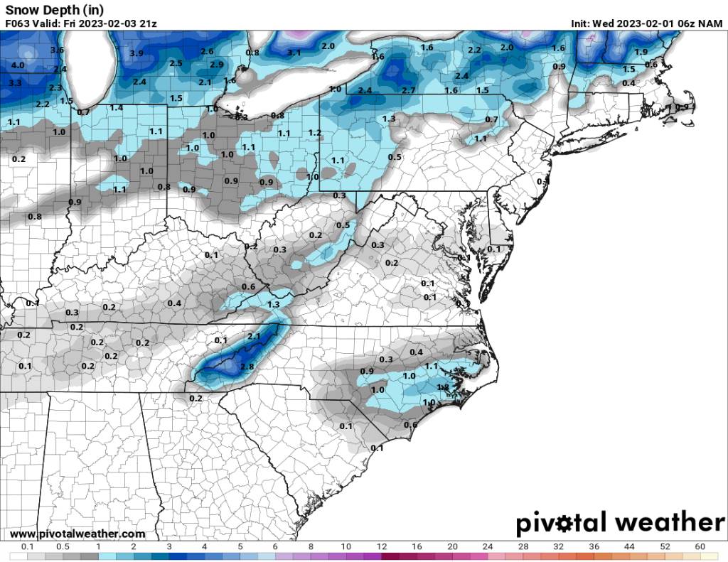
.jpg.8bfe7f4d25a206ec1d20acbf65f0bef4.jpg)

.jpg.2df892c320902139ab1ca3049bc6e5c1.jpg)
.jpg.5a78f40a1002b24763c1091a9d93e704.jpg)