

Met1985
-
Posts
16,668 -
Joined
-
Last visited
Content Type
Profiles
Blogs
Forums
American Weather
Media Demo
Store
Gallery
Everything posted by Met1985
-

2023-2024 Fall/Winter Mountain Thread
Met1985 replied to The Alchemist's topic in Southeastern States
Happy Thanksgiving guys! I hope everyone has a wonderful day! -
2023-2024 Fall/Winter Mountain Thread
Met1985 replied to The Alchemist's topic in Southeastern States
Ended up with 2.15 inches of rainfall for a 2 day total. This was exactly what we needed. -
2023-2024 Fall/Winter Mountain Thread
Met1985 replied to The Alchemist's topic in Southeastern States
Snow at me casa tonight with a temp of 36. Light snow but it's snow. Wind is ripping also. -
2023-2024 Fall/Winter Mountain Thread
Met1985 replied to The Alchemist's topic in Southeastern States
This would be one hell of an upslope snow storm shown on the 00z gfs. Sent from my SM-G998U using Tapatalk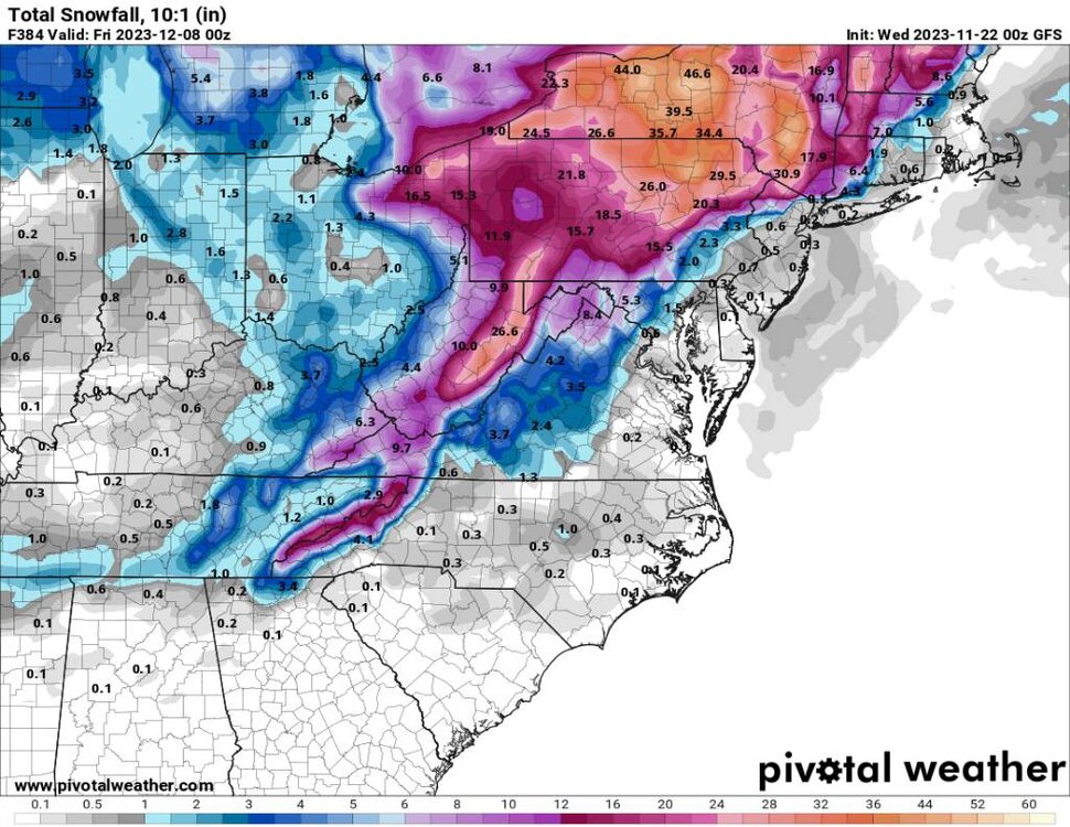
-
2023-2024 Fall/Winter Mountain Thread
Met1985 replied to The Alchemist's topic in Southeastern States
Maybe some high elevation snow this morning? Sent from my SM-G998U using Tapatalk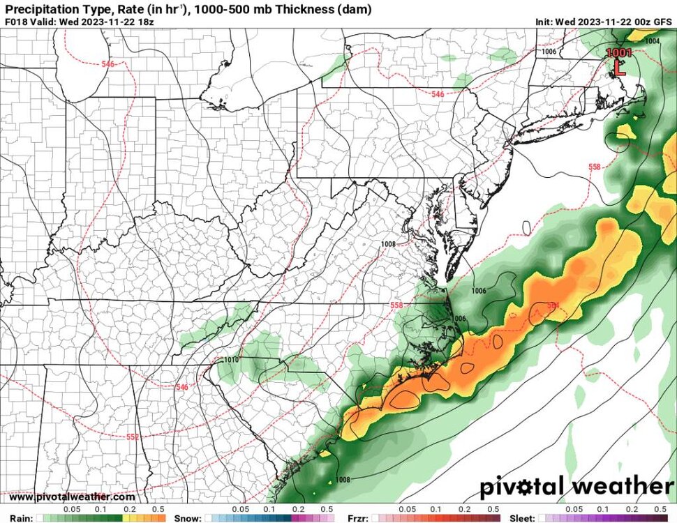
-
Yeah we have an 1800 acre wildfire right along I-40 here in Haywood that is 0% contained. Hopefully the rain comes in on the heels of the freaking high wind we are supposed to get tomorrow.
-
2023-2024 Fall/Winter Mountain Thread
Met1985 replied to The Alchemist's topic in Southeastern States
It can snow now but our climo for snow really hits towards the middle and end of December. -
2023-2024 Fall/Winter Mountain Thread
Met1985 replied to The Alchemist's topic in Southeastern States
This is exactly what we need. Widespread 2 to 3 inches of rainfall. Sent from my SM-G998U using Tapatalk
-
2023-2024 Fall/Winter Mountain Thread
Met1985 replied to The Alchemist's topic in Southeastern States
Oh they didn't have been lacking for sure. We haven't had the cold fronts or the moisture recently to really have a big event or a bunch of small events. -
2023-2024 Fall/Winter Mountain Thread
Met1985 replied to The Alchemist's topic in Southeastern States
This is a chaotic weather pattern. We have the tpv dropping down, a ridge out west but then some junk in the SW trying to pump up the SE ridge against the tpv... Sent from my SM-G998U using Tapatalk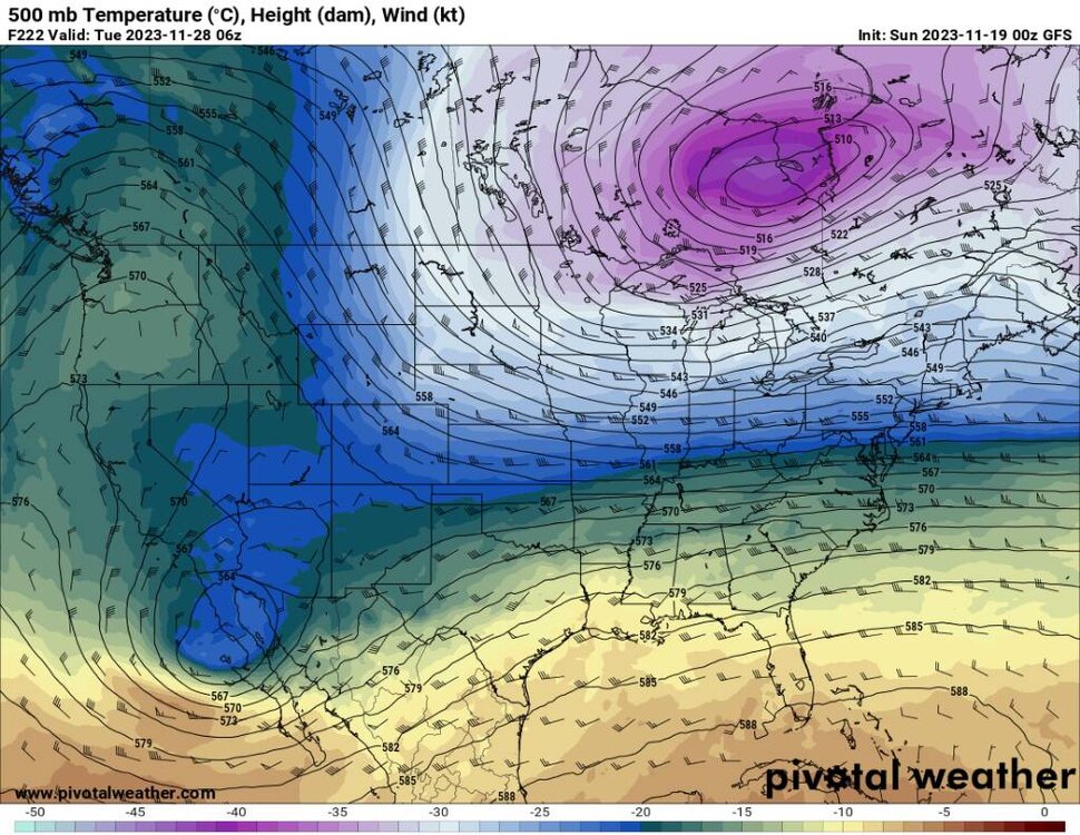
-
2023-2024 Fall/Winter Mountain Thread
Met1985 replied to The Alchemist's topic in Southeastern States
I'd like to see the axis of this a bit more west but I'll take it. Sent from my SM-G998U using Tapatalk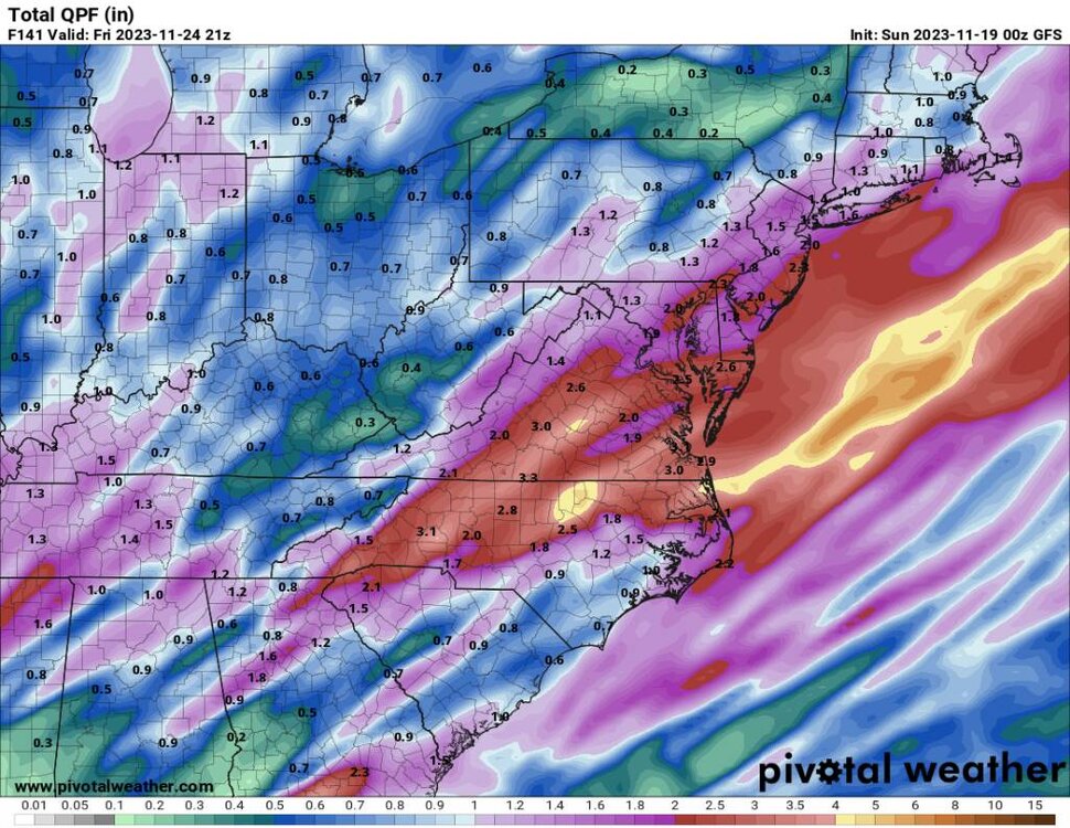
-
Yeah I definitely don't want another false hope of anything of any duration like last December. I remember ecwn the ensembles were horrible last year in winter. Showing great signs and even storms only to head fake. I am the side of true winter not starting until January but not having an all out torch would be nice.
-
Winter '23-'24 Will Be A Lesson In Relativity
Met1985 replied to 40/70 Benchmark's topic in New England
Great work! Even though I live in the SE I read a lot from here because there are so many knowledgeable people and mets from this forum region. Well done! -
2023-2024 Fall/Winter Mountain Thread
Met1985 replied to The Alchemist's topic in Southeastern States
Yeah that second batch overnight and this morning was very beneficial. I'm looking at close to three quarters of an inch which is a dang win at this point. We got a lot more than what the weather models were showing. -
2023-2024 Fall/Winter Mountain Thread
Met1985 replied to The Alchemist's topic in Southeastern States
Nice! I've not seen any snow on any of the guidances but that would be whiplash. -
2023-2024 Fall/Winter Mountain Thread
Met1985 replied to The Alchemist's topic in Southeastern States
Some of us will go from 70s today to highs in the 40s. NWS says temps dropping tomorrow to 44 degrees by 5 pm. On and off showers through the weekend as well. Hopefully most can get a bit of rainfall. -
2023-2024 Fall/Winter Mountain Thread
Met1985 replied to The Alchemist's topic in Southeastern States
Well the 00z Euro is anemic now. Sent from my SM-G998U using Tapatalk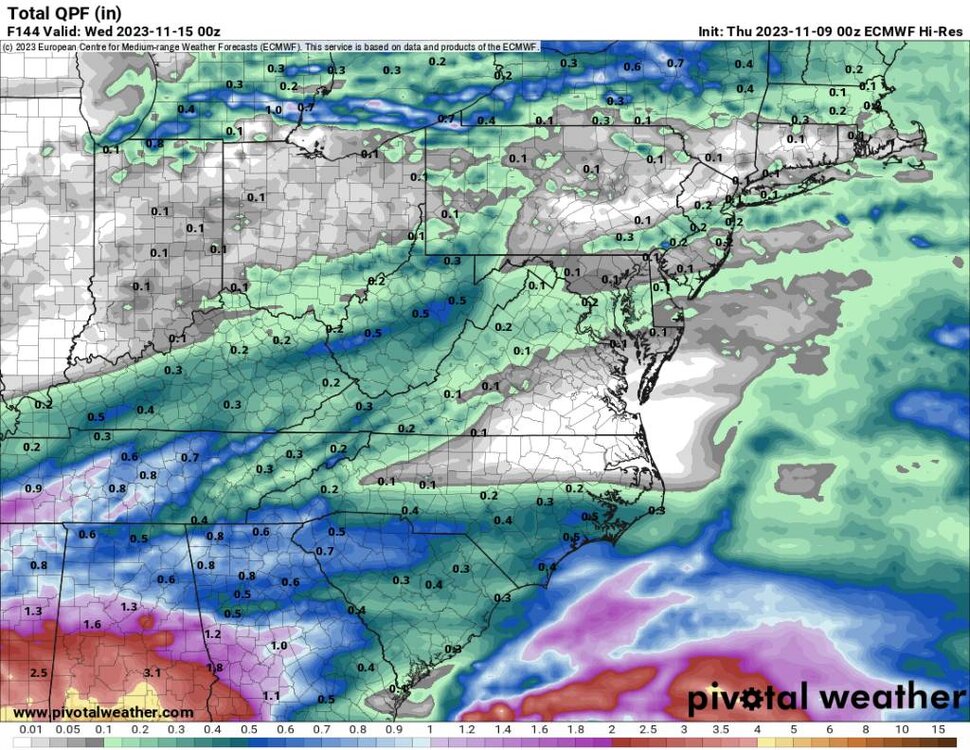
-
2023-2024 Fall/Winter Mountain Thread
Met1985 replied to The Alchemist's topic in Southeastern States
00z gfs a bit better. Sent from my SM-G998U using Tapatalk
-
2023-2024 Fall/Winter Mountain Thread
Met1985 replied to The Alchemist's topic in Southeastern States
Yeah I have my doubts about any real meaningful rainfall over the next 10 or so days. -
2023-2024 Fall/Winter Mountain Thread
Met1985 replied to The Alchemist's topic in Southeastern States
Also from Tomorrow to Friday we will drop some 20 to 25 degrees for highs which will be a shock to the system. -
2023-2024 Fall/Winter Mountain Thread
Met1985 replied to The Alchemist's topic in Southeastern States
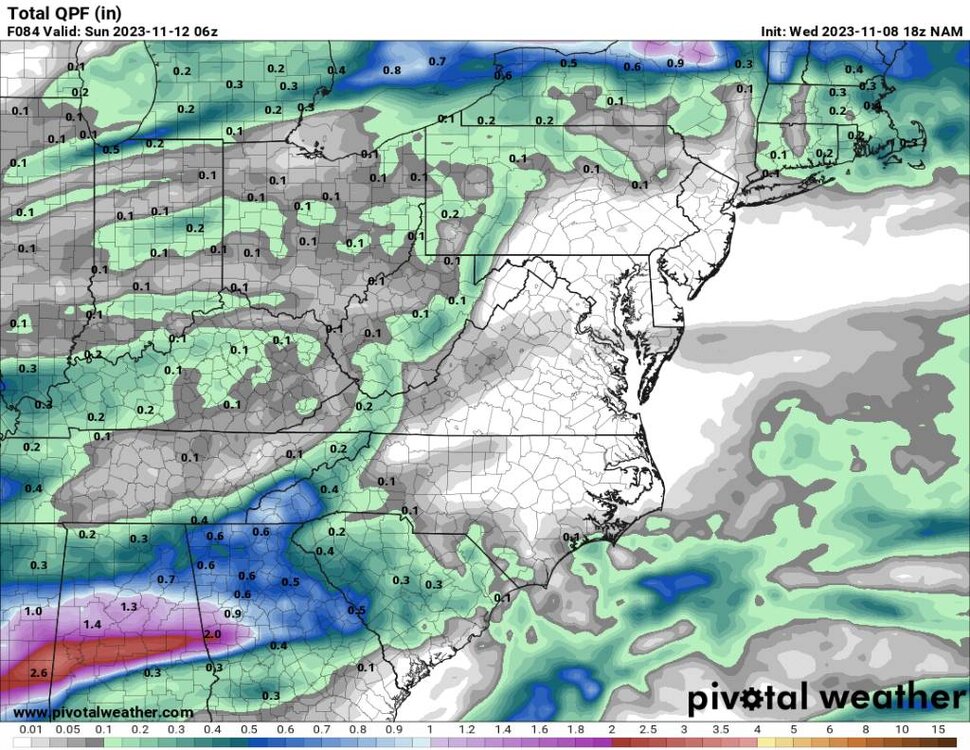
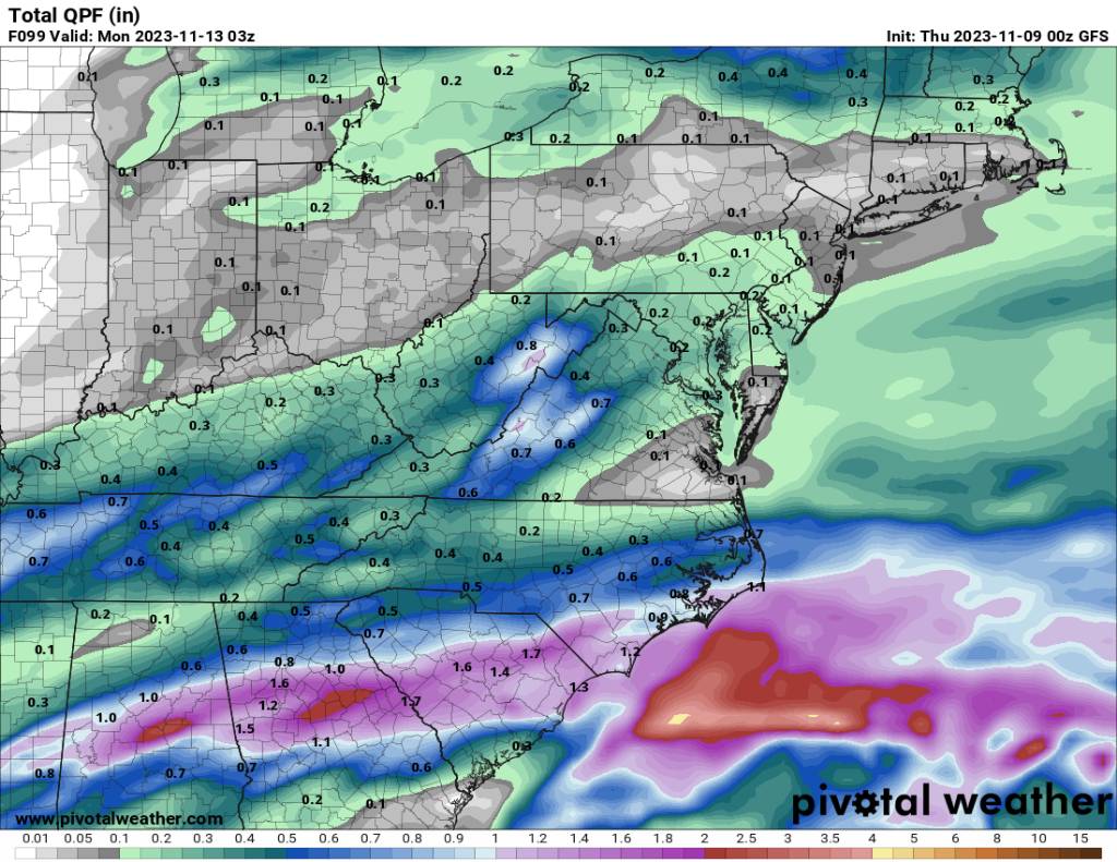
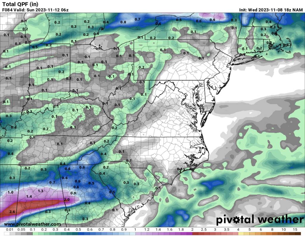
We have gfs as paltry rainfall, NAM as mentioned, and the Euro more robust. Sent from my SM-G998U using Tapatalk.thumb.jpg.99790a382653cafa51de196c8f029248.jpg)
.thumb.jpg.b56b1bf71872016472f11e169ae64fd5.jpg)
-
Yeah we need a whole hemispheric shake up.
-
Yeah we have several wildfires going on currently in WNC. This is one of the driest Falls that I can remember around here. Hoping the pattern changes soon but it doesn't look promising.
-
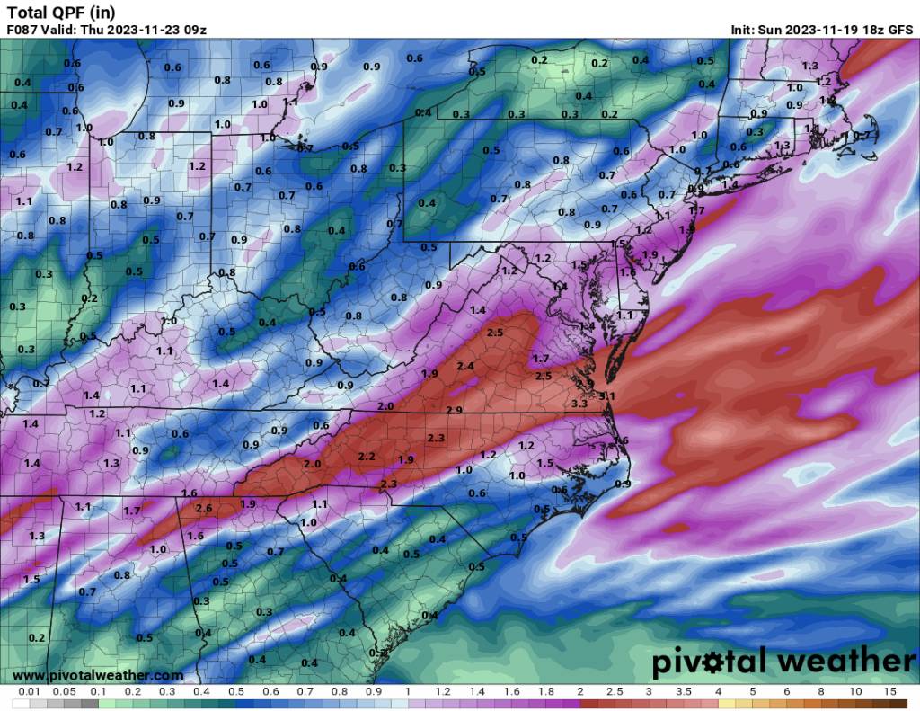
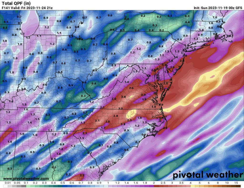
That is pathetic for the whole run. This is a shit pattern we are in.
-
We should be used to this. Just another torch pattern.


.jpg.9824b467c7197dd0b6047bf3787a9a8e.jpg)
.jpg.4aa548dd1f8f43f8a4b7a5231b365b37.jpg)