Met1985
-
Posts
16,909 -
Joined
-
Last visited
Content Type
Profiles
Blogs
Forums
American Weather
Media Demo
Store
Gallery
Everything posted by Met1985
-

2023-2024 Fall/Winter Mountain Thread
Met1985 replied to The Alchemist's topic in Southeastern States
A solid quarter inch of snow on the ground with a temp of 25. Only in the mountains can we have flooding one day and literally snowy roads the next... -
2023-2024 Fall/Winter Mountain Thread
Met1985 replied to The Alchemist's topic in Southeastern States
Getting some light snow action here in south Asheville. Cannot wait to get back home because it looks like a good bit of moisture made it through Haywood. -
2023-2024 Fall/Winter Mountain Thread
Met1985 replied to The Alchemist's topic in Southeastern States
You should do really well with this orientation. -
2023-2024 Fall/Winter Mountain Thread
Met1985 replied to The Alchemist's topic in Southeastern States
Nope it is snowing in Haywood all the way into Canton as well. -
2023-2024 Fall/Winter Mountain Thread
Met1985 replied to The Alchemist's topic in Southeastern States
Moderate snow at my casa. -
2023-2024 Fall/Winter Mountain Thread
Met1985 replied to The Alchemist's topic in Southeastern States
The orientation of the snow coming in is a bit different. It's coming in from the SW. which will actually give the southern mountains a chance at seeing some decent snow. Haywood virtually gets shadowed because of the Balsams. You can see it on all the models. Interesting for sure but I hope most enjoy. -
2023-2024 Fall/Winter Mountain Thread
Met1985 replied to The Alchemist's topic in Southeastern States
The wind has definitely picked up with a temp of 38 currently. -
2023-2024 Fall/Winter Mountain Thread
Met1985 replied to The Alchemist's topic in Southeastern States
This batch moving through is intense. -
2023-2024 Fall/Winter Mountain Thread
Met1985 replied to The Alchemist's topic in Southeastern States
Dang I hate to hear that. Too much water all at once. -
2023-2024 Fall/Winter Mountain Thread
Met1985 replied to The Alchemist's topic in Southeastern States
Lightning popping all around now. A 38 degree thunderstorm. Crazy. -
2023-2024 Fall/Winter Mountain Thread
Met1985 replied to The Alchemist's topic in Southeastern States
Just had a huge bolt of lightning strike around the house! One of those window rattling thunders! And it's absolutely pounding the rainfall! Big bolt of lightning. -
2023-2024 Fall/Winter Mountain Thread
Met1985 replied to The Alchemist's topic in Southeastern States
Yeah the river here has risen a lot probably the most it's risen in 2 years... That makes a lot of people uncomfortable around here. Going from severe drought to severe flooding is unnerving here in Haywood. -
2023-2024 Fall/Winter Mountain Thread
Met1985 replied to The Alchemist's topic in Southeastern States
Yeah my stream had basically dried up and this is the fullest I've seen it since spring here. -
2023-2024 Fall/Winter Mountain Thread
Met1985 replied to The Alchemist's topic in Southeastern States
I'm over 4 inches and counting this morning. Water is freaking everywhere. -
2023-2024 Fall/Winter Mountain Thread
Met1985 replied to The Alchemist's topic in Southeastern States
Good. -
2023-2024 Fall/Winter Mountain Thread
Met1985 replied to The Alchemist's topic in Southeastern States
No kidding! Absolutely torrential rainfall the past several hours. Relentless. -
2023-2024 Fall/Winter Mountain Thread
Met1985 replied to The Alchemist's topic in Southeastern States
Yeah all the way to the gulf Sent from my SM-G998U using Tapatalk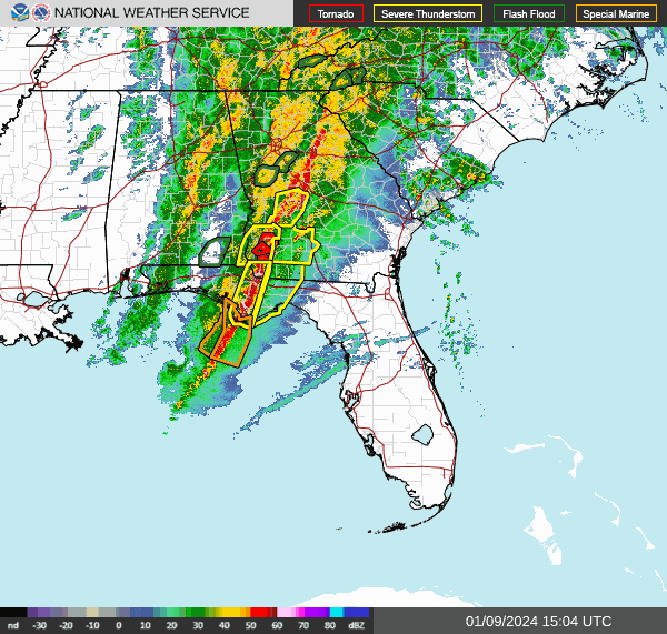
-
2023-2024 Fall/Winter Mountain Thread
Met1985 replied to The Alchemist's topic in Southeastern States
A ton of rainfall still to come. Sent from my SM-G998U using Tapatalk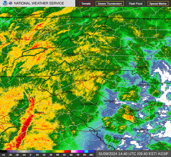
-
2023-2024 Fall/Winter Mountain Thread
Met1985 replied to The Alchemist's topic in Southeastern States
Yeah it's been hammering here all night. My creek below my house has run out, streams are up and river is on the rise. -
Next season we should be back in NINA I believe.
-
2023-2024 Fall/Winter Mountain Thread
Met1985 replied to The Alchemist's topic in Southeastern States
Getting some of those embedded storms now. -
2023-2024 Fall/Winter Mountain Thread
Met1985 replied to The Alchemist's topic in Southeastern States
Big time rainfall coming. Sent from my SM-G998U using Tapatalk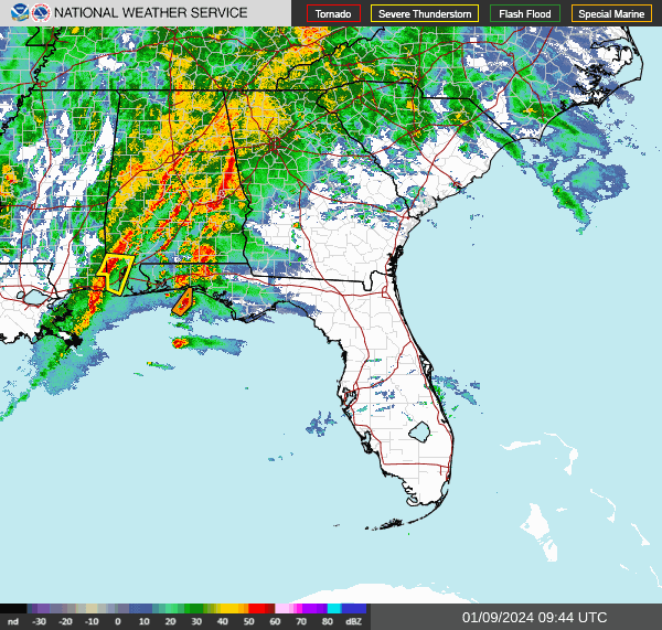
-
2023-2024 Fall/Winter Mountain Thread
Met1985 replied to The Alchemist's topic in Southeastern States
Lots of heavy rainfall. Sent from my SM-G998U using Tapatalk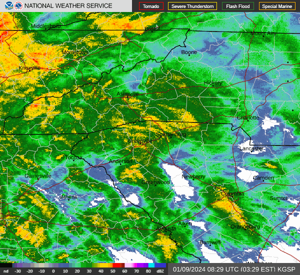
-
2023-2024 Fall/Winter Mountain Thread
Met1985 replied to The Alchemist's topic in Southeastern States
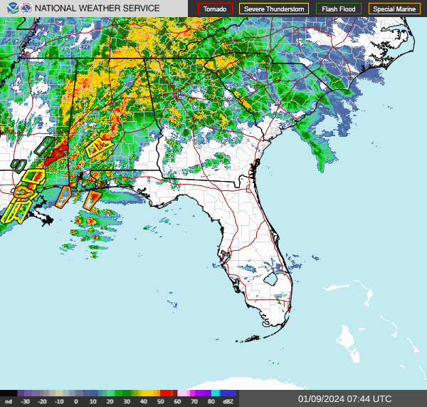
If we get into 1 or 2 of those intense bands then lookout. But already a ton of water has fallen. Moderate to heavy rainfall in Haywood and Buncombe. -
2023-2024 Fall/Winter Mountain Thread
Met1985 replied to The Alchemist's topic in Southeastern States
Radar is impressive. Sent from my SM-G998U using Tapatalk