
Kay
-
Posts
2,313 -
Joined
Content Type
Profiles
Blogs
Forums
American Weather
Media Demo
Store
Gallery
Everything posted by Kay
-
30
-
A fox just walked past my house with a fish in his/her mouth. Then headed down the street and into some woods. I wonder if there are kits. Idk if the fish was a catch or a find...but I want it to be a catch because that's much cooler. Looked fresh to me and intact.
-
I escaped the wedge around 1 pm. Damp and cool when I got in the car at home...sunny and glorious when I got out in College Park.
-
Better round came through around 11-midnight with thunder and lightning. A little over half inch rain since yesterday.
-
A rumble or two earlier. Just a gentle rain at present. The breeze coming in the windows smells good. High of 85 today. More clouds than sun made it a good afternoon for yard/garden cleanup.
-
Good week for temp gradient weenies
-
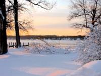
Sun finally visible under the clouds, instant blinding sunset
-
Excellent content, thank you for your service. Looks a bit like the Matterhorn
-
Just got back from a hike in the woods locally. Low 60s. 10/10 March day! I walk in these woods nearly every day and today is it - first green up is happening.
-
Yes, same. Genuine excitement. For Roger, it was definitely not just "an imby sport".
-
 I hear the roar approaching.
 -
Awful, sorry to hear this. He always seemed like a very nice person. RIP
-
Especially after making your opinion and boredom known numerous times. You're on the record and your work is done
- 1,093 replies
-
- 6
-

-

-

-

-
- severe
- thunderstorms
- (and 1 more)
-
Finally getting rates and snow. Beautiful parachutes. No accum 35
-
I'm still at home in Harford Co where it has only been rain imby. 38. Heavier precip on the way.. Heading to Columbia in a couple hours, so tragically missing the deathbanding there.
-
Just caught up on like 4 pages, and despite the troll, and consistent warnings from our own throughout, I don't think a single poster is delusional about today. Little sad, actually. Bittersweet, not being delusional.
-
Minor quibble but I would've have gone with BAC in this analogy I'll be in HoCo as of tomorrow evening. Should be good for an extra inch or 3 of snowmap Edit: semi-ninjad by Randy. I'm chasing that deathband
-
Moving this here since the first rumble of spring counts as severe thread worthy (doesn't it?). Had rain, thunder, and lightning nearby per Radarscope about an hour ago. Cleared and sun out now.
-
Seriously wtf. Kind of fun though, and no stress. Just to sit and marvel at it.
-
72
-
High of 73. Had a great ramble in the woods this afternoon. Not that green here yet. Almost weird to see the sun! Many turtles were out enjoying it. Frog chorus also going strong.
-
Saw my first forsythia blooms in Columbia the other day.
-
Hair is an actual weather instrument. (Hairometer?)
-
High of 71, mostly cloudy. Glorious sunset in progress.