
Kay
-
Posts
2,313 -
Joined
Content Type
Profiles
Blogs
Forums
American Weather
Media Demo
Store
Gallery
Everything posted by Kay
-
Cloudy and 55 currently
-
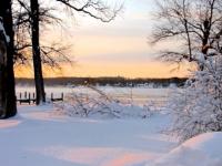
Fine powdered sugar decktopper achieved. The dead leaves on the grass are whitening. Enjoying the view I expected nothing. Snow is always welcome.
-
Light snow fine flakes 32/23
-
Entering the chat with my HWO 32/9
-
Heard it again but had an obstructed view atm, then heard again in the late afternoon from indoors. Missed again. Otoh...I randomly saw a pair of hawks mating in a tree! Heard a ruckus, looked up, flipped out. Red-shouldered? It was quick. Also saw a cormorant later. Since Ive been grumpy-posting about March and winter's end, I will say today was a nice example for a good March day, barely cracked 50 (high 52), sunny, light winds, very refreshing! I was surprised how much snow was hanging on in certain shaded stretches in the neighborhood.
-
Think I just heard an osprey. No visual. Time for a lunchtime mini hike. 45
-
More mesonet stations on the way?
-
Warm-ish March is fine if we must. Torching March = mud + mosquitos. Terrible.
-
Both POS but your thread had more entertainment value
-
Good case, Maestro. Also "a half beat too slow" lol wtf. Tough crowd
-
I know I'm probably an outlier, but I always hope it's cold or cool as long as possible. I really enjoy spring, once it's proper spring. But forecast warmth now is still a drag for me. Idgaf about shorts and tshirts. Lawn care can wait as long as possible. I'll allow that warmer hikes are mildly appealing. March is a terrible month. The worst. A few torches in it doesn't make it better. All you bring on spring weenies, I get you, your warmth cravings are normal, I'm just not like that.
-
Omg thanks for the comeback lmao I'm dying. wait no...NO...I'm not dying. I feel good. I feel like dancing! I think I could see a few more snowflakes in March! don't take meeeeeeee
-
"Current satellite imagery, ship buoys, and surface observations near the East Coast are showing that the main surface low is about 150 miles ESE of Ocean City, MD and 150 miles ENE of Virginia Beach, VA. It is about 50 miles further to the east-northeast and about 6 hours faster than model guidance suggested earlier." LWX early Sunday evening
-
That is a dramatic tale. Glad no one died in a stampede! I had the same experience with people disbelieving. Times like that you get into weather chats with so many people lol. I'll probably never forget a random moment, standing in line at a 7-11 briefly talking to a dude who was in town from CO (and clearly very proud of his snow climo) who confidently told me how it was going to be nbd. He wouldn't believe me. I agree, once in a lifetime. For my location anyway, and my tastes, no winter has been better.
-
I will reply in banter tbc
-
At the risk of starting a memory lane posting spree...yes. And in particular, for me, the period BETWEEN the two storms, when we knew the second one was coming, too...it was all just unbelievably exciting and amazing! @bncho I hope you and other younger folks get to experience something like that winter.
-
Nice and eerie. There have been some wild fog/bay melt looks around here lately, but haven't captured anything that does justice.
-
Update: Today's the day. Still swaths of near-shore ice atm but otherwise the river is open.
-
Everyone needs to know at least kvetch and chutzpah.
-

The February 22-23 Late Season Miracle: JV Disco/Banter Thread
Kay replied to bncho's topic in Mid Atlantic
I know, I get it. Can't speak for others but suspect it's probably ok to talk Nina again. If one can bear to lol. -
3"
-
The February 22-23 Late Season Miracle: JV Disco/Banter Thread
Kay replied to bncho's topic in Mid Atlantic
Hey, are you gonna be salty forever about a gentle suggestion by a met to not focus on Nina stuff? I was on at that moment, and I truly think the idea was, it's a fast-moving obs thread during a storm, and Nina talk can quickly add up to a lot of posts. I think the met even said something making it clear they meant, just not now during storm mode. -
The inevitable AA co. deathband
-
1.75" just now


