donsutherland1
-
Posts
24,169 -
Joined
Content Type
Profiles
Blogs
Forums
American Weather
Media Demo
Store
Gallery
Everything posted by donsutherland1
-
October-November had mean temperatures of a half standard deviation or more above normal as recently as 2014 and a very cold winter (2014-15) followed.
-
Yes. 48.
-
Through October 18, Central Park has had a mean temperature of 64.6° (11th warmest). However, October 2021 would rank among the top 3 warmest starts to October without Central Park's trees issue. https://www.americanwx.com/bb/topic/55633-october-2021/?do=findComment&comment=6145116 Using the regression equation noted in the linked post, the figure would be approximately 67.4° (3rd warmest) without the trees issue. Using the shorter 1948-2021 period, which reflects the period of record for numerous local stations, it would rank 2nd. A ranking of 3rd would be in line with what has occurred around the region. Regional Ranking for Select Stations Record Length of 50 Years or More) and start of record: Albany: 4th (1874) Bridgeport: 5th (1948) Islip: 3rd (1963) New Brunswick: Tied 6th (1893) New Haven: 1st (1948) New York City-JFK: 4th (1948) New York City-LGA: 5th (1939) Newark: 2nd (1931) Philadelphia: Tied 5th (1873) Poughkeepsie: 2nd (1931) White Plains: 6th (1948) The biggest issue concerns artificially low maximum temperatures. The October 1-18 average high temperature at Central Park has been 70.3°. That is lower than the averages at both JFK Airport and LaGuardia Airport. In addition, on 16 of the 18 days (89%), Central Park registered the lowest maximum temperature or was tied with the lowest maximum temperature. In sum, the neglect of the trees issue at Central Park is impairing the integrity of the climate record when the trees are leafed out.
-
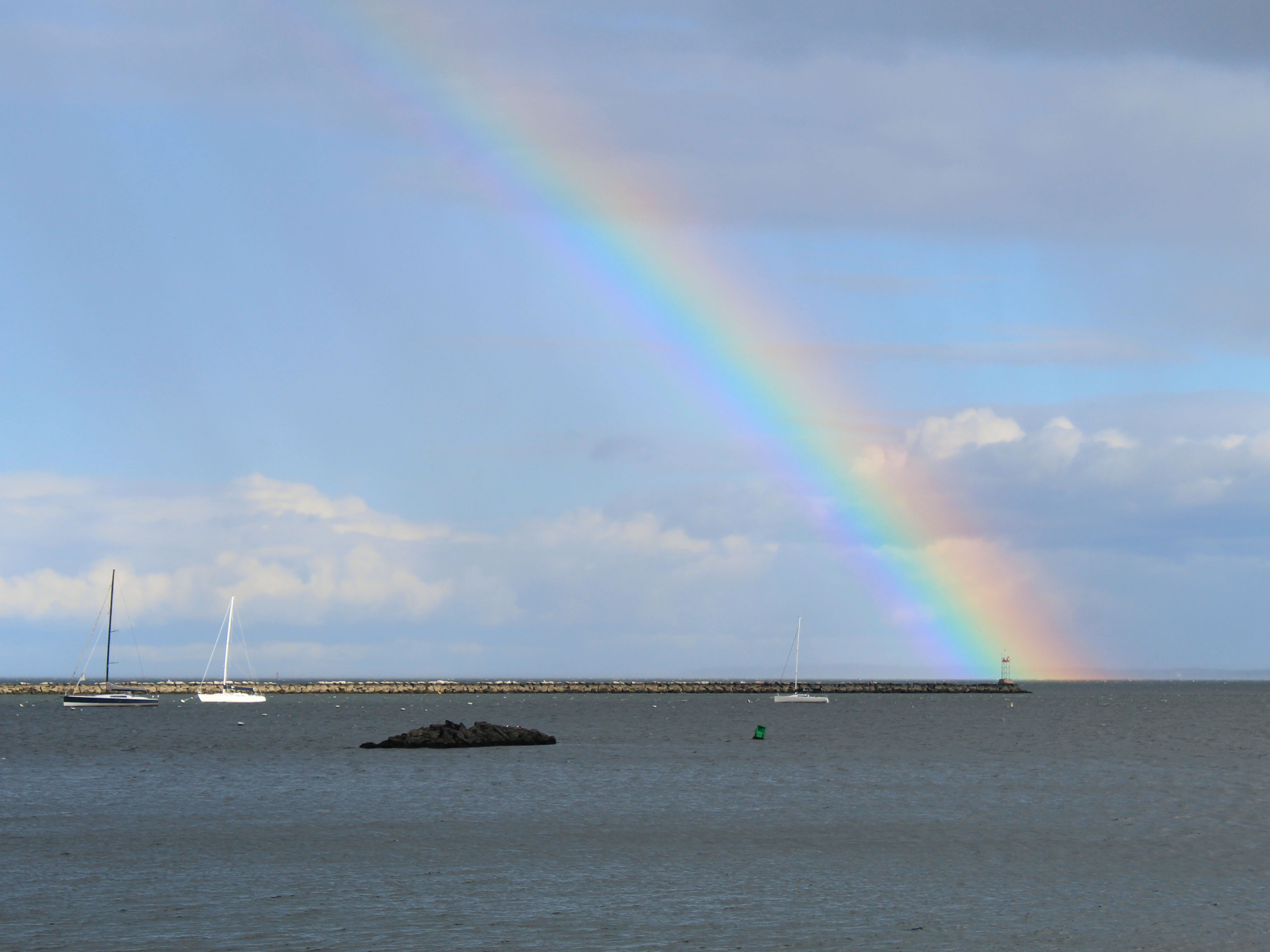
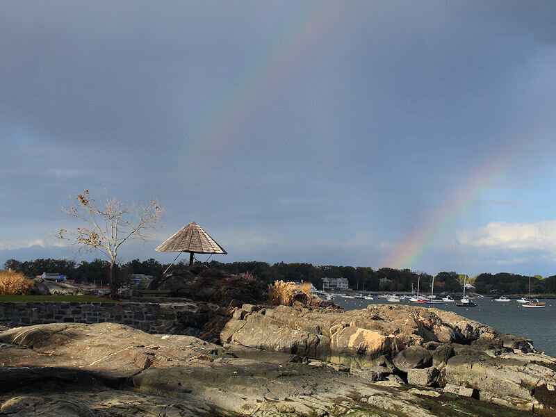
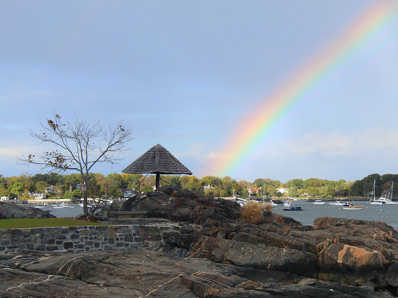
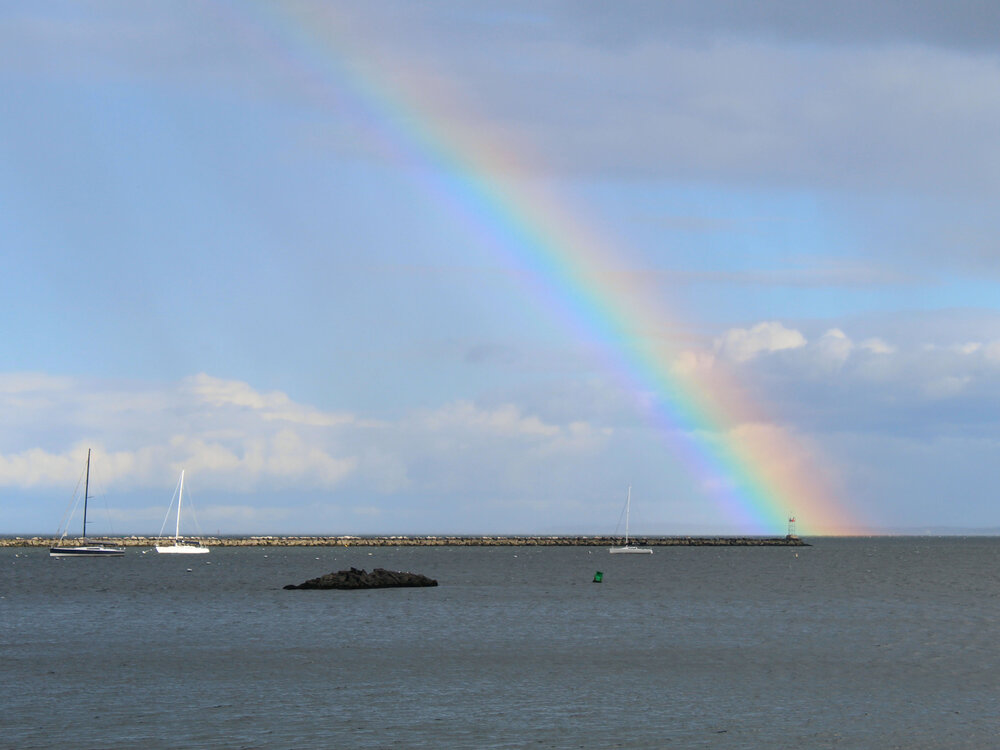
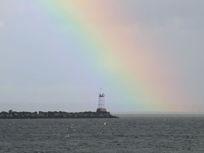
An amazing rainbow.
-
Morning thoughts… It will partly to mostly sunny and milder today. High temperatures will likely reach the middle and upper 60s in most of the region. Likely high temperatures around the region include: New York City (Central Park): 65° Newark: 71° Philadelphia: 69° Normals: New York City: 30-Year: 63.3°; 15-Year: 64.0° Newark: 30-Year: 64.8°; 15-Year: 65.8° Philadelphia: 30-Year: 66.0°; 15-Year: 66.6° It will turn noticeably milder tomorrow.
-
October Discussion: Bring the Frost-Hold the Snow
donsutherland1 replied to 40/70 Benchmark's topic in New England
At 10:54 pm, the temperature at Boston had fallen to 49 degrees. That is the latest first 40s temperature on record. The old record was October 13, 2018. 6 of the 15 cases where the first such reading occurred October 1 or later have occurred since 2010. 4 of the last 5 years have seen the first 40s occur on October 1 or later. The mean first date has increased as follows during the last three base periods: 1971-00: September 18; 1981-10: September 19: 1991-20: September 23. Records go back to 1872. -
Yes. The high was 64.
-
I have never seen more than two.
-
JFK had a low of 50 so far. It should be in the 40s tonight.
-
Today was the coolest day so far this season. New York City and Philadelphia recorded low temperatures in the 40s for the first time this season. Tomorrow will be another cool day. After perhaps the coldest readings so far this season, the mercury will reach the lower and middle 60s across the area. Warmer air will return Wednesday. Another cool shot is likely for the weekend. Elsewhere, Bismarck recorded its 154th 70° day. That broke the annual record of 153 days, which had been set in 2016. Caribou has yet to record its first freeze of the season. The previous latest first freeze occurred on October 17, 1970. The MJO has now completed its passage through Phase 5 at a very high amplitude. During the 1991-2020 period, there were 6 cases with passage through Phase 5 with at least three days at an amplitude of 1.500 or above: 1998, 2000, 2004, 2010, 2017, and 2020. There was a strong signal for the second half of October to wind up warmer than normal (83%) cases in the New York City area. However, that signal broke down to a 50-50 split for the first 10 days of November. That hints at possible timing for a pattern transition depending on the pattern evolution and changes in the teleconnections. Fall 2021 will likely be wetter to much wetter than normal in the northern Middle Atlantic region. Since 1869, there have been 9 August cases where New York City picked up 20.00" or more rainfall during the summer. Two thirds of those cases (and 4/5 of those with summer mean temperatures of 73.0° or above) had 17.00" or more fall precipitation in New York City. 2011 is probably the closest match in terms of precipitation and a nearly identical summer mean temperature. Mean fall precipitation for those 9 cases was 14.86". The median was 17.35". The 1991-2020 normal value is 12.27". Following very wet July-September periods, winter (December-February) precipitation has typically been near or below normal. The most recent exception was winter 2018-19. The ENSO Region 1+2 anomaly was -0.2°C and the Region 3.4 anomaly was -0.8°C for the week centered around October 13. For the past six weeks, the ENSO Region 1+2 anomaly has averaged +0.15°C and the ENSO Region 3.4 anomaly has averaged -0.43°C. La Niña conditions will likely persist through at least mid-winter. The SOI was +19.66 today. The preliminary Arctic Oscillation (AO) figure was -1.464 today. On October 16 the MJO was in Phase 6 at an amplitude of 0.589 (RMM). The October 15-adjusted amplitude was 0.967 (RMM). Based on sensitivity analysis applied to the latest guidance, there is an implied 93% probability that New York City will have a warmer than normal October (1991-2020 normal). October will likely finish with a mean temperature near 61.6° (3.7° above normal).
-
A heavier shower moving out over the Long Island Sound resulted in a rainbow.
-
Late morning with a distinct autumn “feel.”
-
Morning thoughts… This morning, the temperature fell below 50° for the first time this season in Central Park. That is the second latest first occurrence on record. Boston is still waiting for its first 40s of the season. The old record was October 13, 2008. It will partly to mostly sunny and cool today. High temperatures will likely reach the upper 50s and lower 60s in most of the region. Likely high temperatures around the region include: New York City (Central Park): 60° Newark: 64° Philadelphia: 63° Normals: New York City: 30-Year: 63.6°; 15-Year: 64.4° Newark: 30-Year: 65.2°; 15-Year: 66.2° Philadelphia: 30-Year: 66.4°; 15-Year: 67.0° Tomorrow will be another autumn-like day with readings mainly topping out in the lower 60s.
-
Tomorrow and Tuesday will be cool days. Nights will be mainly in the 40s and highs in the upper 50s and lower 60s. Warmer air will likely return by mid-week. Another cool shot is likely for the weekend. Out West, Bismarck reached 75°. That was the 153rd 70° or above day, which tied the record set in 2016. Boston is still awaiting its first temperature in the 40s. The previous latest first such occurrence was October 13, 2018. The MJO has now completed its passage through Phase 5 at a very high amplitude. During the 1991-2020 period, there were 6 cases with passage through Phase 5 with at least three days at an amplitude of 1.500 or above: 1998, 2000, 2004, 2010, 2017, and 2020. There was a strong signal for the second half of October to wind up warmer than normal (83%) cases in the New York City area. However, that signal broke down to a 50-50 split for the first 10 days of November. That hints at possible timing for a pattern transition depending on the pattern evolution and changes in the teleconnections. Fall 2021 will likely be wetter to much wetter than normal in the northern Middle Atlantic region. Since 1869, there have been 9 August cases where New York City picked up 20.00" or more rainfall during the summer. Two thirds of those cases (and 4/5 of those with summer mean temperatures of 73.0° or above) had 17.00" or more fall precipitation in New York City. 2011 is probably the closest match in terms of precipitation and a nearly identical summer mean temperature. Mean fall precipitation for those 9 cases was 14.86". The median was 17.35". The 1991-2020 normal value is 12.27". Following very wet July-September periods, winter (December-February) precipitation has typically been near or below normal. The most recent exception was winter 2018-19. La Niña conditions have now developed. The ENSO Region 1+2 anomaly was +0.1°C and the Region 3.4 anomaly was -0.7°C for the week centered around October 6. For the past six weeks, the ENSO Region 1+2 anomaly has averaged +0.08°C and the ENSO Region 3.4 anomaly has averaged -0.35°C. La Niña conditions will likely persist through at least mid-winter. The SOI was +19.66 today. The preliminary Arctic Oscillation (AO) figure was -1.732 today. On October 15 the MJO was in Phase 6 at an amplitude of 0.966 (RMM). The October 14-adjusted amplitude was 1.417 (RMM). Based on sensitivity analysis applied to the latest guidance, there is an implied 90% probability that New York City will have a warmer than normal October (1991-2020 normal). October will likely finish with a mean temperature near 61.7° (3.8° above normal).
-
All are calendar year figures. 70-degree days: Click column heading to sort ascending, click again to sort descending. Rank Year Number of Days Max Temperature >= 70 Missing Count 1 2010 173 0 2 2015 171 0 - 1985 171 0 4 2021 170 76 - 2007 170 0 6 1994 169 0 - 1946 169 0 8 1991 168 0 - 1986 168 0 10 2012 167 0 - 1995 167 0 80-degree days: Click column heading to sort ascending, click again to sort descending. Rank Year Number of Days Max Temperature >= 80 Missing Count 1 2015 118 0 2 2021 115 76 3 1994 114 0 4 2016 113 0 - 1993 113 0 - 1991 113 0 7 2011 111 0 - 2010 111 0 9 1959 108 0 10 2007 106
-
The new data from CPC comes out tomorrow. It should be negative at that point.
-
70 or above: 5th place 75 or above: 1st with 126 days (old record: 124, 1971, 2001, and 2010) 80 or above: Tied for 12th
-
Morning thoughts… It will partly to mostly sunny and noticeably cooler today. High temperatures will likely reach lower and middle 60s in most of the region. Likely high temperatures around the region include: New York City (Central Park): 62° Newark: 66° Philadelphia: 65° Normals: New York City: 30-Year: 64.0°; 15-Year: 64.8° Newark: 30-Year: 65.5°; 15-Year: 66.7° Philadelphia: 30-Year: 66.7°; 15-Year: 67.4° Monday and Tuesday will be autumn-like days with readings mainly topping out in the upper 50s and lower 60s.
-
3 days for each record.
-
Some additional showers are likely, especially before midnight. Behind the frontal passage responsible for the showers and earlier thunderstorms, readings will return to near normal levels tomorrow and Monday. Warmer air will likely return near the middle of next week. Newark reached 70° for the 170th time this year. As a result, 2021 is now tied with 2007 for the 4th most days on record. Newark also reached 80° for the 115th time this year. That is the 2nd highest number of such days. At 11:59 pm yesterday, Bismarck saw the temperature dip to 32° under clear skies and a calm wind. That is the latest first freeze on record for Bismarck. The old record was October 14, 2008. The MJO has now completed its passage through Phase 5 at a very high amplitude. During the 1991-2020 period, there were 6 cases with passage through Phase 5 with at least three days at an amplitude of 1.500 or above: 1998, 2000, 2004, 2010, 2017, and 2020. There was a strong signal for the second half of October to wind up warmer than normal (83%) cases in the New York City area. However, that signal broke down to a 50-50 split for the first 10 days of November. That hints at possible timing for a pattern transition depending on the pattern evolution and changes in the teleconnections. Fall 2021 will likely be wetter to much wetter than normal in the northern Middle Atlantic region. Since 1869, there have been 9 August cases where New York City picked up 20.00" or more rainfall during the summer. Two thirds of those cases (and 4/5 of those with summer mean temperatures of 73.0° or above) had 17.00" or more fall precipitation in New York City. 2011 is probably the closest match in terms of precipitation and a nearly identical summer mean temperature. Mean fall precipitation for those 9 cases was 14.86". The median was 17.35". The 1991-2020 normal value is 12.27". Following very wet July-September periods, winter (December-February) precipitation has typically been near or below normal. The most recent exception was winter 2018-19. La Niña conditions have now developed. The ENSO Region 1+2 anomaly was +0.1°C and the Region 3.4 anomaly was -0.7°C for the week centered around October 6. For the past six weeks, the ENSO Region 1+2 anomaly has averaged +0.08°C and the ENSO Region 3.4 anomaly has averaged -0.35°C. La Niña conditions will likely persist through at least mid-winter. The SOI was +28.43 today. The preliminary Arctic Oscillation (AO) figure was -0.788 today. On October 14 the MJO was in Phase 6 at an amplitude of 1.416 (RMM). The October 13-adjusted amplitude was 1.686 (RMM). Based on sensitivity analysis applied to the latest guidance, there is an implied 94% probability that New York City will have a warmer than normal October (1991-2020 normal). October will likely finish with a mean temperature near 61.9° (4.0° above normal).
-
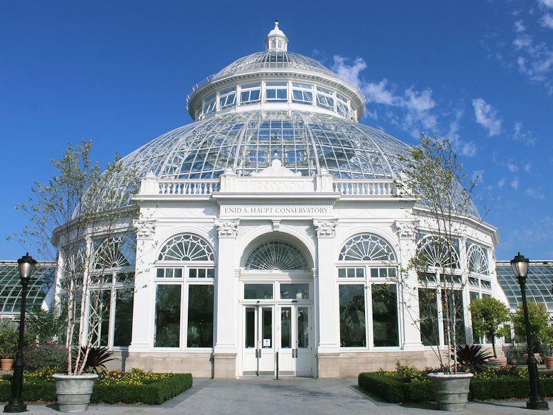
The temperature rose into the middle 70s at the New York Botanical Garden. Inside, the chrysanthemum show is underway.


-
Numerous cities saw their warmest Oct 1-15 including: Akron, OH; Grand Rapids, MI; Milwaukee; Rockford, IL; and, Youngstown, OH. Baltimore (3rd), Chicago (2nd); Cleveland (2nd), Detroit (2nd), and Duluth (2nd) were very warm. Locally, Newark was tied for 3rd warmest.
-
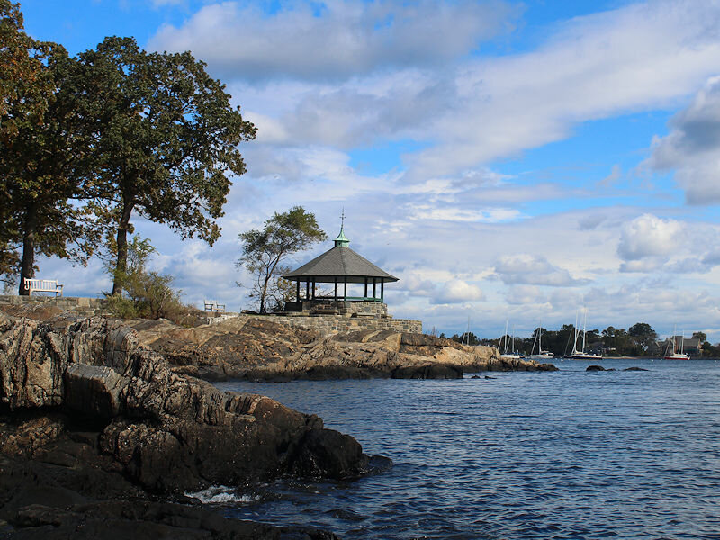
In spite of the calendar and a breeze off the Long Island Sound, it felt like a late August morning.

-
Morning thoughts… It will become mostly cloudy but remain unseasonably warm. Showers and thunderstorms are possible as a strong cold front moves across the region. High temperatures will likely reach the middle and upper 70s in most of the region. Likely high temperatures around the region include: New York City (Central Park): 75° Newark: 80° Philadelphia: 80° Normals: New York City: 30-Year: 64.4°; 15-Year: 65.2° Newark: 30-Year: 65.9°; 15-Year: 67.1° Philadelphia: 30-Year: 67.1°; 15-Year: 67.9° Sunday and Monday will be autumn-like days with readings mainly topping out in the upper 50s and lower 60s.
-
JFK’s high was 77.