

donsutherland1
-
Posts
24,189 -
Joined
Content Type
Profiles
Blogs
Forums
American Weather
Media Demo
Store
Gallery
Everything posted by donsutherland1
-
Morning thoughts… Today will be mostly sunny and unseasonably warm. High temperatures will likely reach the upper 70s and lower 80s in most of the region. Likely high temperatures around the region include: New York City (Central Park): 78° Newark: 83° Philadelphia: 81° Normals: New York City: 30-Year: 71.9°; 15-Year: 73.1° Newark: 30-Year: 73.4°; 15-Year: 74.9° Philadelphia: 30-Year: 74.7°; 15-Year: 75.9° Tomorrow will be another warm day, but a strong cold front will move across the region tomorrow night.
-
Yes. That’s where the warmest anomalies will be.
-
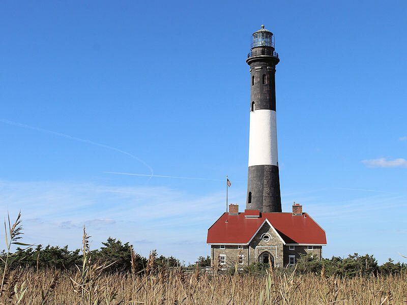
It’s usually quite breezy up there. The views have been great the past few days with the absence of haze.
-
Tomorrow will be mostly sunny and unseasonably warm. Temperatures will likely reach the upper 70s and lower 80s. Tuesday will also be warm, but a cold front will push across the region overnight bringing some showers and perhaps thundershowers to parts of the region. Afterward, the coolest air so far this fall will close out the month. The MJO had recently been locked in Phase 3 at a high amplitude, frequently in excess of 1.500. Only 2006 and 2009 saw the MJO in Phase 3 at an amplitude of 1.500 or above for 2 or more days during September 10-20. Both years saw September end with a cold shot that continued into the first days of October. Both days saw Central Park's temperature fall to 49° on September 30. The guidance has now come into better agreement concerning a cool shot to end the month. Afterward, in the MJO cases, a fairly sharp rebound in temperatures followed. October wound up wetter than normal with 7.07" rainfall in 2006 and 5.58" of rainfall in 2009. Normal rainfall (1991-2020) is 4.38". 2021 remains on course to become the 6th out of the last 7 years during which September has had a mean temperature of 70° or above in New York City. Prior to 2000, New York City saw such warmth on average once every five years. In short, September has become more an extension of summer than a gateway to autumn in the New York City area. There is increasing consensus on the long-range guidance that October will be an unseasonably warm month. The first half could feature much above normal readings in the Northern Plains into Central Canada. Fall 2021 will likely be wetter to much wetter than normal in the northern Middle Atlantic region. Since 1869, there have been 9 August cases where New York City picked up 20.00" or more rainfall during the summer. Two thirds of those cases (and 4/5 of those with summer mean temperatures of 73.0° or above) had 17.00" or more fall precipitation in New York City. 2011 is probably the closest match in terms of precipitation and a nearly identical summer mean temperature. Mean fall precipitation for those 9 cases was 14.86". The median was 17.35". The 1991-2020 normal value is 12.27". The ENSO Region 1+2 anomaly was +0.2°C and the Region 3.4 anomaly was -0.4°C for the week centered around September 15. For the past six weeks, the ENSO Region 1+2 anomaly has averaged +0.03°C and the ENSO Region 3.4 anomaly has averaged -0.45°C. Neutral ENSO conditions will likely prevail through September. Afterward, La Niña conditions could begin to develop. The SOI was -0.24 today. The preliminary Arctic Oscillation (AO) figure was -0.455 today. On September 24 the MJO was in Phase 4 at an amplitude of 0.714 (RMM). The September 23-adjusted amplitude was 0.945 (RMM). Based on sensitivity analysis applied to the latest guidance, there is an implied 94% probability that New York City will have a warmer than normal September (1991-2020 normal). September will likely finish with a mean temperature near 70.4° (1.2° above normal).
-
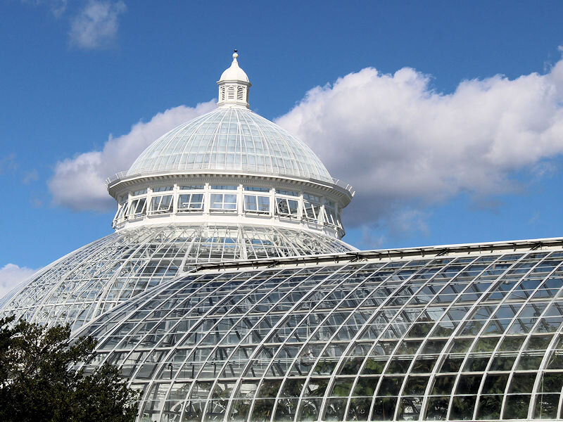
The afternoon saw plentiful sunshine, fluffy cumulus clouds, and readings in the 70s. The New York Botanical Garden is transitioning to more of an autumn appearance.
-
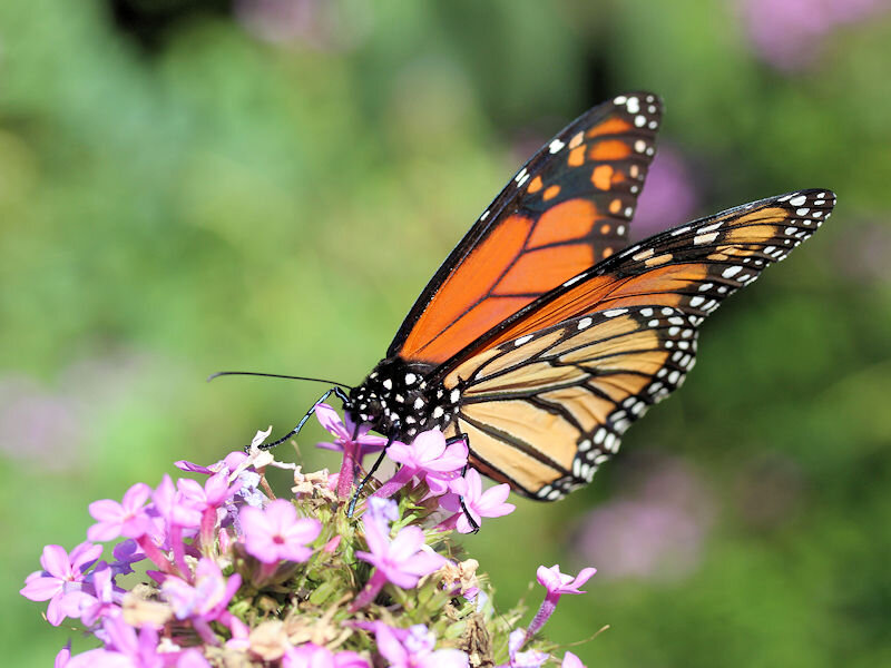
Wonderful capture.
-
The percentage of EPS members showing sufficient rain to bring Central Park’s monthly total to 10.00” has increased in recent runs. The last three cycles: 9/24 12z: 29% 9/25 0z: 41% 9/25 12z: 57% (ensemble mean: 0.3”)
-
Morning thoughts… Today will be mostly sunny and pleasantly warm. High temperatures will likely reach the lower and middle 70s in most of the region. Likely high temperatures around the region include: New York City (Central Park): 73° Newark: 77° Philadelphia: 75° Normals: New York City: 30-Year: 72.3°; 15-Year: 73.5° Newark: 30-Year: 73.8°; 15-Year: 75.2° Philadelphia: 30-Year: 75.1°; 15-Year: 76.3° Tomorrow will be a very warm day.
-
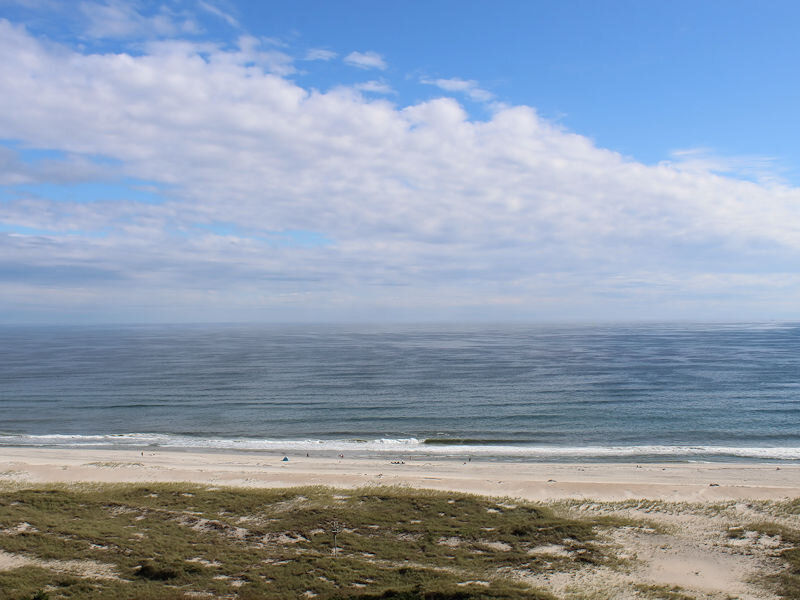
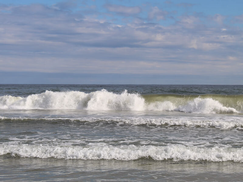
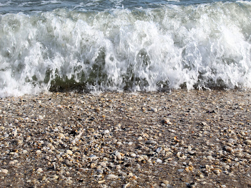
Under partly sunny skies with temperatures in the 70s, it was another fine late September beach day.
-
Tomorrow and Monday will be fair and pleasantly warm days. Afterward, a cold front could bring some showers or thundershowers to the region on Tuesday. The MJO had recently been locked in Phase 3 at a high amplitude, frequently in excess of 1.500. Only 2006 and 2009 saw the MJO in Phase 3 at an amplitude of 1.500 or above for 2 or more days during September 10-20. Both years saw September end with a cold shot that continued into the first days of October. Both days saw Central Park's temperature fall to 49° on September 30. The guidance has now come into better agreement concerning a cool shot to end the month. Afterward, in the MJO cases, a fairly sharp rebound in temperatures followed. October wound up wetter than normal with 7.07" rainfall in 2006 and 5.58" of rainfall in 2009. Normal rainfall (1991-2020) is 4.38". 2021 remains on course to become the 6th out of the last 7 years during which September has had a mean temperature of 70° or above in New York City. Prior to 2000, New York City saw such warmth on average once every five years. In short, September has become more an extension of summer than a gateway to autumn in the New York City area. There is increasing consensus on the long-range guidance that October will be an unseasonably warm month. The first half could feature much above normal readings in the Northern Plains into Central Canada. Fall 2021 will likely be wetter to much wetter than normal in the northern Middle Atlantic region. Since 1869, there have been 9 August cases where New York City picked up 20.00" or more rainfall during the summer. Two thirds of those cases (and 4/5 of those with summer mean temperatures of 73.0° or above) had 17.00" or more fall precipitation in New York City. 2011 is probably the closest match in terms of precipitation and a nearly identical summer mean temperature. Mean fall precipitation for those 9 cases was 14.86". The median was 17.35". The 1991-2020 normal value is 12.27". The ENSO Region 1+2 anomaly was +0.2°C and the Region 3.4 anomaly was -0.4°C for the week centered around September 15. For the past six weeks, the ENSO Region 1+2 anomaly has averaged +0.03°C and the ENSO Region 3.4 anomaly has averaged -0.45°C. Neutral ENSO conditions will likely prevail through September. Afterward, La Niña conditions could begin to develop. The SOI was -15.92 today. The preliminary Arctic Oscillation (AO) figure was +0.142 today. On September 23 the MJO was in Phase 4 at an amplitude of 0.946 (RMM). The September 22-adjusted amplitude was 1.305 (RMM). Based on sensitivity analysis applied to the latest guidance, there is an implied 89% probability that New York City will have a warmer than normal September (1991-2020 normal). September will likely finish with a mean temperature near 70.4° (1.2° above normal).
-
Morning thoughts… Today will be mostly sunny and pleasantly warm. High temperatures will likely reach the middle and upper 70s in most of the region. A few locations could reach or exceed 80°. Likely high temperatures around the region include: New York City (Central Park): 75° Newark: 79° Philadelphia: 77° Normals: New York City: 30-Year: 72.7°; 15-Year: 73.9° Newark: 30-Year: 74.3°; 15-Year: 75.6° Philadelphia: 30-Year: 75.5°; 15-Year: 76.6° Tomorrow will be another sun-filled day.
-
17/51 (33%) of the 9/25 0z EPS members now show sufficient rainfall to bring Central Park’s monthly total to 10”. It’s still a reach, but there remains some opportunity.
-
In the wake of the frontal passage that brought a widespread 1"-2" rainfall into today, clouds and rain shifted eastward and the sun returned. Abundant sunshine occurred near New York City and westward. There, readings soared into the 70s. Tomorrow, the entire region will benefit from abundant sunshine. It will be a warm day with temperatures rising into the middle and upper 70s. A few locations could reach or exceed 80°. Sunday will be a similar but perhaps slightly cooler day. The MJO had recently been locked in Phase 3 at a high amplitude, frequently in excess of 1.500. Only 2006 and 2009 saw the MJO in Phase 3 at an amplitude of 1.500 or above for 2 or more days during September 10-20. Both years saw September end with a cold shot that continued into the first days of October. Both days saw Central Park's temperature fall to 49° on September 30. A fairly sharp rebound in temperatures followed. October wound up wetter than normal with 7.07" rainfall in 2006 and 5.58" of rainfall in 2009. Normal rainfall (1991-2020) is 4.38". Despite the guidance of a few days ago and a likely cold shot to end the month, 2021 is still on course to become the 6th out of the last 7 years during which September has had a mean temperature of 70° or above in New York City. Prior to 2000, New York City saw such warmth on average once every five years. In short, September has become more an extension of summer than a gateway to autumn in the New York City area. There is increasing consensus on the long-range guidance that October will be an unseasonably warm month. The first half could feature much above normal readings in the Northern Plains into Central Canada. Fall 2021 will likely be wetter to much wetter than normal in the northern Middle Atlantic region. Since 1869, there have been 9 August cases where New York City picked up 20.00" or more rainfall during the summer. Two thirds of those cases (and 4/5 of those with summer mean temperatures of 73.0° or above) had 17.00" or more fall precipitation in New York City. 2011 is probably the closest match in terms of precipitation and a nearly identical summer mean temperature. Mean fall precipitation for those 9 cases was 14.86". The median was 17.35". The 1991-2020 normal value is 12.27". The ENSO Region 1+2 anomaly was +0.2°C and the Region 3.4 anomaly was -0.4°C for the week centered around September 15. For the past six weeks, the ENSO Region 1+2 anomaly has averaged +0.03°C and the ENSO Region 3.4 anomaly has averaged -0.45°C. Neutral ENSO conditions will likely prevail through September. Afterward, La Niña conditions could begin to develop. The SOI was -18.18 today. The preliminary Arctic Oscillation (AO) figure was +0.787 today. On September 22 the MJO was in Phase 4 at an amplitude of 1.305 (RMM). The September 21-adjusted amplitude was 1.553 (RMM). Based on sensitivity analysis applied to the latest guidance, there is an implied 86% probability that New York City will have a warmer than normal September (1991-2020 normal). September will likely finish with a mean temperature near 70.5° (1.3° above normal).
-
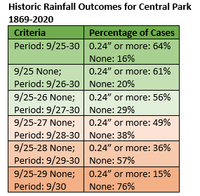
New York City's Central Park still needs 0.24" of rain before the end of September to register its 3rd consecutive month with 10" or more of precipitation. The EPS ensembles have grown a little wetter around 9/29-30. The 9/24 0z run saw 10% of members with enough rainfall to reach 10" for the month. The 12z run saw 29% of members with sufficient rainfall to reach 10" for the month. Below is a list showing the percentage of outcomes to month's end from tomorrow and then from each day when no additional rain has fallen. The historic probability for cases when no rain was recorded through 9/28 (as is the case with the EPS) is just a little higher than the current share of EPS members showing sufficient rainfall to reach 10" for September.
-
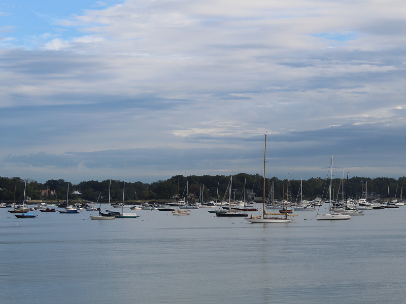
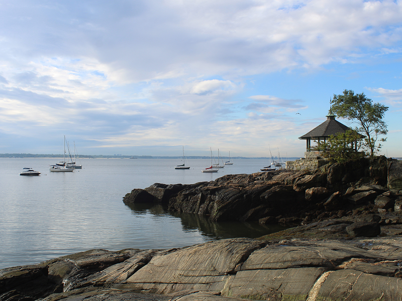
Two photos as the front responsible for the rainfall slowly edged eastward.
-
Yes, that’s correct.
-
9.76” as 2.03” fell. It will be tough, but a small handful of ensemble members (around 10%) have enough rain.
-
Morning thoughts… At 7:10 am, the front responsible for the heavy rainfall that commenced yesterday continued to move slowly eastward. Central Park picked up 2.03” of rain bringing its monthly total to 9.76”. 2021 is the first year on record with 3 consecutive months of 9.50” or more rainfall. Annual rainfall in New York City has reached 51.69”. That surpassed the 51.38” that fell in 1871 to make 2021 New York City’s 34th wettest year on record. Today will see rainfall shift slowly eastward on Long Island. Clouds will break, especially west of Suffolk County allowing for some sunshine. Areas to the south and west of Newark could see a lot of sunshine. It will be cool for the season. High temperatures will likely reach the lower and middle 70s in most of the region. Where clouds linger longest, temperatures will hold in the 60s. Likely high temperatures around the region include: New York City (Central Park): 71° Newark: 76° Philadelphia: 74° Normals: New York City: 30-Year: 73.1°; 15-Year: 74.3° Newark: 30-Year: 74.7°; 15-Year: 76.0° Philadelphia: 30-Year: 75.9°; 15-Year: 77.0° A sun-filled weekend lies ahead.
-
Newark also hit 80 both days.
-
Ahead of an advancing front, the temperature soared into the lower 80s in much of the region. However, for a record 2nd consecutive day, the temperature at New York City's Central Park failed to reach 80° when all of the following cities reached 80° or above: Bridgeport, Islip, New Haven, New York City-JFK, and New York City-LGA. Through 8 pm rainfall totals included: Allentown: 1.76" Atlantic city: 0.74" Baltimore: 0.69" Binghamton: 1.29" (old record: 1.24", 2003) Harrisburg: 1.33" Mount Pocono, PA: 2.49" New York City-NYC: 0.94" Newark: 0.52" Philadelphia: 1.45" Scranton: 1.39" Washington, DC: 1.30" Additional rainfall is likely overnight into the first part of tomorrow. Behind the front, the sun will return tomorrow and readings will reach the lower 70s. The MJO had recently been locked in Phase 3 at a high amplitude, frequently in excess of 1.500. Only 2006 and 2009 saw the MJO in Phase 3 at an amplitude of 1.500 or above for 2 or more days during September 10-20. Both years saw September end with a cold shot that continued into the first days of October. Both days saw Central Park's temperature fall to 49° on September 30. A fairly sharp rebound in temperatures followed. October wound up wetter than normal with 7.07" rainfall in 2006 and 5.58" of rainfall in 2009. Normal rainfall (1991-2020) is 4.38". Despite the guidance of a few days ago and a likely cold shot to end the month, 2021 is still on course to become the 6th out of the last 7 years during which September has had a mean temperature of 70° or above in New York City. Considering that the close of September is still more than 10 days out, the guidance can still reverse. Prior to 2000, New York City saw such warmth on average once every five years. In short, September has become more an extension of summer than a gateway to autumn in the New York City area. Fall 2021 will likely be wetter to much wetter than normal in the northern Middle Atlantic region. Since 1869, there have been 9 August cases where New York City picked up 20.00" or more rainfall during the summer. Two thirds of those cases (and 4/5 of those with summer mean temperatures of 73.0° or above) had 17.00" or more fall precipitation in New York City. 2011 is probably the closest match in terms of precipitation and a nearly identical summer mean temperature. Mean fall precipitation for those 9 cases was 14.86". The median was 17.35". The 1991-2020 normal value is 12.27". The ENSO Region 1+2 anomaly was +0.2°C and the Region 3.4 anomaly was -0.4°C for the week centered around September 15. For the past six weeks, the ENSO Region 1+2 anomaly has averaged +0.03°C and the ENSO Region 3.4 anomaly has averaged -0.45°C. Neutral ENSO conditions will likely prevail through September. Afterward, La Niña conditions could begin to develop. The SOI was -10.22 today. The preliminary Arctic Oscillation (AO) figure was +1.040 today. On September 21 the MJO was in Phase 4 at an amplitude of 1.554 (RMM). The September 20-adjusted amplitude was 1.530 (RMM). Based on sensitivity analysis applied to the latest guidance, there is an implied 87% probability that New York City will have a warmer than normal September (1991-2020 normal). September will likely finish with a mean temperature near 70.6° (1.4° above normal).
-
The cooling power of trees? Today’s high temperature was 79 degrees at Central Park. For the first time, Central Park failed to reach 80 degrees on 2 consecutive days where Bridgeport, Islip, JFK, LGA, and New Haven all reached 80 degrees or above.
-
The ones in New Rochelle are thriving.
-
There is a home in New Rochelle, NY with palm trees.
-
Through 4 pm, Binghamton has received 1.29” of rain. That breaks the daily record of 1.24” from 2003.
-
Newark reached 80 degrees for the 110th day this year. That is the 8th highest number of days in record.

