donsutherland1
-
Posts
24,169 -
Joined
Content Type
Profiles
Blogs
Forums
American Weather
Media Demo
Store
Gallery
Everything posted by donsutherland1
-
Abundant sunshine pushed the mercury into the upper 70s and lower 80s across the region. The temperature at LaGuardia Airport hit 83°, which tied the daily record set in 1956. At Newark, the thermometer topped out at 84°. These will likely be the warmest readings until next spring. With today's warmth, Newark reached 70° for the 169th time this year. As a result, 2021 is now tied with 1946 and 1994 for the 5th most days on record. Today was also the 114th 80° day at Newark, tying 2021 with 1994 for 2nd highest number. Through this afternoon, Bismarck has yet to experience its first freeze of the season. As a result, 2021 is now poised to surpass the prior mark for the latest first freeze. That record is October 14, 2008, which was tied yesterday. Tomorrow will be another very warm day, but some showers and even a thundershower are possible as a strong cold front moves across the region. Behind the frontal passage, readings will return to near normal levels before warmer air returns near the middle of next week. The MJO has now completed its passage through Phase 5 at a very high amplitude. During the 1991-2020 period, there were 6 cases with passage through Phase 5 with at least three days at an amplitude of 1.500 or above: 1998, 2000, 2004, 2010, 2017, and 2020. There was a strong signal for the second half of October to wind up warmer than normal (83%) cases in the New York City area. However, that signal broke down to a 50-50 split for the first 10 days of November. That hints at possible timing for a pattern transition depending on the pattern evolution and changes in the teleconnections. Fall 2021 will likely be wetter to much wetter than normal in the northern Middle Atlantic region. Since 1869, there have been 9 August cases where New York City picked up 20.00" or more rainfall during the summer. Two thirds of those cases (and 4/5 of those with summer mean temperatures of 73.0° or above) had 17.00" or more fall precipitation in New York City. 2011 is probably the closest match in terms of precipitation and a nearly identical summer mean temperature. Mean fall precipitation for those 9 cases was 14.86". The median was 17.35". The 1991-2020 normal value is 12.27". Following very wet July-September periods, winter (December-February) precipitation has typically been near or below normal. The most recent exception was winter 2018-19. La Niña conditions have now developed. The ENSO Region 1+2 anomaly was +0.1°C and the Region 3.4 anomaly was -0.7°C for the week centered around October 6. For the past six weeks, the ENSO Region 1+2 anomaly has averaged +0.08°C and the ENSO Region 3.4 anomaly has averaged -0.35°C. La Niña conditions will likely persist through at least mid-winter. The SOI was +21.66 today. The preliminary Arctic Oscillation (AO) figure was -0.788 today. On October 13 the MJO was in Phase 6 at an amplitude of 1.689 (RMM). The October 12-adjusted amplitude was 1.936 (RMM). Based on sensitivity analysis applied to the latest guidance, there is an implied 92% probability that New York City will have a warmer than normal October (1991-2020 normal). October will likely finish with a mean temperature near 61.8° (3.9° above normal).
-
Yes, in late November.
-
Morning thoughts… It will be partly cloudy and very warm. High temperatures will likely reach the upper 70s and lower 80s in most of the region. Likely high temperatures around the region include: New York City (Central Park): 76° Newark: 82° Philadelphia: 81° Normals: New York City: 30-Year: 64.7°; 15-Year: 65.6° Newark: 30-Year: 66.3°; 15-Year: 67.5° Philadelphia: 30-Year: 67.5°; 15-Year: 68.3° Saturday will be another very warm day. However, a strong cold could bring a shower or thundershower as it moves across the region.
-
Latest: November 1, 1950.
-
Newark: 82 JFK: 80 LGA: 79 NYC: 76
-
Under abundant sunshine, temperatures rose into the upper 70s and even lower 80s across the region. Newark reached 70° for the 168th time this year. As a result, 2021 is now tied with 1986 and 1991 for the 7th most days on record. Today was also the 113th 80° day at Newark, tying 2021 with 1991, 1993, and 2016 for 3rd highest number. Through this afternoon, Bismarck has yet to experience its first freeze of the season. The latest first freeze on record occurred on October 14, 2008. That record could be tied by the end of the day and broken tomorrow. Tomorrow will be an exceptionally warm day. The temperature could approach or reach 80° in many parts of the region. Saturday will be another very warm day, but some showers and even a thundershower are possible as a strong cold front moves across the region. Behind the frontal passage, readings will return to near normal levels. The MJO is currently passing through Phase 5 at a very high amplitude. During the 1991-2020 period, there were 6 cases with passage through Phase 5 with at least three days at an amplitude of 1.500 or above: 1998, 2000, 2004, 2010, 2017, and 2020. There was a strong signal for the second half of October to wind up warmer than normal (83%) cases in the New York City area. However, that signal broke down to a 50-50 split for the first 10 days of November. That hints at possible timing for a pattern transition depending on the pattern evolution and changes in the teleconnections. Fall 2021 will likely be wetter to much wetter than normal in the northern Middle Atlantic region. Since 1869, there have been 9 August cases where New York City picked up 20.00" or more rainfall during the summer. Two thirds of those cases (and 4/5 of those with summer mean temperatures of 73.0° or above) had 17.00" or more fall precipitation in New York City. 2011 is probably the closest match in terms of precipitation and a nearly identical summer mean temperature. Mean fall precipitation for those 9 cases was 14.86". The median was 17.35". The 1991-2020 normal value is 12.27". Following very wet July-September periods, winter (December-February) precipitation has typically been near or below normal. The most recent exception was winter 2018-19. La Niña conditions have now developed. The ENSO Region 1+2 anomaly was +0.1°C and the Region 3.4 anomaly was -0.7°C for the week centered around October 6. For the past six weeks, the ENSO Region 1+2 anomaly has averaged +0.08°C and the ENSO Region 3.4 anomaly has averaged -0.35°C. La Niña conditions will likely persist through at least mid-winter. The SOI was +16.89 today. The preliminary Arctic Oscillation (AO) figure was -0.957 today. On October 12 the MJO was in Phase 5 at an amplitude of 1.939 (RMM). The October 11-adjusted amplitude was 2.179 (RMM). Based on sensitivity analysis applied to the latest guidance, there is an implied 91% probability that New York City will have a warmer than normal October (1991-2020 normal). October will likely finish with a mean temperature near 61.9° (4.0° above normal).
-
The temperature at JFK Airport hit 80 degrees today. That is the latest such temperature since October 19, 2016. The average last such temperature occurs on September 27th (1991-2020). During the 1981-2010 period, the average last 80-degree reading occurred on September 24th.
-
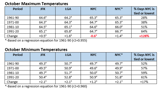
At 12 pm, temperatures in New York City were as follows: Central Park: 71°, JFK: 76°, and LGA: 74°. Central Park is reporting the lowest temperature among New York City's three major stations. This is not an anomaly. This is now an increasingly frequent outcome in October, especially when it comes to maximum temperatures. During 1961-90, Central Park's high temperature was the lowest or tied with the lowest reading on 28% of days. During the 1991-20 period, Central Park recorded the lowest temperature on 64% of days. During the October 1-13, 2021 period, Central Park's high temperature has been the lowest or tied with the lowest on all days. Moreover, between 1961-90 and 1991-20, JFK (+0.5°) and LGA (+1.6°) saw increasing high temperatures. In contrast, Central Park saw a decline in its average October high temperature of 0.6°. Below are some tables that illustrate how things have evolved. The use of regression equations developed from the 1961-90 period (NYC is the dependent variable; JFK and LGA are the independent variables) before the tree issue arose suggests that the October 1-13, 2021 mean temperature in Central Park would be 67.7°. Instead, the mean was 65.2°, a large 2.5° difference.
-
There will be another warmup next week and it warmth could persist through the end of the month.
-
Morning thoughts… It will be partly cloudy and very warm. High temperatures will likely reach the middle and upper 70s in most of the region. Likely high temperatures around the region include: New York City (Central Park): 75° Newark: 79° Philadelphia: 78° Normals: New York City: 30-Year: 65.1°; 15-Year: 66.0° Newark: 30-Year: 66.6°; 15-Year: 67.9° Philadelphia: 30-Year: 67.9°; 15-Year: 68.7° A generally warmer than normal regime will continue into the weekend before a strong cold moves across the region.
-
It was mostly cloudy but still unseasonably mild for the season. Many locations saw the temperature reach or exceed 70°. Newark reached 70° for the 167th time this year. As a result, 2021 is now tied with 1995 and 2012 for the 9th most days on record. In the Northern Plains, heavy rain fell in parts of North Dakota. Through 7 pm CDT, Bismarck had picked up 1.38" of rain. That surpassed the October 13 daily record of 0.97", which had been set in 1940. This is the second largest daily rainfall on record for October. It was also the second day this month with 1" or more rainfall. That ties the October record of two such days. That record was set in 1994 and tied in 2013. Moreover, 2021 is the only year in which two top-10 daily rainfalls occurred in the same year. Records go back to 1874. In addition, Bismarck has yet to experience its first freeze of the season. The latest first freeze on record occurred on October 14, 2008. Tomorrow will become noticeably warmer as ample sunshine returns. Friday could see the temperature approach or reach 80° in many parts of the region. Saturday will be another very warm day, but some showers and even a thundershower are possible as a strong cold front moves across the region. Behind the frontal passage, readings will return to near normal levels. The MJO is currently passing through Phase 5 at a very high amplitude. During the 1991-2020 period, there were 6 cases with passage through Phase 5 with at least three days at an amplitude of 1.500 or above: 1998, 2000, 2004, 2010, 2017, and 2020. There was a strong signal for the second half of October to wind up warmer than normal (83%) cases in the New York City area. However, that signal broke down to a 50-50 split for the first 10 days of November. That hints at possible timing for a pattern transition depending on the pattern evolution and changes in the teleconnections. Fall 2021 will likely be wetter to much wetter than normal in the northern Middle Atlantic region. Since 1869, there have been 9 August cases where New York City picked up 20.00" or more rainfall during the summer. Two thirds of those cases (and 4/5 of those with summer mean temperatures of 73.0° or above) had 17.00" or more fall precipitation in New York City. 2011 is probably the closest match in terms of precipitation and a nearly identical summer mean temperature. Mean fall precipitation for those 9 cases was 14.86". The median was 17.35". The 1991-2020 normal value is 12.27". Following very wet July-September periods, winter (December-February) precipitation has typically been near or below normal. The most recent exception was winter 2018-19. The ENSO Region 1+2 anomaly was +0.1°C and the Region 3.4 anomaly was -0.7°C for the week centered around October 6. For the past six weeks, the ENSO Region 1+2 anomaly has averaged +0.08°C and the ENSO Region 3.4 anomaly has averaged -0.35°C. Neutral ENSO conditions will likely yield to La Niña conditions later this month. The SOI was +14.50 today. The preliminary Arctic Oscillation (AO) figure was -1.207 today. On October 11 the MJO was in Phase 5 at an amplitude of 2.179 (RMM). The October 10-adjusted amplitude was 1.866 (RMM). Based on sensitivity analysis applied to the latest guidance, there is an implied 92% probability that New York City will have a warmer than normal October (1991-2020 normal). October will likely finish with a mean temperature near 61.9° (4.0° above normal).
-
Morning thoughts… It will be partly cloudy and milder. High temperatures will likely reach the lower and middle 70s in most of the region. Likely high temperatures around the region include: New York City (Central Park): 71° Newark: 75° Philadelphia: 75° Normals: New York City: 30-Year: 65.5°; 15-Year: 66.5° Newark: 30-Year: 67.0°; 15-Year: 68.3° Philadelphia: 30-Year: 68.3°; 15-Year: 69.2° A generally warmer than normal regime will continue into the weekend before a strong cold moves across the region.
-
Under variably cloudy skies, readings reached the upper 60s and lower 70s today. Newark reached 70° for the 166th time this year. As a result, 2021 now as the 11th highest figure on record. Tomorrow will likely be a bit warmer. Sunshine and much above normal temperatures are likely Thursday and Friday. Saturday will be another very warm day, but some showers are even a thundershower are possible as a strong cold front moves across the region. Behind the frontal passage, readings will return to near normal levels. The MJO is currently passing through Phase 5 at a very high amplitude. During the 1991-2020 period, there were 6 cases with passage through Phase 5 with at least three days at an amplitude of 1.500 or above: 1998, 2000, 2004, 2010, 2017, and 2020. There was a strong signal for the second half of October to wind up warmer than normal (83%) cases in the New York City area. However, that signal broke down to a 50-50 split for the first 10 days of November. That hints at possible timing for a pattern transition depending on the pattern evoluton and changes in the teleconnections. Fall 2021 will likely be wetter to much wetter than normal in the northern Middle Atlantic region. Since 1869, there have been 9 August cases where New York City picked up 20.00" or more rainfall during the summer. Two thirds of those cases (and 4/5 of those with summer mean temperatures of 73.0° or above) had 17.00" or more fall precipitation in New York City. 2011 is probably the closest match in terms of precipitation and a nearly identical summer mean temperature. Mean fall precipitation for those 9 cases was 14.86". The median was 17.35". The 1991-2020 normal value is 12.27". Following very wet July-September periods, winter (December-February) precipitation has typically been near or below normal. The most recent exception was winter 2018-19. The ENSO Region 1+2 anomaly was +0.1°C and the Region 3.4 anomaly was -0.7°C for the week centered around October 6. For the past six weeks, the ENSO Region 1+2 anomaly has averaged +0.08°C and the ENSO Region 3.4 anomaly has averaged -0.35°C. Neutral ENSO conditions will likely yield to La Niña conditions later this month. The SOI was +12.96 today. The preliminary Arctic Oscillation (AO) figure was -0.788 today. On October 10 the MJO was in Phase 5 at an amplitude of 1.864 (RMM). The October 9-adjusted amplitude was 1.704 (RMM). Based on sensitivity analysis applied to the latest guidance, there is an implied 90% probability that New York City will have a warmer than normal October (1991-2020 normal). October will likely finish with a mean temperature near 61.9° (4.0° above normal).
-
Such pattern changes have often occurred following passages when the MJO was in Phase 5 at a very high amplitude at this time of the year. The most recent such example was in 2010. October 16-31 was 1.9 degrees above normal. November 1-10 was 4.9 degrees below normal.
-
Morning thoughts… It will be partly to mostly cloudy and milder. High temperatures will likely reach the upper 60s and lower 70s in most of the region. Likely high temperatures around the region include: New York City (Central Park): 69° Newark: 73° Philadelphia: 72° Normals: New York City: 30-Year: 65.8°; 15-Year: 66.9° Newark: 30-Year: 67.4°; 15-Year: 68.7° Philadelphia: 30-Year: 68.7°; 15-Year: 69.6° A generally warmer than normal regime will continue into the weekend before a strong cold moves across the region.
-
Drier air moved into the region allowing for partly sunny skies and mild readings in the 70s. Newark reached 70° for the 165th time this year. As a result, 2021 is tied for 11th place with 1990 and 2017. Tomorrow will likely be a similar day. Sunshine and much above normal temperatures are likely from mid-week into the start of the weekend. Overall, the generally warm regime will continue into weekend before a strong cold front ushers in cooler readings. In the wake of the frontal passage, readings will return to near normal levels. Fall 2021 will likely be wetter to much wetter than normal in the northern Middle Atlantic region. Since 1869, there have been 9 August cases where New York City picked up 20.00" or more rainfall during the summer. Two thirds of those cases (and 4/5 of those with summer mean temperatures of 73.0° or above) had 17.00" or more fall precipitation in New York City. 2011 is probably the closest match in terms of precipitation and a nearly identical summer mean temperature. Mean fall precipitation for those 9 cases was 14.86". The median was 17.35". The 1991-2020 normal value is 12.27". Following very wet July-September periods, winter (December-February) precipitation has typically been near or below normal. The most recent exception was winter 2018-19. The ENSO Region 1+2 anomaly was +0.1°C and the Region 3.4 anomaly was -0.7°C for the week centered around October 6. For the past six weeks, the ENSO Region 1+2 anomaly has averaged +0.08°C and the ENSO Region 3.4 anomaly has averaged -0.35°C. Neutral ENSO conditions will likely yield to La Niña conditions later this month. The SOI was +2.32 today. The preliminary Arctic Oscillation (AO) figure was -0.038 today. On October 9 the MJO was in Phase 5 at an amplitude of 1.701 (RMM). The October 8-adjusted amplitude was 2.024 (RMM). Based on sensitivity analysis applied to the latest guidance, there is an implied 87% probability that New York City will have a warmer than normal October (1991-2020 normal). October will likely finish with a mean temperature near 61.8° (3.9° above normal).
-
Morning thoughts… It will be partly to mostly cloudy and milder. High temperatures will likely reach the upper 60s and lower 70s in most of the region. Likely high temperatures around the region include: New York City (Central Park): 70° Newark: 74° Philadelphia: 74° Normals: New York City: 30-Year: 66.2°; 15-Year: 67.3° Newark: 30-Year: 67.8°; 15-Year: 69.2° Philadelphia: 30-Year: 69.0°; 15-Year: 70.0° A generally warmer than normal regime will continue into the weekend before a strong cold moves across the region.
-
Yes. The PNA is forecast to turn positive. The weekend should turn cooler. It will be interesting to see how long this lasts.
-
An offshore storm brought clouds, a stiff east-northeasterly wind, and some light rain to the region. Rainfall amounts included: Atlantic City: 0.03"; Bridgeport: 0.04"; Islip: 0.11"; New York City: 0.11"; Newark: 0.33"; and, Philadelphia: 0.03". The rainfall at Central Park pushed the 2021 total to 52.22". That surpassed the 52.13" that fell in 1979 as New York City's 32nd highest annual figure on record. Warmer and drier air will start to return tomorrow, but it will be partly to mostly cloudy. Sunshine and much above normal temperatures are likely around mid-week. Overall, the generally warm regime will continue into at least mid-month. Fall 2021 will likely be wetter to much wetter than normal in the northern Middle Atlantic region. Since 1869, there have been 9 August cases where New York City picked up 20.00" or more rainfall during the summer. Two thirds of those cases (and 4/5 of those with summer mean temperatures of 73.0° or above) had 17.00" or more fall precipitation in New York City. 2011 is probably the closest match in terms of precipitation and a nearly identical summer mean temperature. Mean fall precipitation for those 9 cases was 14.86". The median was 17.35". The 1991-2020 normal value is 12.27". Following very wet July-September periods, winter (December-February) precipitation has typically been near or below normal. The most recent exception was winter 2018-19. The ENSO Region 1+2 anomaly was 0.0°C and the Region 3.4 anomaly was 0.0°C for the week centered around September 29. For the past six weeks, the ENSO Region 1+2 anomaly has averaged +0.07°C and the ENSO Region 3.4 anomaly has averaged -0.28°C. Neutral ENSO conditions will likely yield to La Niña conditions later this month. The SOI was -4.13 today. The preliminary Arctic Oscillation (AO) figure was +0.395 today. On October 8 the MJO was in Phase 5 at an amplitude of 2.025 (RMM). The October 7-adjusted amplitude was 2.236 (RMM). Based on sensitivity analysis applied to the latest guidance, there is an implied 85% probability that New York City will have a warmer than normal October (1991-2020 normal). October will likely finish with a mean temperature near 61.8° (3.9° above normal).
-
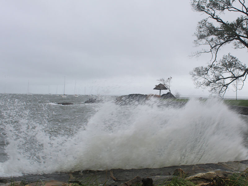
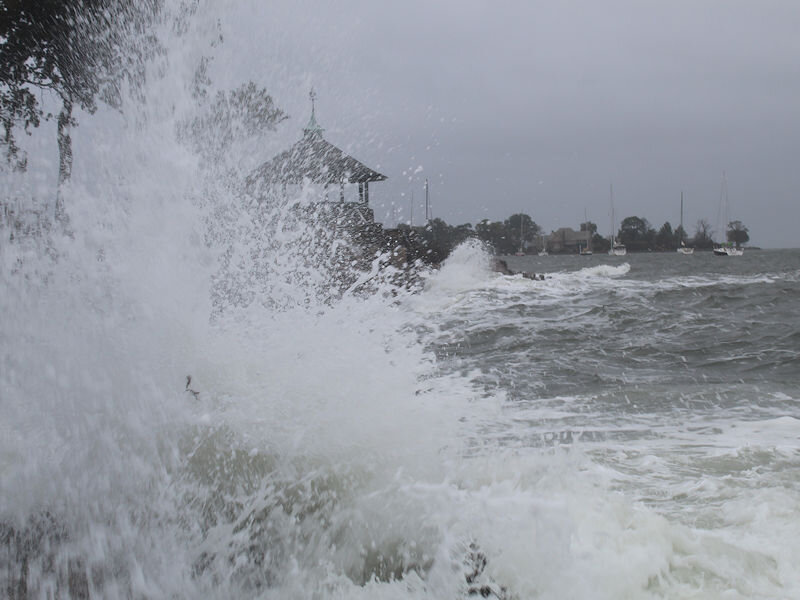
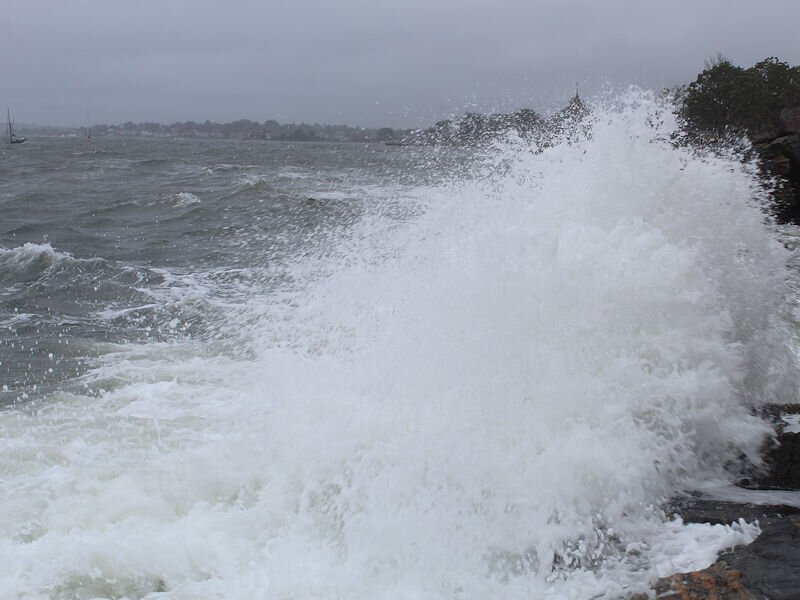
Waves on the Long Island Sound.

-
Morning thoughts… It will be mostly cloudy and cool. Some showers are possible from time to time, but much of the day should be dry. Rainfall amounts will be light, mainly 0.25” or less. Only the Jersey Shore and eastern half of Long Island will likely see more appreciable amounts of rain. High temperatures will likely reach the middle and upper 60s in most of the region. Likely high temperatures around the region include: New York City (Central Park): 64° Newark: 68° Philadelphia: 69° Normals: New York City: 30-Year: 66.6°; 15-Year: 67.7° Newark: 30-Year: 68.2°; 15-Year: 69.6° Philadelphia: 30-Year: 69.4°; 15-Year: 70.5° A generally warmer than normal regime will continue into at least mid-month.
-
I’ve seen that that large outside of the Bronx at the Marshlands Conservancy, but this is the biggest one I saw at the NY Botanical Garden.
-
SSTAs seem to suggest a predominant positive NAO. The seasonal models had decreased the amount of potential blocking. While there remains uncertainty about snowfall, I don’t think a really big snowfall season is on the table. Something near normal or somewhat above normal may be possible at the high-end. But things could still change as the pattern continues to evolve and the La Niña develops.
-
Much of the region experienced a cool breeze that capped temperatures in the 60s. However, Newark reached 70° for the 164th time this year. As a result, 2021 is ranked in 13th place. Tomorrow will be another mostly cloudy and cool day. Temperatures will likely top out in the middle and upper 60s. Some showers and periods of rain are possible. Aside from the Jersey Shore and Long Island, most of the region should see 0.25" or less total rainfall. Warmer air will start to return on Monday. Overall, the generally warm regime will continue into at least mid-month. Fall 2021 will likely be wetter to much wetter than normal in the northern Middle Atlantic region. Since 1869, there have been 9 August cases where New York City picked up 20.00" or more rainfall during the summer. Two thirds of those cases (and 4/5 of those with summer mean temperatures of 73.0° or above) had 17.00" or more fall precipitation in New York City. 2011 is probably the closest match in terms of precipitation and a nearly identical summer mean temperature. Mean fall precipitation for those 9 cases was 14.86". The median was 17.35". The 1991-2020 normal value is 12.27". Following very wet July-September periods, winter (December-February) precipitation has typically been near or below normal. The most recent exception was winter 2018-19. The ENSO Region 1+2 anomaly was 0.0°C and the Region 3.4 anomaly was 0.0°C for the week centered around September 29. For the past six weeks, the ENSO Region 1+2 anomaly has averaged +0.07°C and the ENSO Region 3.4 anomaly has averaged -0.28°C. Neutral ENSO conditions will likely yield to La Niña conditions later this month. The SOI was +2.51 today. The preliminary Arctic Oscillation (AO) figure was -0.213 today. On October 7 the MJO was in Phase 5 at an amplitude of 2.239 (RMM). The October 6-adjusted amplitude was 2.145 (RMM). Based on sensitivity analysis applied to the latest guidance, there is an implied 84% probability that New York City will have a warmer than normal October (1991-2020 normal). October will likely finish with a mean temperature near 62.0° (4.1° above normal).
-
Amidst cloudy skies and a stiff breeze that held temperatures in the middle 60s, the New York Botanical Garden is continuing its autumn transition.