donsutherland1
-
Posts
23,610 -
Joined
Content Type
Profiles
Blogs
Forums
American Weather
Media Demo
Store
Gallery
Everything posted by donsutherland1
-
On this date in 1941, a blizzard dumped 15.7" of snow on New York City. This time around readings soared to record-tying and record breaking highs. Daily records included: Albany: 64° (old record: 63°, 1974) Atlantic City: 71° (old record: 68°, 1959 and 2004) Baltimore: 78° (old record: 76°, 1935) Hartford: 64° (tied record set in 1935) New York City-LGA: 68° (old record: 64°, 1976) New York City-NYC: 68° (tied record set in 1935) Newark: 69° (tied record set in 1935) Poughkeepsie: 67° (old record: 63°, 1935) Sterling, VA: 78° (old record: 70°, 2004) Wilmington, DE: 71° (tied record set in 1935) Tomorrow will be another exceptionally warm day. Temperatures will likely reach the upper 60s and lower 70s in the northern Middle Atlantic region. Baltimore and Washington, DC could reach or exceed 80°. There could be some showers or thundershowers as a cold front moves across the region. Afterward, readings could cool, but remain mainly above seasonable levels until after March 10th. Then, a colder pattern could develop. The duration of such a pattern remains somewhat uncertain. Overall, March will likely be warmer than normal. There may also be one or two opportunities for at least some measurable snow in the northern Middle Atlantic and southern New England areas. The ENSO Region 1+2 anomaly was -1.5°C and the Region 3.4 anomaly was -0.8°C for the week centered around February 23. For the past six weeks, the ENSO Region 1+2 anomaly has averaged -1.08°C and the ENSO Region 3.4 anomaly has averaged -0.70°C. La Niña conditions will likely persist through at least late March. The SOI was +22.35 today. The preliminary Arctic Oscillation (AO) was +1.031 today. On March 4 the MJO was in Phase 3 at an amplitude of 0.069 (RMM). The March 3-adjusted amplitude was 0.161 (RMM).
-
With sunshine breaking through the clouds and temperatures in the 60s, it feels like spring. At the New York Botanical Garden, there are increasing signs of spring.


-
Morning thoughts… It will be mostly cloudy and warm today High temperatures will likely reach the middle and upper 60 in most of the region and 70s in southeastern Pennsylvania. Likely high temperatures around the region include: New York City (Central Park): 66° Newark: 68° Philadelphia: 71° Near record and record warmth is likely tomorrow. Normals: New York City: 30-Year: 46.6°; 15-Year: 47.1° Newark: 30-Year: 47.7°; 15-Year: 48.3° Philadelphia: 30-Year: 49.3°; 15-Year: 49.6°
-
Tomorrow and Monday will provide an early preview of spring. Tomorrow will likely see numerous near record and record high temperatures. Select daily records for tomorrow include: Atlantic City: 68°, 1959 and 2004 Baltimore: 76°, 1935 New York City-JFK: 63°, 2004 New York City-LGA: 64°, 1976 New York City-Central Park: 68°, 1935 Newark: 69°, 1935 Philadelphia: 71°, 1935 Trenton: 71°, 1894 Afterward, readings could cool, but remain above seasonable levels until after March 10th. Then, there is growing model consensus that a noticeably colder pattern could develop. The development and duration of such a pattern remain somewhat uncertain. Overall, March will likely be warmer than normal. There may also be one or two opportunities for at least some measurable snow in the northern Middle Atlantic and southern New England areas. The ENSO Region 1+2 anomaly was -1.5°C and the Region 3.4 anomaly was -0.8°C for the week centered around February 23. For the past six weeks, the ENSO Region 1+2 anomaly has averaged -1.08°C and the ENSO Region 3.4 anomaly has averaged -0.70°C. La Niña conditions will likely persist through at least late March. The SOI was +19.39 today. The preliminary Arctic Oscillation (AO) was -0.317 today. On March 3 the MJO was in Phase 5 at an amplitude of 0.161 (RMM). The March 2-adjusted amplitude was 0.314 (RMM).
-
Morning thoughts… It will be variably cloudy and warmer today High temperatures will likely reach the middle and upper 40s in most of the region and 50s in southern New Jersey and southeastern Pennsylvania. Likely high temperatures around the region include: New York City (Central Park): 45° Newark: 47° Philadelphia: 54° Near record and record warmth is likely tomorrow. Normals: New York City: 30-Year: 46.4°; 15-Year: 46.8° Newark: 30-Year: 47.4°; 15-Year: 48.0° Philadelphia: 30-Year: 49.0°; 15-Year: 49.2°
-
It will be variably cloudy and milder tomorrow. A sharp rebound in temperatures is likely on Sunday. Sunday and Monday could provide an early preview of springlike readings across much of the region. Afterward, readings could cool, but remain above seasonable levels until after March 10th. Then, there is growing model consensus that a noticeably colder pattern could develop. The development and duration of such a pattern remain somewhat uncertain. Overall, March will likely be warmer than normal. There may also be one or two opportunities for at least some measurable snow in the northern Middle Atlantic and southern New England areas. The ENSO Region 1+2 anomaly was -1.5°C and the Region 3.4 anomaly was -0.8°C for the week centered around February 23. For the past six weeks, the ENSO Region 1+2 anomaly has averaged -1.08°C and the ENSO Region 3.4 anomaly has averaged -0.70°C. La Niña conditions will likely persist through at least late March. The SOI was +14.12 today. The preliminary Arctic Oscillation (AO) was not available today. On March 2 the MJO was in Phase 4 at an amplitude of 0.317 (RMM). The March 1-adjusted amplitude was 0.471 (RMM).
-
Morning thoughts… It will be mostly sunny and unseasonably cold today. High temperatures will likely reach the upper 30s and lower 40s in most of the region. Likely high temperatures around the region include: New York City (Central Park): 38° Newark: 40° Philadelphia: 44° It will turn warmer tomorrow and Sunday could be exceptionally warm for the season. Normals: New York City: 30-Year: 46.1°; 15-Year: 46.5° Newark: 30-Year: 47.1°; 15-Year: 47.7° Philadelphia: 30-Year: 48.7°; 15-Year: 48.9°
-
Cooler air started pushing into the region following passage of a strong cold front early this morning. In the Southeast, there was near record and record warmth. At Atlanta, the temperature reached 80°, which tied the record set in 1992. At Charlotte, the mercury reached 85°, which broke the old record of 84° from 1976. That was also Charlotte's earliest 85° or above temperature on record. Tomorrow will be fair but unseasonably cold. Temperatures will likely start in the teens outside the major cities of the northern Middle Atlantic region and lower 20s elsewhere and then recover to only the middle and upper 30s. However, a sharp rebound in temperatures is likely on Sunday. Sunday and Monday could provide an early preview of springlike readings across much of the region. Afterward, readings could cool, but remain above seasonable levels until after March 10th. Then, there is growing model consensus that a noticeably colder pattern could develop. The development and duration of such a pattern remain somewhat uncertain. Overall, March will likely be warmer than normal. There may also be one or two opportunities for at least some measurable snow in the northern Middle Atlantic and southern New England areas. The ENSO Region 1+2 anomaly was -1.5°C and the Region 3.4 anomaly was -0.8°C for the week centered around February 23. For the past six weeks, the ENSO Region 1+2 anomaly has averaged -1.08°C and the ENSO Region 3.4 anomaly has averaged -0.70°C. La Niña conditions will likely persist through at least late March. The SOI was +18.43 today. The preliminary Arctic Oscillation (AO) was +0.169. On March 1 the MJO was in Phase 4 at an amplitude of 0.468 (RMM). The February 28-adjusted amplitude was 0.563 (RMM).
-
Morning thoughts… It will become partly sunny. Temperatures will fall sharply this evening. High temperatures will likely reach the middle and upper 40s in most of the region. Likely high temperatures around the region include: New York City (Central Park): 44° Newark: 45° Philadelphia: 50° Tomorrow will be blustery and cold. Normals: New York City: 30-Year: 45.8°; 15-Year: 46.2° Newark: 30-Year: 46.9°; 15-Year: 47.4° Philadelphia: 30-Year: 48.7°; 15-Year: 48.9°
-
Another shot of cold air will arrive tomorrow. Cool conditions will likely continue into the start of the weekend. The height of the cold will be on Friday where temperatures could start in the teens outside the major cities of the northern Middle Atlantic region and lower 20s elsewhere. However, a sharp rebound in temperatures is likely on Sunday. Sunday and Monday could provide an early preview of springlike readings across much of the region. Afterward, readings could cool, but remain above seasonable levels. Overall, March will likely be warmer than normal. There may also be one or two opportunities for at least some measurable snow in the northern Middle Atlantic and southern New England areas. The ENSO Region 1+2 anomaly was -1.5°C and the Region 3.4 anomaly was -0.8°C for the week centered around February 23. For the past six weeks, the ENSO Region 1+2 anomaly has averaged -1.08°C and the ENSO Region 3.4 anomaly has averaged -0.70°C. La Niña conditions will likely persist through at least late March. The SOI was +16.18 today. The preliminary Arctic Oscillation (AO) was +0.661. On February 28 the MJO was in Phase 4 at an amplitude of 0.558 (RMM). The February 27-adjusted amplitude was 0.716 (RMM).
-
Morning thoughts… It will be partly sunny and mild. High temperatures will likely reach the upper 40s and lower 50s in most of the region. Some areas could reach the middle 50s. Likely high temperatures around the region include: New York City (Central Park): 49° Newark: 50° Philadelphia: 57° Colder air will return tomorrow and persist into the start of the weekend. Normals: New York City: 30-Year: 45.6°; 15-Year: 45.9° Newark: 30-Year: 46.6°; 15-Year: 47.1° Philadelphia: 30-Year: 48.1°; 15-Year: 48.2°
-
Tomorrow will be fair and mild before another shot of cold air arrives for late in the week and the start of the weekend. However, a sharp rebound in temperatures is likely starting Sunday. Sunday through Tuesday could provide an early taste of springlike readings across much of the region. Overall, March will likely be warmer than normal. There may also be one or two opportunities for at least some measurable snow in the northern Middle Atlantic and southern New England areas. The ENSO Region 1+2 anomaly was -1.5°C and the Region 3.4 anomaly was -0.8°C for the week centered around February 23. For the past six weeks, the ENSO Region 1+2 anomaly has averaged -1.08°C and the ENSO Region 3.4 anomaly has averaged -0.70°C. La Niña conditions will likely persist through at least late March. The SOI was +11.97 today. The preliminary Arctic Oscillation (AO) was +0.819. On February 27 the MJO was in Phase 4 at an amplitude of 0.713 (RMM). The February 26-adjusted amplitude was 0.684 (RMM).
-
Morning thoughts... Today will be mostly cloudy and mild. Temperatures will likely reach the middle and upper 40s in most of the region. The temperature will rise into the 50s in southeastern Pennsylvania. Likely high temperatures include: New York City (Central Park): 46° Newark: 48° Philadelphia: 54° Tomorrow will be another mild day before a fresh shot of cold air arrives. Normals: New York City: 30-Year: 45.3°; 15-Year: 45.6° Newark: 30-Year: 46.3°; 15-Year: 46.8° Philadelphia: 30-Year: 47.9°; 15-Year: 47.9° 30-Day Verification: New York City (Central Park): Average daily forecast: 42.8° Average temperature: 43.5° Average error: 2.1° Newark: Average daily forecast: 43.4° Average temperature: 44.0° Average error: 1.8° Philadelphia: Average daily forecast: 47.1° Average temperature: 47.7° Average error: 1.4°
-
Despite bright sunshine, temperatures were unseasonably cold today. New York City finished February with a monthly mean temperature of 37.3°, which was 1.4° above normal. A cooler air mass is again moving into the region. March will start out colder than normal. A system could bring some precipitation to the region late in the week. A warming trend could develop afterward. Overall, March will likely be warmer than normal. There may also be one or two opportunities for at least some measurable snow in the northern Middle Atlantic and southern New England areas. The ENSO Region 1+2 anomaly was -1.5°C and the Region 3.4 anomaly was -0.8°C for the week centered around February 23. For the past six weeks, the ENSO Region 1+2 anomaly has averaged -1.08°C and the ENSO Region 3.4 anomaly has averaged -0.70°C. La Niña conditions will likely persist through at least late March. The SOI was +12.01 today. The preliminary Arctic Oscillation (AO) was +1.234. For the winter, the AO averaged a preliminary +0.800. 73% of days saw positive AO readings. On February 26 the MJO was in Phase 4 at an amplitude of 0.683 (RMM). The February 25-adjusted amplitude was 0.903 (RMM).
-
Get well soon.
-
March 2022 temperature forecast contest
donsutherland1 replied to Roger Smith's topic in Weather Forecasting and Discussion
DCA _ NYC _ BOS __ ORD _ ATL _ IAH ____ DEN _ PHX _ SEA 3.0 2.3 1.8 1.8 3.8 2.4 1.7 1.8 -0.7 -
Morning thoughts… It will be partly to mostly sunny and cold. High temperatures will likely reach the middle and upper 30s in most of the region. Likely high temperatures around the region include: New York City (Central Park): 35° Newark: 37° Philadelphia: 42° It will turn milder starting tomorrow. Normals: New York City: 30-Year: 45.1°; 15-Year: 45.4° Newark: 30-Year: 46.1°; 15-Year: 46.5° Philadelphia: 30-Year: 47.6°; 15-Year: 47.6°
-
A cooler air mass is again moving into the region. March will start out colder than normal. A system could bring some precipitation to the region late in the week. A warming trend could develop afterward. The ENSO Region 1+2 anomaly was -1.7°C and the Region 3.4 anomaly was -0.6°C for the week centered around February 16. For the past six weeks, the ENSO Region 1+2 anomaly has averaged -0.90°C and the ENSO Region 3.4 anomaly has averaged -0.70°C. La Niña conditions will likely persist into at least mid-March. The SOI was +19.79 today. The preliminary Arctic Oscillation (AO) was +1.243. On February 25 the MJO was in Phase 4 at an amplitude of 0.901 (RMM). The February 24-adjusted amplitude was 0.970 (RMM). Based on sensitivity analysis applied to the latest guidance, there is an implied near 100% probability that New York City will have a warmer than normal February (1991-2020 normal). February will likely finish with a mean temperature near 37.2° (1.3° above normal).
-
Today is mild. It started cold. Poor wording on my part.
-
Morning thoughts… It will be partly to mostly sunny and cold. A few places could see a rain or snow shower during the afternoon. High temperatures will likely reach the middle and upper 40s in most of the region. Likely high temperatures around the region include: New York City (Central Park): 45° Newark: 47° Philadelphia: 51° Tomorrow will be fair and colder. Normals: New York City: 30-Year: 44.8°; 15-Year: 45.1° Newark: 30-Year: 45.8°; 15-Year: 46.2° Philadelphia: 30-Year: 47.3°; 15-Year: 47.3°
-
Tomorrow will be partly cloudy and milder. A rain or snow shower is possible as a reinforcing shot of cold air will move into the region. Overall, the closing days of February into the first week of March will be generally colder than normal. March could start with a sharp cold shot. A system could bring some precipitation to the region late next week. A warming trend could develop afterward. The duration of this warming remains uncertain. The ENSO Region 1+2 anomaly was -1.7°C and the Region 3.4 anomaly was -0.6°C for the week centered around February 16. For the past six weeks, the ENSO Region 1+2 anomaly has averaged -0.90°C and the ENSO Region 3.4 anomaly has averaged -0.70°C. La Niña conditions will likely persist into at least mid-March. The SOI was +19.79 today. The preliminary Arctic Oscillation (AO) was +1.617. On February 24 the MJO was in Phase 3 at an amplitude of 0.968 (RMM). The February 23-adjusted amplitude was 1.090 (RMM). Based on sensitivity analysis applied to the latest guidance, there is an implied near 100% probability that New York City will have a warmer than normal February (1991-2020 normal). February will likely finish with a mean temperature near 37.1° (1.2° above normal).
-
Morning thoughts… It will be partly to mostly sunny and cold. High temperatures will likely reach the middle and upper 30s in most of the region. Likely high temperatures around the region include: New York City (Central Park): 36° Newark: 37° Philadelphia: 41° Tomorrow will be fair and milder. Normals: New York City: 30-Year: 44.6°; 15-Year: 44.8° Newark: 30-Year: 45.6°; 15-Year: 45.9° Philadelphia: 30-Year: 47.0°; 15-Year: 46.9°
-
It’s tough to be sure. The wave lengths are shortening, so that adds complexity. I still suspect that we’ll see at least some accumulations of snow in March and that there might be a window of opportunity for at least a moderate snowfall.
-
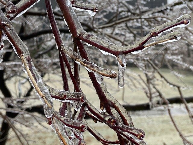
In the wake of the snow, sleet, and freezing rain, tomorrow will be fair but cold. Temperatures will rise no higher than the 30s across the region. Overall, the closing days of February into the first week of March will be generally colder than normal. March could start with a sharp cold shot. A warming trend could develop afterward. The duration of this warming remains uncertain. The ENSO Region 1+2 anomaly was -1.7°C and the Region 3.4 anomaly was -0.6°C for the week centered around February 16. For the past six weeks, the ENSO Region 1+2 anomaly has averaged -0.90°C and the ENSO Region 3.4 anomaly has averaged -0.70°C. La Niña conditions will likely persist into at least mid-March. The SOI was +7.59 today. The preliminary Arctic Oscillation (AO) was +1.633. On February 23 the MJO was in Phase 3 at an amplitude of 1.089 (RMM). The February 22-adjusted amplitude was 1.502 (RMM). Based on sensitivity analysis applied to the latest guidance, there is an implied 98% probability that New York City will have a warmer than normal February (1991-2020 normal). February will likely finish with a mean temperature near 37.1° (1.2° above normal).
-
February 24/25 Potential Winter Storm
donsutherland1 replied to mikem81's topic in New York City Metro
Bronx: