weatherwiz
-
Posts
79,817 -
Joined
-
Last visited
Content Type
Profiles
Blogs
Forums
American Weather
Media Demo
Store
Gallery
Everything posted by weatherwiz
-
This isn't coming near the East Coast lol. If you want to talk about "how far west it can get" well maybe that's 70W or 73W and guess what happens if it makes it there...a sharp re-curve northeast. This was never going to be a "close call" for the coast. A storm coming into 70 or 75W and then sharply recurving isn't "close". If there was a weather pattern in place where there was room for a capture...then you could say close. Outside of a weather pattern to bring them up the coast they re-curve out to sea...that is the "climo". You can't call that close lol. Close implies there was a chance...there never was.
-
Already not liking the darker earlier mornings and the earlier sunsets...both very noticeable now and it's getting depressing. Not looking forward to the dark by 4:00...unless its snowing out. The thought of having a a snowstorm ongoing and its like 4:30 PM and already dark but its so peaceful and calm with heavy snow is very soothing.
-
HRRR yesterday advertised this well, the HRRR was just a bit more southwest. It handled yesterday well too from the day prior. It’s redeemed itself a bit lol
-
I’d watch Abington and Whitman for potential microburst
-
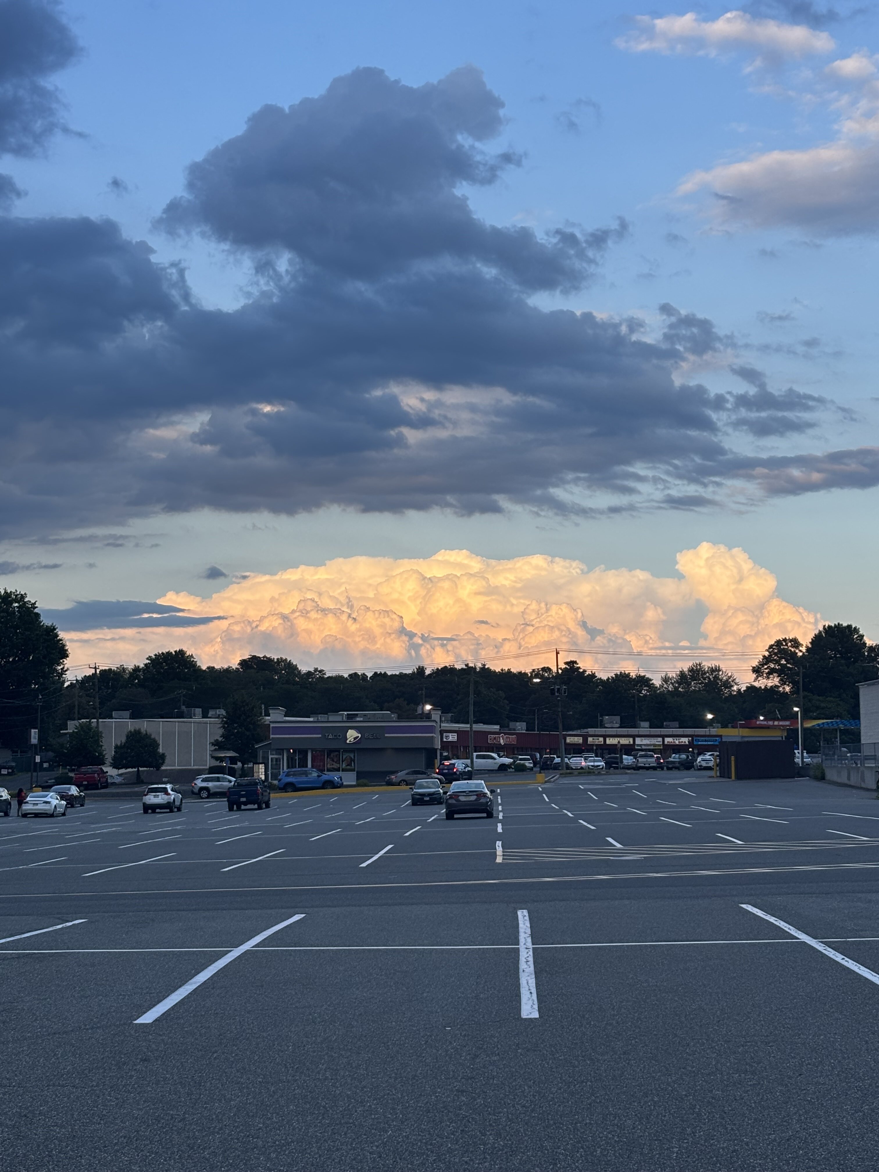
Great shot of the stuff south of Boston

-
2020 had that supercell that ripped across southwester/southern CT (think august 26th or 27th). Outside of some very localized damage it's been a bore since the 2018 event. Was it two summers ago (maybe three) where we had a decent stretch I think in July with storms...nothing crazy but it was active.
-
The farther west the track, the sharper the recurve
-
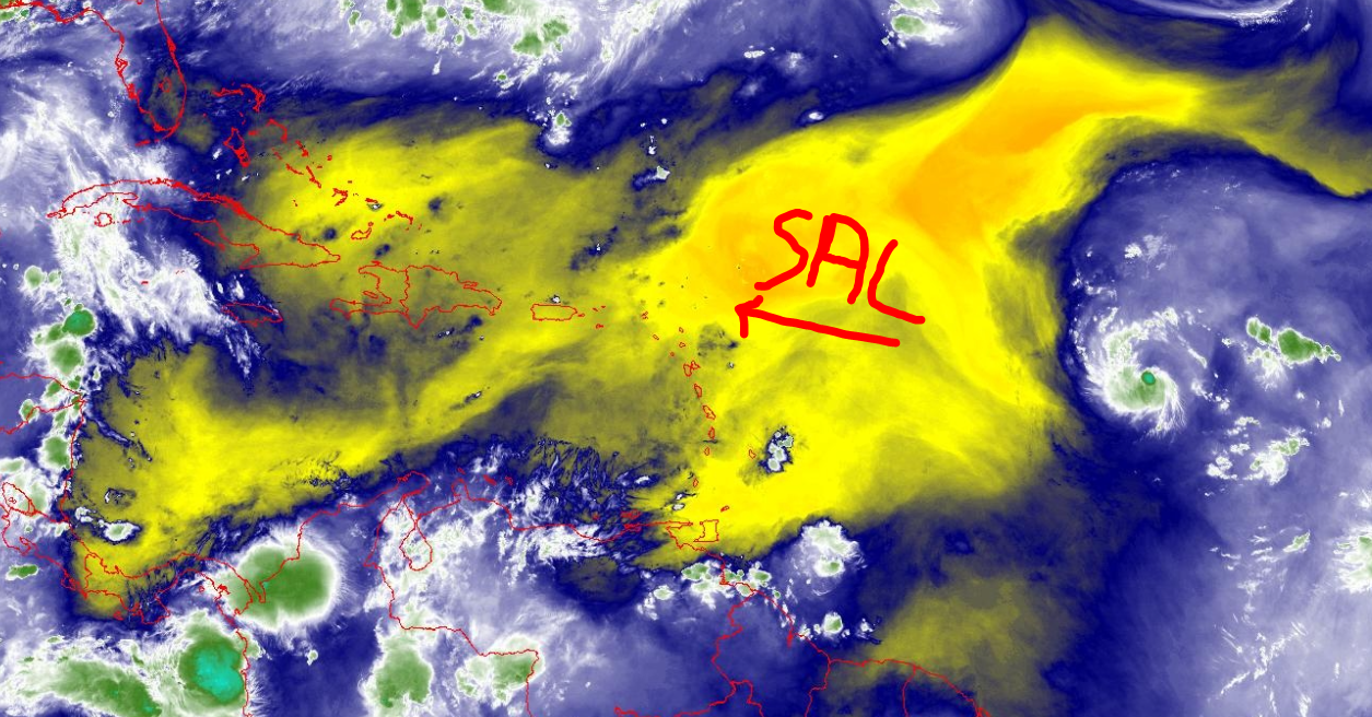
Just going to have to wait for Erin to begin strengthening...but I am still curious if once that happens it will end up ingesting more of this SAL. I think one saving grace for Erin right now is because it isn't overly strong and wrapped its not getting t, much, if any into the center. But its been doing much better with convection today, not a terrible looking structure but getting there.
-
OP is an outlier AWT...but the spread is insane
-
I agree, if Erin can get going...she will take off.
-
I will be willing to bet the euro OP is of the most western outlier when it comes to the EPS. but I will be curious to see what the mean is on the Euro. We may see some heavily skewed west members but willing to bet this is a major outlier
-
noticing alot of models start to crank Erin around Puerto Rico but are environmental conditions really going to favor that? Dry air/SAL I think is still going to be an issue and may even have some stronger shear to the north?
-
I still think this very well could track west of Bermuda, especially given Erin is remaining weaker and continuing to track on the southern envelope on guidance which feasibly means tracking farther west prior to re-curving. But the end game is still going to re-curve and still far enough away from the EC for the only impact to be high surf. Maybe Cape Hatteras gets scrapped with cirrus. But all summer, we have seen some impressive shortwaves tracking across eastern Canada and getting across southeastern Canada at times. The ridge may be stronger, but if anything its stronger in the poleward direction versus being more of a E-W expansive high. There are a series of shortwaves which will be diving through over the next week which will continue impacting the WAR and allowing for weaknesses. Maybe this gets to 75W but even if so, the end game will be a sharp recurve.
-
lol
-
I don't think the long range pattern looks to become one that would favor any potential concern (at least for our region and probably from like the Carolina's north). But this is looking through the end of the month. As we get closer to September and into September there is always potential for a wild card contributor which can quickly reshape the pattern. Anyways, behind Erin the Atlantic looks extremely quiet. I think @WxWatcher007mentioned this a few days ago but the background state looks to becoming more favorable but we may not really see much in the way of development until probably moving through the first week of September. We will have to watch for some home grown with tendency for stalled fronts off the southeast coast but the pattern may also favor alot of dry air towards the coast along with strong wind shear.
-
Yeah RIP Erin. If Erin starts to organize and try to strengthening its just going to begin ingesting this air deeper into the circulation. Not too mention Erin is still hauling westwards

-
None. It's done, over, caput, zero chance.
-
Southwest CT probably gets the most rain with storms today
-
I guess sea-breeze boundary is something to watch for tomorrow. The HRRR has been dreadful this summer in terms of convection but I think it is onto something.
-
If anything the best chance for stuff is like late tomorrow afternoon/evening and overnight. 12z HRRR is pretty active late afternoon/early evening (looks like RRFS will be too). Regardless though should be a rapid weakening of activity with east extent.
-
yup...something to certainly watch for them and as you've stated a few times they have been a real magnet these past few years. Something which could also end up heavily influencing the weather pattern here for the last week of August.
-
I'm with Kevin, I don't see all that much Thursday, probably northwest and mostly northwest of our region...back more into NY like around Albany and into VT. Probably be a lot of isolated or scattered stuff, nothing widespread.
-
I wouldn't worry too much about where the storm is relative to guidance right now (too far north, south, etc). Erin is still in the initial phases of development and organization and there is going to be a lot of wobbling going on. Once Erin gets closer to hurricane state with a more well-defined center. Anyways rather minute because does it really matter if it starts recurving at 60W or 70W...the pattern over the East its going to get scooped OTS but yes Atlantic Canada can't be ruled out. This is 0.000000000000000001% for East Coast.
-
A heat wave and heat advisory are not in the same. You don’t need high dews or heat index for a heat wave